© Kneippland Unterallgäu - Tobias Klöck

© Kneippland Unterallgäu - Tobias Klöck

© Kneippland Unterallgäu - Tobias Klöck
- Kort beskrivning
-
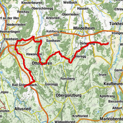
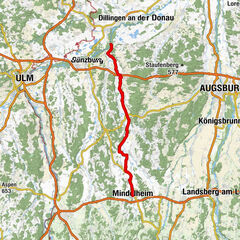
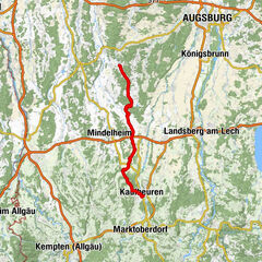
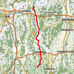
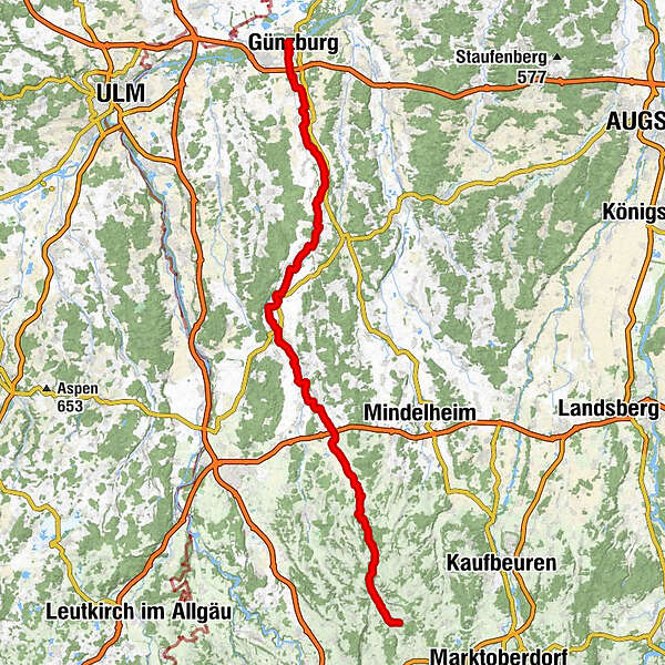
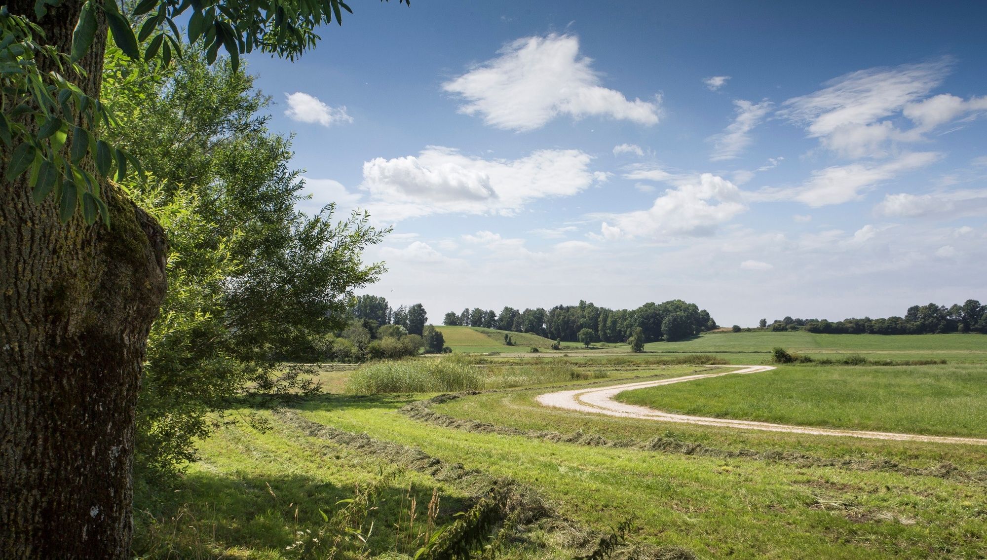
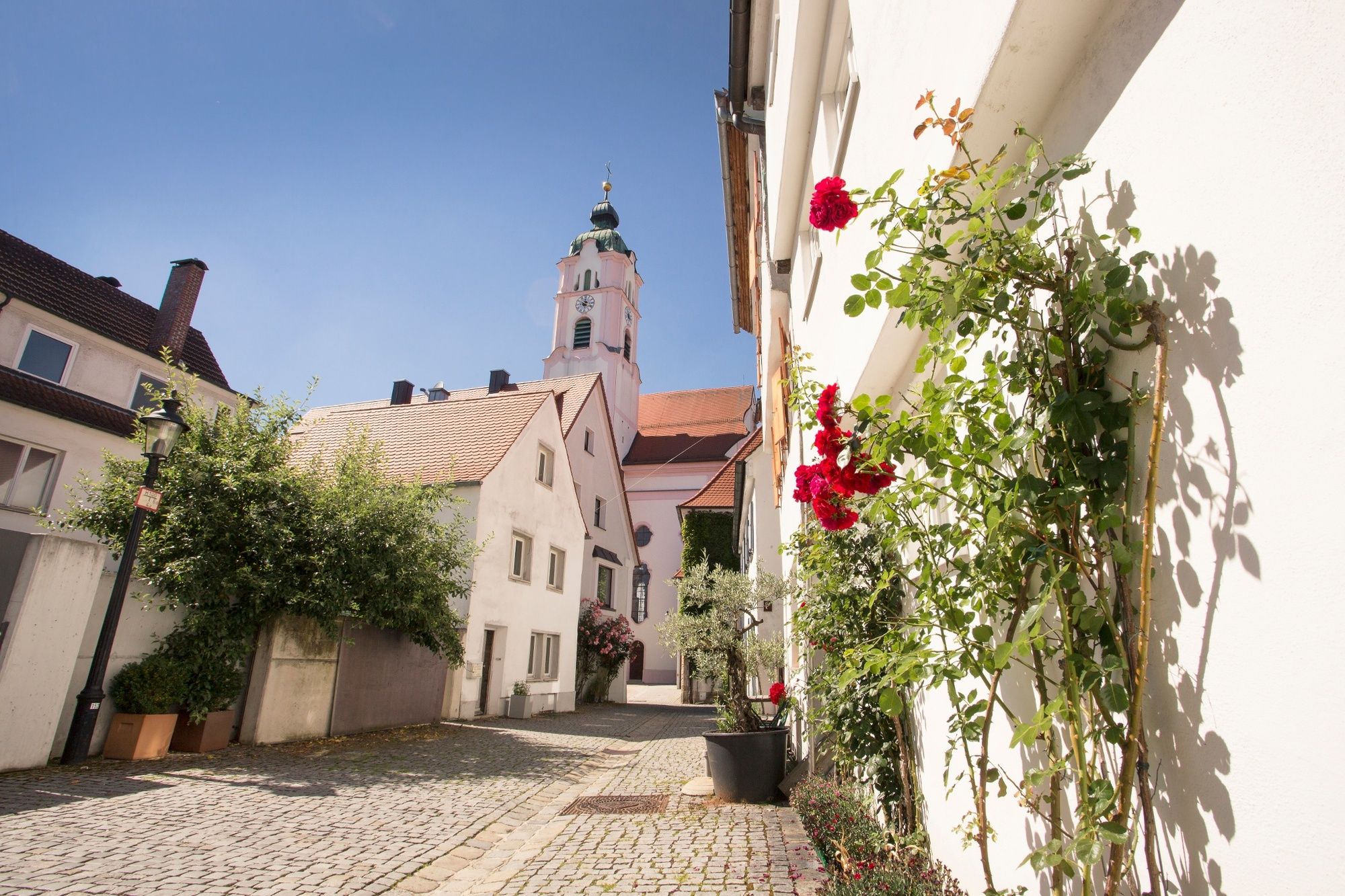
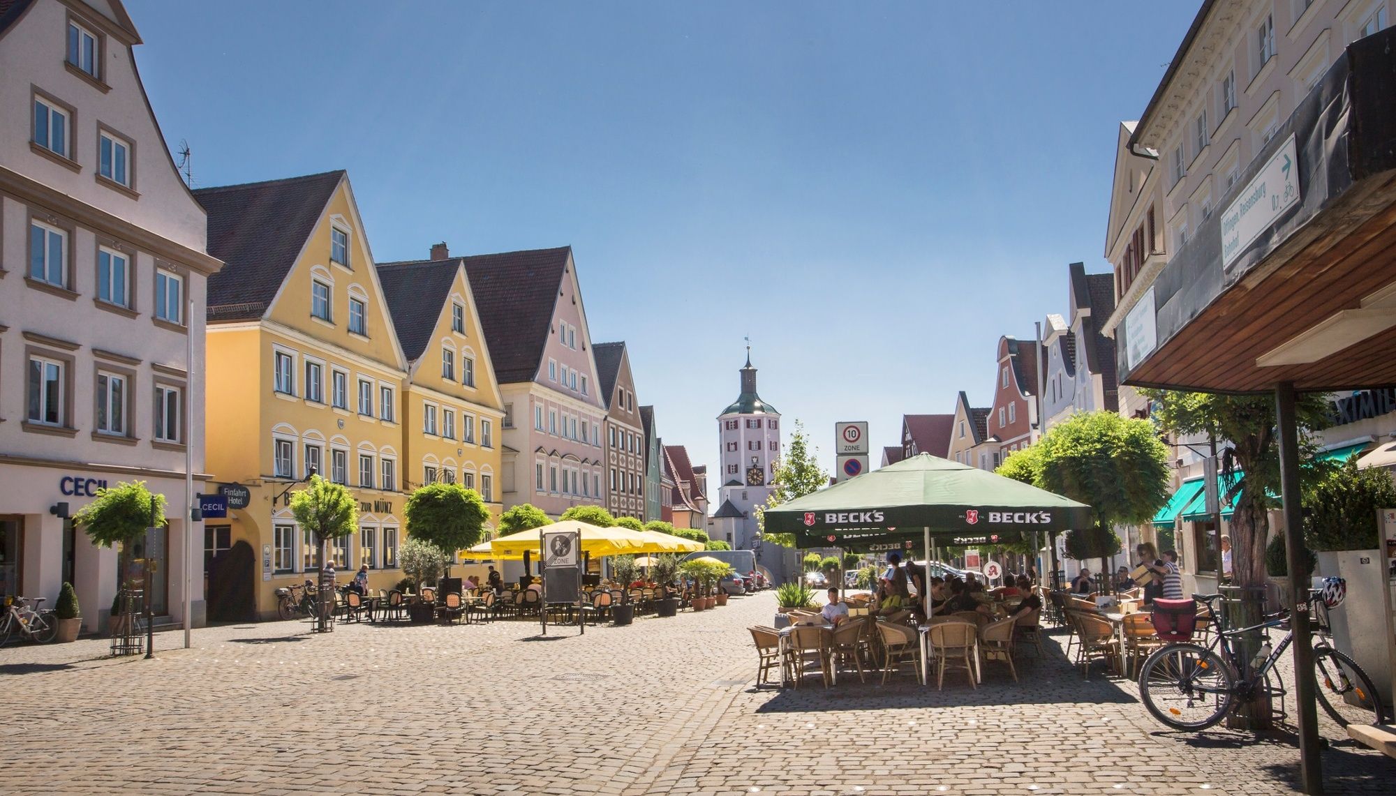
The Günztal cycle path leads from its source in the eastern Allgäu town of Günzach for about 92 km to Günzburg, where the Günz flows into the Danube. Along the route, magnificent churches and castles are embedded in the varied landscape. The flora and fauna along the Günz are particularly worth seeing, as many sections of the river are still in their natural state.
- Svårighet
-
lätt
- Utvärdering
-
- Väg
-
Östliche GünzGasthof Hirsch1,2 kmGünzach1,3 kmRohr2,5 kmObergünzburg4,5 kmRonsberg10,9 kmMariä Himmelfahrt11,2 kmLetten13,0 kmRohrhof13,5 kmHochreutte13,9 kmKreuzkapelle (Engetried)14,5 kmGasthaus Kreuz15,0 kmEngetried15,1 kmPfarrkirche Sankt Blasius15,2 kmMarkt Rettenbach18,2 kmSt. Leonhard19,8 kmGottenau20,7 kmHammerschmied22,7 kmKapelle23,7 kmLindenhöf24,2 kmGasthof Adler26,3 kmSt. Martin26,5 kmSontheim26,6 kmSontheim (Schwab)27,2 kmSchlegelsberg29,0 kmKapelle30,0 kmPeter und Paul30,7 kmGasthaus zum goldenen Bären31,0 kmErkheim31,1 kmMariä Himmelfahrt31,4 kmDaxberg33,6 kmSt. Nikolaus33,8 kmÖlmühle35,6 kmEgg an der Günz39,3 kmEngishausen41,8 kmBabenhausen47,0 kmSt. Andreas47,1 kmBebenhausen52,1 kmNepomuk-Bildstock52,5 kmKettershausen53,9 kmMohrenhausen55,1 kmZaiertshofen58,2 kmDeisenhausen64,7 kmOberegg68,1 kmHöselhurst70,6 kmWattenweiler72,6 kmEllzee75,1 kmWaldstetter Mühle76,9 kmIchenhausen80,2 kmWasserburg88,9 kmGünzburg (446 m)91,1 kmSt. Martin91,7 km
- Bästa säsongen
-
janfebmaraprmajjunjulaugsepoktnovdec
- Högsta punkt
- 805 m
- Destination
-
Günzburg
- Höjdprofil
-
 © outdooractive.com
- Författare
-
Turnén Günztal cycle path används av outdooractive.com förutsatt.
GPS Downloads


Allmän information
Förfriskningsstopp
Kulturell/Historisk
Flora
Fauna
Fler turer i regionerna