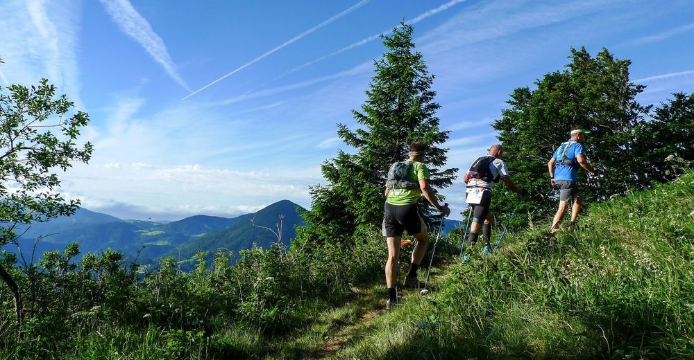
Julian Alps: Podbrdo Trail Running Festival Marathon

Trailrunning
© Turizem Dolina Soce - Gaj Rosič

- Kort beskrivning
-
This trail leads along the territory of the municipalities of Bohinj, Cerkno, Tolmin and Železniki. Runners (and hikers) run along mule trails and mountain treks on the slopes of Mt. Črna prst and Mt. Porezen.
- Svårighet
-
tung
- Utvärdering
-
- Väg
-
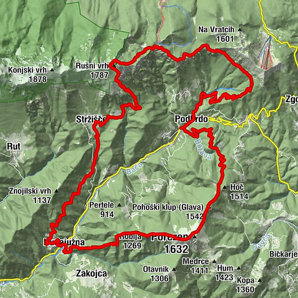
Podberda0,5 kmSv. Miklavž0,6 kmŠance (1.350 m)9,2 kmKobla (1.498 m)10,3 kmPlanina Kal (1.362 m)11,2 kmNa Kalu (1.362 m)11,6 kmČez Suho (1.760 m)13,9 kmBabji zob (1.368 m)15,4 kmKalarsko sedlo (988 m)16,6 kmKal17,8 kmCerkev sv. Ožbolta18,8 kmStržišče19,2 kmKuk21,2 kmZnojile21,8 kmObloke25,4 kmsv. Barbara26,4 kmHudajužna26,5 kmDurnik (1.152 m)30,2 kmRobija (1.269 m)31,0 kmJeseniška planina31,7 kmPorezen (1.632 m)32,8 kmPlaninski dom na Poreznu33,0 kmPohoški kup (Glava) (1.542 m)33,9 kmPodberda39,5 km
- Bästa säsongen
-
janfebmaraprmajjunjulaugsepoktnovdec
- Högsta punkt
- 1.746 m
- Destination
-
Podbrdo Sports field
- Höjdprofil
-
 © outdooractive.com

- Författare
-
Turnén Julian Alps: Podbrdo Trail Running Festival Marathon används av outdooractive.com förutsatt.