© Turizem Bohinj - Tomo Jeseničnik


© Turizem Bohinj - Matevž Lenarčič

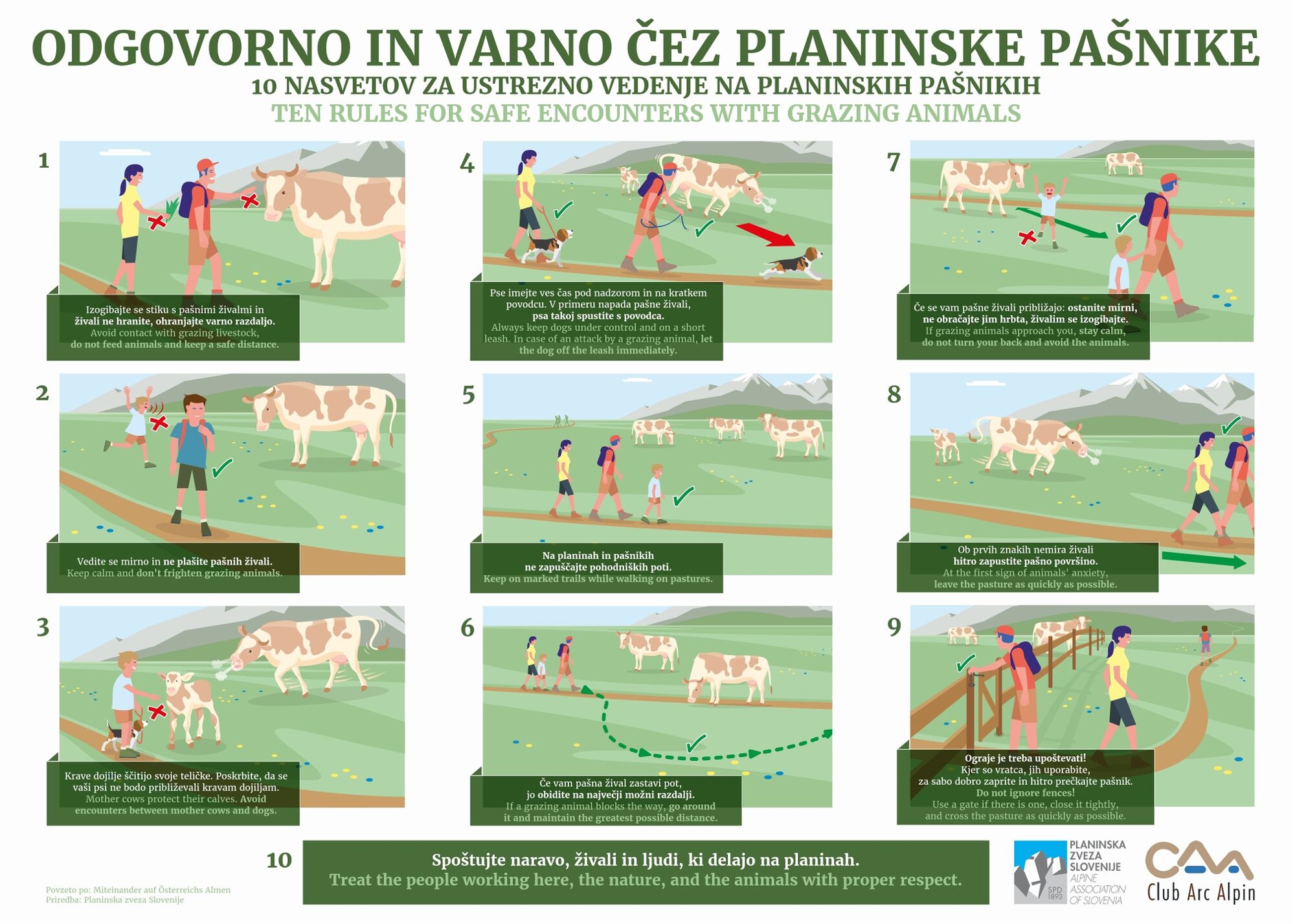
© PZS - Planinska zveza Slovenije

- Kort beskrivning
-
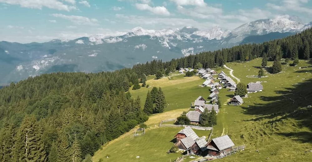
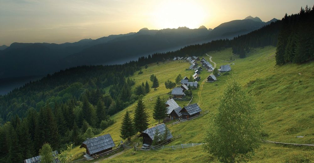
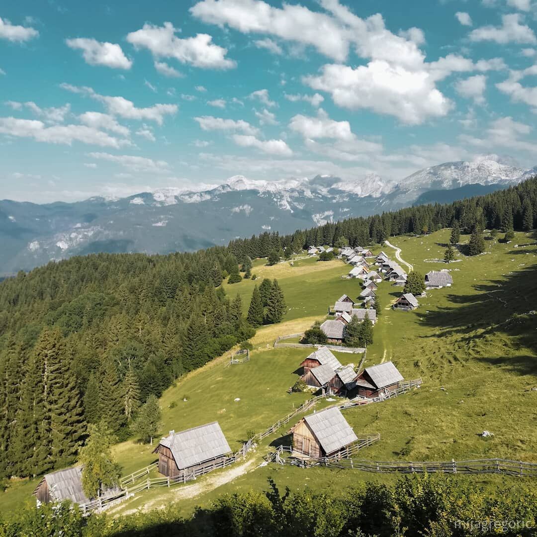
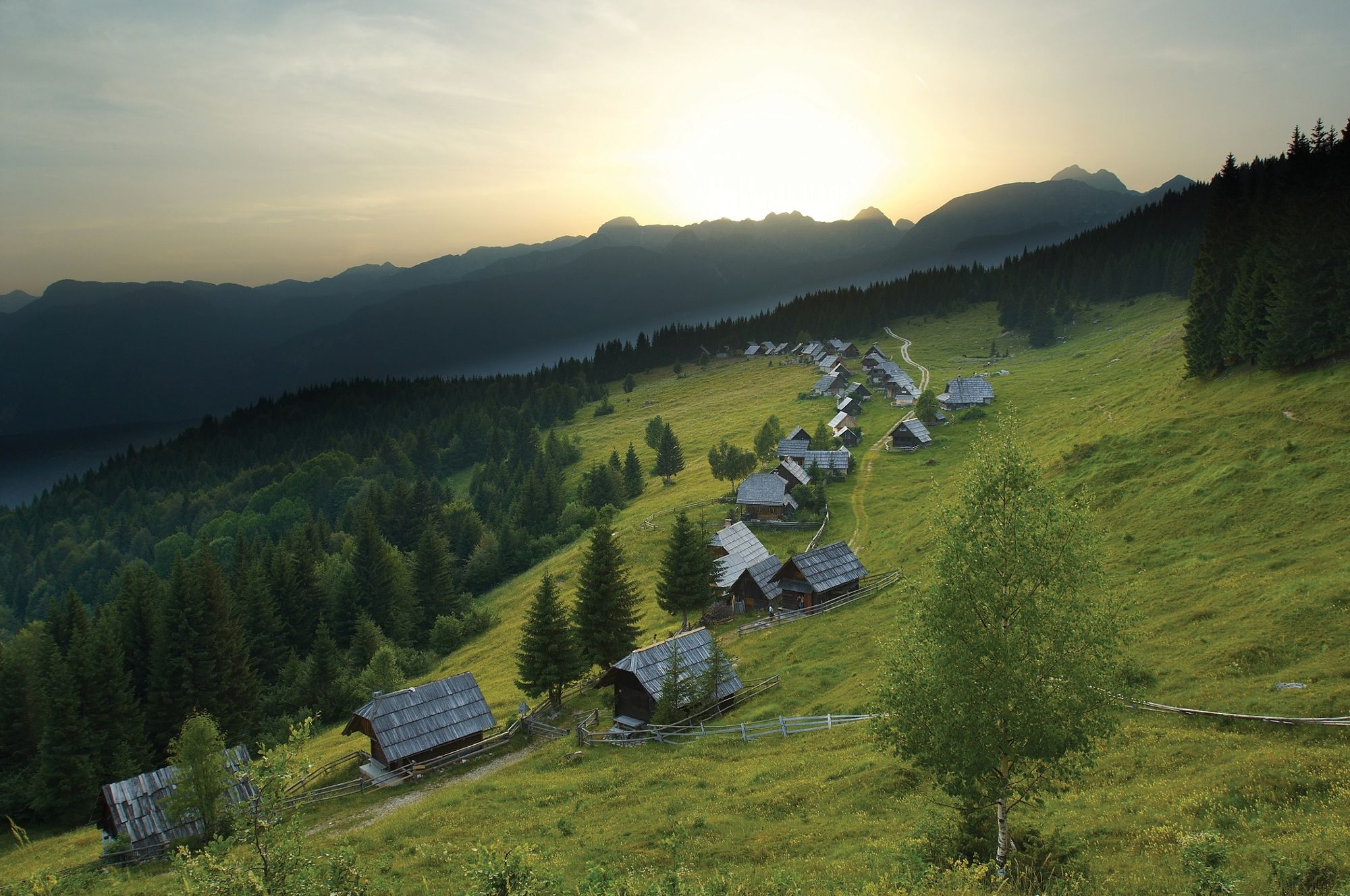
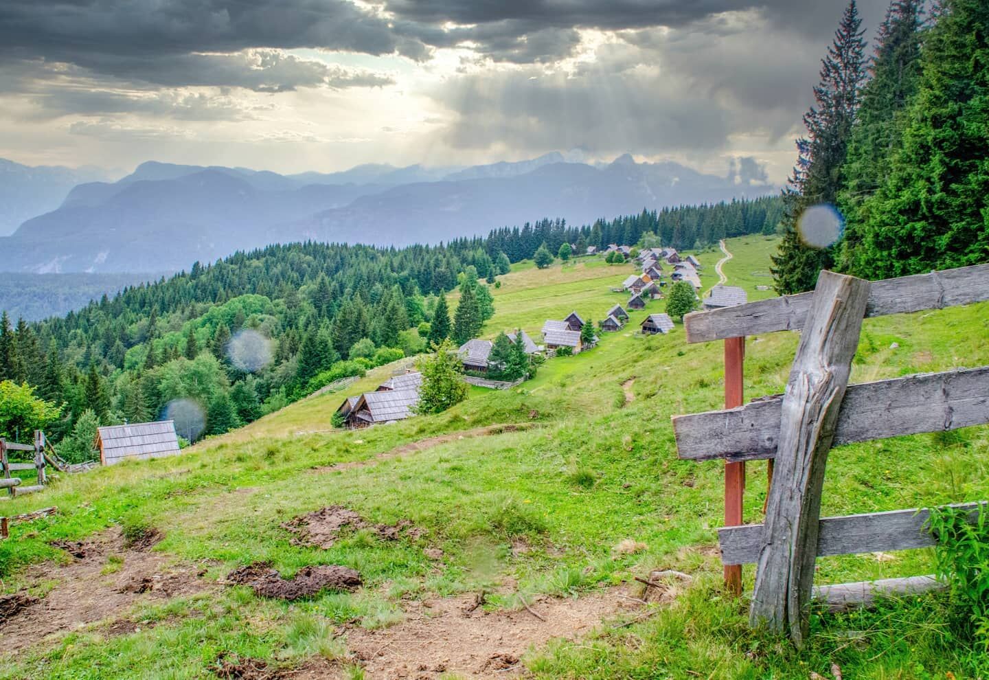
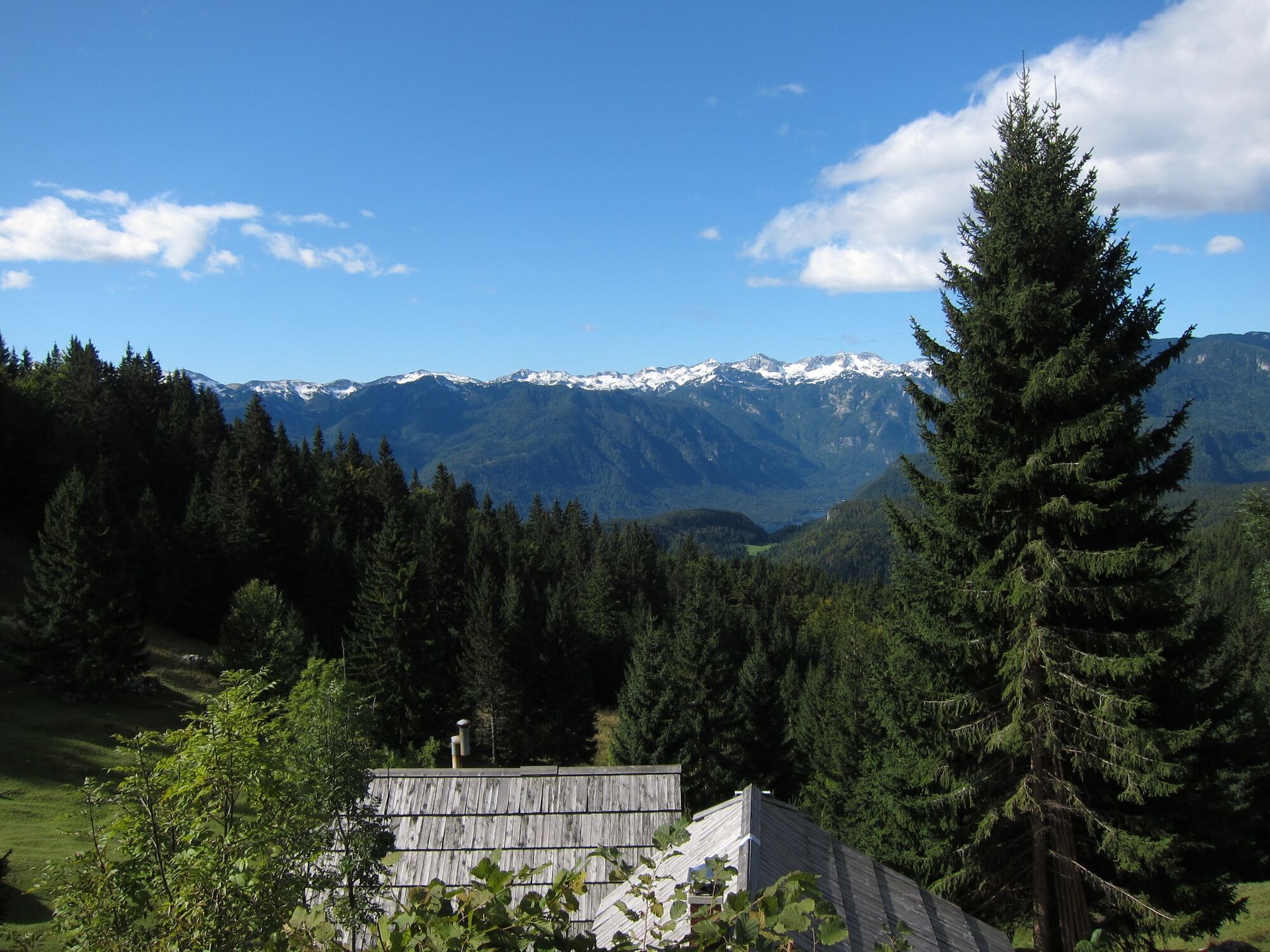
The Zajamniki pasture is recognised by its panoramic location on the sunny side of the Pokljuka plateau. The cottages and stalls are reminiscent of an extended village, because they are built in an arch along the main road.
- Svårighet
-
tung
- Utvärdering
-
- Väg
-
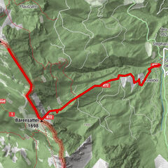
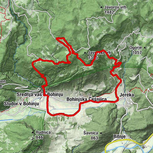
Mitterdorf0,0 kmGostilna pri Hrvatu0,1 kmPlanina na Šeh2,1 kmKadunjec (1.323 m)3,7 kmPlanina Zajamniki4,1 kmEagles viewpoint7,9 kmFrauenberg10,1 kmKerschdorf10,9 kmMitterdorf13,6 kmGostilna pri Hrvatu13,7 km
- Bästa säsongen
-
janfebmaraprmajjunjulaugsepoktnovdec
- Högsta punkt
- 1.337 m
- Destination
-
Linden tree in Srednja vas (bus stop)
- Höjdprofil
-
 © outdooractive.com

- Författare
-
Turnén Zajamniki from Srednja vas används av outdooractive.com förutsatt.
GPS Downloads


Allmän information
Läkande klimat
Kulturell/Historisk
Flora
Lovande
Fler turer i regionerna
-
Wörthersee - Rosental
1949
-
Bohinjska Bistrica
118