
- Kort beskrivning
-
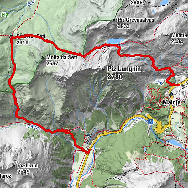
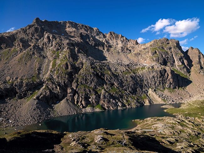
Walk up from Maloja to the three-part watershed and follow the traces of the Romans down to the Bergell
- Svårighet
-
tung
- Utvärdering
-
- Väg
-
Chiesa Evangelica Maloja0,1 kmPila0,4 kmInn1,5 kmInnquelle4,4 kmPass Lunghin (2.645 m)4,8 kmSeptimer Pass (2.310 m)7,2 kmSeptimerhütte7,6 kmCasaccia (1.458 m)13,1 km
- Bästa säsongen
-
janfebmaraprmajjunjulaugsepoktnovdec
- Högsta punkt
- 2.631 m
- Destination
-
Casaccia
- Höjdprofil
-
 © outdooractive.com


- Författare
-
Turnén Maloja - Lunghin watershed - Casaccia används av outdooractive.com förutsatt.
GPS Downloads


Allmän information
Kulturell/Historisk
Lovande
Fler turer i regionerna
-
Veltlin / Valtellina
853
-
Val Bregaglia Engadin
458
-
Casaccia
201