© Visit Éislek

- Kort beskrivning
-
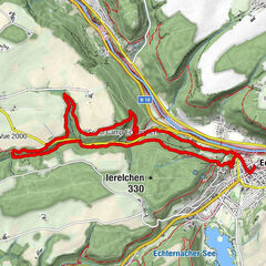
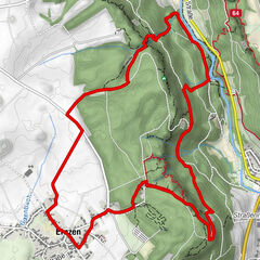
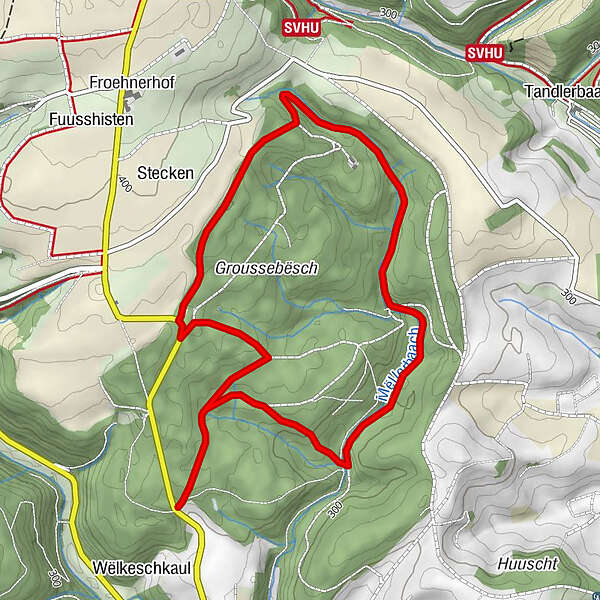
From the leisurely afternoon round to the challenging hiking tour, everything is included in the Local Hiking Trails.
- Svårighet
-
lätt
- Utvärdering
-
- Bästa säsongen
-
janfebmaraprmajjunjulaugsepoktnovdec
- Högsta punkt
- 378 m
- Destination
-
Bastendorf
- Höjdprofil
-
 © outdooractive.com

- Författare
-
Turnén Local hiking trail TA 1 - Bastendorf används av outdooractive.com förutsatt.
GPS Downloads


Allmän information
Lovande
Fler turer i regionerna
-
Eifel/ Rheinland-Pfalz
1057
-
Guttland
413
-
Diekirch
183