© Oststeiermark Tourismus - TVB ApfelLand Stubenbergsee

© Oststeiermark Tourismus - Tourismusverband Oststeiermark

© Oststeiermark Tourismus - Tourismusverband Oststeiermark
- Kort beskrivning
-
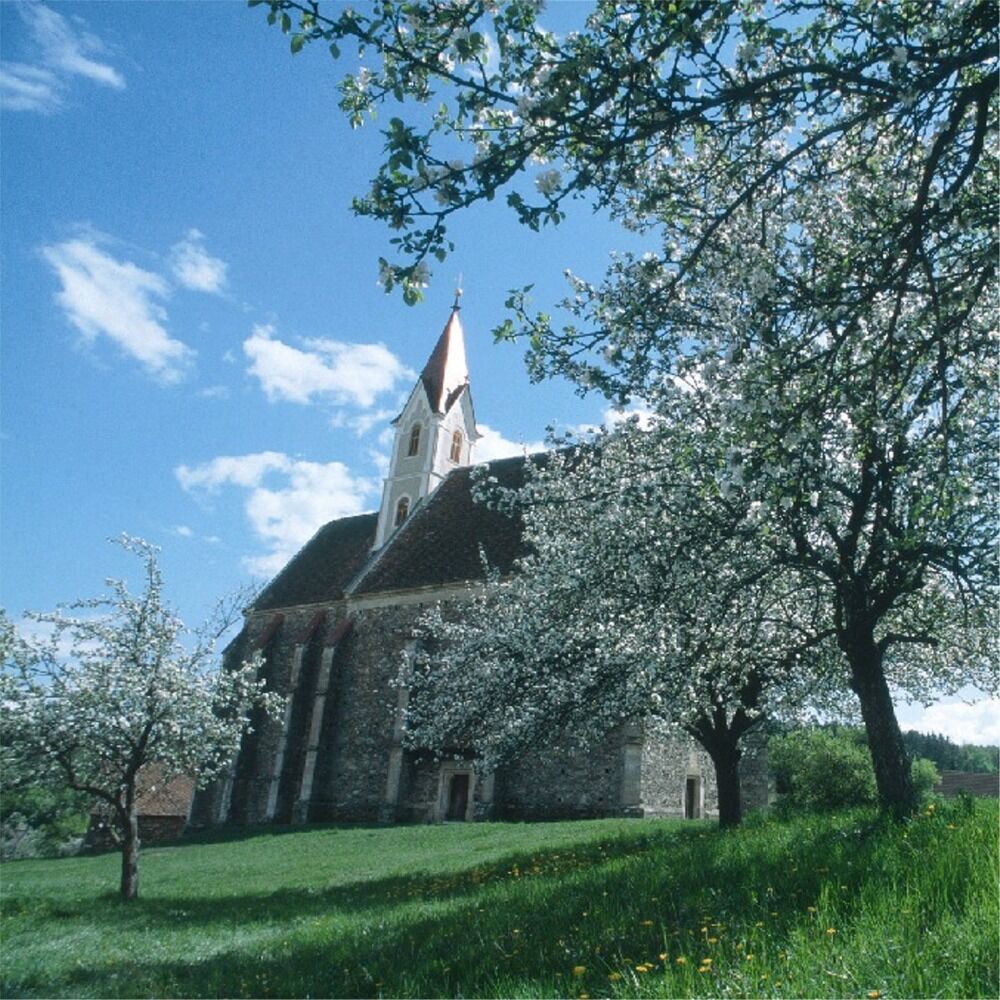
From the church of St. Johann i.d. Haide we start the pilgrimage trail 13 with the yellow-white marking either north towards Heiligenbrunn (Rohrbach) or west via Maria Lebing to Fieberbründl.
- Svårighet
-
medium
- Utvärdering
-
- Väg
-
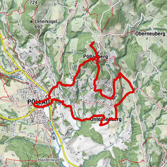
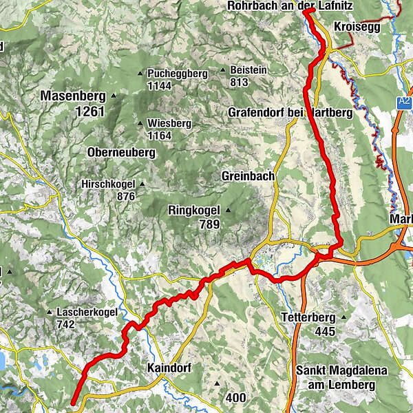
Heiligenbrunn0,0 kmRohrbachschlag0,7 kmLafnitz2,7 kmGasthaus Cafe Müller2,8 kmKapelle Lafnitz2,8 kmWeiße Kreuz4,4 kmGrafendorf bei Hartberg5,6 kmSchöngrundner5,7 kmLechen6,8 kmSankt Johann in der Haide13,8 kmGasthof Kirchenwirt13,9 kmSafenau18,2 kmWallfahrtskirche Maria Lebing19,6 kmSpielplatz des Gasthofes Pack19,7 kmHartberg20,2 kmSchildbach20,9 kmMitterdombach24,2 kmHaselberg26,8 kmSankt Stefan29,5 kmReichl-Kapelle29,9 kmEnggasse31,6 kmHofkirchen bei Hartberg32,3 kmBallonhotel Restaurant Thaller32,4 kmObertiefenbach33,5 kmWallfahrtskirche Maria Fieberbründl35,1 kmKirchenwirt Durlacher35,2 kmMaria Fieberbründl35,2 km
- Bästa säsongen
-
janfebmaraprmajjunjulaugsepoktnovdec
- Högsta punkt
- 482 m
- Destination
-
Fieberbründl / Heiligenbrunn
- Höjdprofil
-


- Författare
-
Turnén Heiligenbrunn - Lebing - Fieberbründl Weg Nr. 13 används av outdooractive.com förutsatt.
GPS Downloads


Allmän information
Förfriskningsstopp
Kulturell/Historisk
Fler turer i regionerna
-
Thermen- & Vulkanland
1324
-
Hartbergerland
830
-
Hartberg
212