

- Kort beskrivning
-
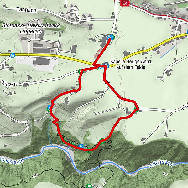
Nice tour to the calcareous tuff in Lingenau, which is one of the most remarkable calc-sinter formations to the north of the Alps.
- Svårighet
-
lätt
- Utvärdering
-
- Väg
-
Kapelle Heilige Anna auf dem Felde0,1 kmRain0,6 kmSt. Anna2,2 km
- Bästa säsongen
-
janfebmaraprmajjunjulaugsepoktnovdec
- Högsta punkt
- 670 m
- Destination
-
Lingenau swimming pool car park (Hotel Quellengarten)
- Höjdprofil
-

- Författare
-
Turnén Lingenau | when water turns to stones används av outdooractive.com förutsatt.
GPS Downloads


Allmän information
Flora
Fauna
Fler turer i regionerna
-
St. Gallen - Bodensee
2070
-
Bregenzerwald
2295
-
Lingenau
729


