

© Alpenregion Bludenz Tourismus GmbH - Bianca Ganahl

© Alpenregion Bludenz Tourismus GmbH - Bianca Ganahl

© Alpenregion Bludenz Tourismus GmbH - Bianca Ganahl

© Vorarlberg Tourismus GmbH
- Kort beskrivning
-
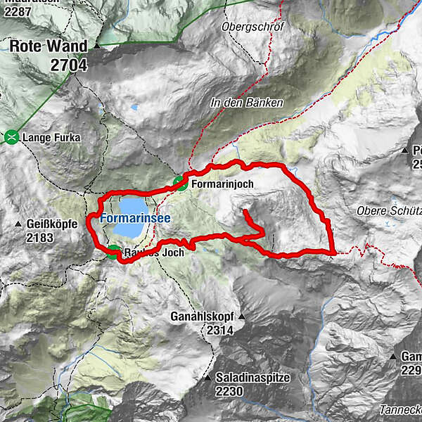
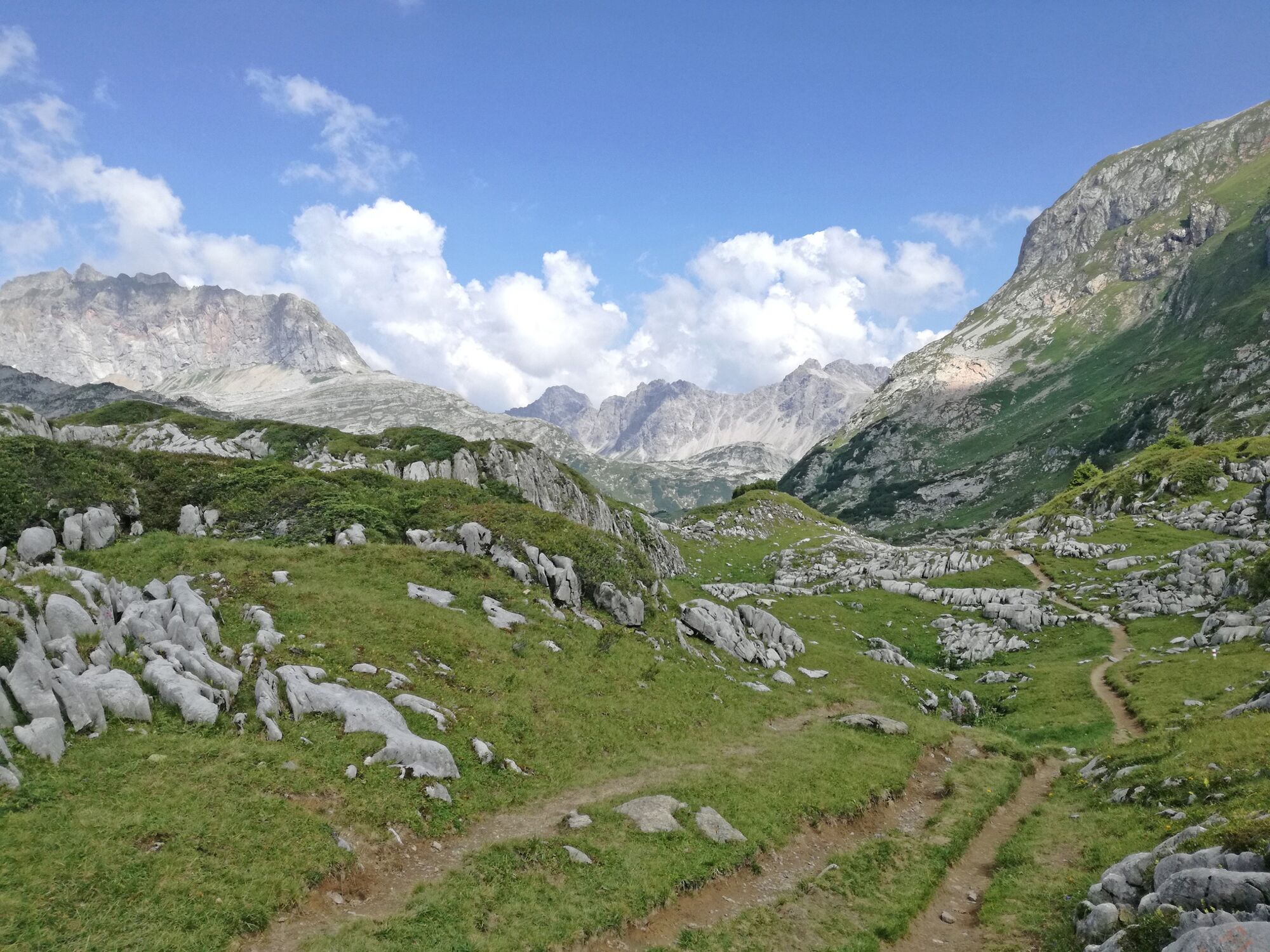
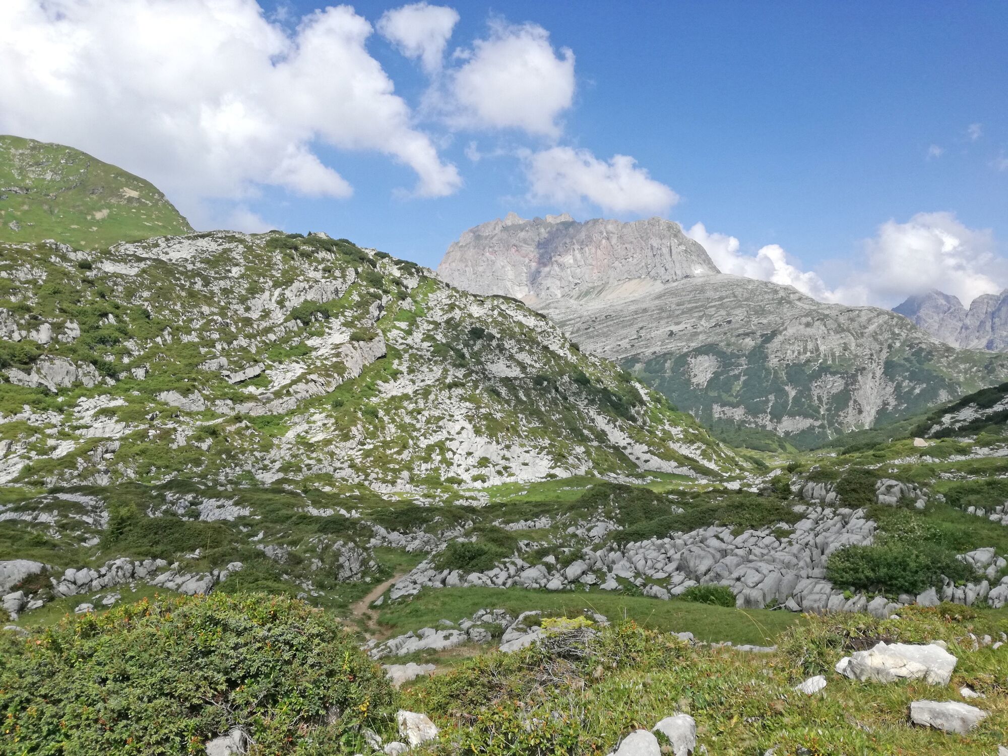
Discover 200-million-years-old evidence of the maritime past of the Alps on Steinernes Meer, a craggy karst plateau.
- Svårighet
-
medium
- Utvärdering
-
- Väg
-
Formarinalpe0,0 kmQuelle Formarinbach1,6 kmFormaletsch (2.292 m)4,8 kmFreiburger Hütte7,2 kmFormarinalpe9,8 km
- Bästa säsongen
-
janfebmaraprmajjunjulaugsepoktnovdec
- Högsta punkt
- 2.283 m
- Destination
-
Formarin Alpe bus stop
- Höjdprofil
-


- Författare
-
Turnén Via Steinerne Meer-Formaletsch to Formarinsee | Dalaas används av outdooractive.com förutsatt.
GPS Downloads


Allmän information
Förfriskningsstopp
Lovande
Fler turer i regionerna
-
Klostertal
1789
-
Dalaas / Wald am Arlberg
466


