


Hiking at the Col d'Aussois


Fearlessly enter Vanoise National Park for a gentle warm-up to kick off the hike. An early start is a good idea, that way you can calmly take your time getting to Fond d'Aussois refuge. Before starting...
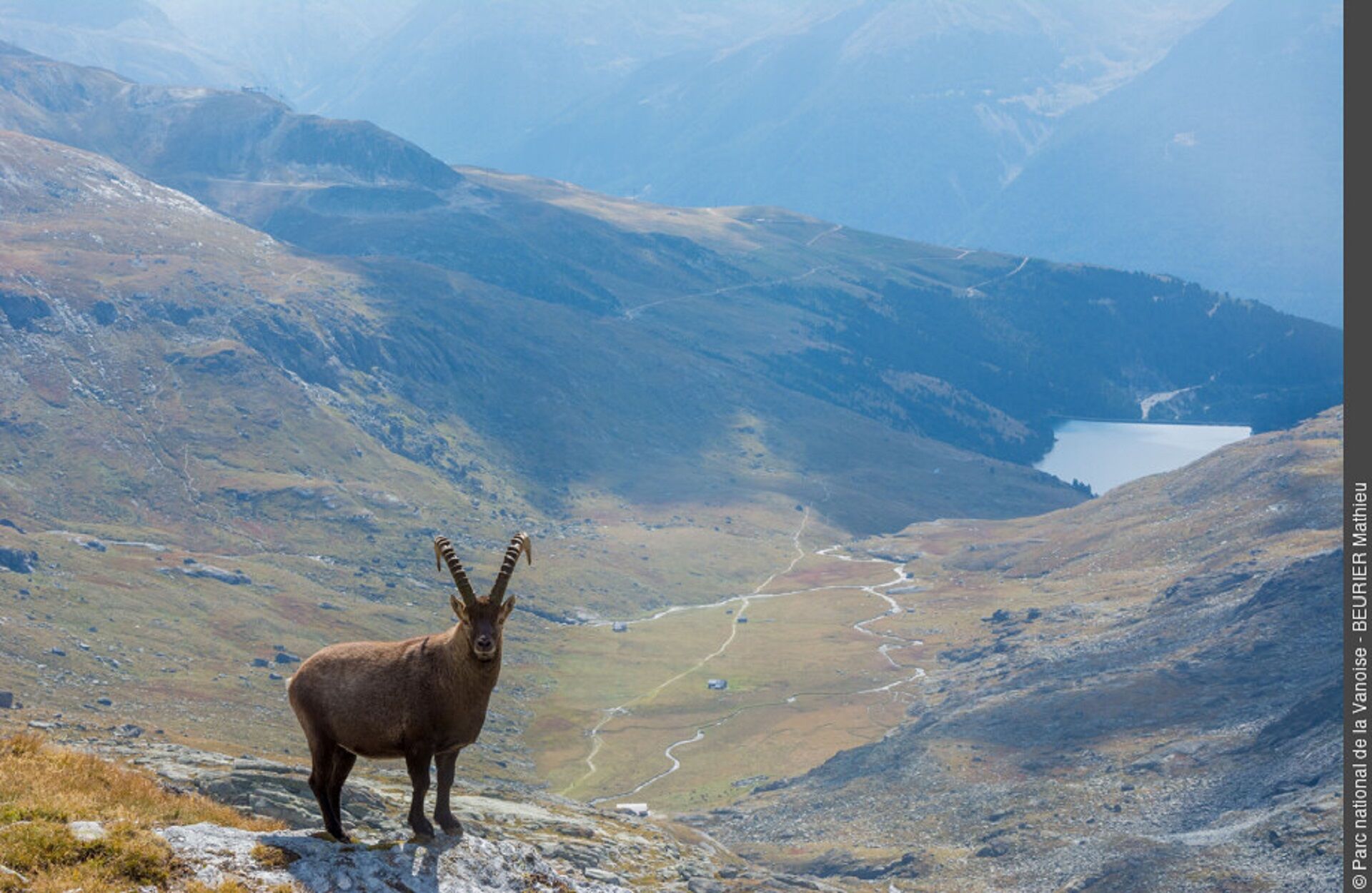
Fearlessly enter Vanoise National Park for a gentle warm-up to kick off the hike. An early start is a good idea, that way you can calmly take your time getting to Fond d'Aussois refuge. Before starting your ascent, pause to observe the rather tame marmots going through their morning routine. A well-maintained trail amidst slabs and rocks takes you up alongside the Saint-Benoît torrent, which is often abundant in the early summer. Sheltered from the breeze, you'll gradually climb through the various alpine zones leading to the pass. All of a sudden, the immensity of the landscape starts to work their magic. Forget about the short grass and other wild flowers. This is a land where rocks reign supreme. On a clear day, look out for the peaks in the distance. Due north, the Roof of Europe reveals itself majestically. Now you're really spoiled: check out that unbeatable view of the Mont-Blanc!

To guide you in the field, consult the "step-by-step" directional diagram provided in pdf.
Ja
The duration of hiking trails is calculated using reference paces: 300 m/h ascent, 500 m/h descent and 4 km/h on the flat.
As hazards may occur at any time on the routes, the GPX tracks provided are not contractual. They are given for information only. Riders use them at their own risk, depending on their level of technological proficiency and their understanding of the terrain.
Webbkameror för rundturen
Populära turer i närområdet
-
Refuge du Fond d'Aussois - a wild valley in the Vanoise - 2-day hike
ljusVandring 9,24 km -
The White Lake
ljusVandring 4,42 km -
Sentier pédestre des Sculptures - Land Art Montagne
ljusTema spår 5,16 km -
Col du Mont Cenis from Modane
tungLandsvägscykel 34,8 km -
Little ascent of Plan d'Aval
tungLandsvägscykel 6,37 km -
4. Day
ljusVandring 11,0 km -
2. Dag
ljusVandring 5,86 km -
Vanoise
MediumVandring 20,2 km -
5,0
Goldtoni - Alpenbogen A068 Refuge de la Leisse-Termignon Val Cenis
MediumLångdistans vandringsled 28,7 km -
3. Dag
MediumVandring 8,30 km
Vandring och spårning


Missa inte erbjudanden och inspiration inför nästa semester
Din e-postadress har lagts till på e-postlistan.