


Panoramaweg - Stage 2
Svårighetsgrad: T1


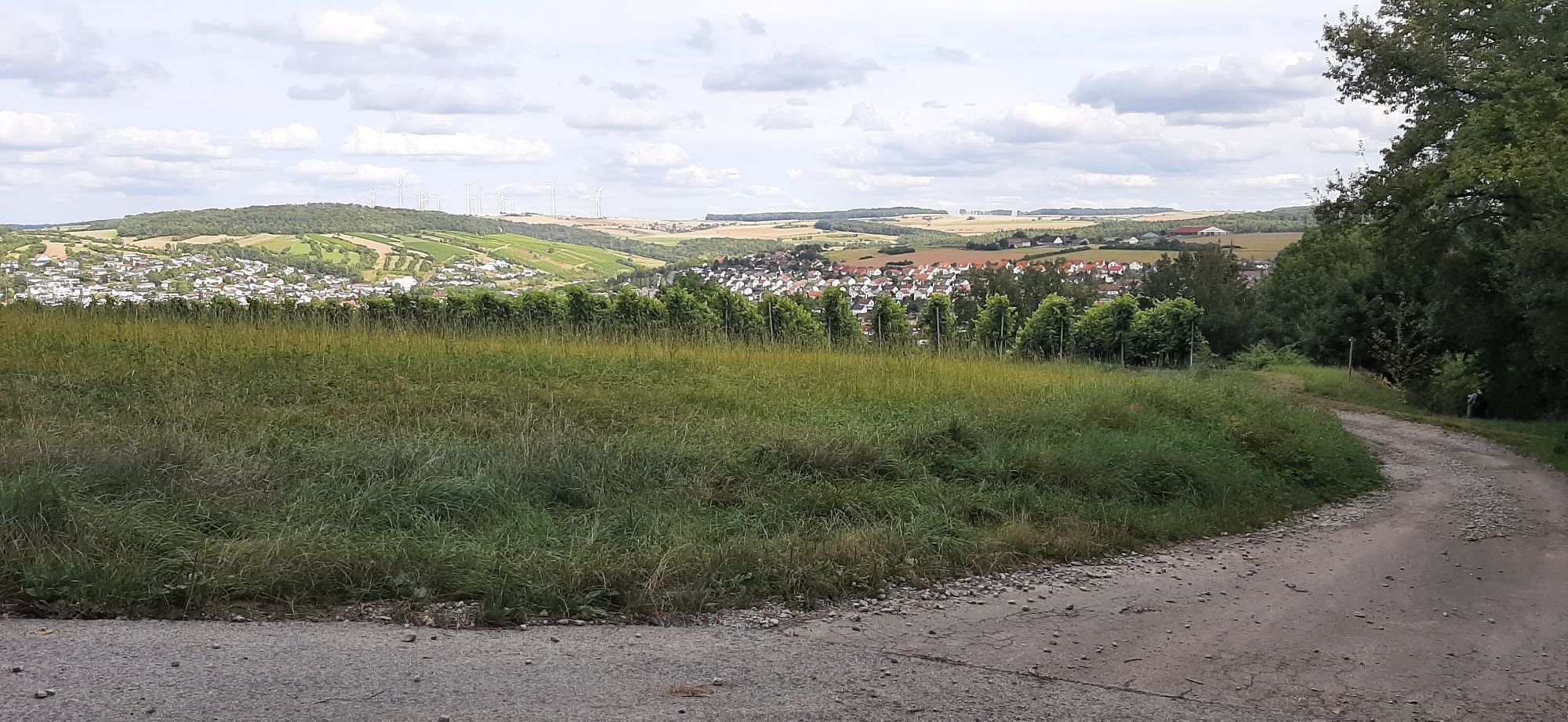
Passing dry grassland areas with dry stone walls, stone ridges, vineyards, and impressive views, the path of the second stage leads you from Creglingen to Röttingen and further over the Karlsberg with...
Passing dry grassland areas with dry stone walls, stone ridges, vineyards, and impressive views, the path of the second stage leads you from Creglingen to Röttingen and further over the Karlsberg with a beautiful view into the Vorbachtal valley to Weikersheim.
From Creglingen, it first goes a bit uphill again, then through fields downhill to the village of Klingen. From there, it goes uphill again through fields and along the forest edge until shortly before Röttingen. There you have the choice: Follow the Panoramaweg Taubertal. This leads you in a hairpin turn immediately uphill again through the Röttingen Bürgerwald, then along the forest edge to the Karlsberg of Weikersheim.
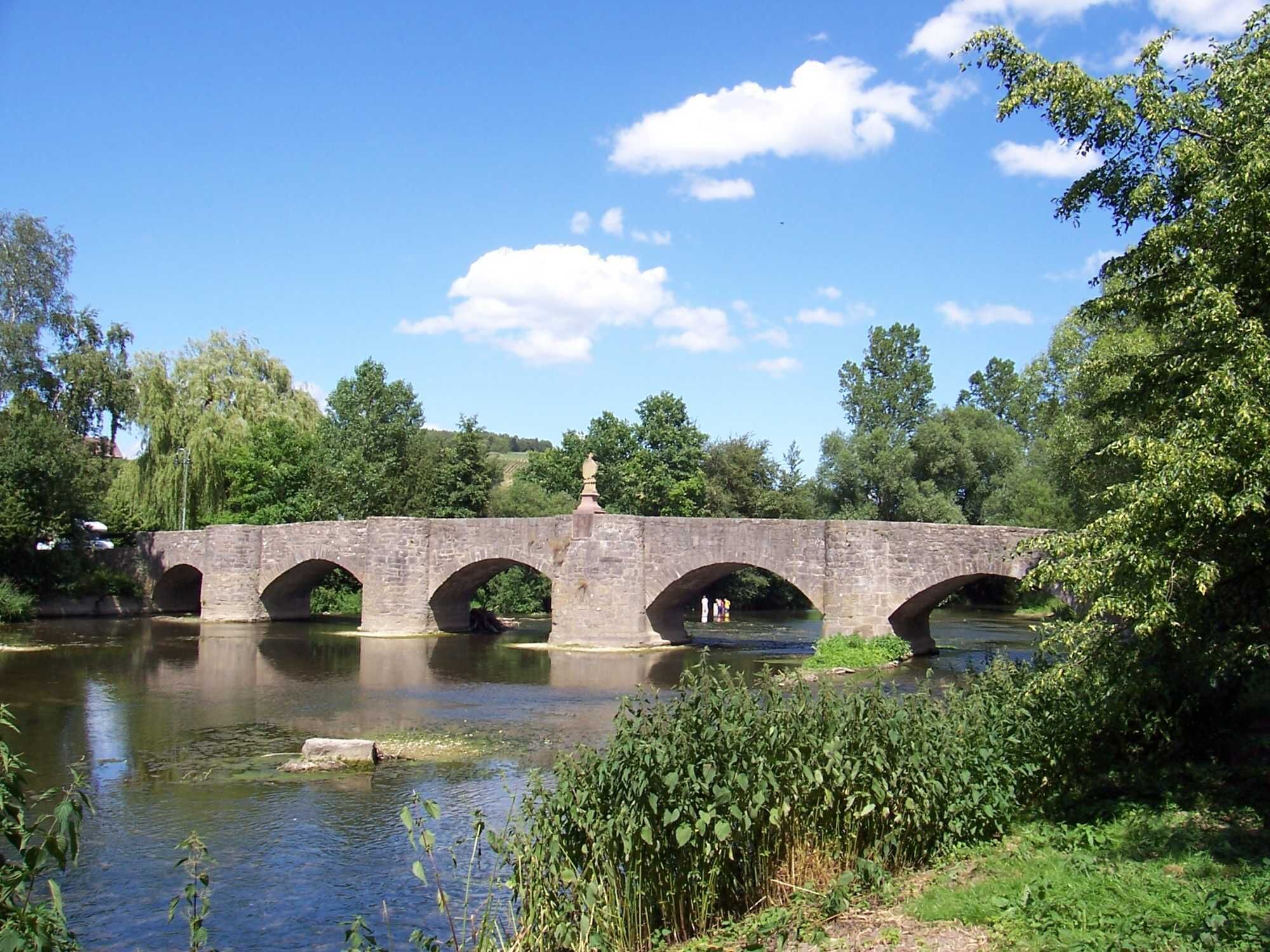
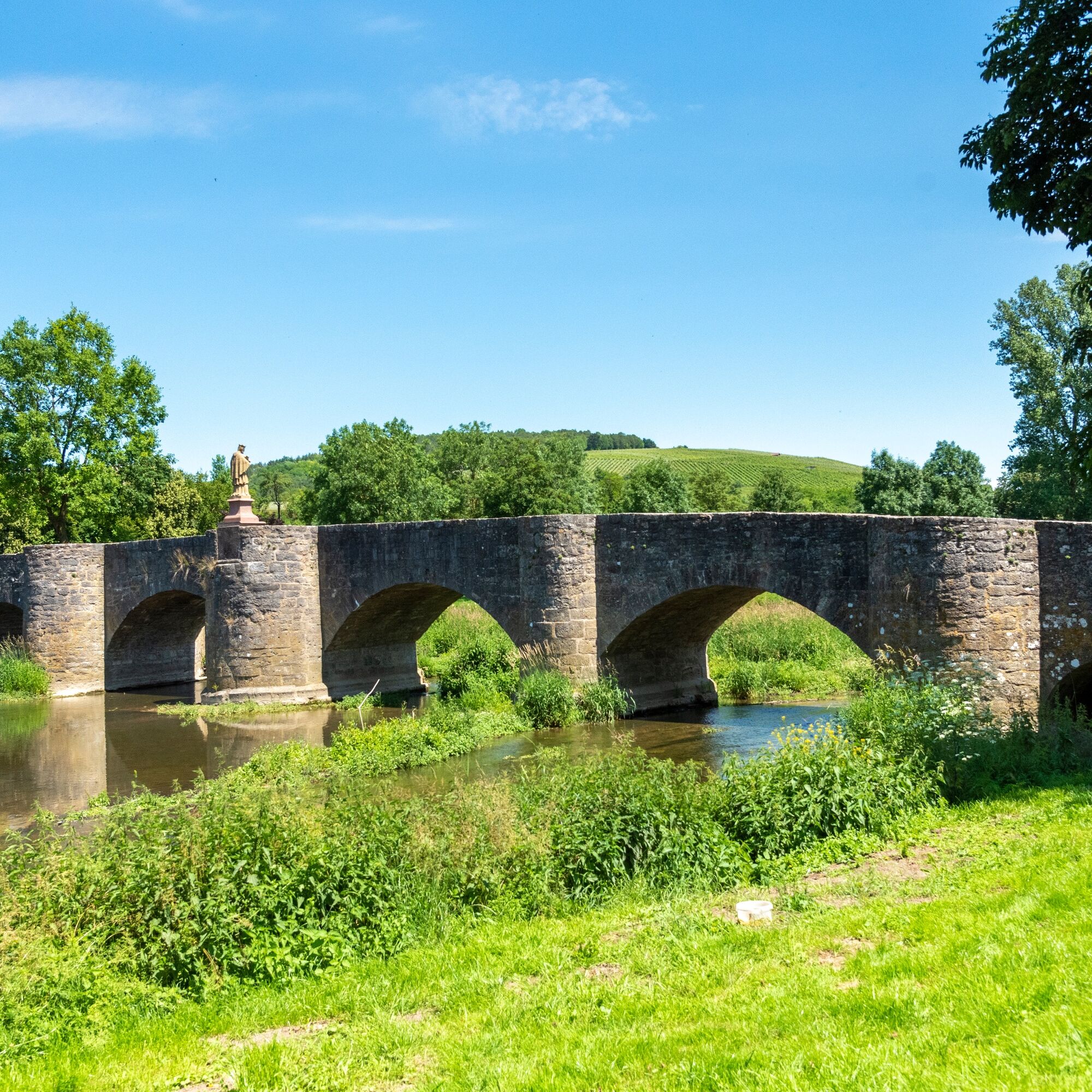
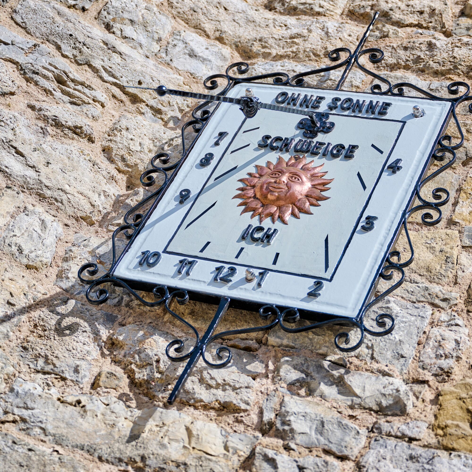
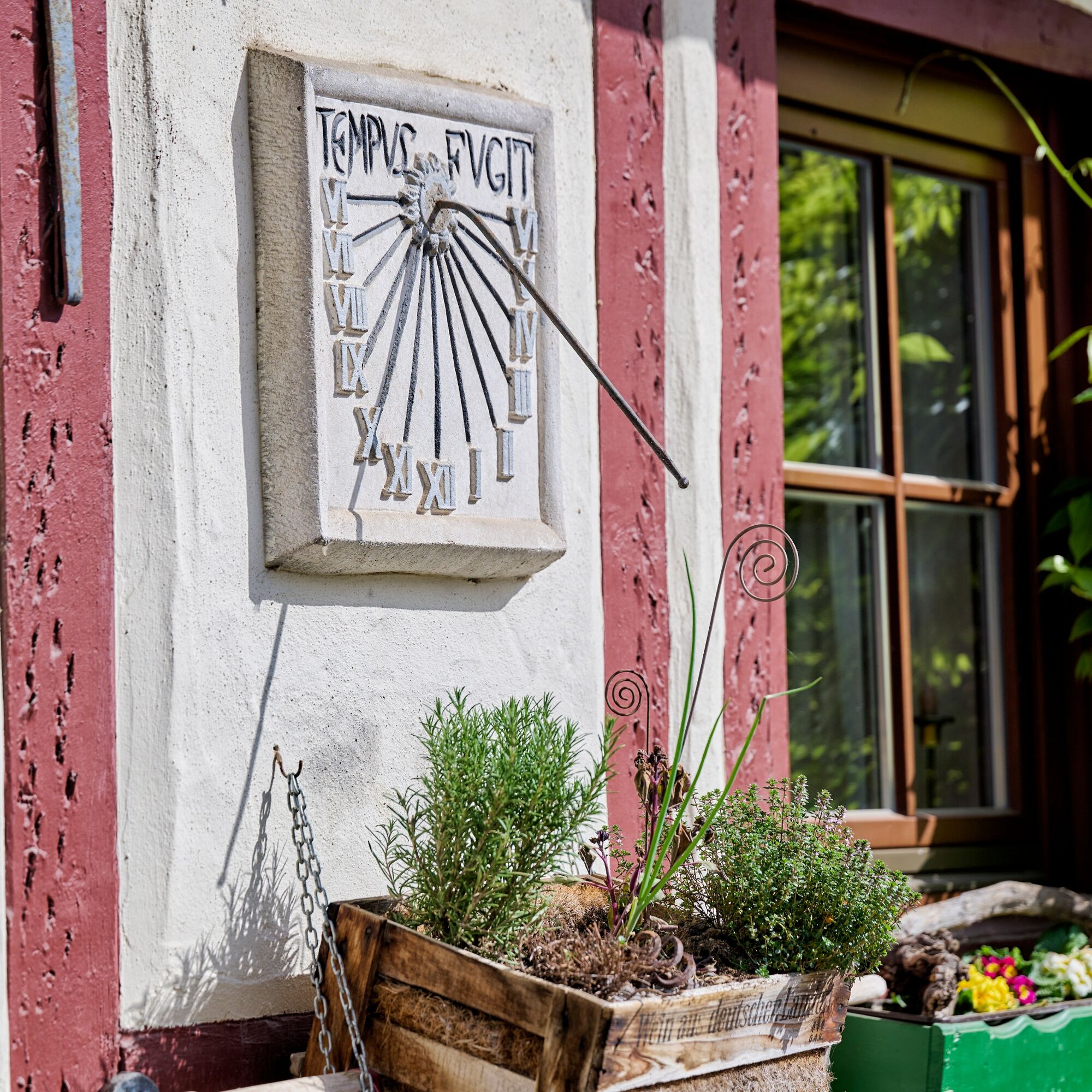
Or you decide on the alternative route to the Panoramaweg Taubertal (red hiking boot silhouette on a white background), which takes you through Röttingen via Tauberrettersheim to Karlsberg, where you meet the original route of the Panoramaweg again. In Röttingen, with this variant, you can also take a look at Brattenstein Castle, the historic town hall, the half-timbered houses, the museum vineyard, the wine museum, and the Paracelsus garden. Or you can take a round on the sundial path or the Kneipp hiking trail. When you arrive in Tauberrettersheim, the Tauber Bridge by Balthasar Neumann (1733) and a herb teaching garden with Kneipp facility await you. https://www.touren.liebliches-taubertal.de/s/3wPHPX.
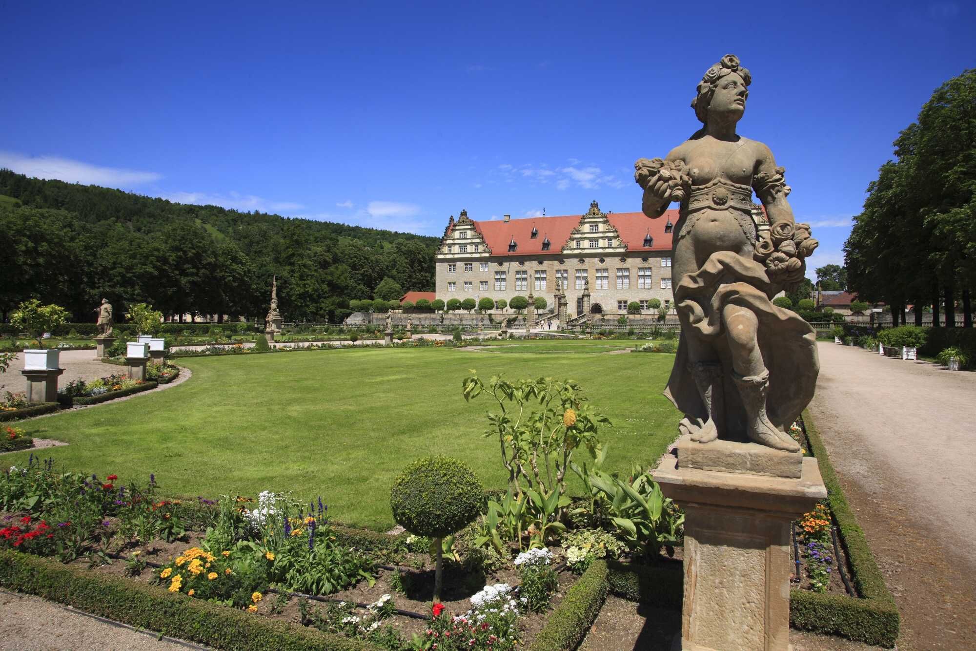
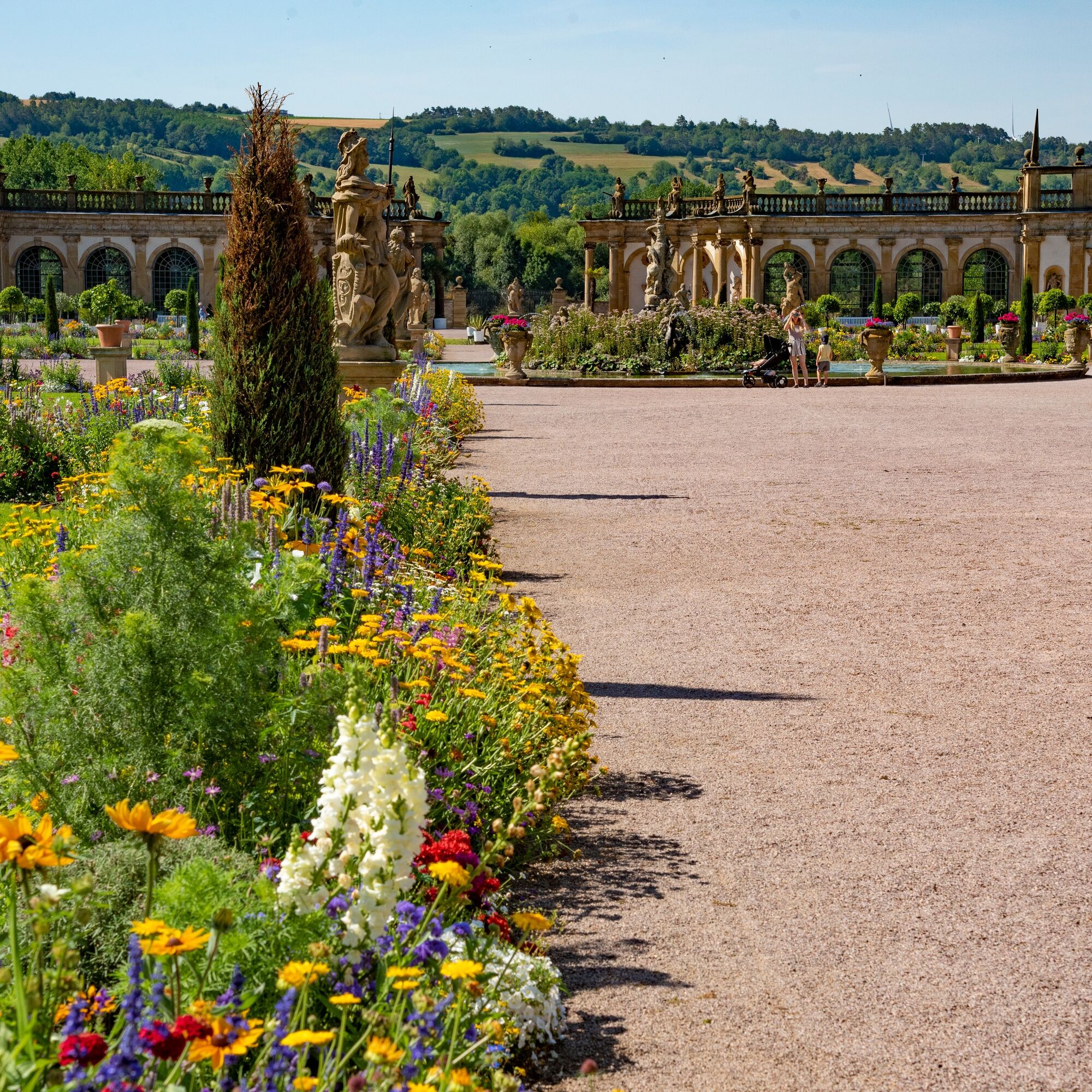
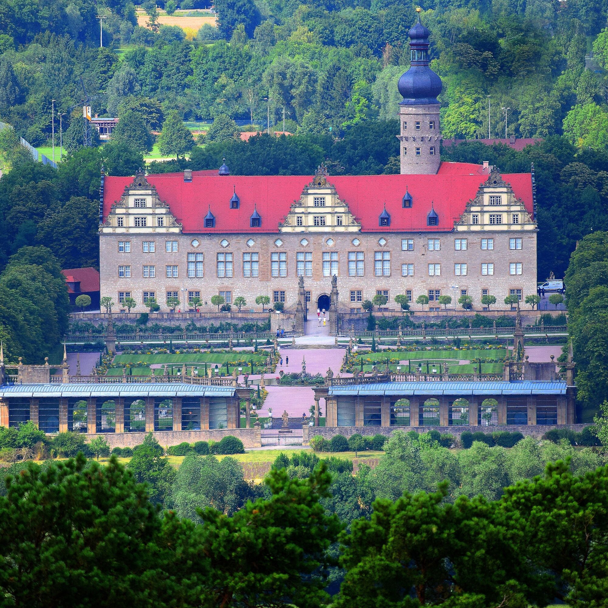
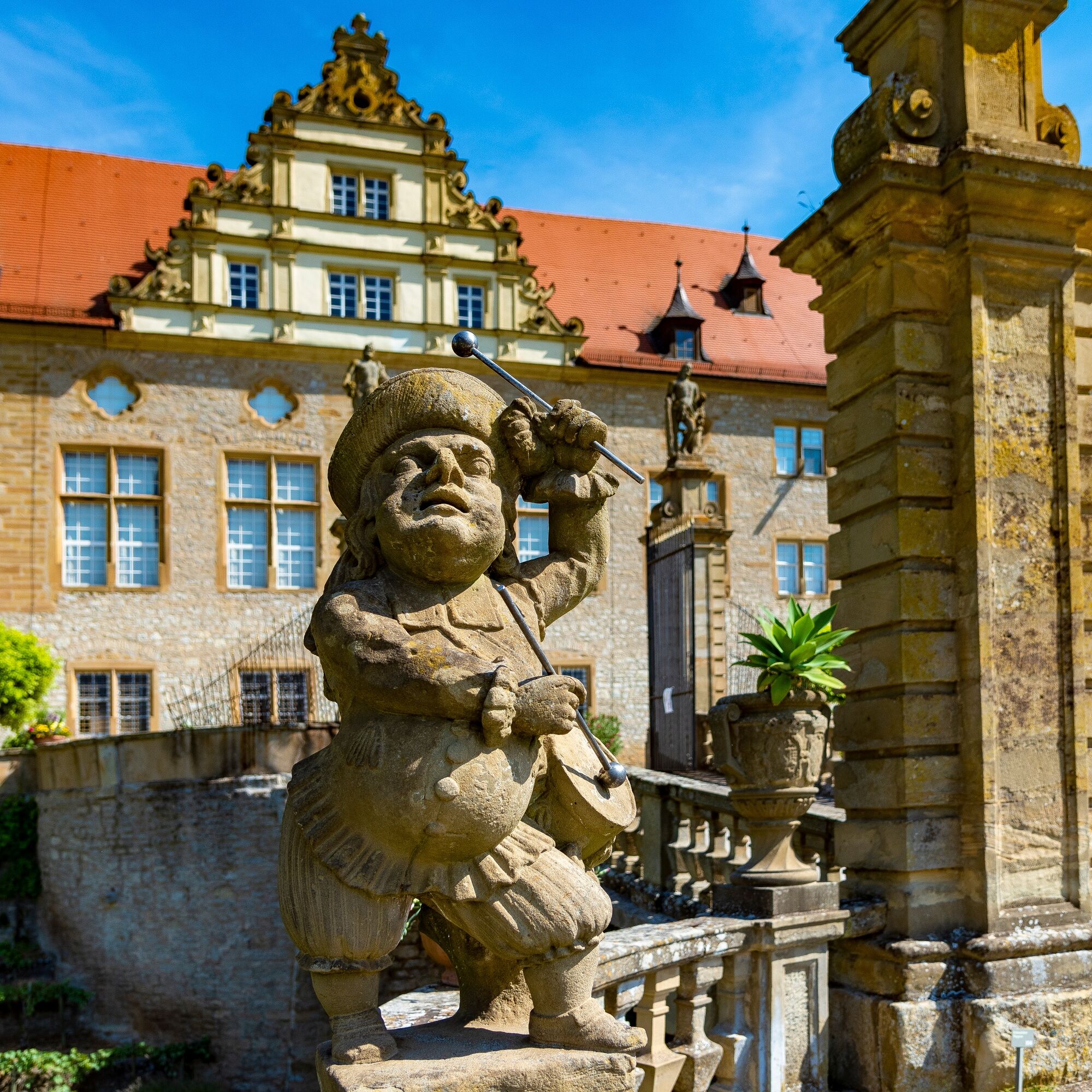
The Panoramaweg leads you past the observatory to Weikersheim. There, you should not miss making a small detour into the old town: In addition to the historically shaped town center, you should visit the Renaissance castle with castle garden, orangery, and alchemy museum. There is also the Tauberländer village museum, the museum in the Gänsturm, and the planet trail in Weikersheim.
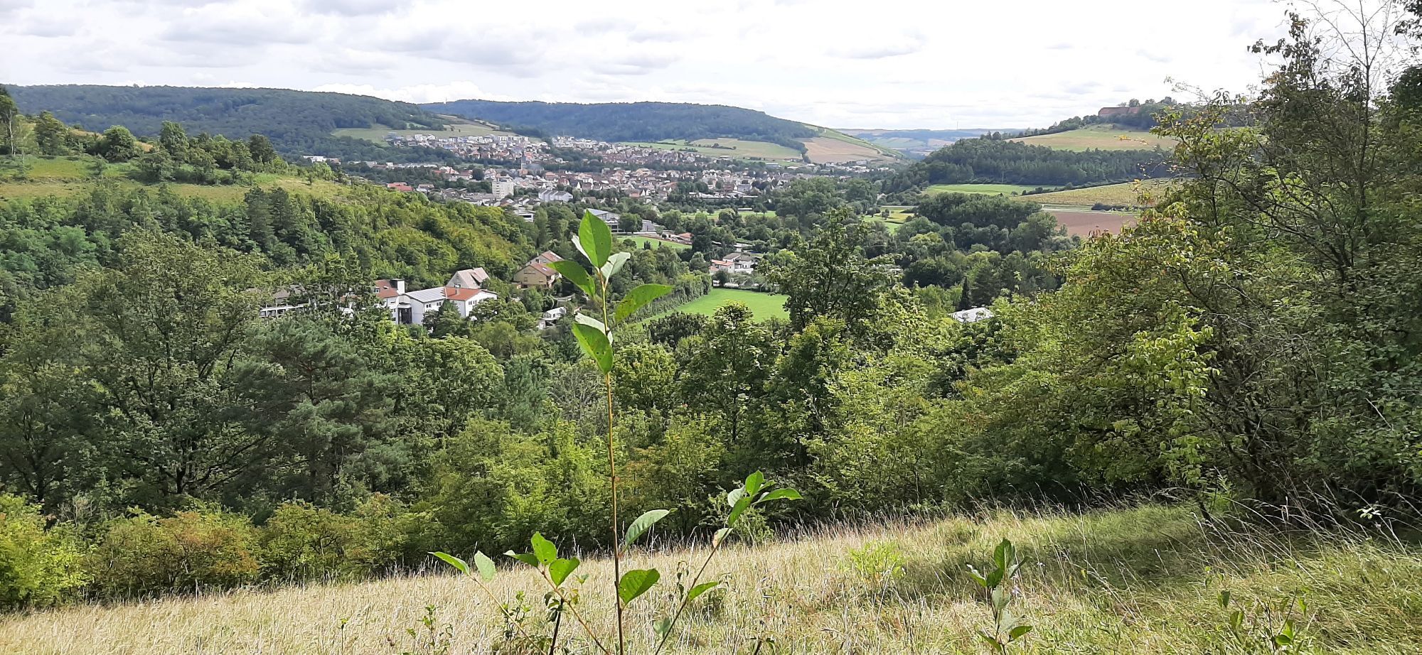
After a climb on the Tauberberg, you will be rewarded with views of Igersheim with the Deutschordensburg Neuhaus. In Igersheim, there is the local history museum in the culture house.
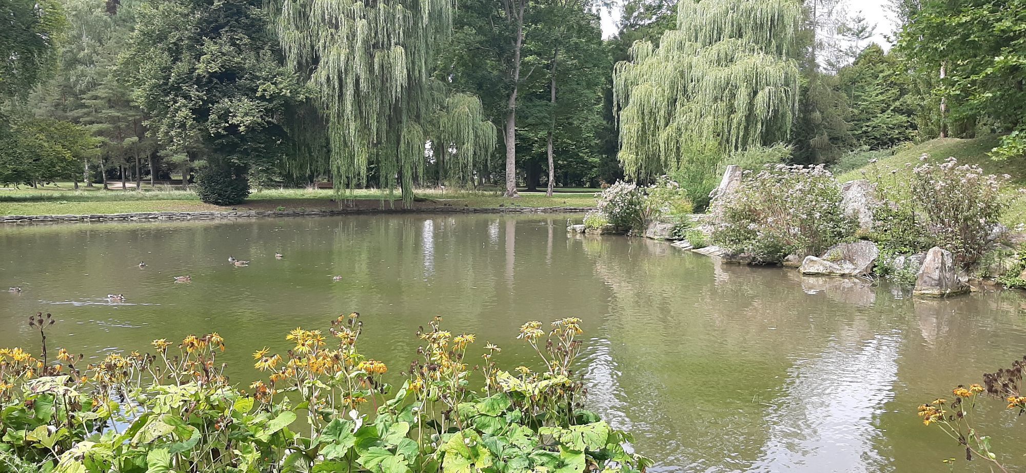
Entering the spa town of Bad Mergentheim, you walk through the large spa and castle park. Before you see the historic marketplace with impressive half-timbered houses, town hall, and twin houses, the path leads you through the residence castle with the Deutschordensmuseum. You can take a break from hiking in the bathing and wellness park "Solymar," at the golf course, in the wildlife park, or during a visit to the Grünewald Madonna in Stuppach.
Intermediate distances:
Creglingen – Röttingen: approx. 8 kilometers
Röttingen – Weikersheim: approx. 10.5 kilometers
Weikersheim – Igersheim: approx. 9 kilometers
Igersheim – Bad Mergentheim: approx. 5 kilometers
Those who prefer to walk over the wine village of Markelsheim with the Markelsheim winemakers cooperative, a wine educational trail, as well as the marketplace with fountain and half-timbered houses instead of completely over the Tauberberg, follow from Weikersheim the Odenwald-Main-Taubertal Pilgrimage Route via Markelsheim to Igersheim, where the route meets the Panoramaweg Taubertal again. This concerns stages 6 & 7 of the Pilgrimage Route.
Sights along the route:
Creglingen: see stage 1
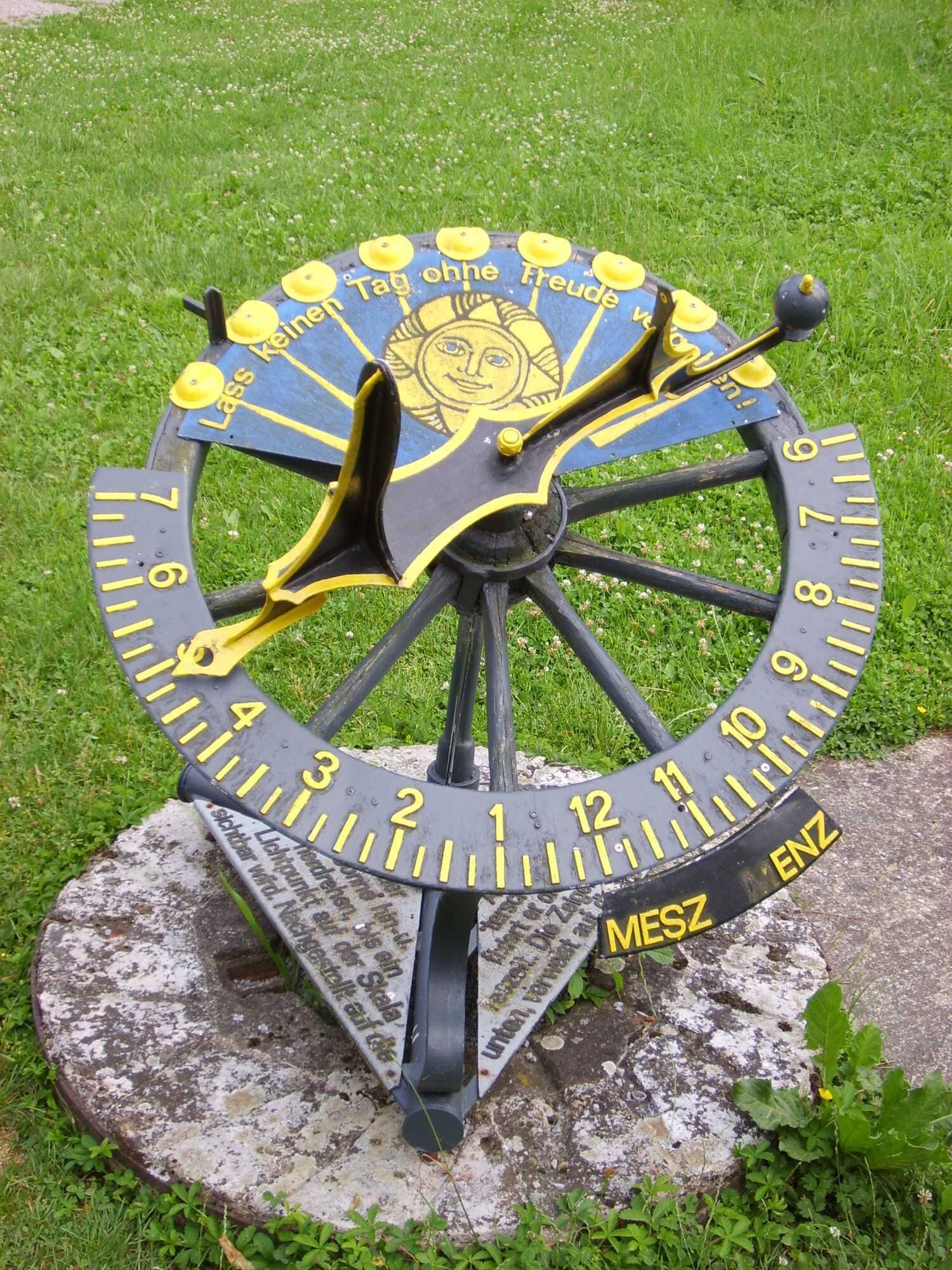
Röttingen: Brattenstein Castle, historic town hall, half-timbered houses, museum vineyard, wine museum, sundial path, archaeological hiking trail, Kneipp hiking trail, Paracelsus garden
Tauberrettersheim: Tauber Bridge by Balthasar Neumann (1733), herb teaching garden with Kneipp facility
Weikersheim: historically shaped town center, Tauberländer village museum, Renaissance castle with alchemy museum, castle garden and orangery, planet trail, museum in the Gänsturm, Karlsberg
Markelsheim: Markelsheim winemakers cooperative, wine educational trail, marketplace with fountain and half-timbered houses
Igersheim: Neuhaus Castle, local history museum in the culture house
Bad Mergentheim: Mergentheim residence castle with Deutschordensmuseum, spa and castle park, historic marketplace with impressive half-timbered houses, bathing and wellness park "Solymar", Grünewald Madonna in Stuppach, wildlife park, golf course


Passing dry grassland areas with dry stone walls, stone ridges, vineyards, and impressive views, the path leads you to Röttingen.
Hiking equipment and provisions recommended.
By bus to Creglingen.
Please observe the local signage.
T1
If you want to expand your hike with day hikes on circular routes, you can do so on this stage with the following circular hikes:
In Röttingen: LT 25- Sundials and Bridges In Weikersheim: LT 23: Renaissance and Stone Ridges In Markelsheim: LT 18- Around the Tauberberg In Bad Mergentheim: LT 17- Spa and Wine, LT 15- Through the Bürgerwald into the Wolf Valley
You want to shorten the stage? In the following towns and municipalities, you will find sufficient accommodation options:
Röttingen Weikersheim Markelsheim Igersheim
You can search for available beds here.
Populära turer i närområdet
-
Main-Tauber-Franconian Rad-Achter: Outer Ring 5th stage
MediumCykling 26,7 km -
5,0
Stadtwald Aub
ljusVandring 8,66 km -
5-star cycle route “Lovely Tauber Valley - The Classic”
tungCykling 101,7 km -
Adventure route 3: To the Frankendom in Wölchingen
MediumCykling 41,8 km -
LT 23 - Renaissance and stone terraces
tungVandring 13,7 km -
Wine cycling trip 4th stage: Health and wine
MediumCykling 28,6 km -
Liebliches Taubertal - The Classic 2nd Stage
ljusCykling 33,7 km -
Liebliches Taubertal - The Classic 1st stage
MediumCykling 39,3 km -
LT 25 Sundials and Bridges
tungVandring 12,3 km -
Taubertal Wine Route
Motorcykel 194,5 km
Vandring och spårning


Missa inte erbjudanden och inspiration inför nästa semester
Din e-postadress har lagts till på e-postlistan.