


"Hegauer Kegelspiel" Wannenberg hike


The climatic spa town of Tengen lies in the middle of the Hegau landscape directly on the Swiss border between the Black Forest, Alps and Lake Constance. Every season gives this idyllic landscape special...
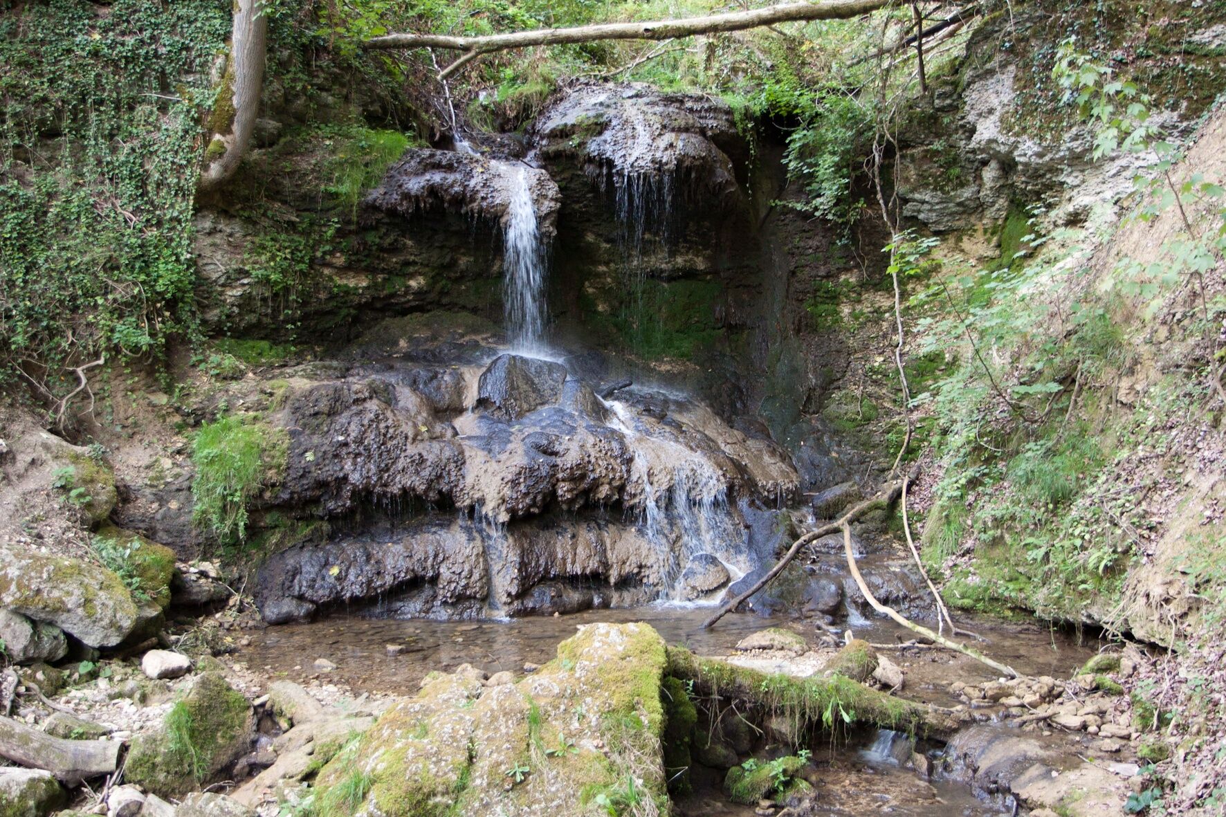
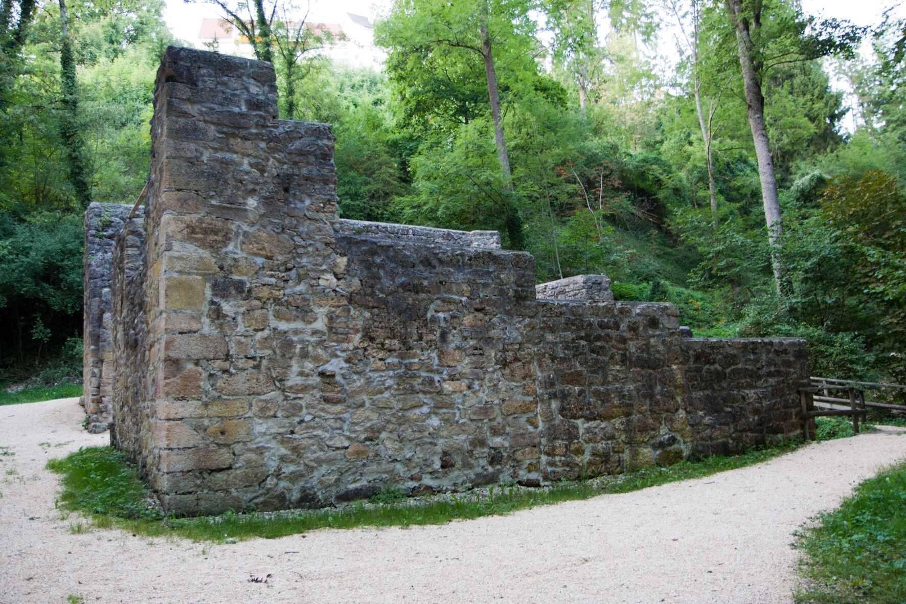
The climatic spa town of Tengen lies in the middle of the Hegau landscape directly on the Swiss border between the Black Forest, Alps and Lake Constance. Every season gives this idyllic landscape special charms. Hikers enjoy the medieval town structures of the city of Tengen, the path through the wildly romantic Mühlbach Gorge with its impressive waterfalls, mill ruins, and water wheels from the Middle Ages. From this time comes the Schätzele Market, which has meanwhile developed into the largest folk festival in the region. The Schätzele Market has existed since 1291 and takes place every year on the last weekend of October.
The region around Tengen also became known for the "Tengener Muschelkalk," which was very popular over the past centuries as a building material and for making millstones. Numerous quarries supplied the entire region with this sought-after building material.

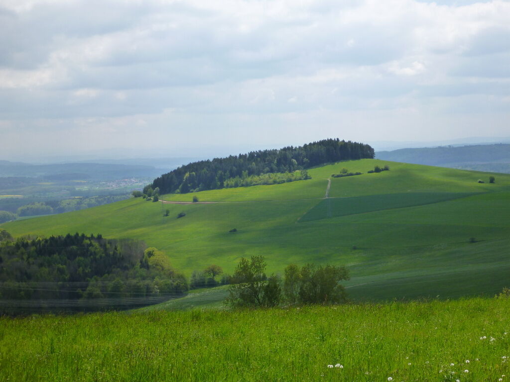


High up on the hill at the parking lot at Spitzhütte in Tengen, the 9 km long hike around the Wannenberg begins. In good weather conditions, a unique Alpine panorama can already be seen here. The path gently descends towards Wannenberg. A few meters higher, you circle the Wannenberg with its numerous seating and resting opportunities. With a view of the small town of Blumenfeld, the route continues across open fields down to Rohrertal. There the path enters the forest again. After a hairpin turn, it goes slightly uphill on the other side of the Nesselbach past the Kreuzkapelle. The path turns left at the edge of the forest and leads uphill over a meadow path. This requires some stamina. But the wonderful view over the Hegau to the Alps rewards the hiker for the effort made. Upon reaching the Alten Postweg, the path turns left and gently descends back to the starting point at the parking lot at Spitzhütte. Numerous seating and resting opportunities invite you to a long break there again.
The circuit of the Wannenberg (760m) and the romantic path back through the Rohrertal offer a wide variety of landscapes. Deep forests, open meadows and crossing the Rohrertal make the Wannenberg hike an interesting and varied hike on the ridges of the Randen.
The Wannenberg hike can also be started at the parking lot at the Alte Postweg hut or at the entrance to Rohrertal.
Ja
Access via highway to the Tengen exit. Then towards Watterdingen and straight ahead to Tengen through the town center. Just before the Blumenfeld junction, the start at the portal is possible on the right at the bridge.
Access to Tengen, follow the signs towards the sports field but stay on K6137. Then follow the signs to Spitzhütte halfway up.
Regional bus lines 7353 and 7360 from Singen or Engen to Tengen; approx. 3.5 km walk to the portal; to Watterdingen; approx. 2.2 km walk to the portal
Parking lot Spitzhütte
Ja
Visit the old town of Tengen with the city gate, bergfried, and castle chapel. Hike through the Mühlbach Gorge with water wheels and waterfall.
Populära turer i närområdet
-
5,0
"Hegauer Kegelspiel" Stettener Panoramaweg
MediumVandring 7,62 km -
5,0
"Hegauer Kegelspiel" Alter Postweg
MediumVandring 9,26 km -
Castle trail 1 - From Tengen via Blumenfeld and back via Büßlingen
MediumVandring 10,1 km -
SwitzerlandMobility 902: Reiatweg
MediumVandring 19,0 km -
Vulkansee Höwenegg Rundweg
ljusVandring 7,05 km -
5,0
"Hegauer Kegelspiel" Hohentwieler
MediumVandring 7,21 km -
Hike to the highest point of Schaffhausen
MediumVandring 10,1 km -
Volcano - Enjoy Hegau - On the tracks of the world champions! 50 km
MediumMountainbike 49,5 km -
"Hegauer Kegelspiel" Hegau Volcano Tour
tungVandring 29,2 km -
Aacher Geißbock
MediumVandring 13,4 km
Vandring och spårning


Missa inte erbjudanden och inspiration inför nästa semester
Din e-postadress har lagts till på e-postlistan.