


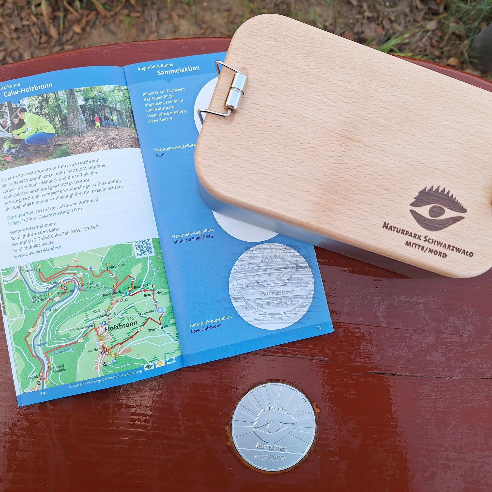
Naturpark-AugenBlick-Runde Calw-Holzbronn


"Moment, stay a while! You are so beautiful!" (Johann Wolfgang von Goethe, Faust I)
This quote beautifully describes what awaits you at the Naturpark-AugenBlick in Holzbronn and all others: an breathtaking...
"Moment, stay a while! You are so beautiful!" (Johann Wolfgang von Goethe, Faust I)
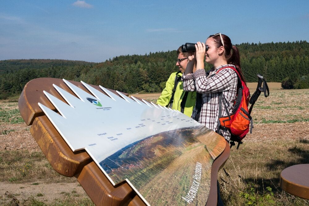
This quote beautifully describes what awaits you at the Naturpark-AugenBlick in Holzbronn and all others: an breathtaking and all-around beautiful view. These special viewpoints invite you to discover the landscape with a bench, small table, and labeled panorama board. The AugenBlicke are designed based on the Naturpark logo – the distinctive Naturpark eye – and at the same time are the starting point for a circular route, the AugenBlick-Runde. Let your gaze wander and discover the varied natural and cultural landscape of the nature park!
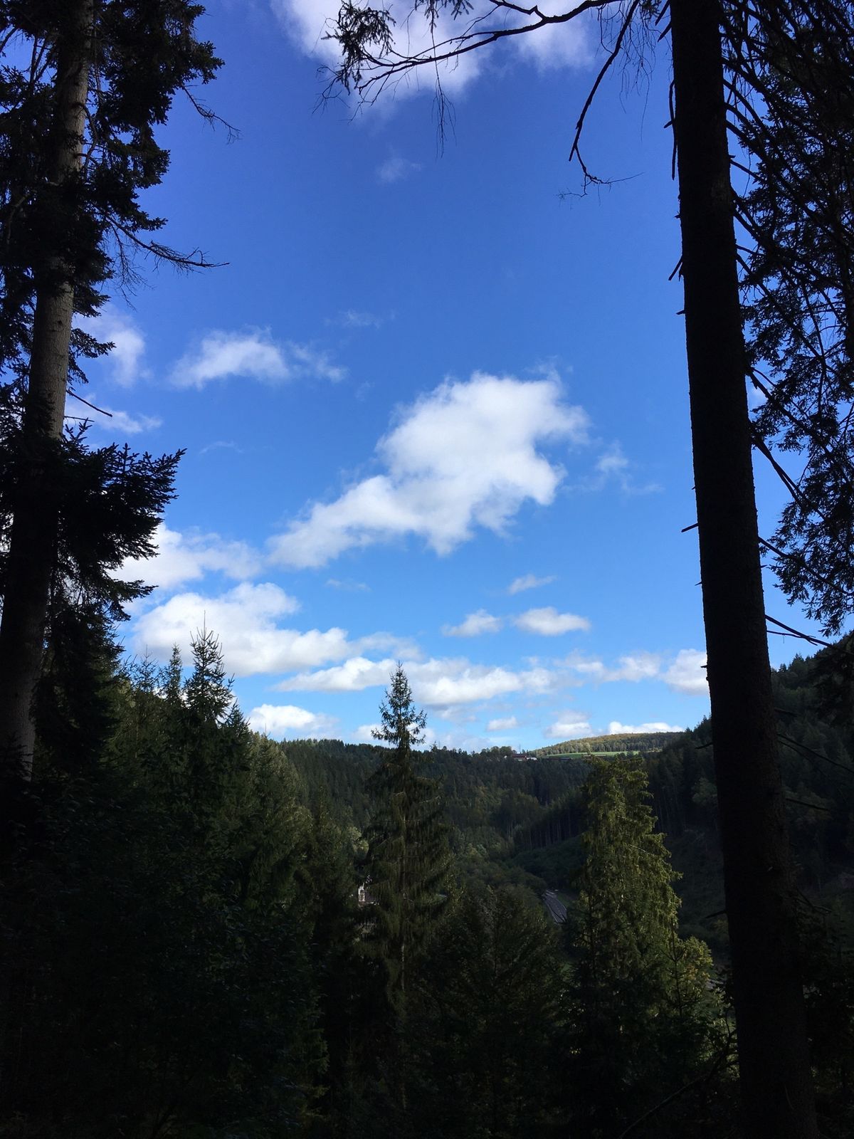
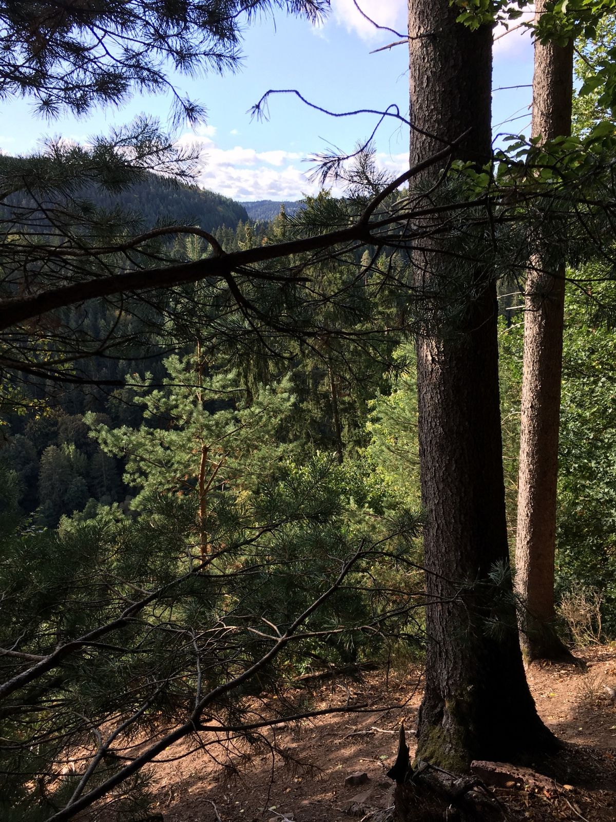
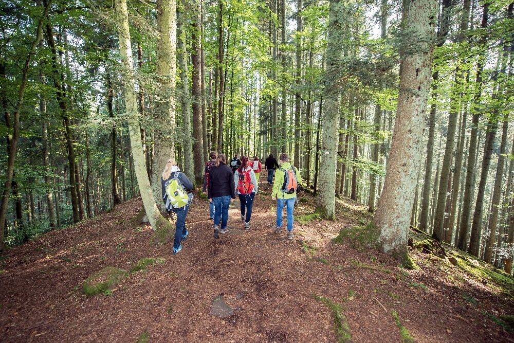
The spectacular circular hike initially leads over wide paths and meadows to the Naturpark-AugenBlick high above the Nagold valley. Then it goes down again over steep and adventurous paths. Past the ruins of Waldeck Castle, the path leads along the river course to the Gasthof Talmühle. Afterwards, the trail runs a short stretch through the fascinating gorge of the Xanderklinge (be sure to watch for the exit!!!). It goes up several meters in altitude before the trail leads out of the forest back to Holzbronn to the starting point.
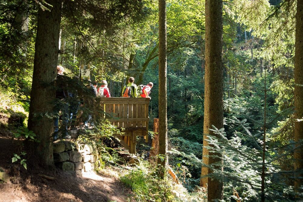
Tip: Viewing platform with a view into the Xanderklinge
So take a moment and reward yourself with a wonderful view!
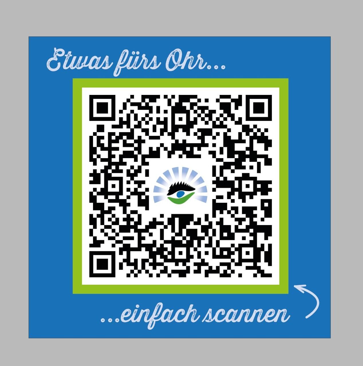
New: mp3 audio file for people with visual impairments at the AugenBlick (scan QR code).


Signage
The logo of the AugenBlick-Runde and the lozenge guide you from one signpost location to the next.
Important to note: The AugenBlick-Runde symbol is not continuously displayed but usually only when the signage of the Schwarzwaldverein (change of lozenges) changes. Therefore, always follow the colored lozenge next to the AugenBlick symbol.
Schwarzwaldverein signpost locations: Holzbronn, Oberholzrain, Benzenlehen, Bildhaus, Baiersbach, Hirschloch, Totenweg, Unterer Baiersbach, Waldeck Ruins, Geigerles Lotterbett, Talmühle, Talmühle Station, Riemenwiesen, Holzbronn
We start our hike at the town hall in Holzbronn and follow the signage of the AugenBlick-Runde. Important to note: The AugenBlick-Runde symbol is not continuously displayed but usually only when the signage of the Schwarzwaldverein (change of lozenges) changes. Therefore, we always follow the printed lozenge next to the AugenBlick symbol.
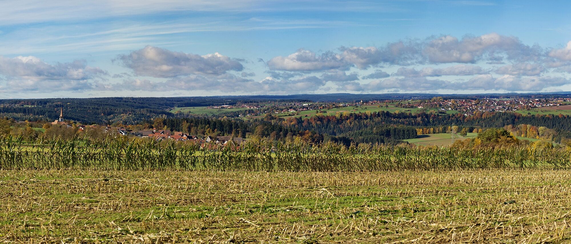
At the beginning, the yellow lozenge points the way and leads us out of the village. Immediately on the left, a fantastic view opens over lush meadows onto the valleys and the gently rolling Black Forest hills. Pause briefly and enjoy before continuing. What a delight!
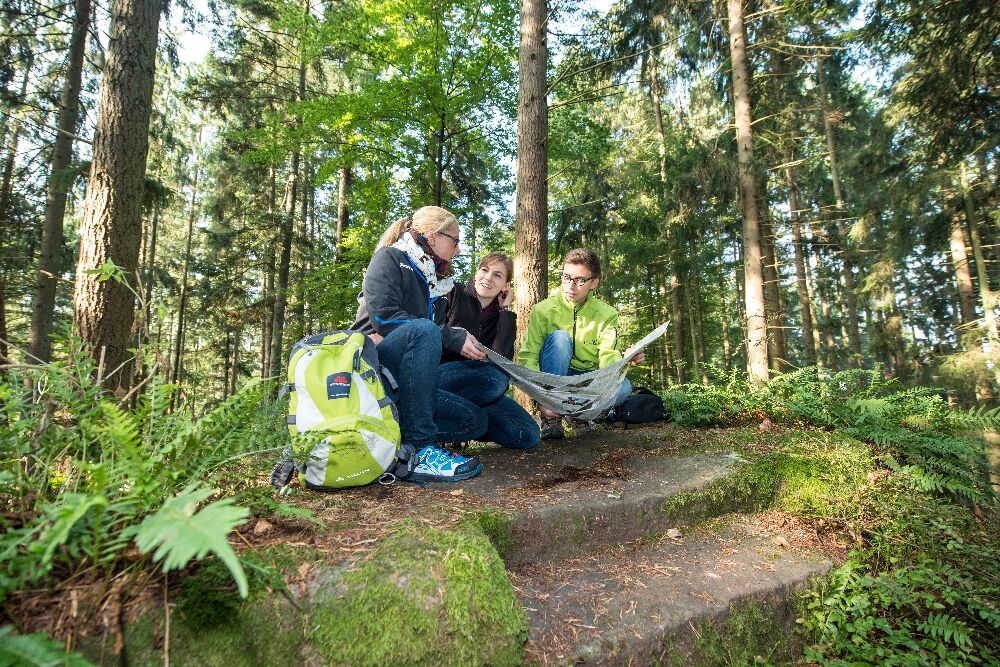
In the midst of fields, a few meters further at the forest edge, we meet the Gäurandweg marked with "Rose hip on green lozenge," which leads us directly to the AugenBlick Holzbronn. On the panoramic board typical for AugenBlick-Runden, we can clearly see which scenic highlights are presented to our eyes near and far. On the heights, Neubulach, Altbulach, Zavelstein, and Emberg spread wonderfully, and when we look straight ahead, our gaze falls on the Dürrbach, Rötenbach, and Teinachtal valleys. An invitation to explore these up close on another hike?! The place acts like a magnet and makes it hard to move on.
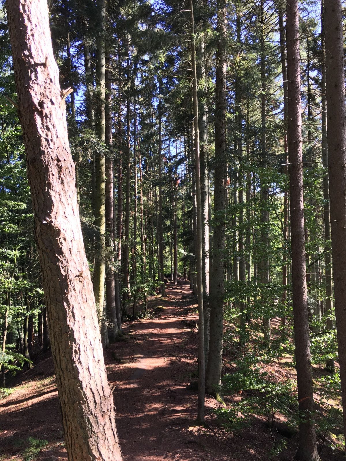
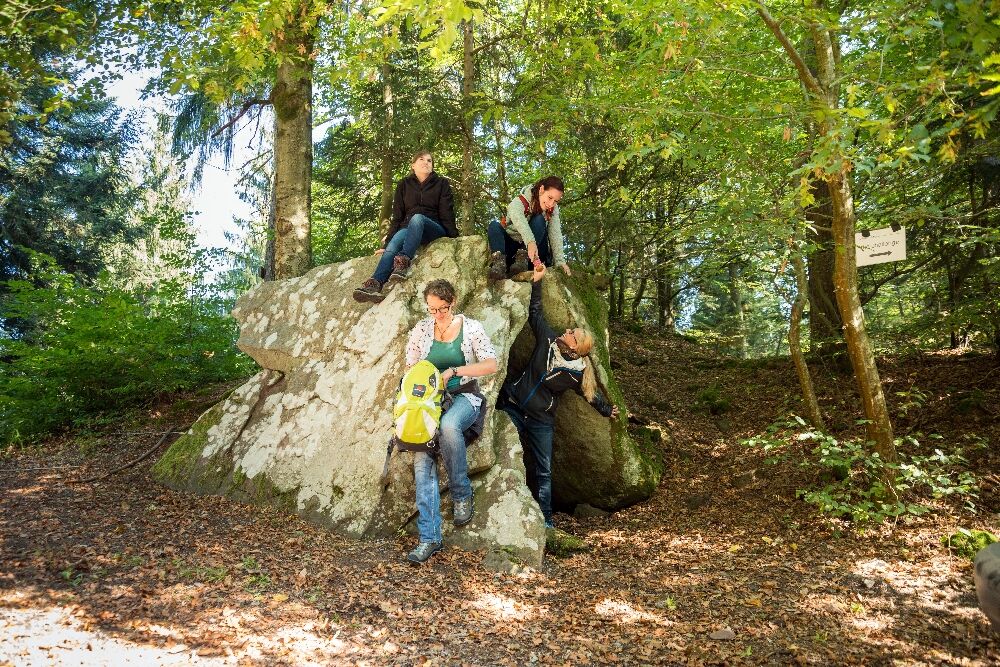
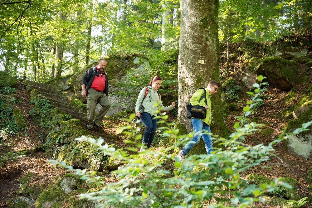
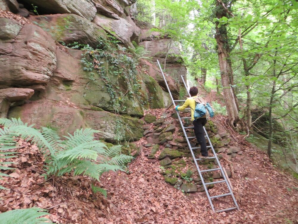
Finally, we manage to detach ourselves and walk down happily. After crossing the K4302, we enter the shady forest, keep left, and soon reach a magnificent forest clearing. At the Hirschloch signpost location, we leave the Gäurandweg and now follow the blue lozenge. Suddenly, a left turn appears before us and opens alpine-like terrain (surefootedness required). The narrow path leads downhill over ladders, mossy stone steps, and gnarly roots along towering rock formations. A truly impressive and memorable section, making our hiking and adventure hearts beat faster!
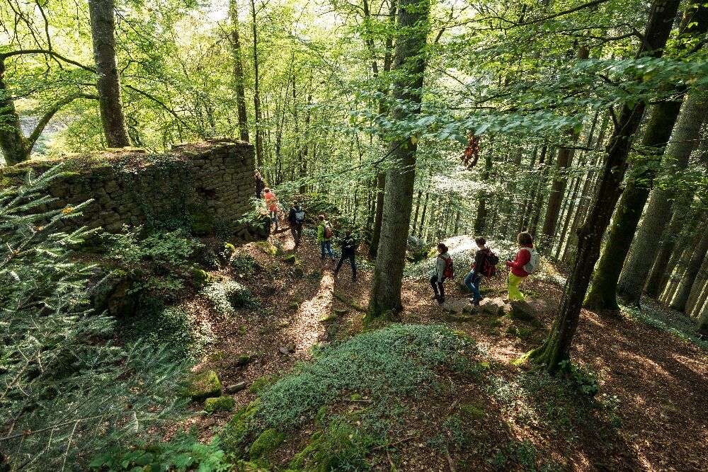
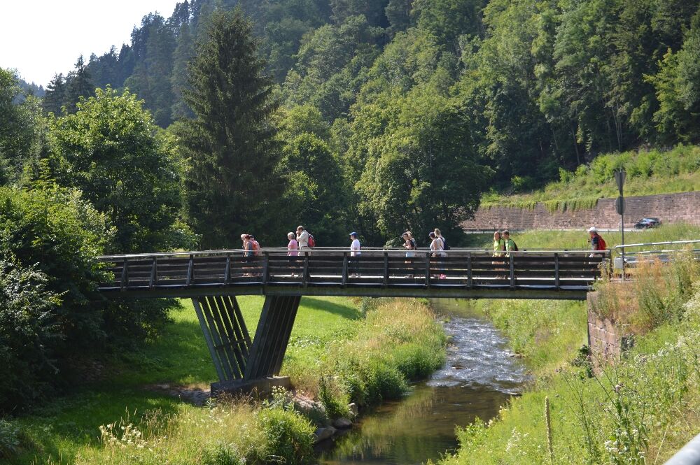
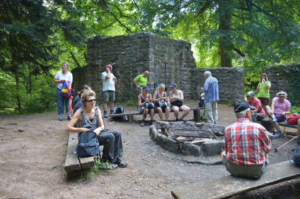
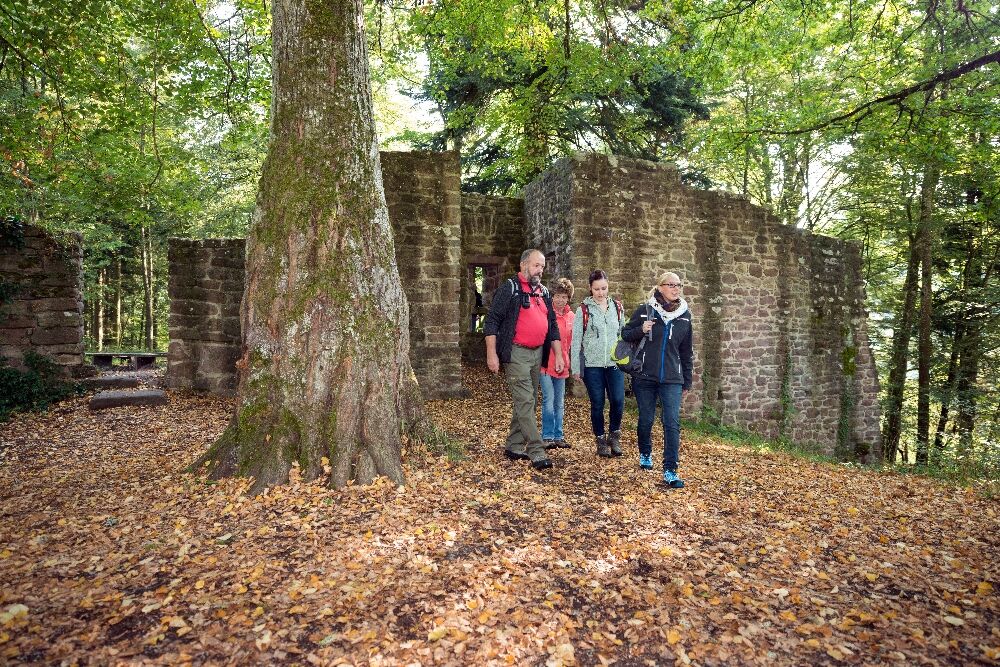
Then we reach a wider path and now follow the yellow lozenge to the left. We reach the B463, walk along a sidewalk next to the road about 200 meters to the right, and cross the Nagold over a wooden bridge. Now we should pause briefly and admire the idyllic half-timbered house with its adjoining garden. A short rest and gathering strength cannot hurt anyway, as we then have to climb steeply to reach the Waldeck Castle Ruins. Once there, we are quickly convinced that the effort was worth it. The ruins present themselves as imposing and well preserved. A tour through the former knight's castle built around 1100 is a must. There is also a cozy barbecue area inviting you to rest.
Afterwards, we climb the stone steps on the right side of the ruins and continue hiking along a ridgeline, passing a kind of rock pulpit. Then we descend and pass the resting place Geigerles Lotterbett, where there is also a barbecue area. Under two sandstone rocks, the musician Geigerle is said to have once created a sleeping chamber. It is indeed a very cozy spot! However, we should not lie down as we don't know if we'll want to continue hiking later. That would be a shame, as more beautiful trail sections await us.
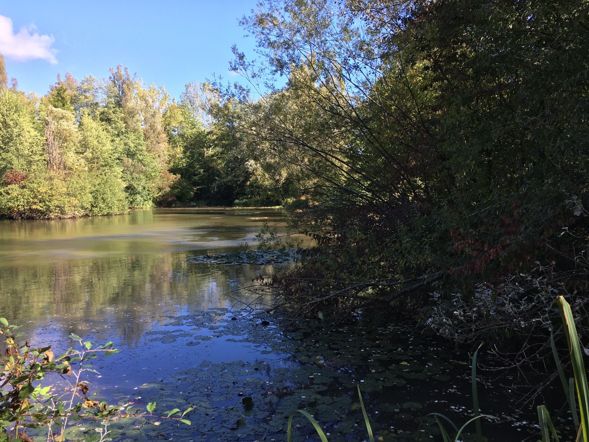
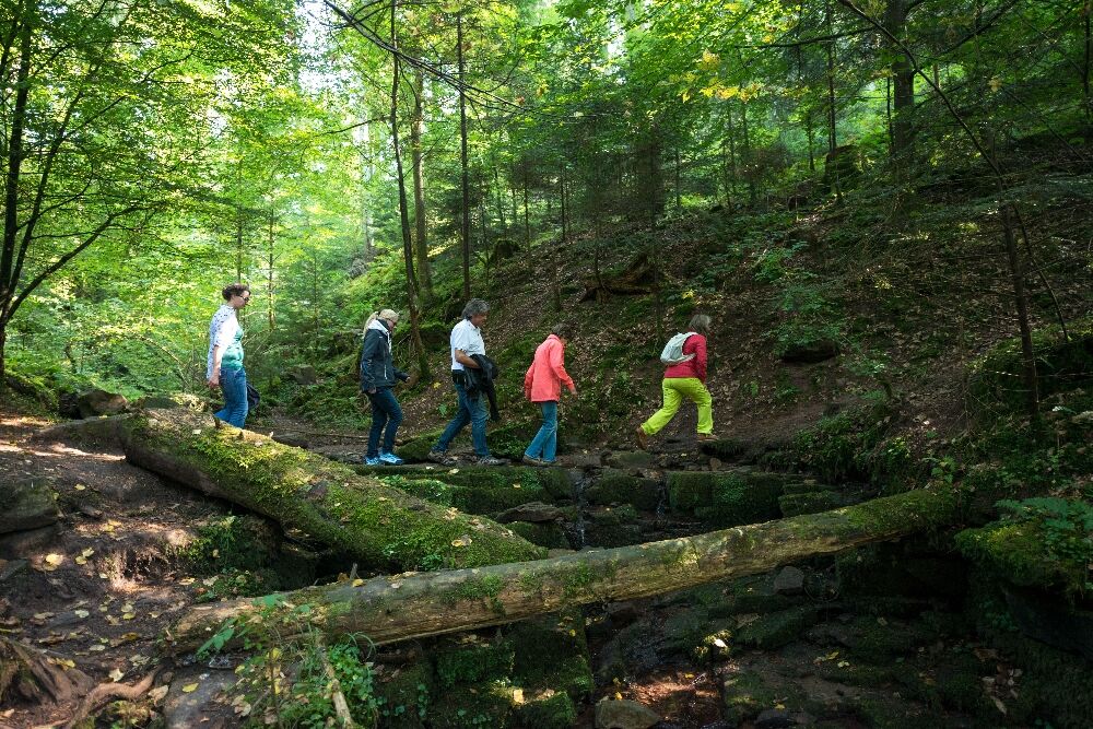
To the left of the barbecue area, we continue downhill on a wide path and then take the left turn. Soon, we reach the Nagold valley via a narrow path. At the Talmühle Inn we cross the river again and follow the blue lozenge briefly. It then leads us over the railway tracks and then to the left. A few meters further, we are welcomed again by the cool freshness of the forest and by a section of the trail that overwhelms us with its abundance of landscape beauty.
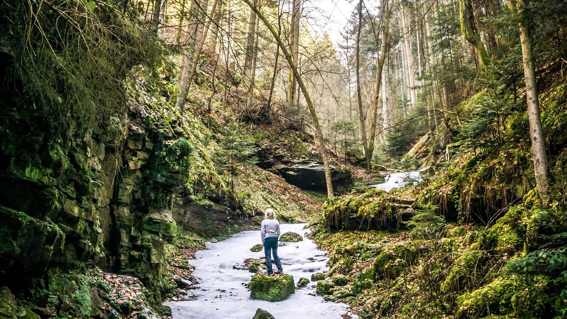
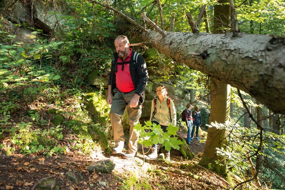
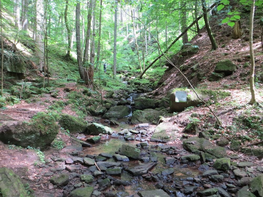
We hike through the gorge called the Xanderklinge, a brook cut into the sandstone. A footpath leads us through this natural phenomenon, and we can hardly keep our eyes on the trail, so fascinated and captivated are we by the gorge's beauty. We pass towering rocks, switch sides of the brook over stones, and climb over roots, rock edges, and deadwood uphill. A soothing silence surrounds us. Soon, an almost inconspicuous, steep path branches off to the left. But we want to ignore it for now, as the trail continues a few meters deeper into the gorge. At a small waterfall (sign "Secluded World"), however, the path finally ends and demands a return (!!! do not continue, as this is a forest biotope - nature protection!!!, there is also high accident risk in the gorge, especially due to falling rocks, stones, trees, deadwood, and flooding during and after heavy rain, so return until the ascent opposite the sign Small Climate). We ascend the alpine-like path uphill and then turn right. A viewing platform invites us once more to look into the breathtaking gorge.
Finally, we cross the brook for the last time and follow the wide path out of the forest back to Holzbronn. We walk the last kilometer back to the town hall almost reverently. We are still lingering in the moments of this impressive hike.
Ja
Sturdy footwear recommended.
The Xanderklinge should not be entered during or after heavy rain/thunderstorms (possibly high water levels)!
The entire Xanderklinge itself is not part of the Naturpark-Augenblick-Runde, as it is a protected biotope and poses a high accident risk - especially due to falling rocks, stones, trees, deadwood, and flooding during and after heavy rain!
Arrival by car: Motorway A8 from Karlsruhe
:
Exit Pforzheim-West (approx. 25 km); continue via federal road B463 towards Calw, then continue on B296 towards Calw and further towards Stuttgart. Then take the B296 right towards Stammheim. Then continue right on K4302 to Holzbronn Motorway A8 from Ulm/Stuttgart:
Exit Leonberg (approx. 30 km), continue via federal road B295 towards Weil der Stadt to Calw. In Calw, turn left onto B296 towards Stammheim. Then continue right on K4302 to Holzbronn Motorway A81 from south / Bodensee:
Exit Gärtringen-Stadtmitte (approx. 20 km), continue via K1075; near Deckenpfronn turn left onto K1022. At the roundabout take the first exit and continue on B296 towards Calw. Then turn left onto K4302 towards Holzbronn.
Plan your trip by car at www.map24.de
Further information is available at www.calw.de/Anreise.
Arrival by train:
Route Pforzheim - Calw - Horb - Tübingen (Kulturbahn). Long-distance train connections (EC, IC, ICE) are best reached in Karlsruhe with connecting trains via Pforzheim (Kulturbahn) to Calw. If arriving via Stuttgart, we recommend continuing by S-Bahn S6 Stuttgart - Weil der Stadt with transfer to bus line 670 to Calw. From the Central Bus Station Calw (ZOB), take the call bus CW3 or school buses 668 on weekdays to Calw-Holzbronn, stop Dorfplatz.
Plan your trip with http://reiseauskunft.bahn.de/bin/query.exe/d
Call buses can be ordered by phone at 07051/96 88 55, via app (VGC app or bwegt Bus & Train), or online at www.vgc-online.de/fahrplaene-netz/vgc-plus no later than 60 minutes before departure.
Arrival by bus:
Greater Stuttgart area: Bus line 670 DB Bahn Regiobus / Volz; (Calw-Weil der Stadt) Connection to S6 Area Böblingen / Sindelfingen: Bus line 763 DB Bahn Regiobus; Calw-Böblingen (Connection to S1) From the Central Bus Station Calw (ZOB), you can reach Holzbronn with the call bus CW3, stop Dorfplatz.
Plan your trip with www.efa-bw.de
Call buses can be ordered by phone at 07051/96 88 55, via app (VGC app or bwegt Bus & Train), or online at www.vgc-online.de/fahrplaene-netz/vgc-plus no later than 60 minutes before departure.
You can plan your trip with public transport here:
It is best to get off at the bus stop "Holzbronn Dorfplatz" and then follow the signed AugenBlick-Runde to the viewpoint. The distance is approx. 1.5 km.
!!!Since there are very few parking spaces in Holzbronn, please use the hiking parking lots around Holzbronn!!!
The parking lot closest to the AugenBlick is the hiking parking lot at the K4302 northeast of Holzbronn (N48° 40.143 E008° 45.235). From here, follow the AugenBlick-Runde over the K4302 and then about one kilometer southeast to the AugenBlick.
On weekends, you can also use the additionally designated hiking parking lot at the Homag company in Holzbronn.
By the way, you can also visit the AugenBlicke in the Naturpark Schwarzwald Mitte/Nord virtually at www.naturpark-augenblicke.de . Here you can get a preview of what to expect at the AugenBlick. The special feature: from each AugenBlick, a high-resolution 360-degree panorama photo of the surrounding Black Forest landscape was taken using so-called gigapixel technology. On the website, you can zoom into the images in fine detail. However, the best experience is always to enjoy the AugenBlicke not on your living room sofa but on site.
Guestbook
If you have visited the AugenBlick and want to leave feedback, you are welcome to sign the guestbook.
It is located directly at the Naturpark-AugenBlick under the bench.
Or give us your feedback here in our Online guestbook.
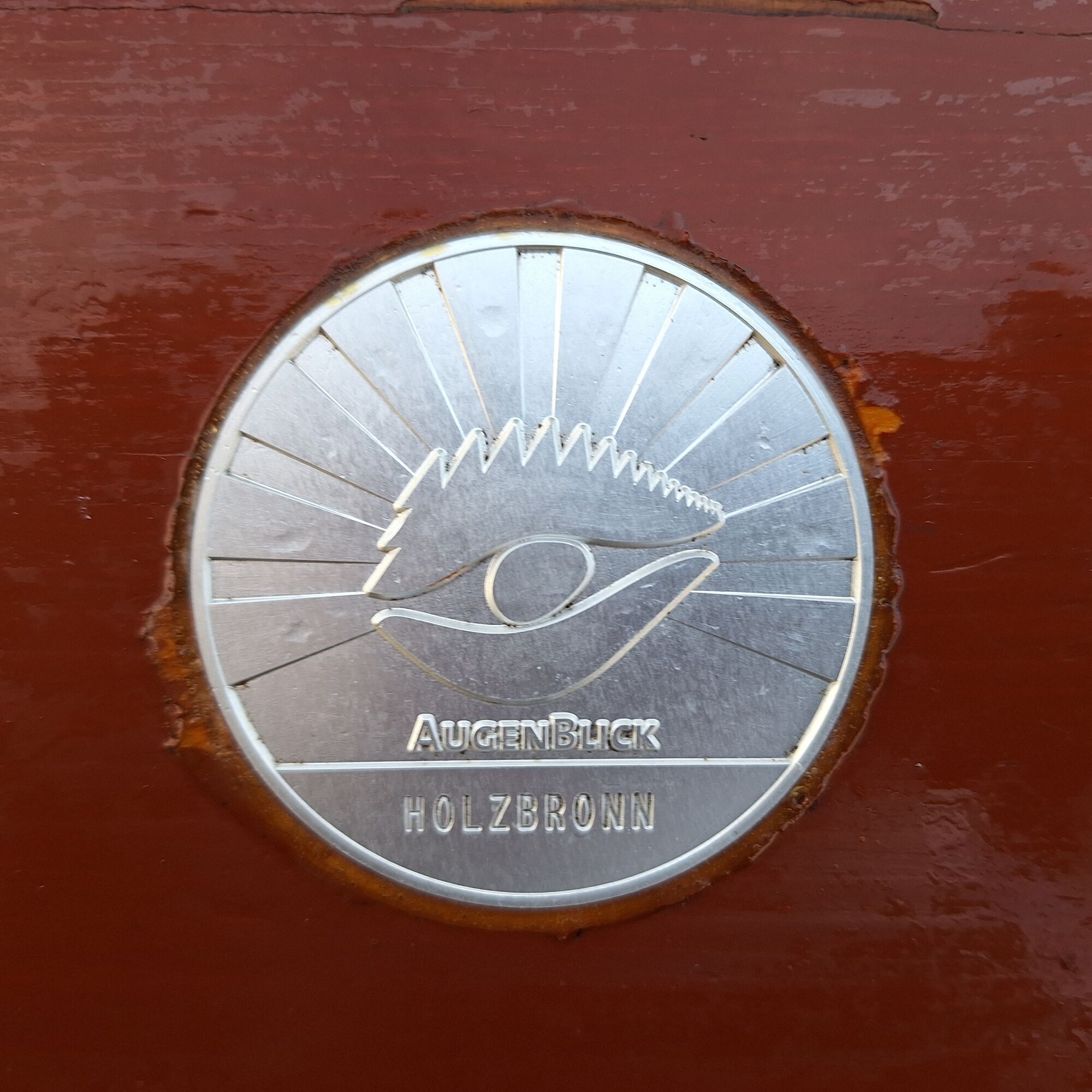
New is a plaque embedded at the seat of the Naturpark-AugenBlick, which you can trace. What is it about? There are 31 Naturpark-AugenBlicke in the Naturpark Schwarzwald Mitte/Nord. Each also has a plaque. This way, you can gradually visit the AugenBlicke and trace the different plaques. The best way is with the new brochure about all AugenBlicke, which provides spaces for this. The current brochure with all 26 AugenBlick routes is available free of charge at the Calw tourist information or conveniently delivered to your home via www.calw.de/Prospekte. If you have visited and documented ten AugenBlicke, a great reward awaits you in the form of a snack box (also available in the souvenir shop of the tourist information).
So, nothing like enjoying and collecting! More information is also available at www.naturpark-augenblicke.de
What hikers say about our Naturpark-AugenBlick and the Augenblick-Runde:
A moment of calm and relaxation - a place inviting to linger. - Philipp and Prisca Here you can regain strength. Wonderful view. Nature is a miracle. - Emma A great viewpoint framed by an exciting route... – Steffi and Reiner A great hike! Beautiful view and pure nature. We'll come back! - Family Berkovich Beautiful, quiet, relaxing landscape. Wonderful circular hiking trail.
You can find these dining options directly in Holzbronn:
Krabba-Nescht
Bannstraße 1
75365 Calw-Holzbronn
Phone 07053 967180
info@krabba-nescht.de
www.krabba-nescht.de
Opening hours: Monday, Wednesday to Saturday from 5:00 pm to 11:00 pm
Sundays and holidays open from 11:00 am to 11:00 pm
Also, on the AugenBlick-Runde, you pass the Gasthof Talmühle.
Gasthof Talmühle
Im Seitzental 53
75387 Neubulach Altbulach
Phone 07053 7415
In Calw-Hirsau, a visit to the Naturpark-host "Hotel Kloster Hirsau" is recommended.
Hotel Kloster Hirsau
Roland Hassel
Wildbader Straße 2
75365 Calw
Phone 07051 96740
info@hotel-kloster-hirsau.de
www.hotel-kloster-hirsau.de
A complete directory of gastronomy can be found here http://www.calw.de/Essen-und-Trinken.
Populära turer i närområdet
-
5,0
Wild romantic Monbach Valley
ljusVandring 6,25 km -
4,7
Hiking through the Monbach Gorge in search of the kingfisher
MediumVandring 10,5 km -
4,0
Wolfsschlucht and Fox Gorge
MediumVandring 9,74 km -
From Bieselsberg into the wild Monbach valley - dream route on small paths
tungVandring 18,0 km -
5,0
Water, Woods and Meadowtrail / Zavelstein > Calw (Premium trail & Genussweg)
tungVandring 14,4 km -
4,7
Through the wild romantic Schweinbachtal to the Bruderhöhle cave
MediumVandring 13,8 km -
5,0
Nature park hiking round tour Zettelberg in Bad-Teinach
tungVandring 15,5 km -
Exciting circular hike with beautiful views and culture
MediumVandring 9,98 km -
3,0
Ecological nature trail around Bad Teinach
MediumVandring 7,04 km -
5,0
Gorge duo in the Nagold Valley – A bwegt hiking route
MediumVandring 14,5 km
Vandring och spårning


Missa inte erbjudanden och inspiration inför nästa semester
Din e-postadress har lagts till på e-postlistan.