


L'A vall'Tout - MTB No.1
Svårighetsgrad: S1


Starting from Laveline du Houx, a typical small village in the Vosges, a good climb awaits you before reaching the heights. A route combining the pleasure of mountain biking and the discovery of beautiful...
Starting from Laveline du Houx, a typical small village in the Vosges, a good climb awaits you before reaching the heights. A route combining the pleasure of mountain biking and the discovery of beautiful landscapes.

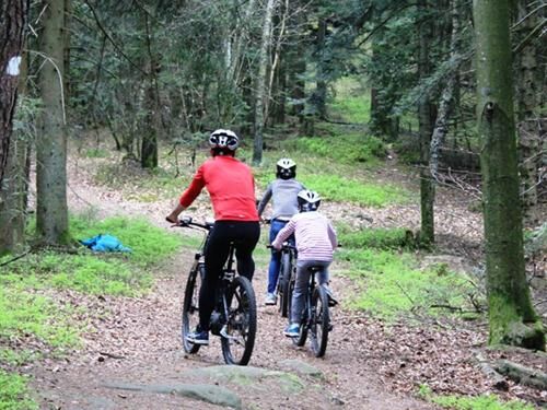
Starting from Laveline du Houx, a typical small village in the Vosges, a good climb awaits you before reaching the heights. A route combining the pleasure of mountain biking and the discovery of beautiful landscapes.
Wearing a helmet is highly recommended
Mountain biking as you like! but…
Use the marked trails for your safety and respect the direction of the routes
Do not overestimate your abilities and keep control of your speed
Be cautious and courteous when overtaking or crossing hikers because pedestrians have the right of way
Check the condition of your mountain bike and plan for supplies and repair tools
If you go alone, leave your route with someone close to you
Respect private property and cultivated areas
Beware of agricultural and forestry machinery
Close the gates behind you
Avoid picking wild flowers, fruits, and mushrooms
Do not disturb the peace of wild animals
Take your trash with you, be discreet and respectful of the environment
88640, Laveline du Houx
www.fluo.eu
Free parking on site
S1
Tourist Office Bruyères Vallons des Vosges
50 avenue du Cameroun
88600 Bruyères
03 29 50 51 33
www.tourisme-bruyeres.com
tourisme.vallonsdesvosges@gmail.com
Populära turer i närområdet
-
Authentic Vosges circuit
tungRidning 135,9 km -
4,5
Hike around Lake Gérardmer
ljusVandring 5,49 km -
Escape to the kingdom of water
tungLångdistans vandringsled 79,2 km -
Balade en famille : La montagne des fourmis géantes
MediumVandring 9,12 km -
The GR de Pays of Tour de la Vologne - Grandes Echappées Vosgiennes
MediumLångdistans vandringsled 149,0 km -
Route Charmotte Farm-Inn - Facing the sandstone hills
MediumVandring 6,74 km -
The Balcons de Corcieux
MediumVandring 11,8 km -
Hike - Saint Mont
MediumVandring 3,89 km -
Family route: the Bourrique jump
ljusVandring 2,74 km -
Circuit n°10 VTT Saut de la Bourrique - Tour de Mérelle
MediumMountainbike 16,6 km
Vandring och spårning


Missa inte erbjudanden och inspiration inför nästa semester
Din e-postadress har lagts till på e-postlistan.