


Lavanttal High Trail: Stage 7 from the Wolfsberger Hut to Griffner Berg


It goes back down into the valley. From the Wolfsberger Hut at 1827 meters, it takes about 5 hours mainly downhill to the foothills of the Saualpe.
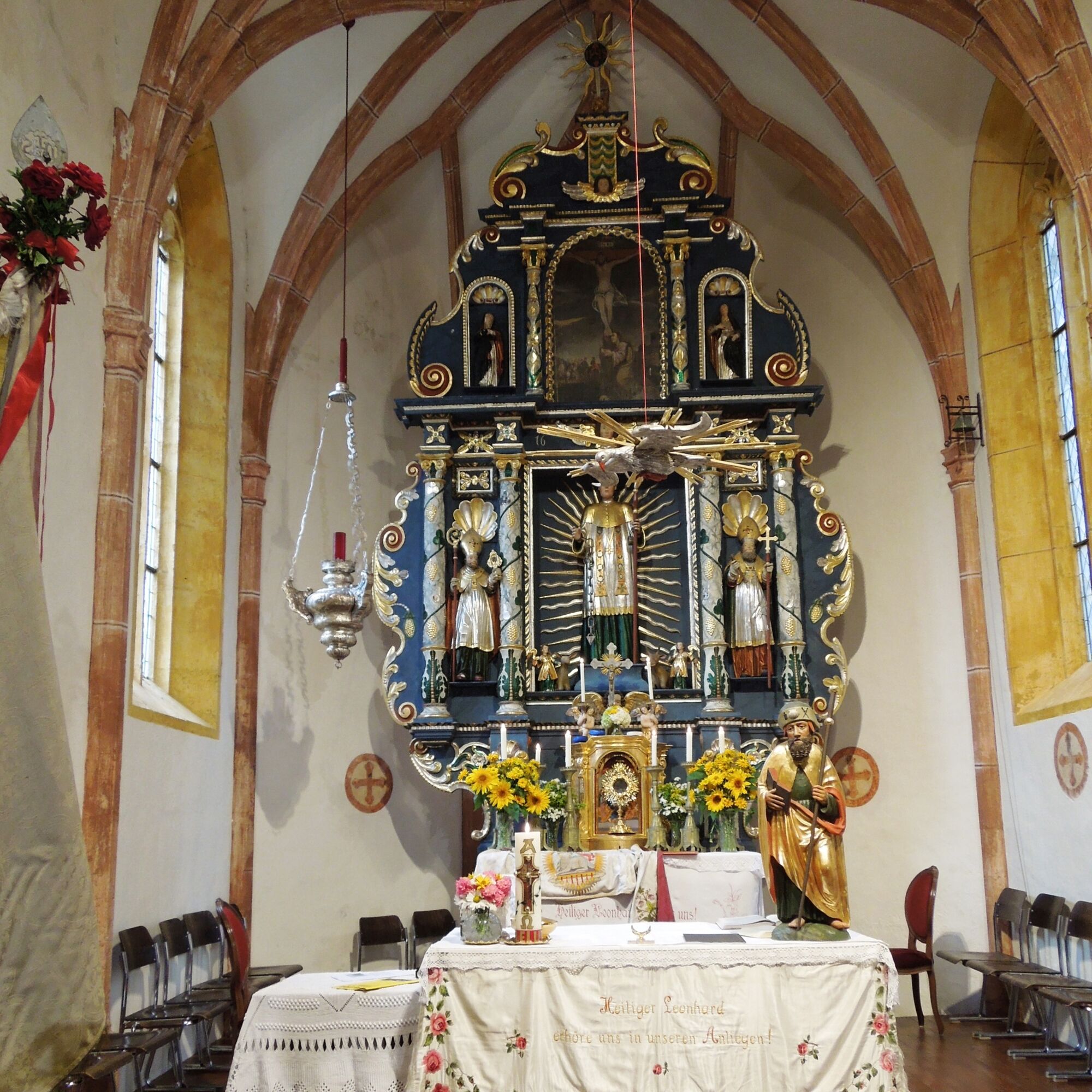
Passing the Roman Catholic subsidiary church St. Leonhard...
It goes back down into the valley. From the Wolfsberger Hut at 1827 meters, it takes about 5 hours mainly downhill to the foothills of the Saualpe.
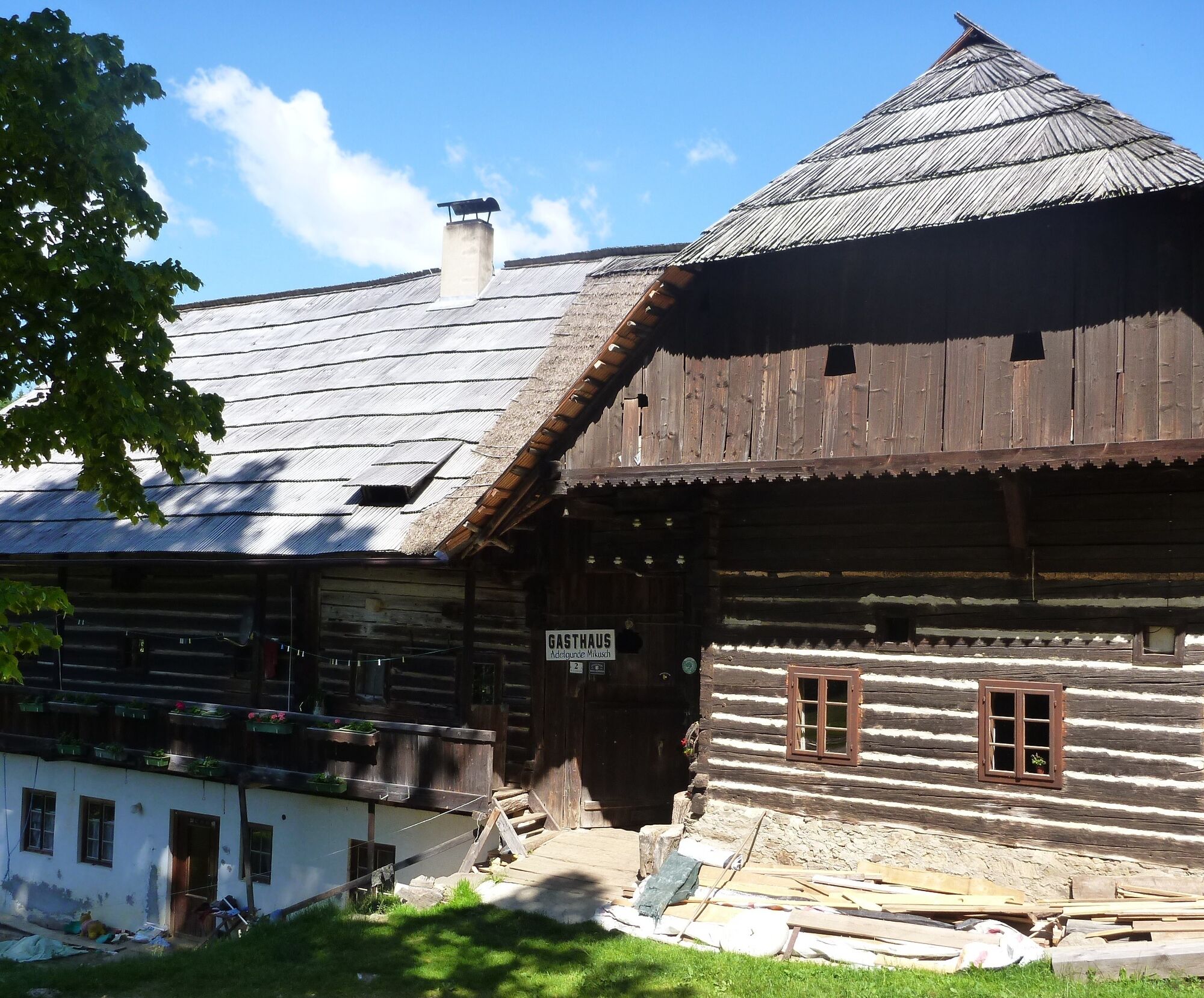
Passing the Roman Catholic subsidiary church St. Leonhard on the Saualpe, a stop at the oldest inn in Carinthia with the Petutschnig family should not be missed. Hospitality has been lived here for over 900 years. The inn is largely in its original condition.
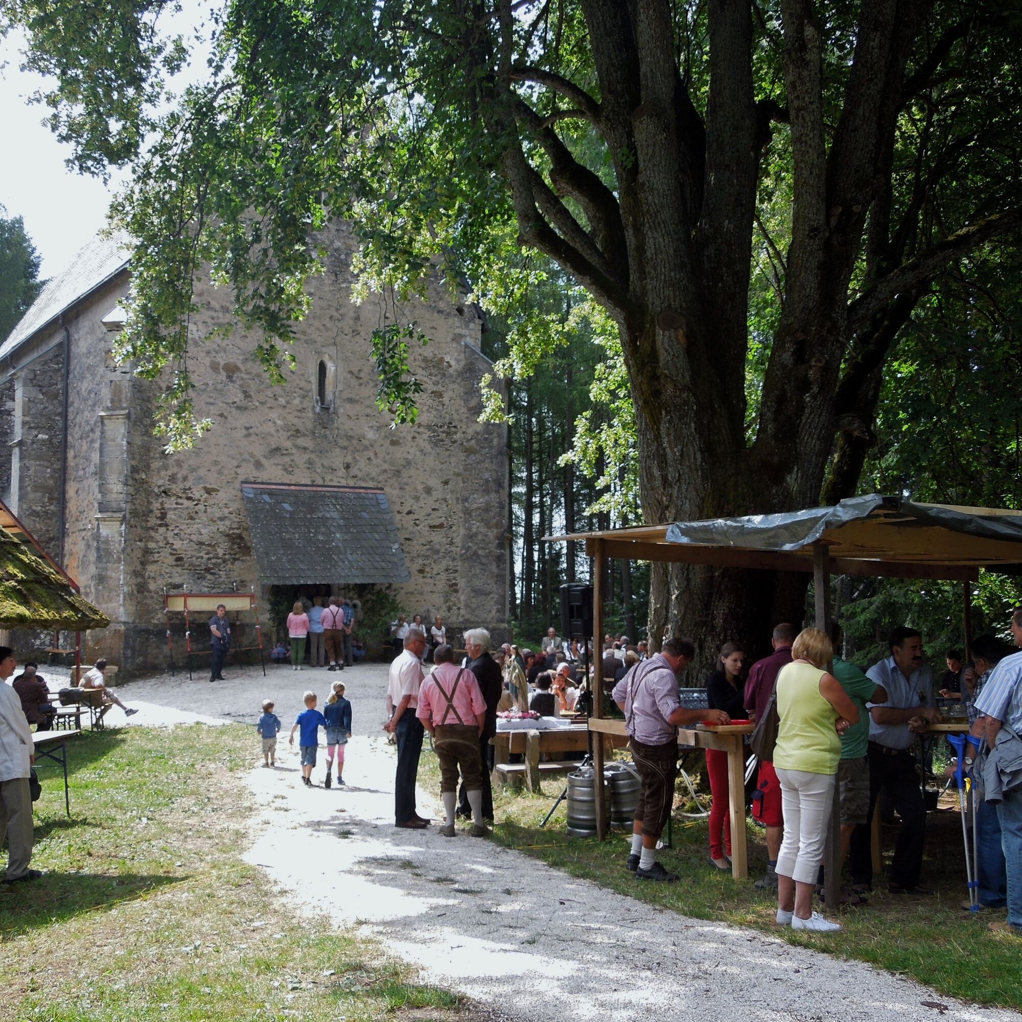
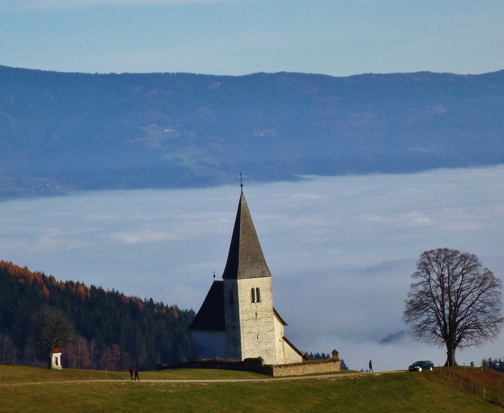
For those interested in sacred architecture, a detour to the subsidiary churches in Tschrietes and Pustriz is worthwhile. The church in Tschrietes was first documented in 1371 and stands on a hill. The Roman Catholic parish church of Pustritz, first mentioned in 1196, bears the patronage of the Visitation of Mary.
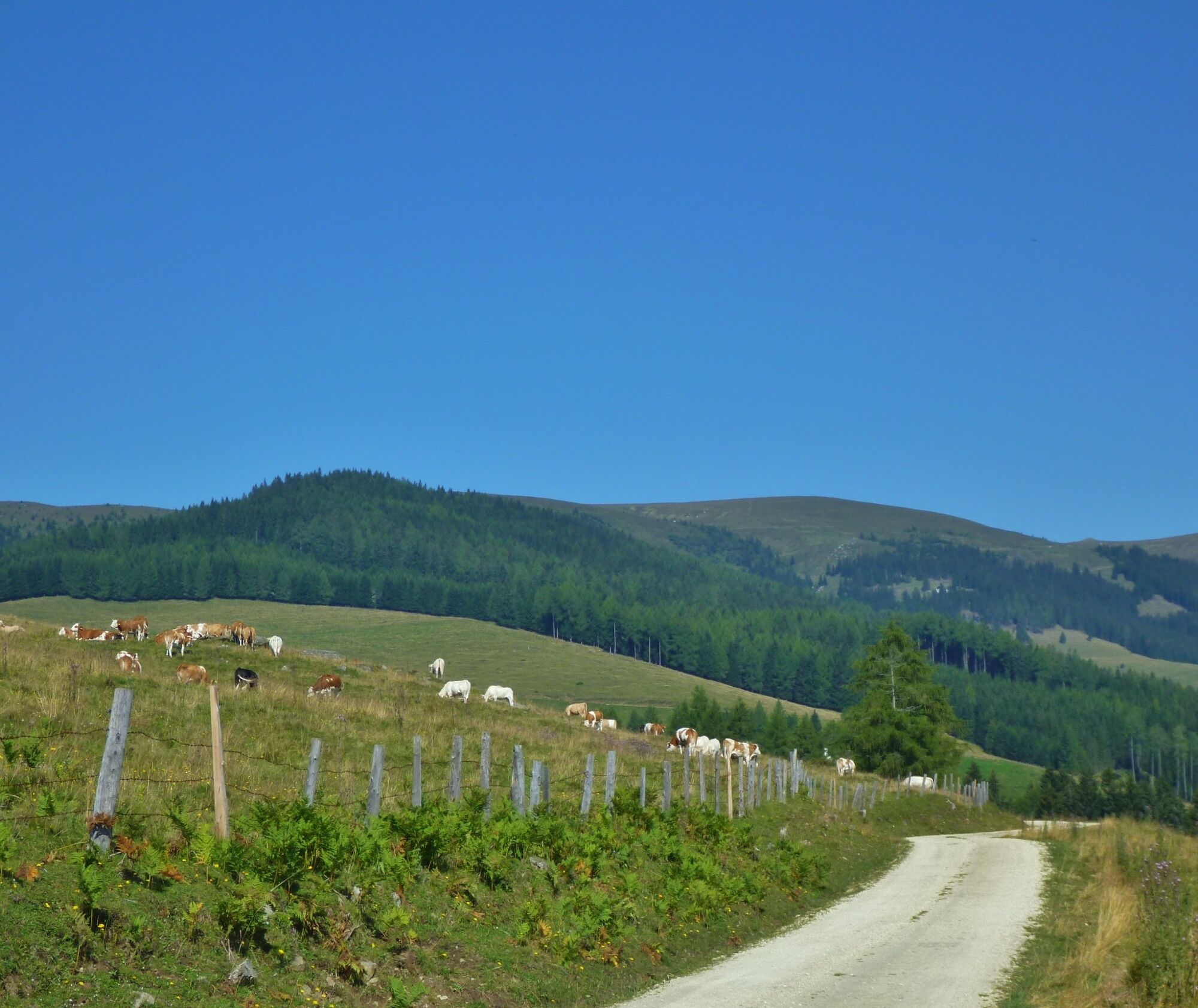
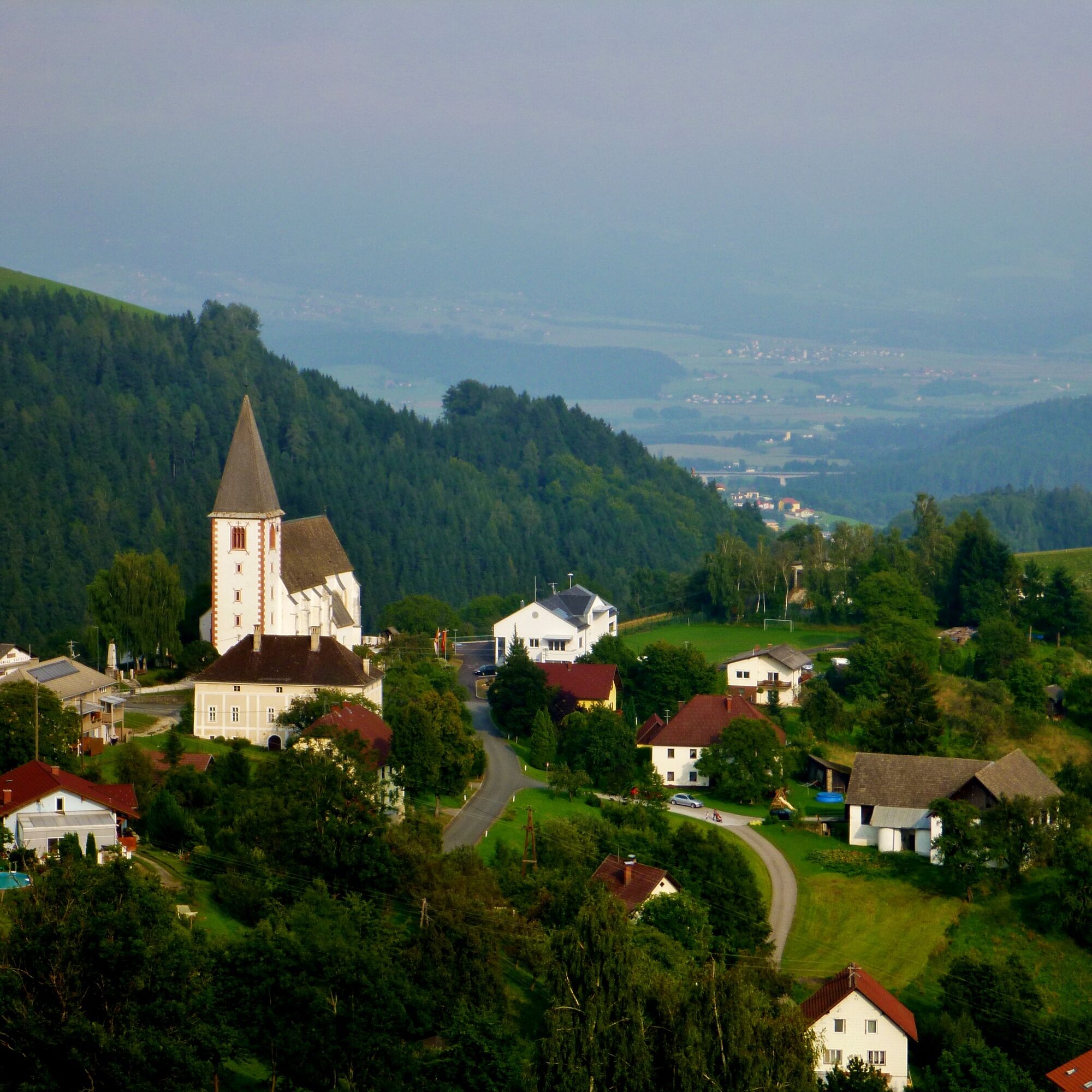
After some historical and beautiful scenic impressions, the goal of the 7th stage, the Griffner Berg at 708 meters, is reached.

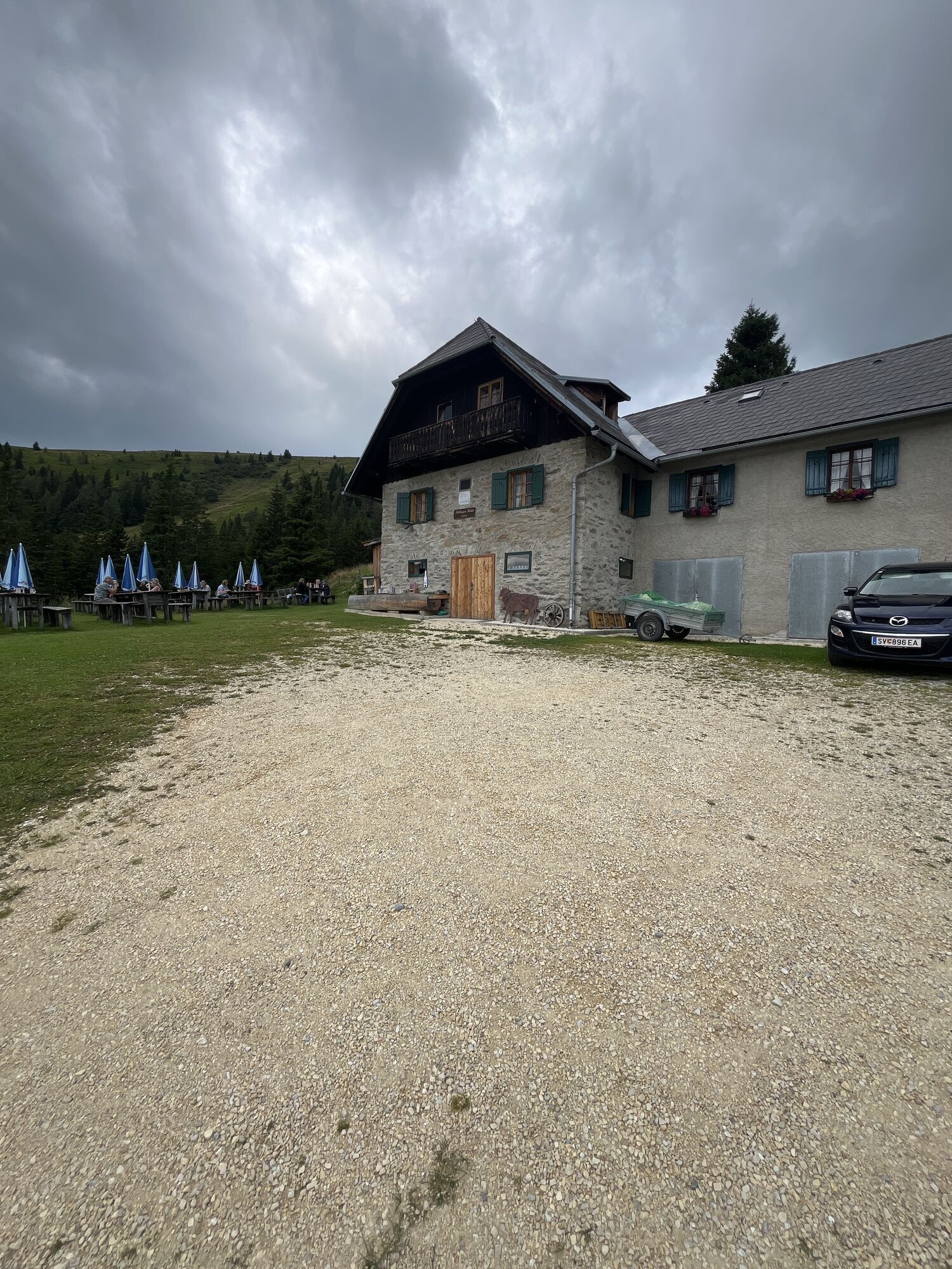
Just below the Wolfsberger Hut, turn right through an entrance onto a pasture heading towards the Pöllinger Hut (signpost "Lavanttal High Trail Route No. 338"). Then it goes briefly steeply downhill until a stream is crossed. South of the Speikkogel, continue about 1.2 km to the Pöllinger Hut. Although the stage passes above this rustic hut, a short visit is worthwhile here. Continue slightly downhill following the trail markers until after about 2 km at Lamminger Halt a forest road is reached. Follow the signpost "Lavanttal High Trail/St. Leonhard/Griffner Berg - Route No. 338" southwards. To the mountain village St. Leonhard on the Saualpe it is about a half-hour walk, always slightly downhill and on beautiful forest paths.
At the former Schranzer inn, it goes down a steep meadow. In a long right-hand bend, the route crosses a wet hollow and leads to the oldest inn on the Saualpe. The Petutschnig Inn is over 900 years old. Afterwards, walk slightly uphill to a wayside shrine (about 800 m). Then the hiking trail gently curves downhill along the road to the Tormannkogel. From the junction to the scattered settlement Tschrietes, there is a wonderful view of the Karawanks. At the Tormannkogel, the hiking trail leaves the road again and goes right into a marked forest path.
The further route leads about 900 m downhill through a mixed forest. Two farmhouses are passed, and then a road continues downhill. After about 1 km, leave the road and a footpath leads the hiker towards Pustriz. After the last residential house, cross the farm driveway and a path leads south into a forest. After about 400 m via a hollow path, you reach an asphalt road. Follow this about 1.8 km downhill until the Bierbaumer inn at Griffner Berg and also the first checkpoint are reached.
From the Bierbaumer inn, walk about 200 m on the road towards Griffen to the junction to Haberberg (signpost Route No. 338 ÖAV). Passing some residential houses, slightly uphill wooded area is reached. After leaving the forest, it is about 400 m to the turnoff for the Töfferl breakfast pension. Turn left at a wayside shrine and follow the signpost Pension Töfferl. After about 350 m, the stage destination, the Pension Töfferl on the Griffner Berg, is reached. As a reward, there is the second checkpoint stamp.
Ja
Packing list - multi-day hike
Breathable hardshell jacket Fleece or softshell jacket Hiking pants, zip-off Hiking boots Backpack (approx. 35 liters) Functional T-shirts Functional underwear Pair of hiking socks Sun headgear Rain pants Thin hat and gloves Maps & tour description Water bottle or hydration bladder Hut sleeping bag/silk liner Trekking poles GPS device LED headlamp Mobile phone & alpine emergency number Sunglasses First aid kit Blister plasters Small pocket knife Sunscreen Hygiene items Travel towel Hiking provisions
10 recommendations from the Austrian Alpine Club
As a nature sport, mountain hiking offers great opportunities for health, community, and experience. The following recommendations from alpine clubs aim to make mountain hikes as safe and enjoyable as possible.
1. Healthy in the mountains
Mountain hiking is endurance sport. The positive stress for heart and circulation requires health and a realistic self-assessment. Avoid time pressure and choose a pace so that no one in the group runs out of breath.
2. Careful planning
Hiking maps, guidebooks, internet, and experts provide information about length, altitude difference, difficulty, and current conditions. Always coordinate routes to the group! Pay special attention to the weather forecast as rain, wind, and cold increase the risk of accidents.
3. Complete equipment
Adapt your equipment to your undertaking and pay attention to low backpack weight. Rain, cold, and sun protection always belong in the backpack as well as a first aid kit and mobile phone (European emergency number 112). Map or GPS supports orientation.
4. Suitable footwear
Good hiking boots protect and relieve the foot and improve surefootedness! Pay attention to perfect fit, slip-resistant soles, waterproofness, and low weight when choosing.
5. Surefootedness is the key
Falls, as a result of slipping or stumbling, are the most common cause of accidents! Note that too fast a pace or fatigue greatly impair your surefootedness and concentration. Beware of rockfall: By walking carefully, you avoid triggering rocks.
6. Stay on marked paths
In pathless terrain, the risk of losing orientation, falling, and rockfall increases. Avoid shortcuts and return to the last known point if you have once left the path. Often underestimated and very dangerous: steep old snowfields!
7. Regular breaks
Timely rest serves recovery, enjoyment of the landscape, and sociability. Eating and drinking are necessary to maintain performance and concentration. Isotonic drinks are ideal thirst quenchers. Muesli bars, dried fruit, and cookies satisfy hunger on the way.
8. Responsibility for children
Note that variety and playful discovery are priority for children! In sections with risk of falling, one adult can only supervise one child. Very exposed routes requiring long-lasting concentration are not suitable for children.
9. Small groups
Small groups ensure flexibility and enable mutual help. Inform trusted persons about destination, route, and return. Stay together as a group. Beware of solo hikers: Even small incidents can lead to serious emergencies.
10. Respect for nature and environment
To protect mountain nature: Do not leave any waste, avoid noise, stay on paths, do not disturb wild and grazing animals, leave plants untouched, and respect protected areas. Use public transport or form car pools for travel.
see plan travel
no public transport connection
Parking lot below the Wolfsberger Hut.
Checkpoints:
Bierbaumer Inn Töfferl Breakfast Pension
Accommodation options:
Töfferl Breakfast Pension
Langegg 15, 9112 Griffen
Tel.: 0664/6488 479
Email: renateflecker@gmail.com
Kaltner Petra - Rooms
Pustritz 30, 9104 Griffen
Tel.: 0664/1273454
Regional information:
Tour information:
The Highlander
The alpine hiking event in southern Austria.
More info at Alpin Süd-Highlander
Populära turer i närområdet
-
5,0
Weißbergerhütte - Gertrusk - Ladingerspitz
MediumVandring 8,95 km -
4,6
Saualpe: Hut route - circular hike
MediumVandring 15,3 km -
From Steinerhütte to Großer Sauofen - permanent IVV hiking trail
ljusVandring 4,67 km -
4,4
Saualpen ridge – Speikkogel, Großer and Kleiner Sauofen
MediumVandring 10,8 km -
4,3
Diex panorama trail
ljusVandring 12,1 km -
4,8
Lavanttal Höhenweg: Stage 6 from Klippitztörl to Wolfsberger Hütte
ljusVandring 13,4 km -
5,0
Steinerhütte-kl.+gr. Sauofen zum Gertrusk und zurück
ljusVandring 15,0 km -
5,0
Saualpe: summit route to the Ladinger Spitz
MediumSkitour 6,06 km -
5,0
St. Paul: Mostwanderweg 1-3
MediumVandring 14,0 km -
4,7
Winter sun on the Saualm
ljusSnösko 4,70 km
Vandring och spårning


Missa inte erbjudanden och inspiration inför nästa semester
Din e-postadress har lagts till på e-postlistan.