


Hike from Hemberg via Gössigenhöchi to Ennetbühl
Svårighetsgrad: T1


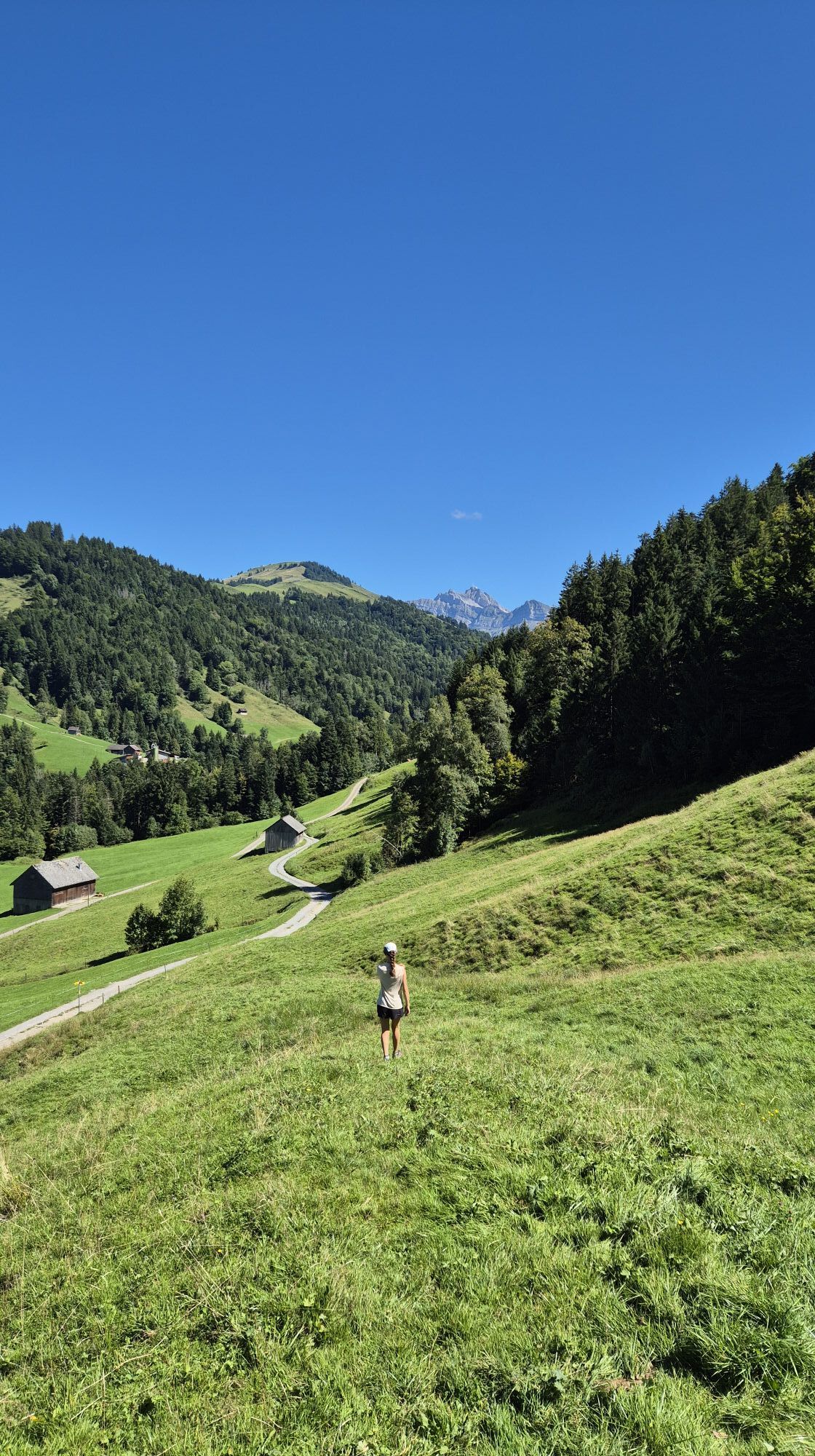
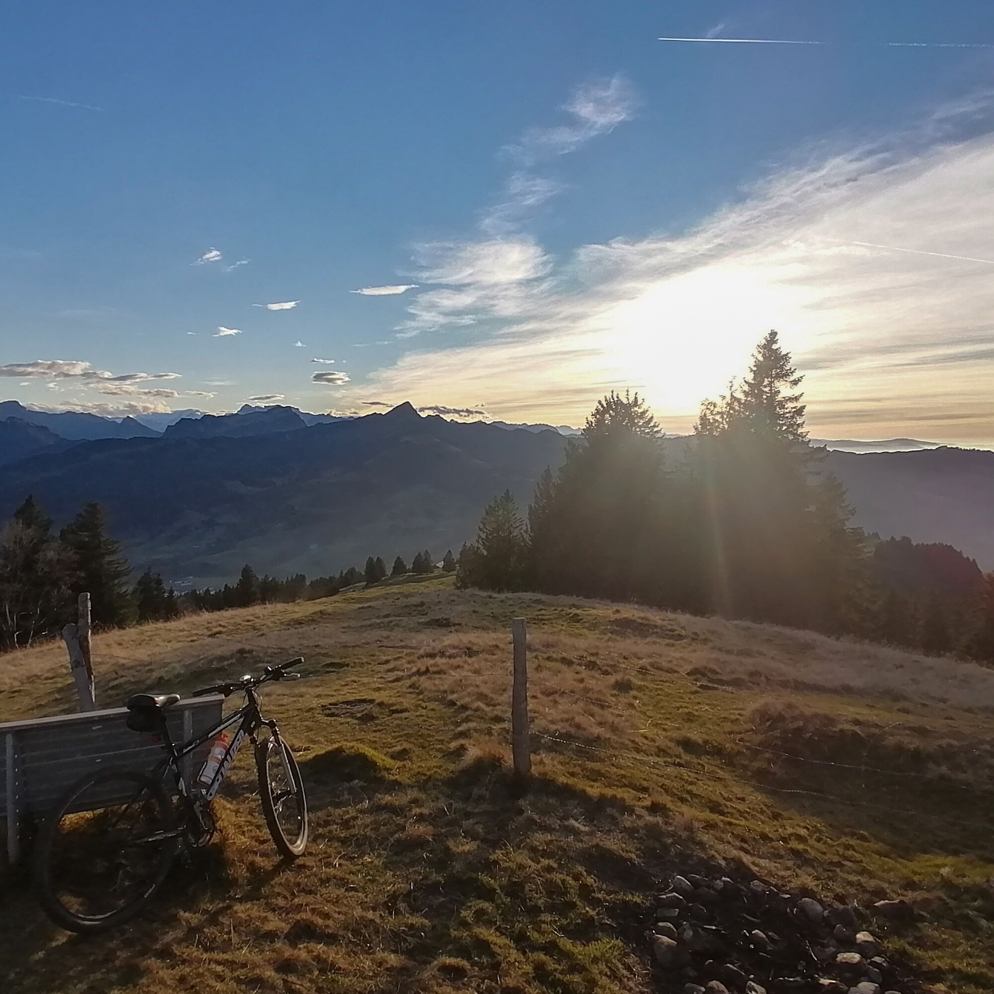
Foton av våra användare
Enjoy an eventful hike from Hemberg to Ennetbühl. The hiking trail follows roads, gravel paths, meadow paths, and goes along forest edges as well as through light forests. Soon the viewpoint Gössigenhöchi...
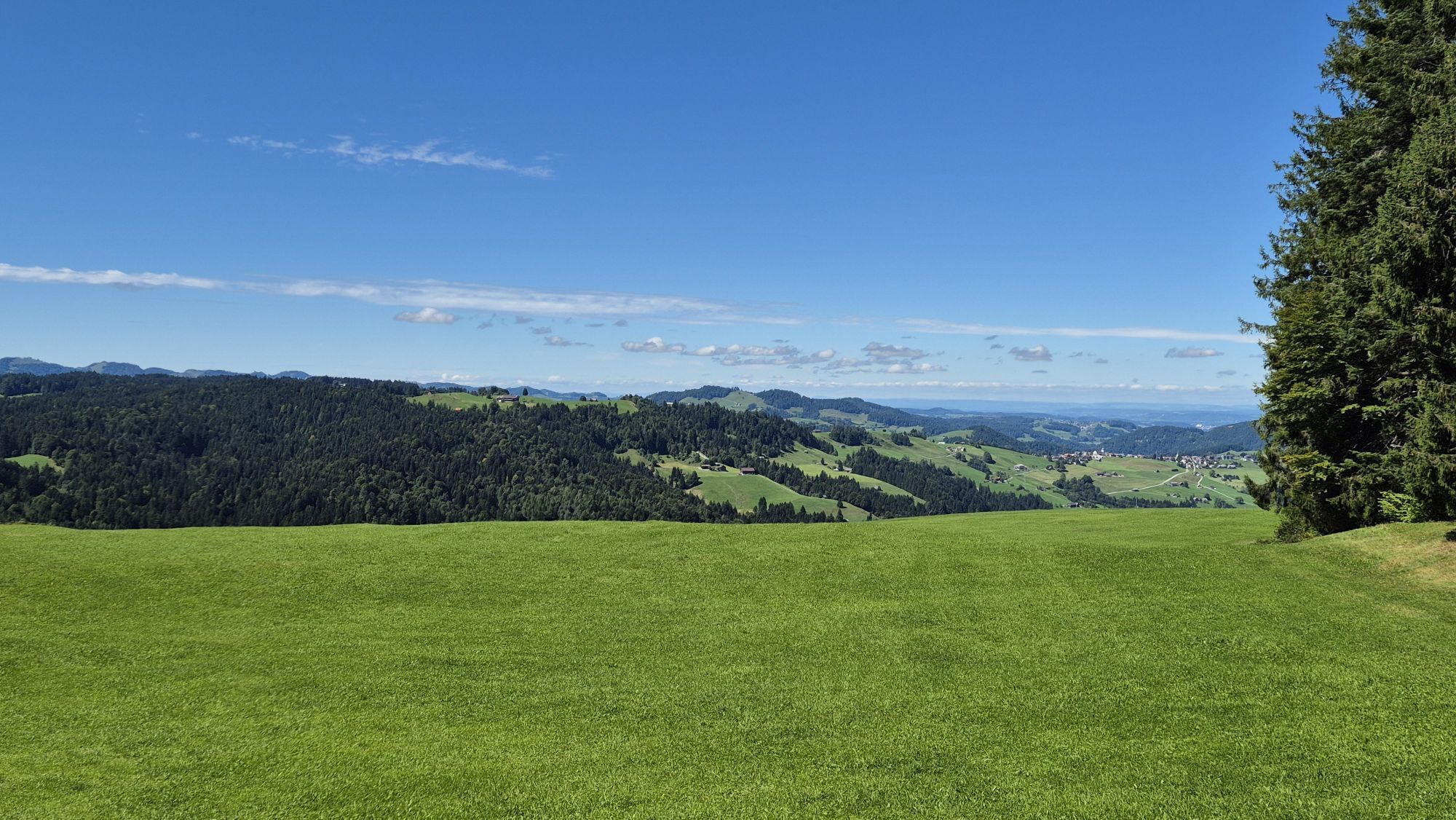
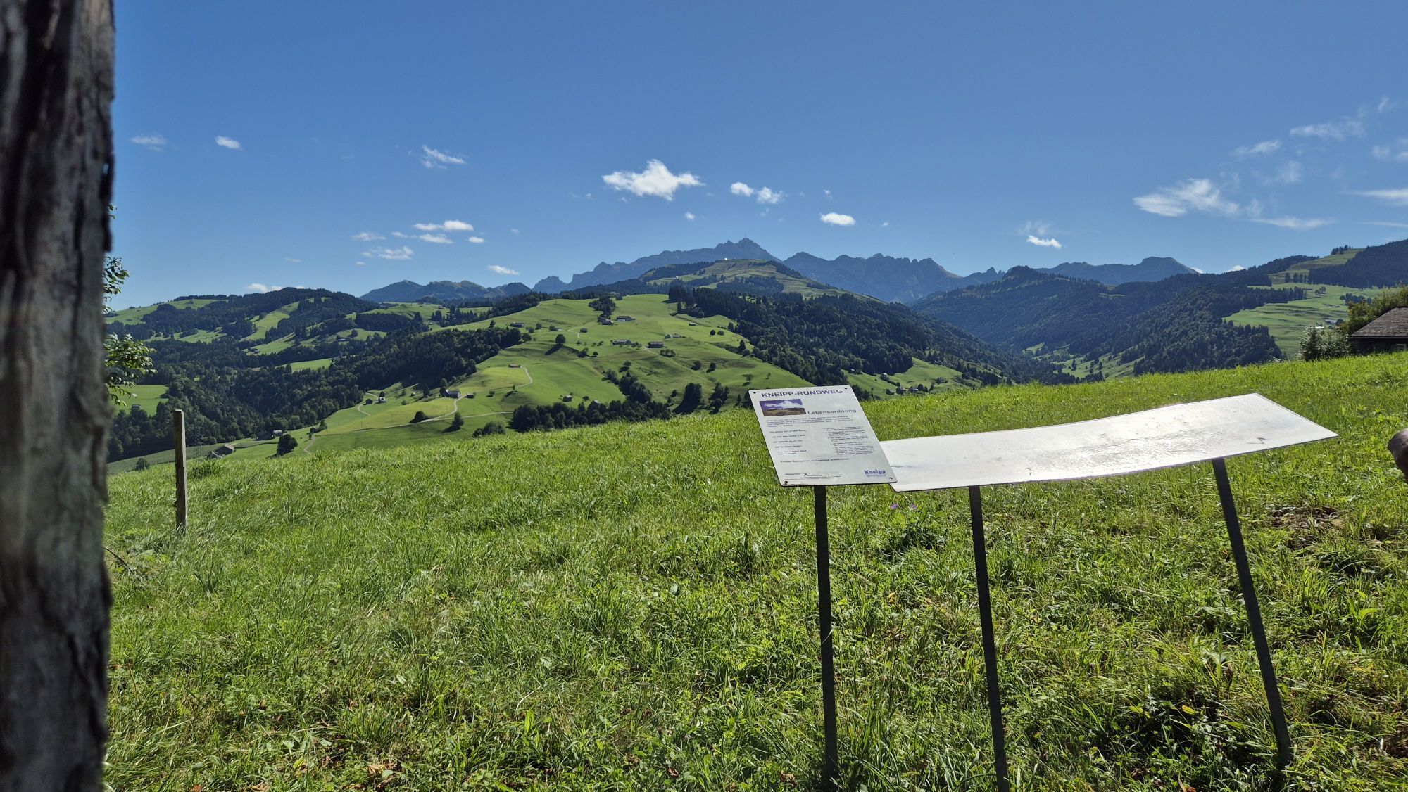
Enjoy an eventful hike from Hemberg to Ennetbühl. The hiking trail follows roads, gravel paths, meadow paths, and goes along forest edges as well as through light forests. Soon the viewpoint Gössigenhöchi is reached, where a wonderful view over Toggenburg, Luteren and Thur valleys awaits as well as to Alpstein and the gentle hills of the Appenzellerland. Then follows the descent towards Ennetbühl, where you pass alpine pastures and farmhouses that recall old times. A hike with many facets and exciting impressions.

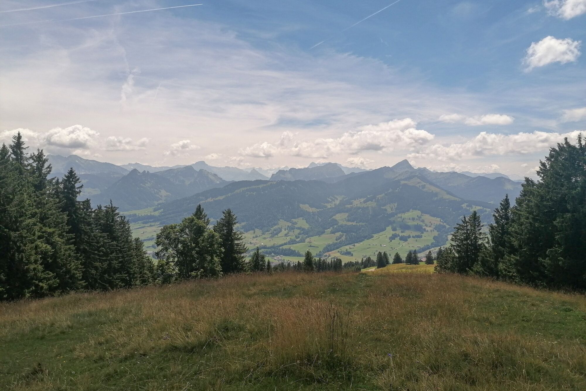
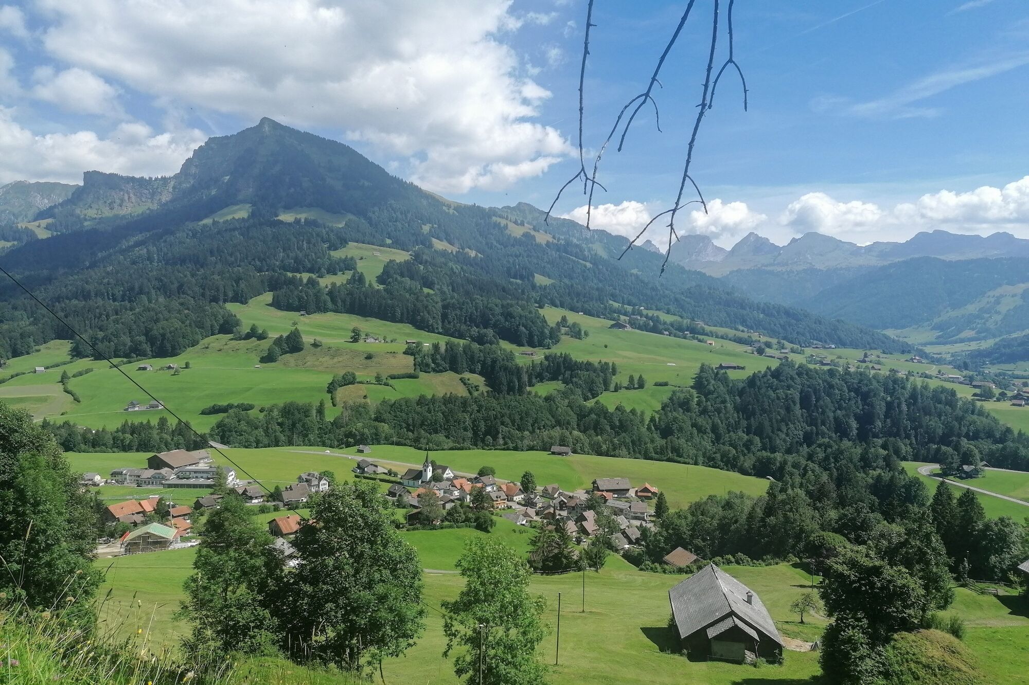
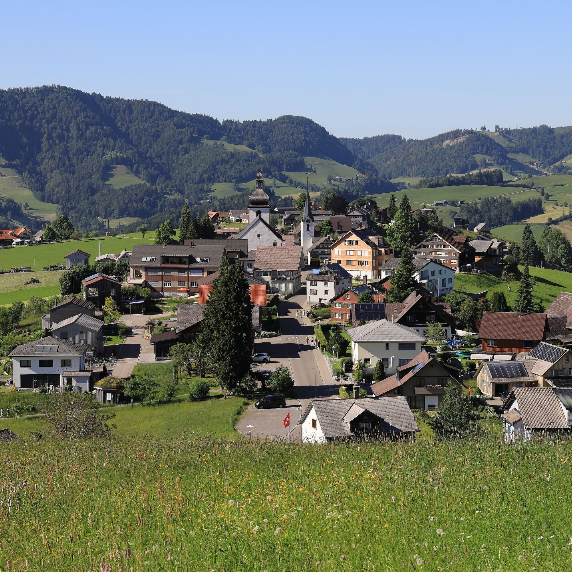

From the village of Hemberg, the path first leads on the road towards Bendel via Gäwis. At the crossroads, the route follows the signposted meadow path gently uphill to Eggli. The path joins an asphalt road and continues left, slightly downhill along the road. On the left side follows the Gschwand forest and now a pleasant incline leads to the Fuchslöcher. From there, the route goes downhill along the meadow path past two adjacent forest patches, then right through the forest. You can already hear the babbling of the Neckert and soon reach the Mistelegg. Now it goes further uphill to the Gehren and from there the ascent continues along the military road. About two kilometers further, at the junction to the meadow path, the path to the right is chosen, which continues parallel to the Neckertaler Höhenweg. The path leads over a stretch of pasture and forest up to Chuchiwis, where the magnificent panoramic view can be enjoyed, before the march continues past mighty maple trees to Gössigenhöchi—the highest point of the hike. Downhill, a section of forest is now crossed before turning right to Aplzimmer Vordere Chlosteralp. Then continue following the route to Alp Gössigen with the beautiful old farmhouse from the 19th century. The short left entry onto the road leads back straight at the next turn to the right. The hike leads over pastures and through the forest until a bridge over the farm Brüggli is crossed. To the left, the path continues over Risi until the village of Ennetbühl is reached.
Route course
Hemberg (945 m) - Gäwis (963 m) - Eggli - Fuchslöcher (989 m) - Oberer Starkenbach - Gehren (1063 m) - Ritteren (1200 m) - Chuchiwis (1296 m) - Gössigenhöchi (1434 m) - Vordere Chlosteralp (1329 m) - Gössigen (1264 m) - Feissenmoos (1174 m) - Brüggli (1197 m) - Risi - Ennetbühl (885 m)
Day hiking backpack (approx. 20 liters) with rain cover, sturdy and comfortable footwear, weather-appropriate and durable clothing in layers, possibly telescopic poles, sun and rain protection, provisions and drinking water, first aid kit, pocket knife, mobile phone, possibly headlamp, map material
The route is well signposted from Hemberg with Gössigenhöchi-Ennetbühl.
Please observe the wildlife quiet zone and do not leave the marked paths.
From Zurich, the way leads after the Wil motorway exit via Lütisburg and Ganterschwil to Brunnadern, continuing to St.Peterzell, where in the middle of the village you turn right towards Hemberg.
From St.Gallen, take the motorway exit St.Gallen Winkeln towards Herisau, Waldstatt and Schönengrund until the village of Hemberg is reached.
You can reach the village of Hemberg from St.Gallen as well as from Wil via Wattwil and the post bus to Hemberg village with the SBB.
Some parking spaces are available in the center of Hemberg village. Due to the route course, we recommend traveling by public transport.
T1
Toggenburg Tourism
Hauptstrasse 104
CH-9658 Wildhaus
Tel: +41 (0)71 999 99 11
Take a rest at Gössigenhöchi and enjoy the view with a small refreshment.
Populära turer i närområdet
-
4,9
Säntis-Gipfeltour, Wasserauen / Appenzell Innerrhoden
tungVandring 21,1 km -
4,6
Riviera Lake Walen Weesen – Quinten
MediumVandring 10,2 km -
4,6
Weesen - Quinten - Walenstadt
tungVandring 20,6 km -
5,0
Schrina Alp and Cultural Trail
MediumTema spår 11,5 km -
4,6
Säntis
MediumVandring i berg 17,5 km -
4,5
Amden - Speer (Rundkurs)
ljusVandring 17,6 km -
3,3
Seerenbach waterfalls
ljusVandring 4,38 km -
5,0
Mountain route over Rotsteinpass to Säntis
tungVandring 8,53 km -
5,0
Chatzenloch hike with suspension bridge
ljusVandring 5,91 km -
4,9
Kronberg - Schwaegalp
ljusVandring 5,90 km
Vandring och spårning


Missa inte erbjudanden och inspiration inför nästa semester
Din e-postadress har lagts till på e-postlistan.