


Tschugga


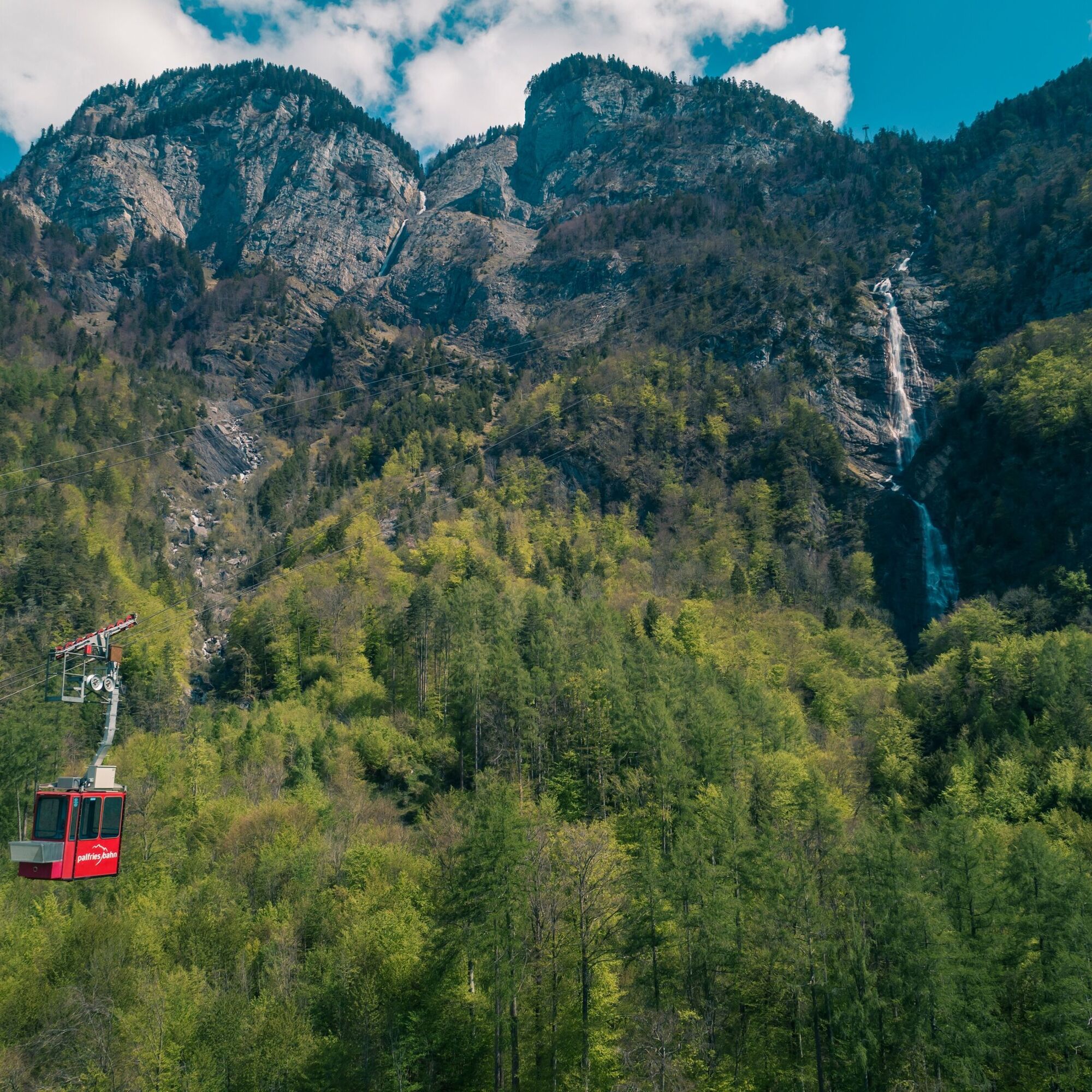
We start the hike at the Palfries mountain station. With the Palfries cable car, we previously overcame about 1,250 meters of altitude in just 12 minutes. The cable car passes over an impressive waterfall...
We start the hike at the Palfries mountain station. With the Palfries cable car, we previously overcame about 1,250 meters of altitude in just 12 minutes. The cable car passes over an impressive waterfall (Ragnatscher Bach) and takes us up to the Palfries high plateau.
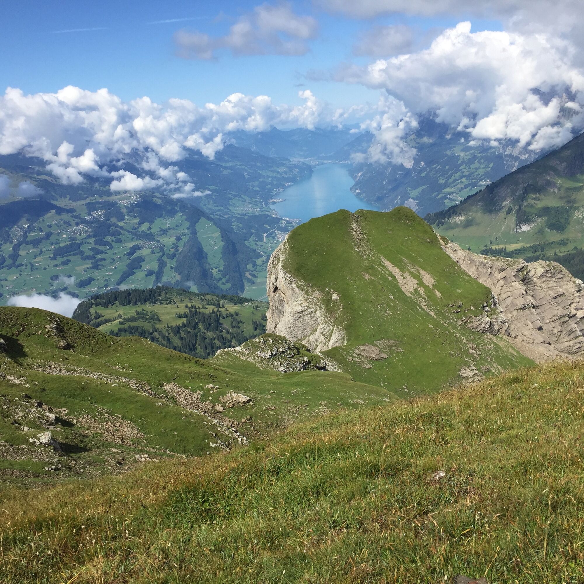
We begin an easy mountain hike to the Tschugga viewpoint. There, our ascent is rewarded with a magnificent view of Lake Walen and the Seez valley lying at its feet.
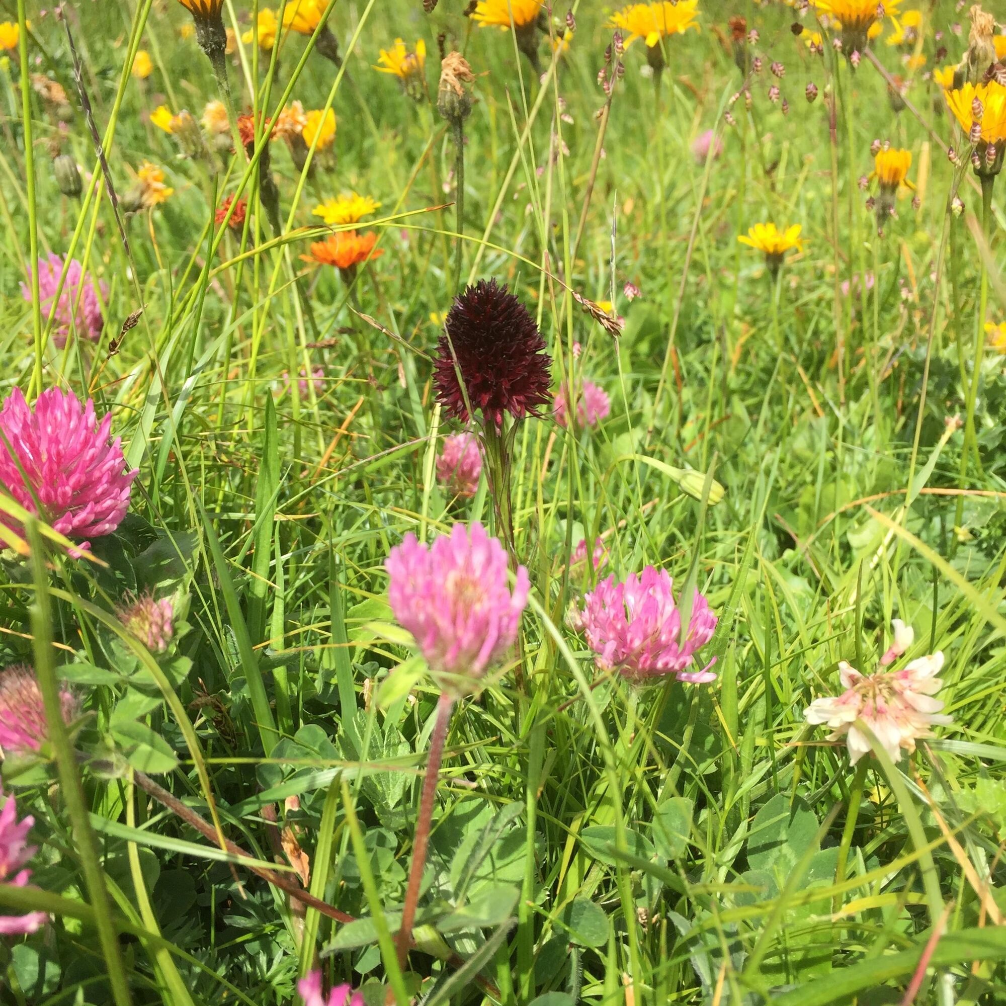
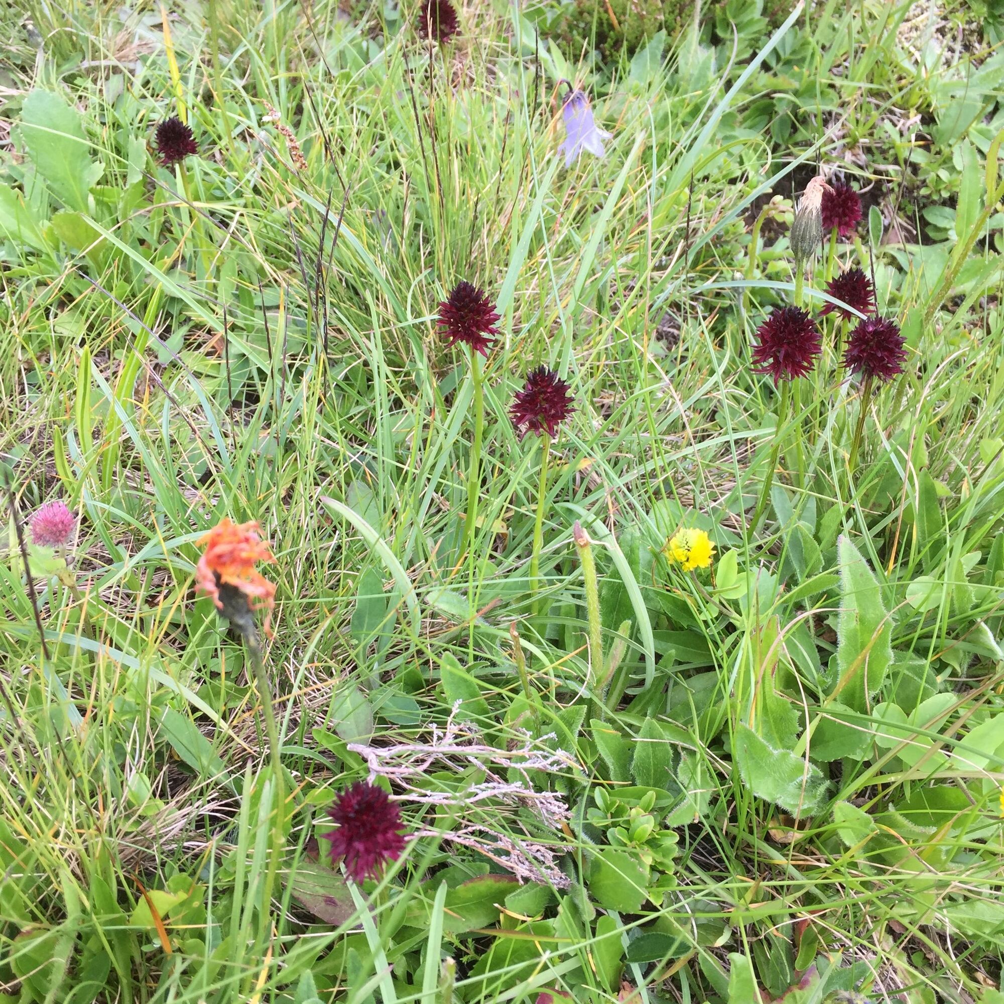
During the mountain spring, we discover the most beautiful and diverse alpine flowers on the ascent, especially on the ridge, such as the gentian. A feast for the eyes! Not infrequently, model airplane pilots can be found on the ridge indulging in their hobby.

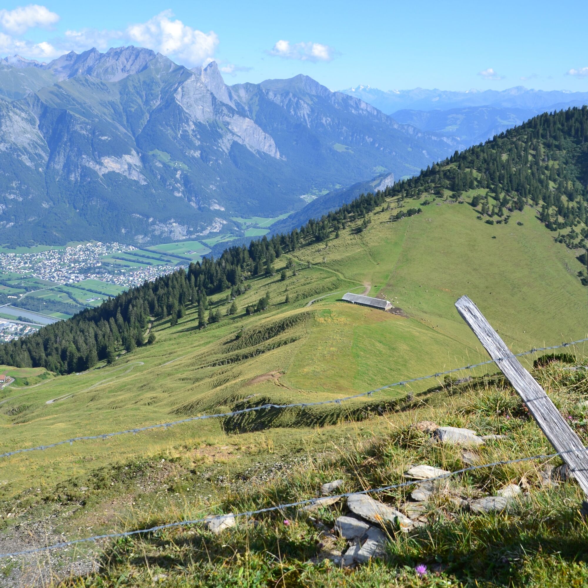
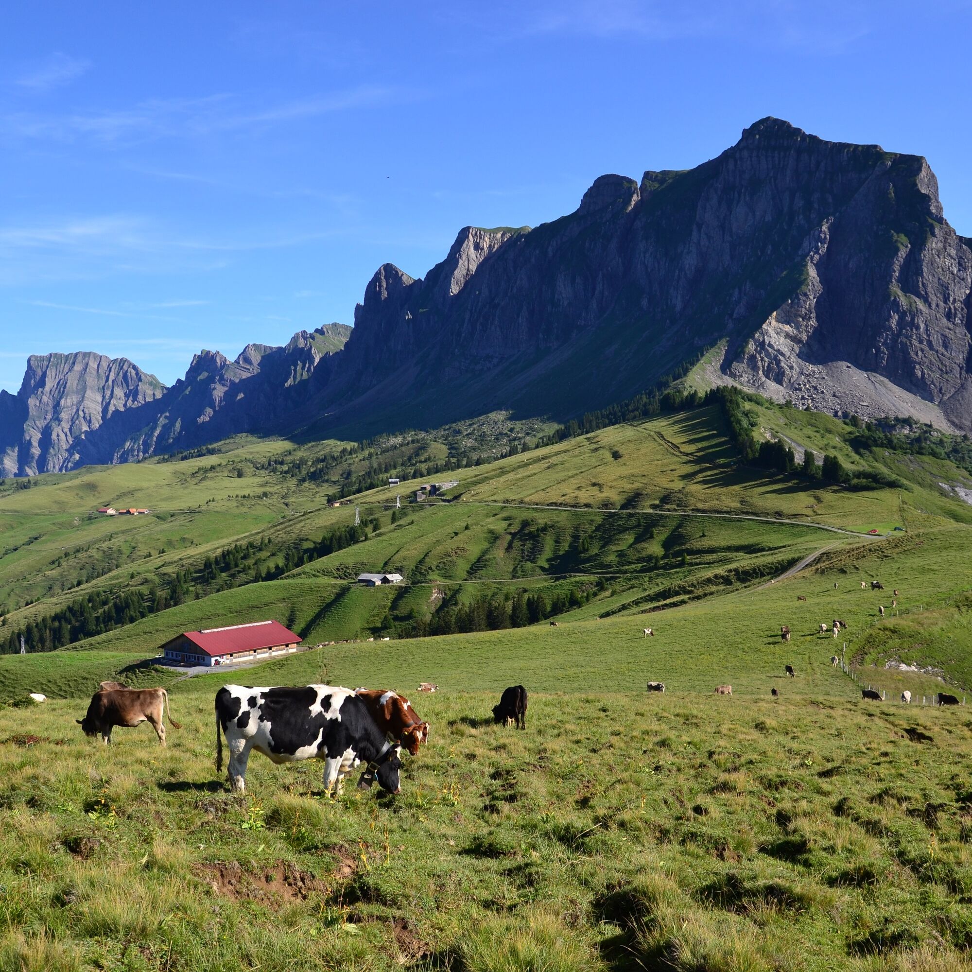
We head in a southeast direction and walk on the paved alpine road to Chamm, the highest point at the access to the Palfries high plateau. There, we leave the road and turn right onto the forest road leading to the nearest alpine hut. After about 200 m, we find a left-turning path crossing the alpine pasture. This generally follows the distinctive border fence towards the destination. Once arrived, we enjoy the view of the surrounding area. The return path takes us back along the same route to the Palfries cable car.
Ja
Ja
Ja
Day hiking backpack (approx. 20 liters) with rain cover, sturdy and comfortable footwear, weather-appropriate and durable multi-layer clothing, possibly telescopic poles, sun and rain protection, provisions and drinking water, first aid kit, pocket knife, mobile phone, possibly headlamp, map material
Motorway exit Flums, then on the main road towards Sargans/Mels. The valley station of the Palfries cable car is located in Heiligkreuz on the left side of the road. The Palfries cable car is signposted.
By train to Flums or Sargans, then continue by bus to the Heiligkreuz Ragnatsch stop. Ride with the Palfries cable car.
Public parking spaces available at the valley station of the Palfries cable car (paid)
Palfries cable car
+41 81 599 43 79
(Reservation required)
Heidiland Tourism, Bad Ragaz information office
+41 81 300 40 20
At Tschugga, we can watch paragliders and hang gliders as they glide down in front of the rock walls and then "climb back up". On the right side, we also see the panorama of Lake Walen.
Webbkameror för rundturen
Populära turer i närområdet
-
4,7
Riviera Walensee Walenstadt - Quinten
MediumVandring 10,4 km -
4,6
To the Alpspitz summit cross
ljusVandring 6,27 km -
4,6
Fürstensteig / Drei Schwestern
MediumVandring 12,2 km -
4,5
Fürstin-Gina-Weg
MediumVandring 12,0 km -
4,8
From Malbun to the Schönberg
MediumVandring 12,4 km -
4,8
Pizalun circular route
ljusVandring 7,18 km -
4,6
Wanderung Malbun - Sass-Seeli - Sassförkle - Drei Kapuziner - Schönberg - und Talstation Täli wieder zurück nach Malbun
MediumVandring 10,8 km -
3,7
Sassweg - von Malbun zum Sass-Seelein
Vandring 4,14 km -
4,6
5-Seen Wanderung am Pizol
ljusVandring 10,1 km -
4,7
Alvier
MediumVandring 3,33 km
Vandring och spårning


Missa inte erbjudanden och inspiration inför nästa semester
Din e-postadress har lagts till på e-postlistan.