


Mountain route over Sellamatt - Gluris - Hinterrugg to Chäserrugg
Svårighetsgrad: T3


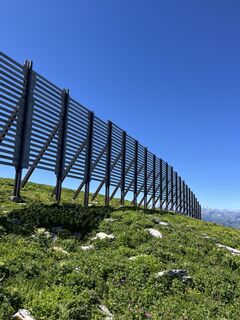
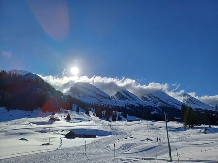
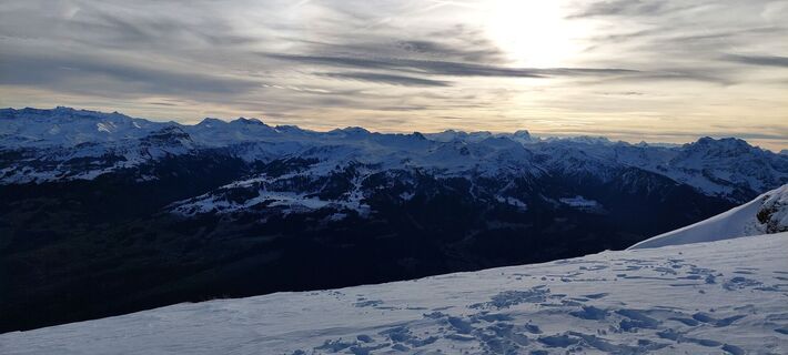
Foton av våra användare
-
 © Burkhard VetschSkapad på 25.01.2023
 -
 © Burkhard VetschSkapad på 11.10.2025
 -
 © Pascal PeterSkapad på 24.08.2025
 -
 © Judith Graf-HerzogSkapad på 23.08.2025
 -

 © Aurelian BöhlerSkapad på 15.08.2025
 -
 © Aurelian BöhlerSkapad på 15.08.2025
 -
 © SvenSkapad på 05.07.2025
 -
 © SvenSkapad på 01.06.2025
 -
 © SvenSkapad på 01.06.2025
 -
 © Erich Graf 2Skapad på 31.05.2025
 -
 © Erich Graf 2Skapad på 31.05.2025
 -
 © Erich Graf 2Skapad på 31.05.2025
 -
 © Burkhard VetschSkapad på 25.01.2023
 -
 © Burkhard VetschSkapad på 25.01.2023
 -
 © brauni69Skapad på 06.07.2025
 -
 © Aurelian BöhlerSkapad på 29.06.2025
 -
 © Aurelian BöhlerSkapad på 29.06.2025
 -
 © Aurelian BöhlerSkapad på 29.06.2025
 -
 © Aurelian BöhlerSkapad på 29.06.2025
 -
 © Aurelian BöhlerSkapad på 29.06.2025
 -
 © Aurelian BöhlerSkapad på 29.06.2025
 -
 © Francesco f ErnstSkapad på 04.03.2025
 -
 © Marlyse LeuSkapad på 12.01.2025
 -

 © Peter WürmliSkapad på 26.12.2024
 -
 © ClaudiaSkapad på 28.12.2022
 -
 © ClaudiaSkapad på 28.12.2022

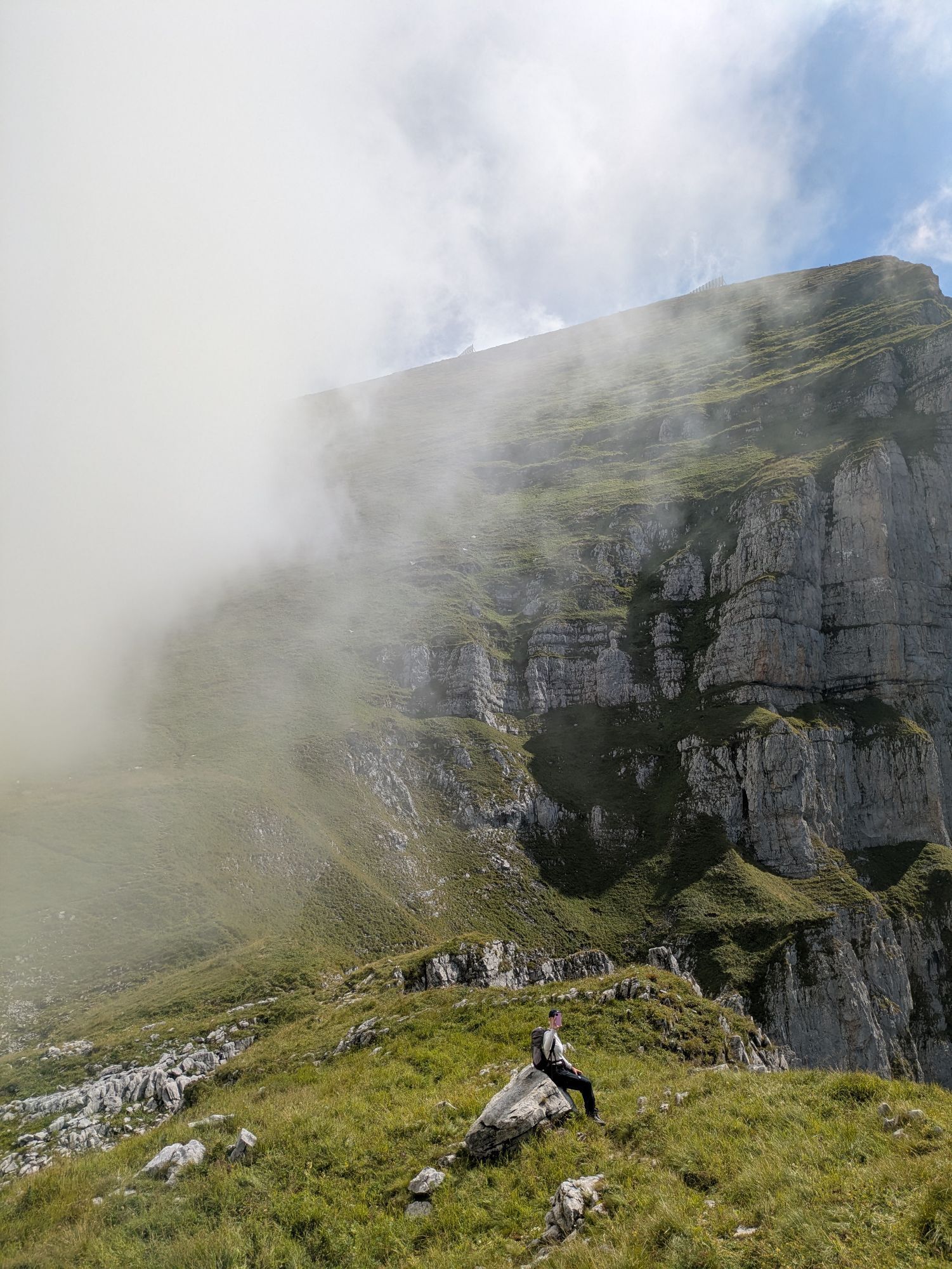
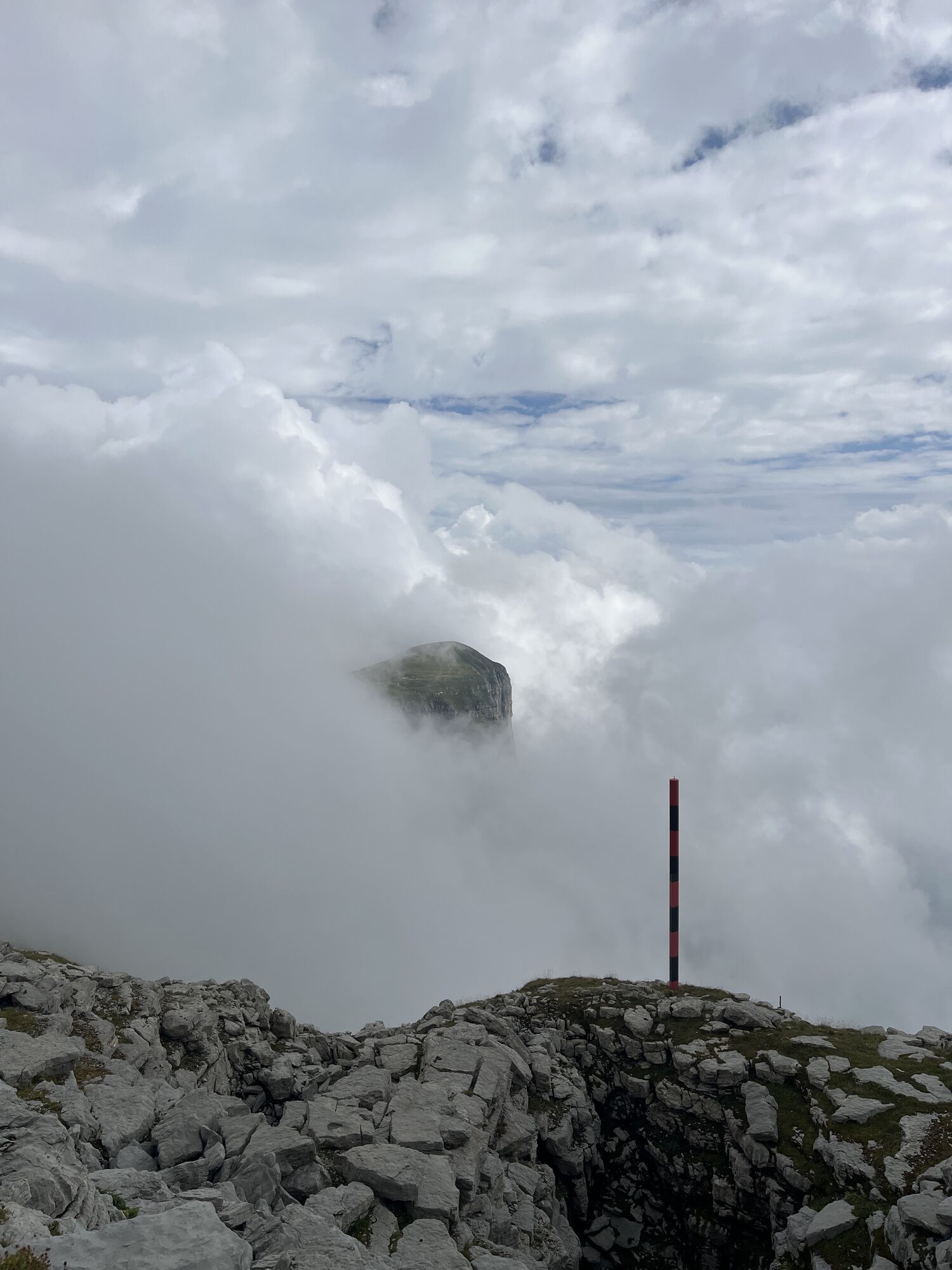
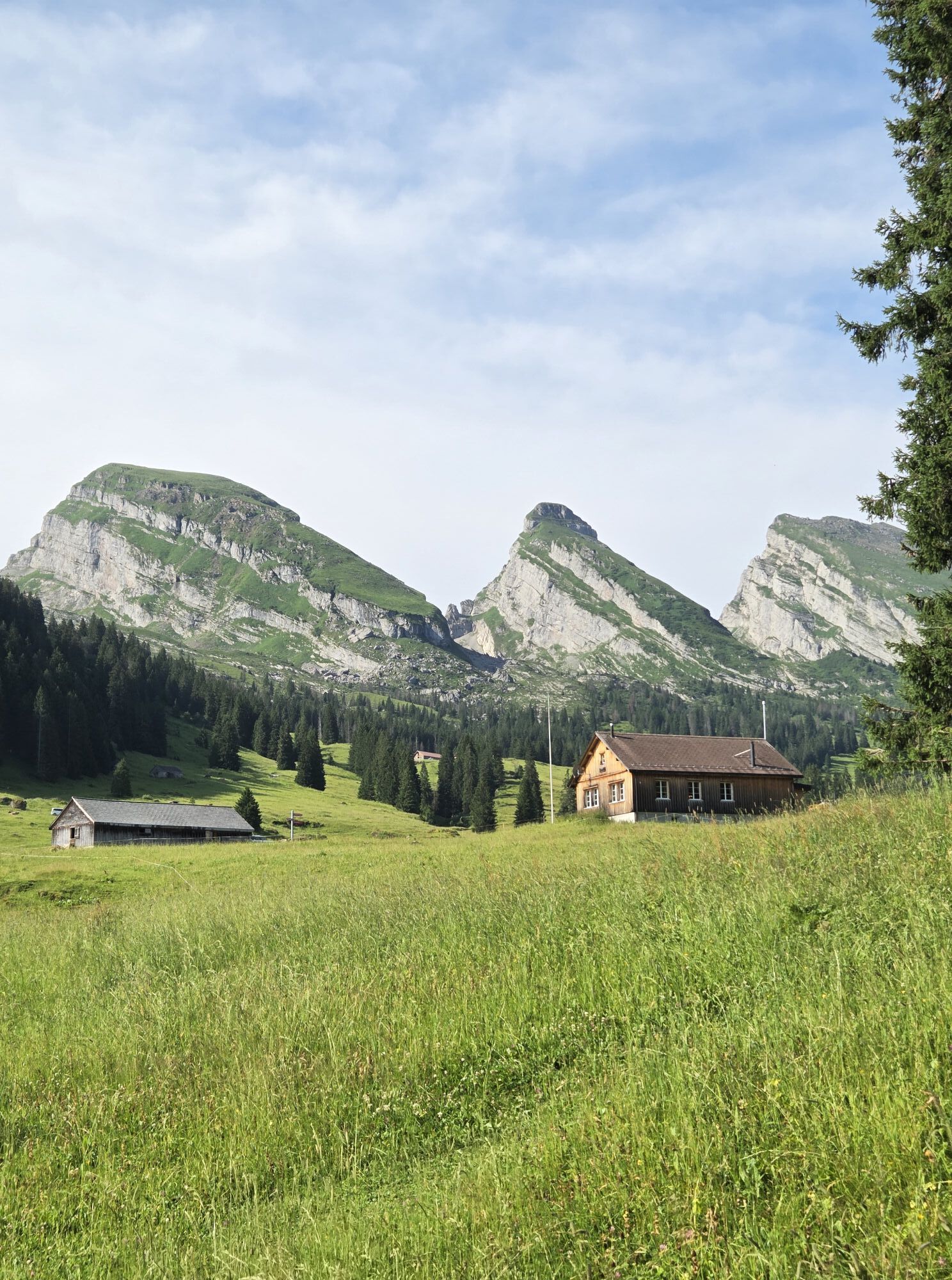
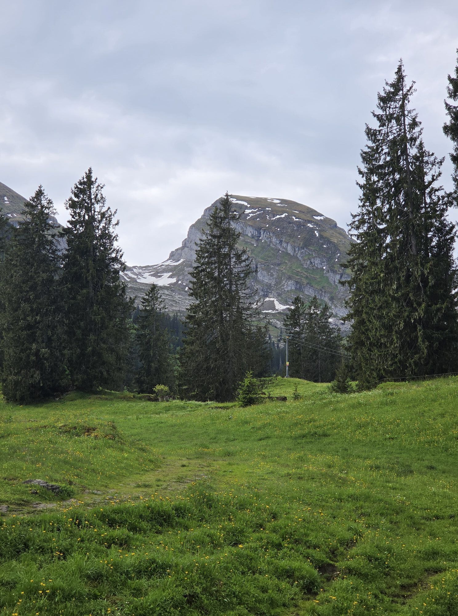
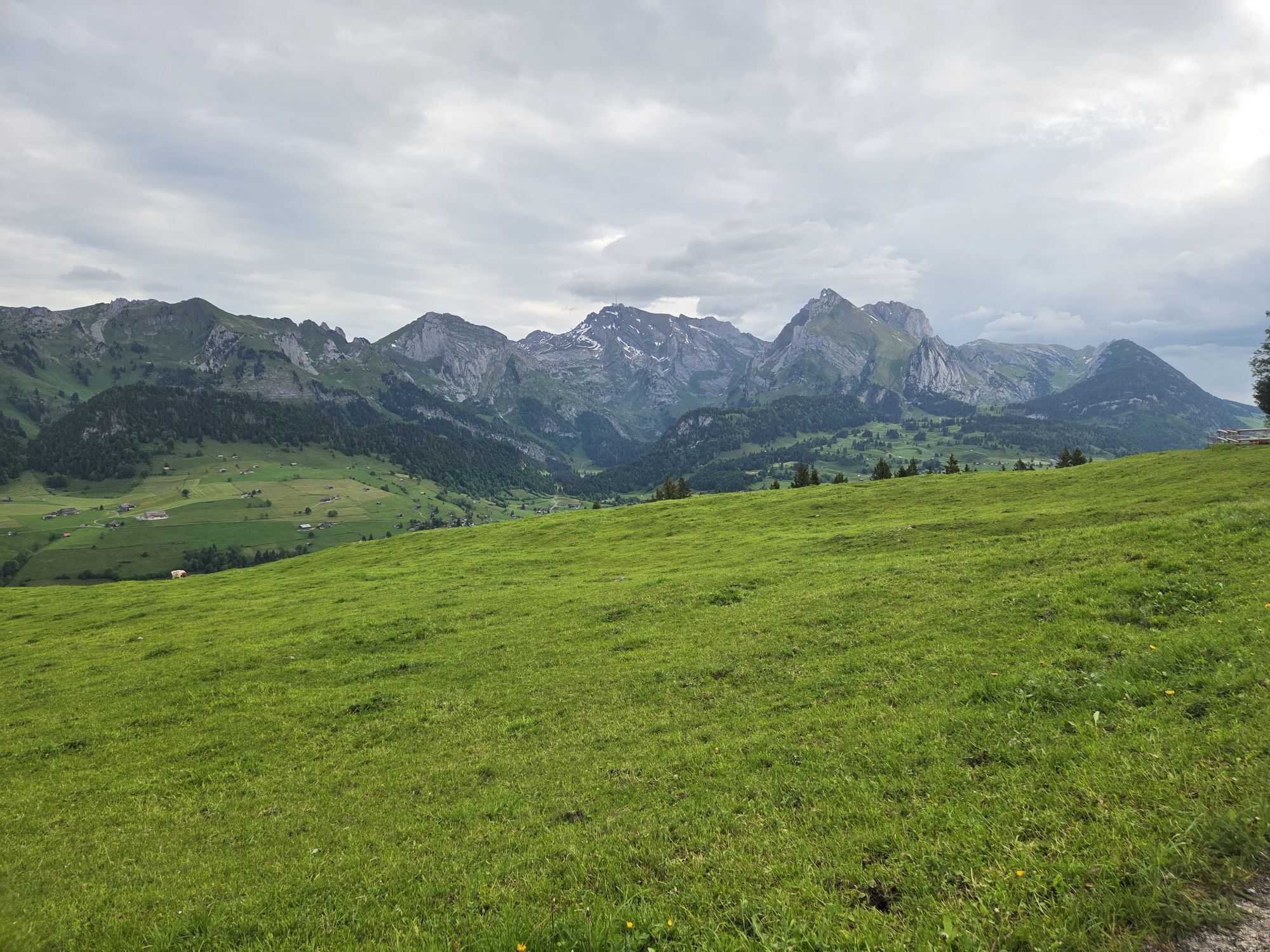


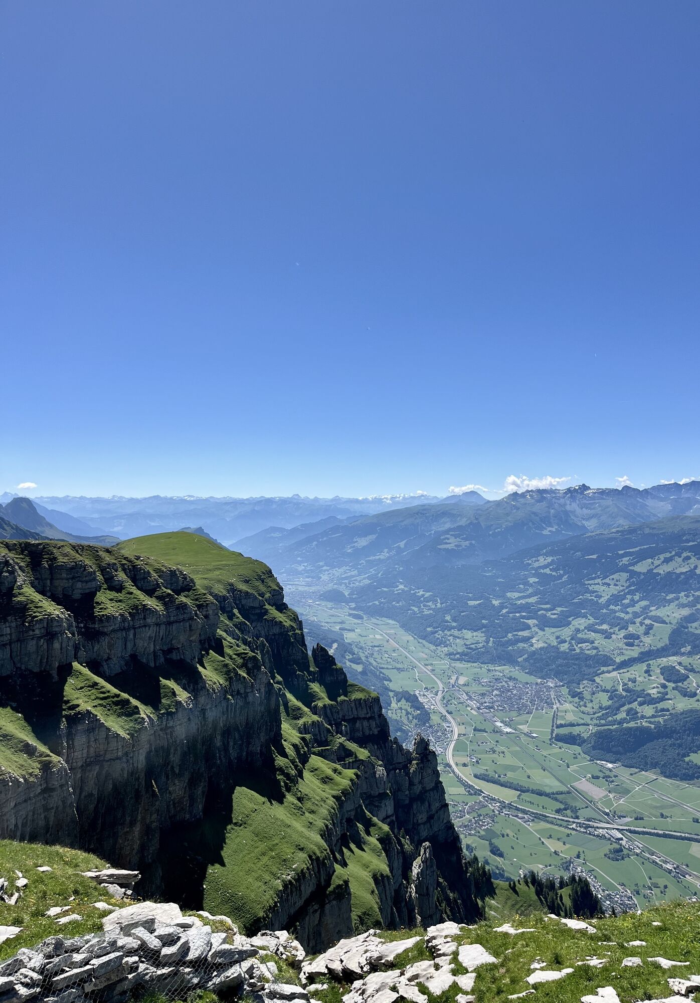


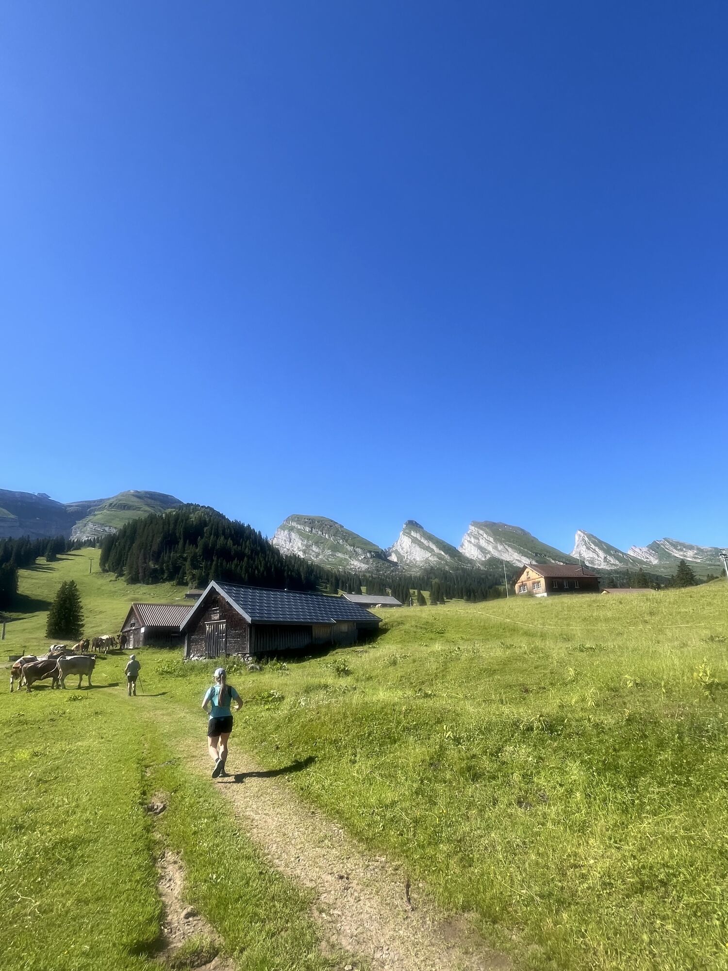

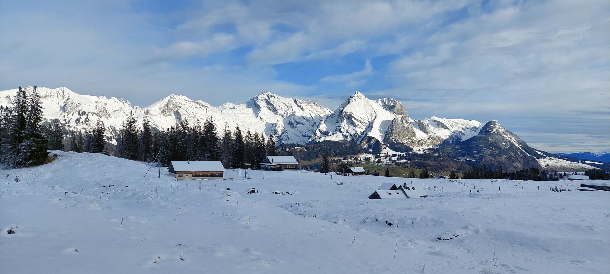
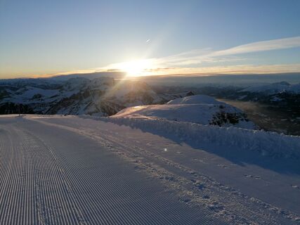
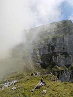
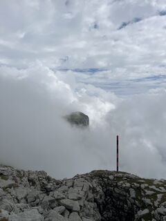
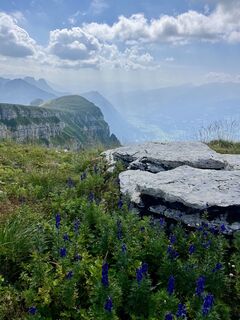
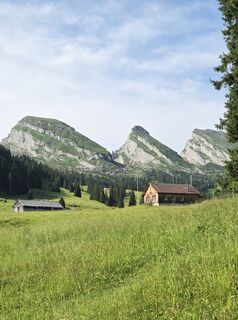
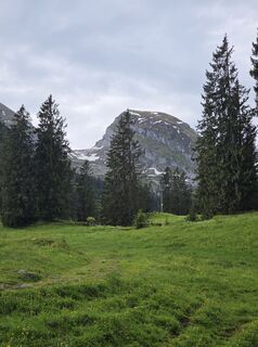
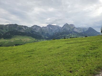
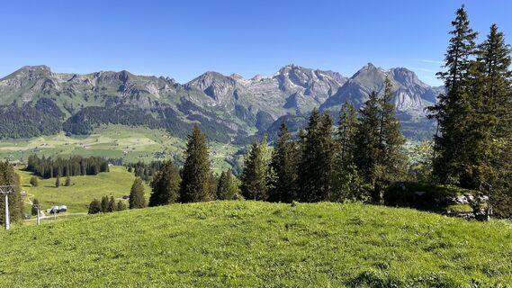
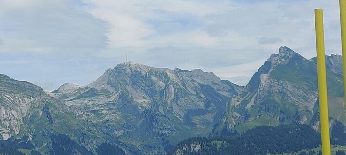
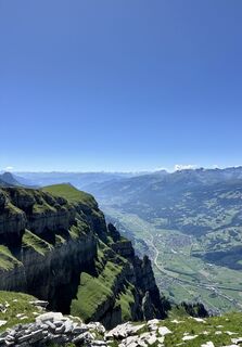
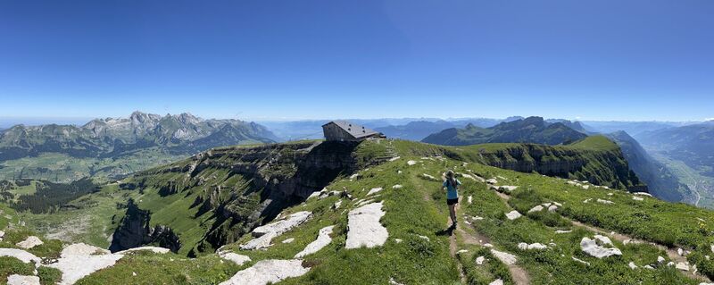
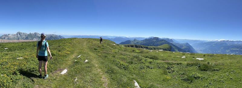
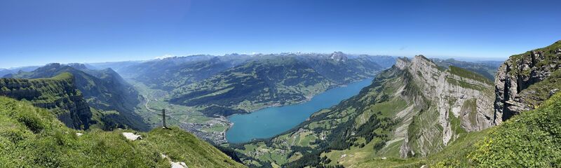
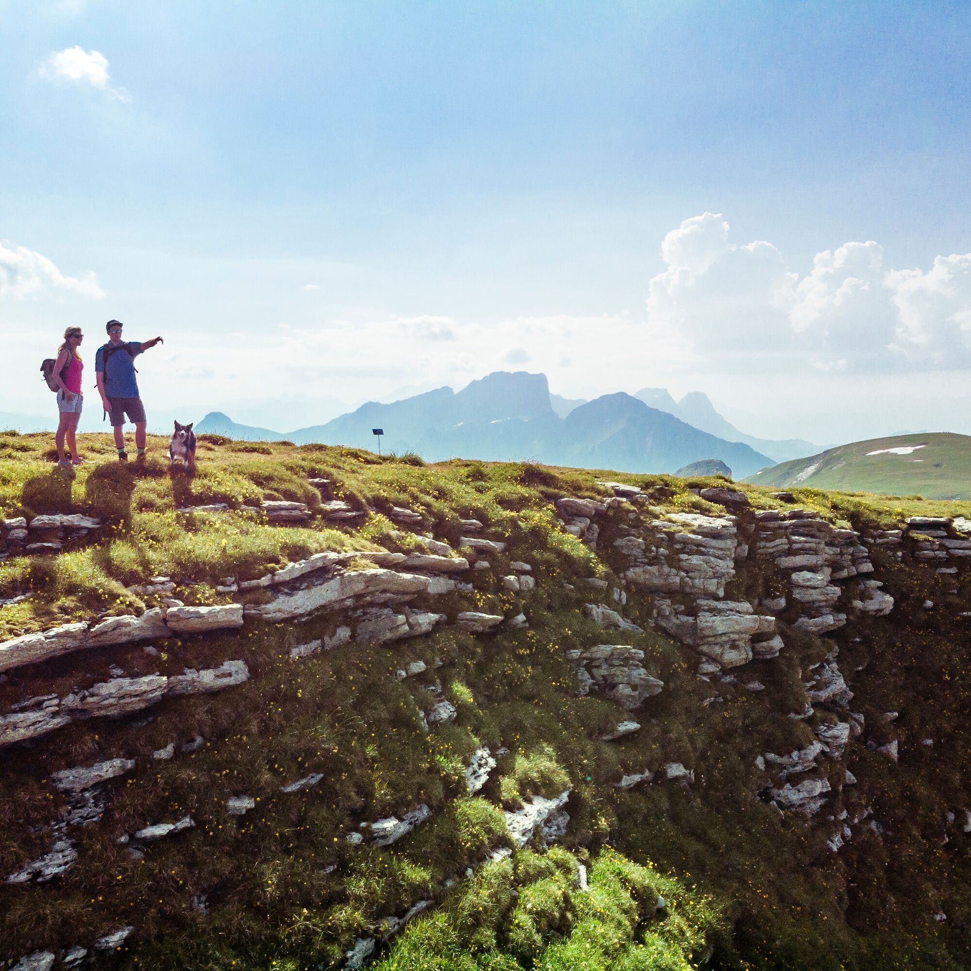
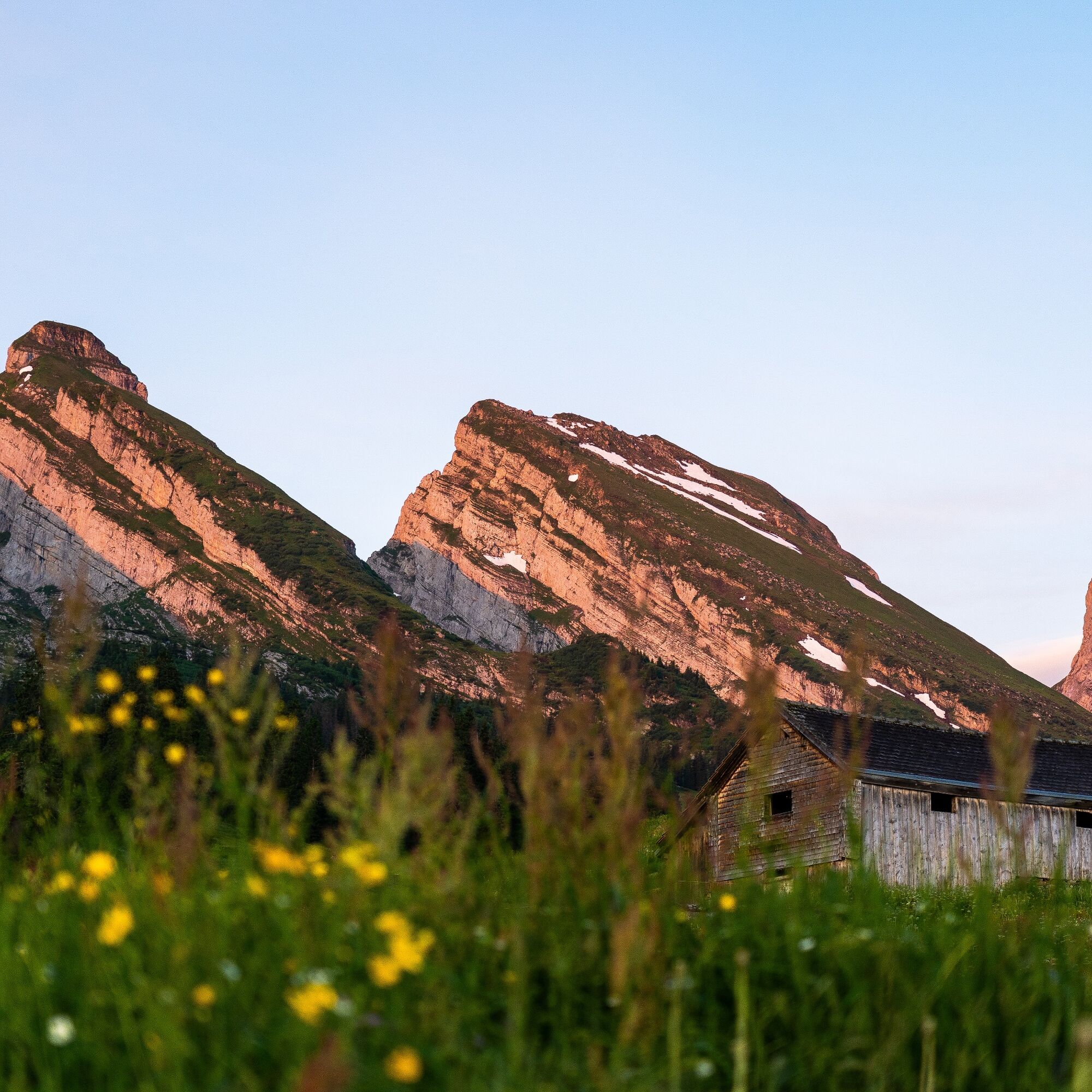
The hike begins on the high plateau of Alp Sellamatt, flanked by the seven Churfirsten. Access is via the chairlift/gondola from Alt St. Johann. Through the forest, over wide alpine meadows and karst landscape,...
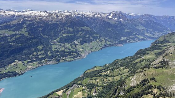
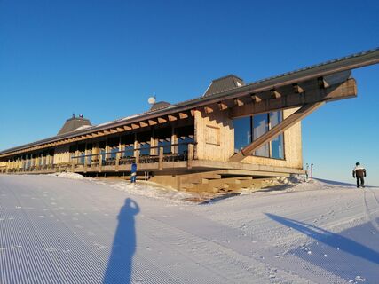
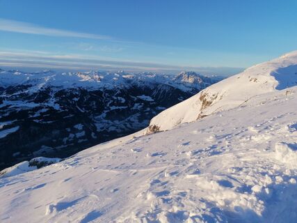
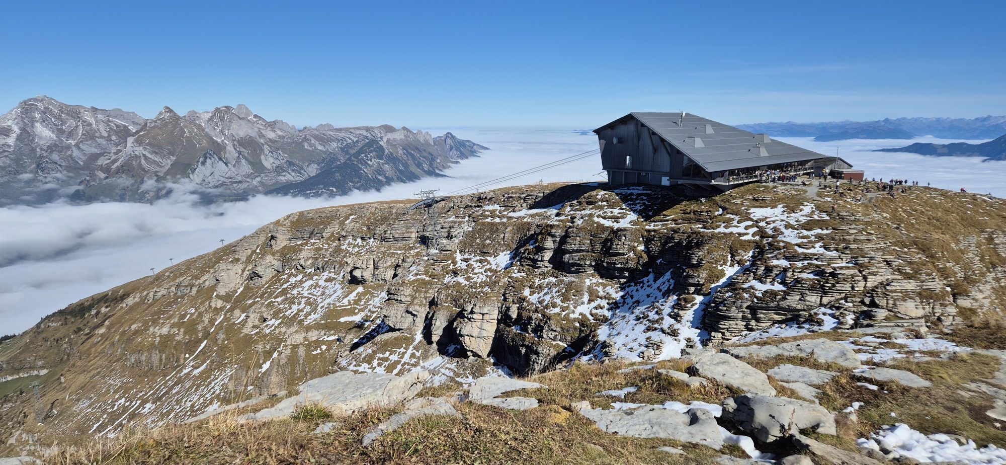
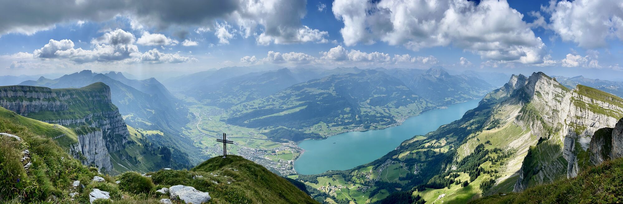
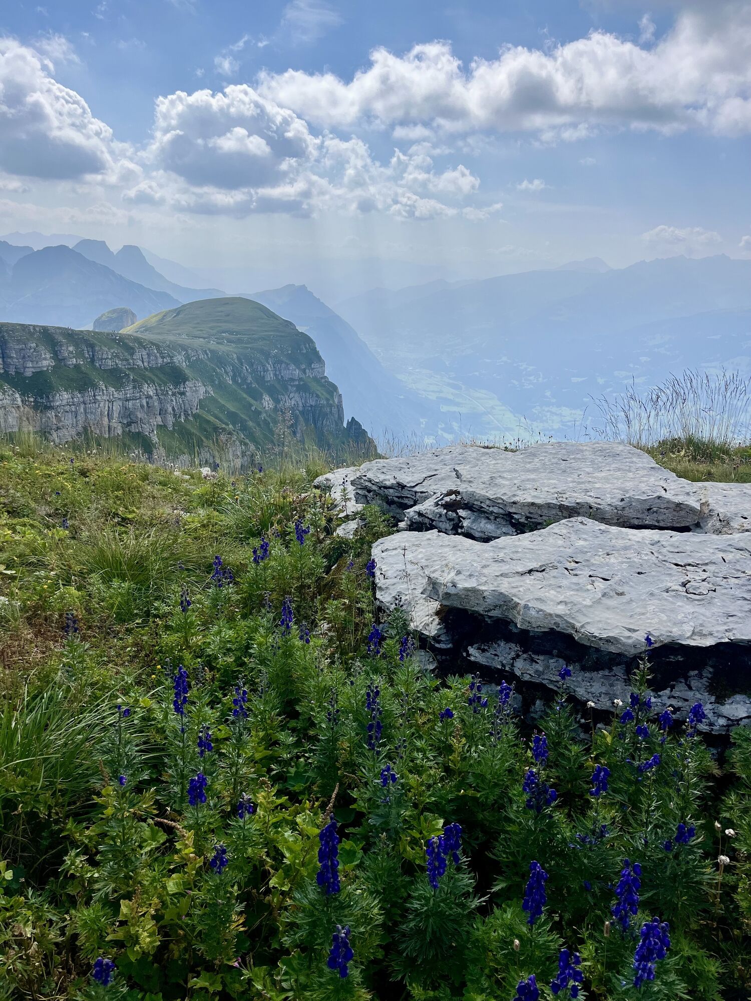
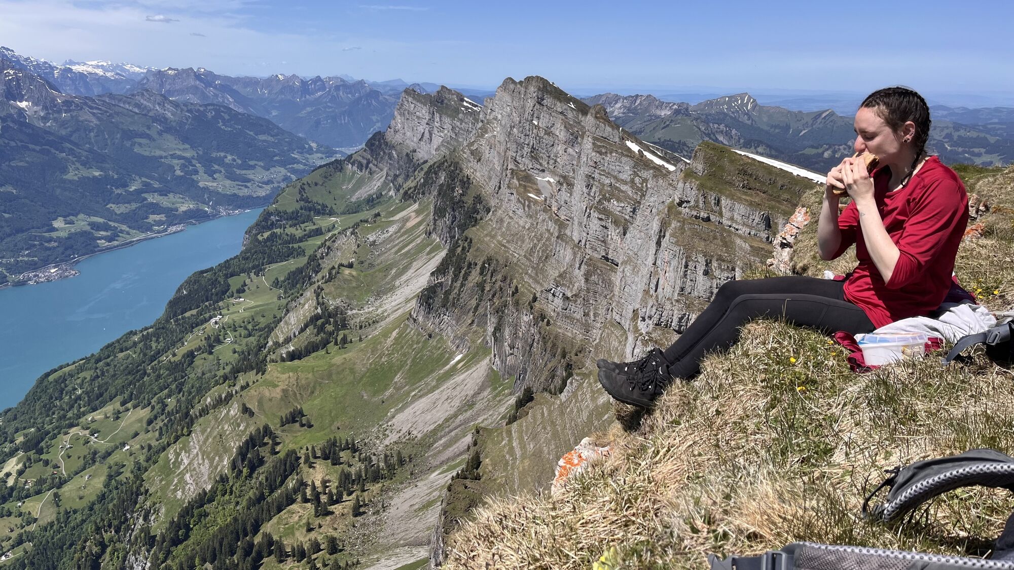
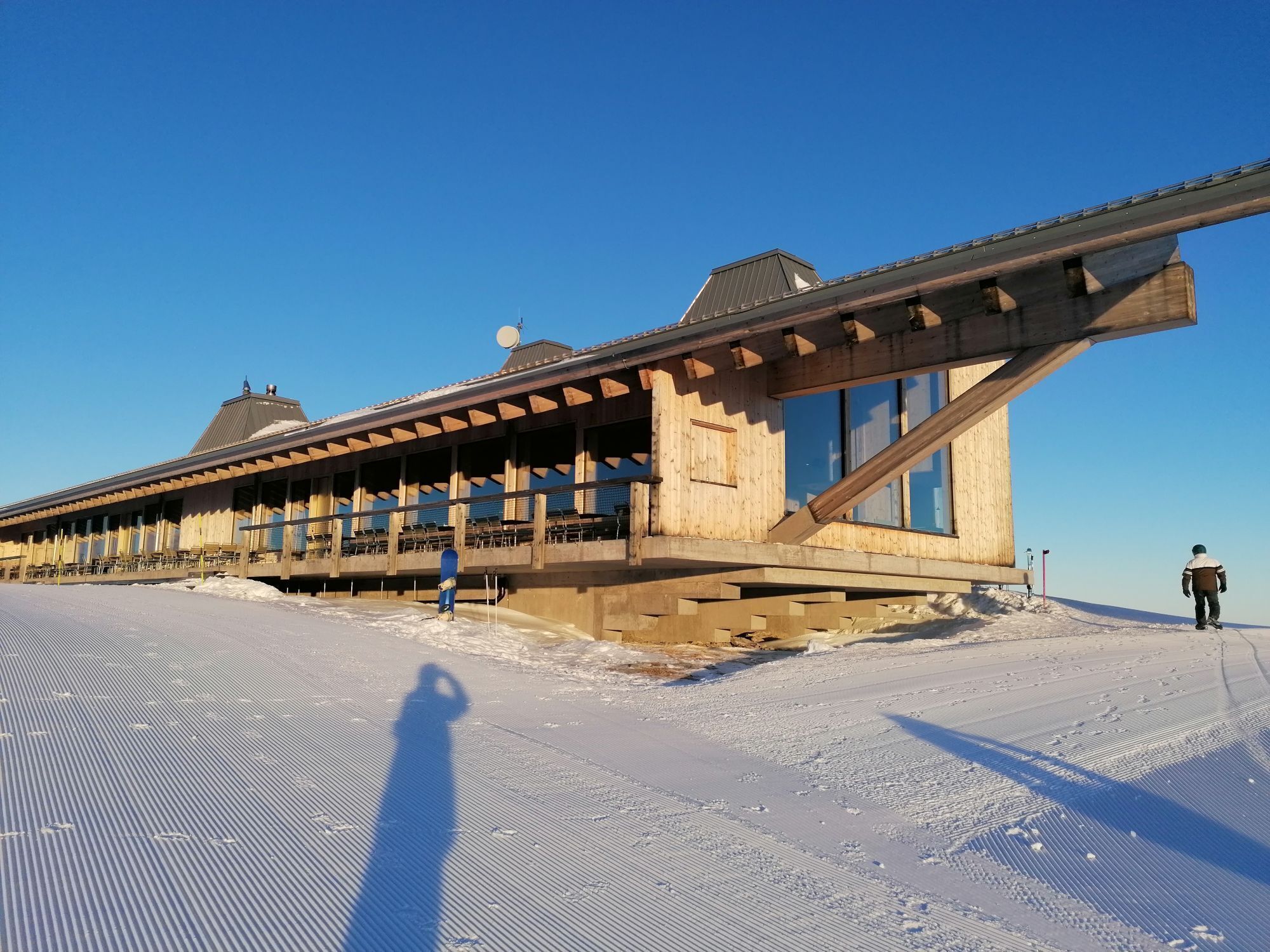
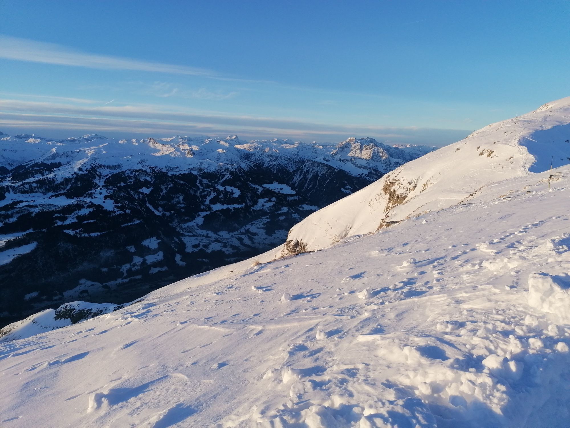
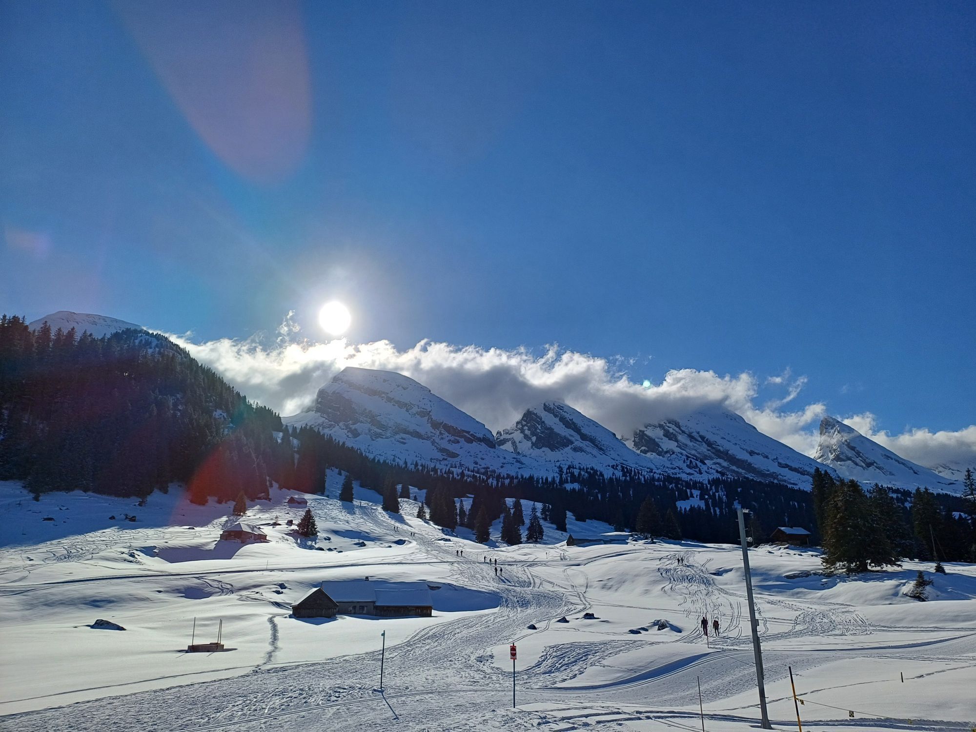
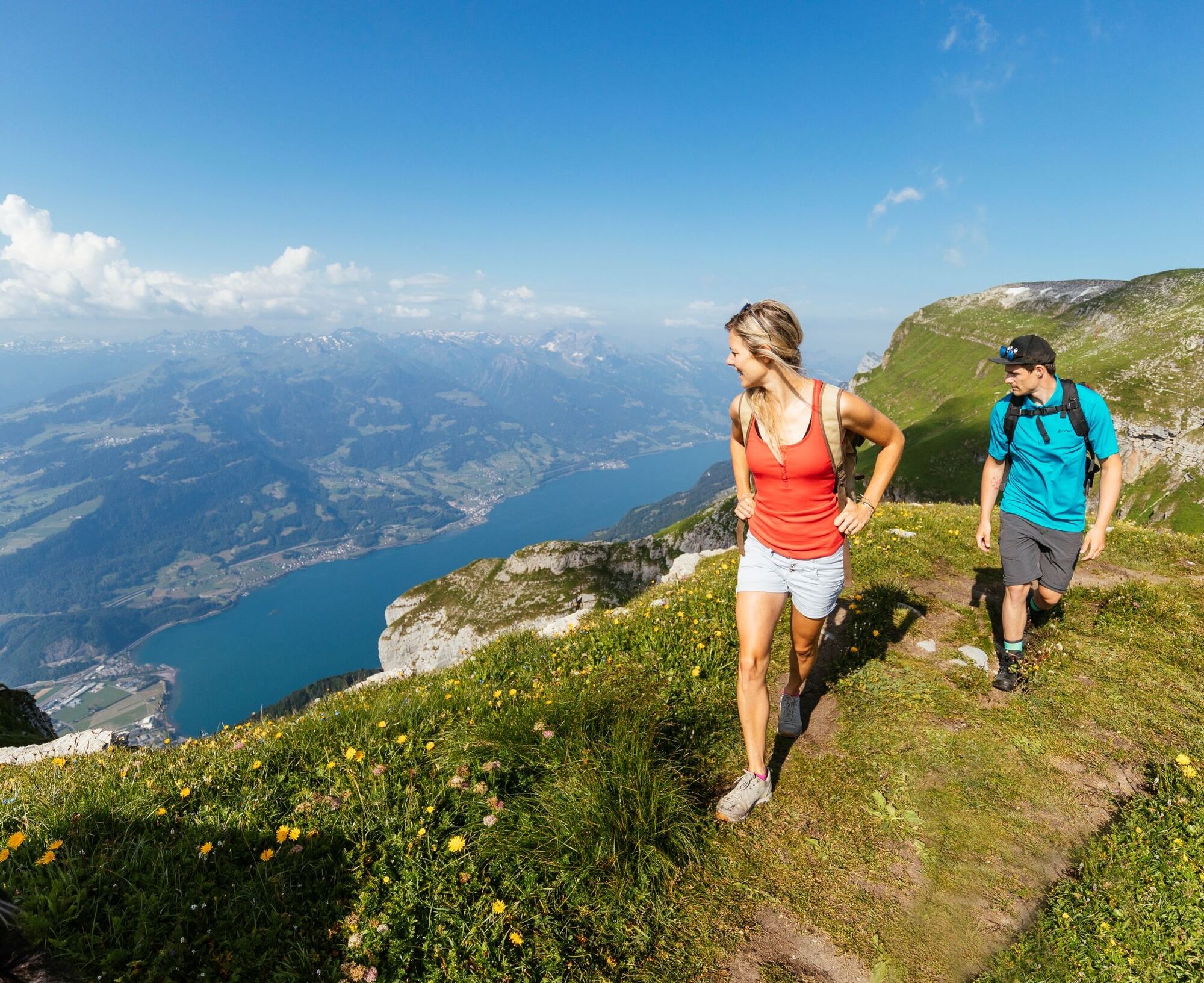
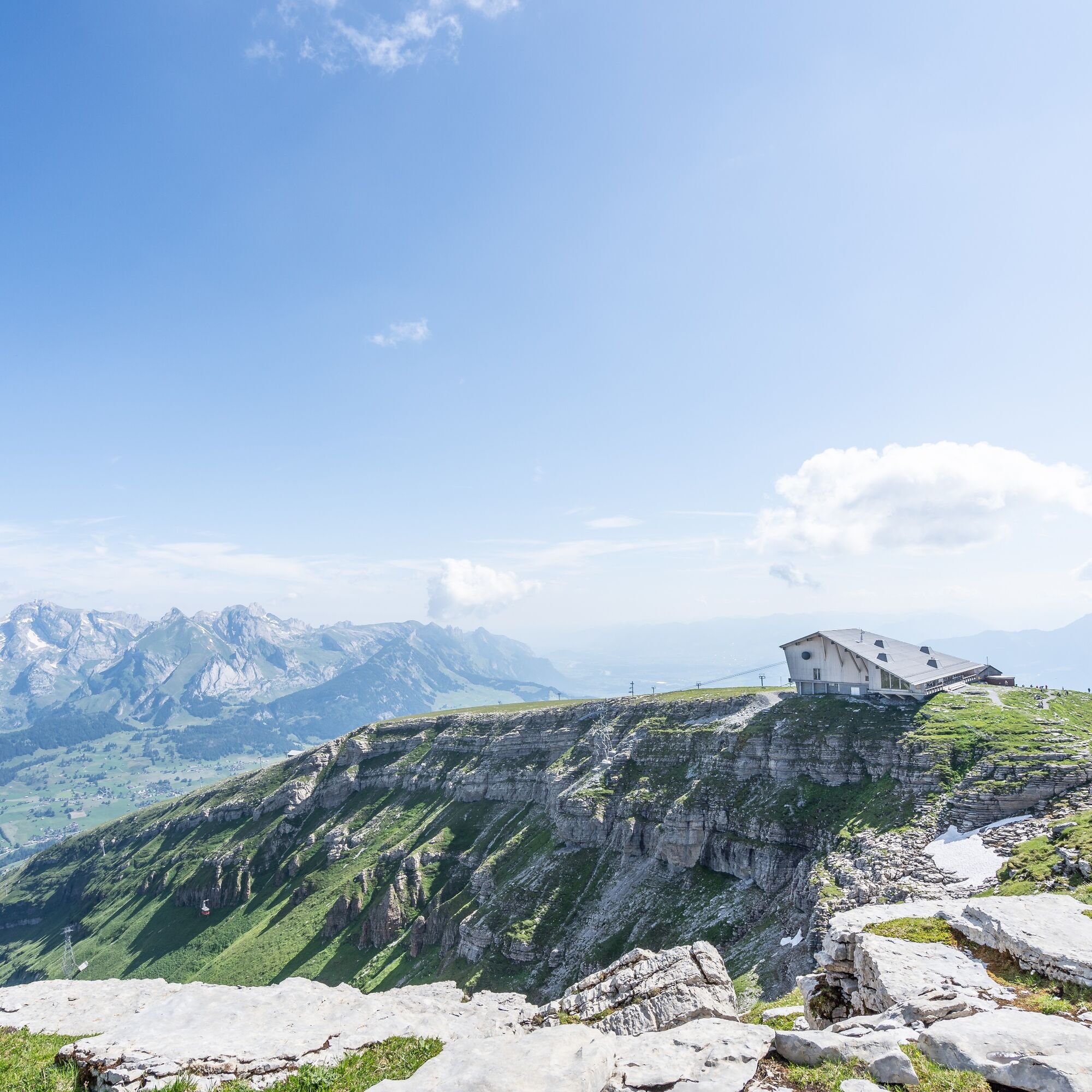
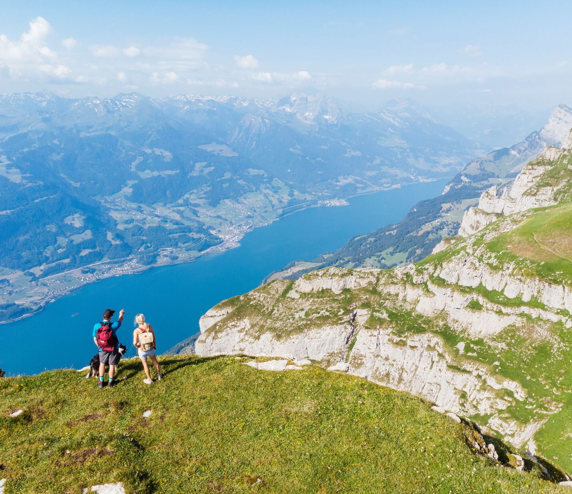
The hike begins on the high plateau of Alp Sellamatt, flanked by the seven Churfirsten. Access is via the chairlift/gondola from Alt St. Johann. Through the forest, over wide alpine meadows and karst landscape, the path leads up into the Gluristal. The area between the Schibenstoll and the Hinderrugg is known for its diverse floral display. At the back of the Gluristal, a mountain trail with some zigzags climbs the steep slope up to the highest of the seven Churfirsten, the Hinterrugg. At 2306 m above sea level, it towers over the Thur valley and Lake Walen. The steep ascent is rewarded with an impressive view. Over the connecting ridge, it continues to the Chäserrugg, which can be reached in just a few minutes. The summit restaurant by Herzog & de Meuron invites you to a pleasant rest while your gaze wanders across 6 countries and over 500 peaks.

Sellamatt - Zinggen - Ruestel - Gluris - Gluristal - Hinterrugg - Chäserrugg
Ja
Ja
Day hiking backpack (approx. 20 liters) with rain cover, sturdy and comfortable footwear, weather-appropriate and durable clothing in layers, telescopic poles, sun and rain protection, provisions and drinking water, first aid kit, pocket knife, mobile phone, map material
Parts of the route require surefootedness and can be slippery depending on conditions.
By train to Nesslau Neu St. Johann station and further by bus to Alt St. Johann village.
From the Rhine Valley by train to Buchs station and then by bus to Alt St. Johann village.
Parking spaces are available at the Alt St. Johann valley station.
T3
Toggenburg Tourism
Hauptstrasse 104
CH-9658 Wildhaus
Tel: +41 (0)71 999 99 11
E-mail: info@toggenburg.swiss
Website: www.toggenburg.swiss
Operating hours of Bergbahnen Toggenburg AG
Tel: +41 71 998 68 10
E-mail: info@chaeserrugg.ch
Website:
The chance to observe wild animals is high. Therefore, binoculars belong in the backpack.
Webbkameror för rundturen
Populära turer i närområdet
-
4,7
Riviera Walensee Walenstadt - Quinten
MediumVandring 10,4 km -
4,9
Säntis-Gipfeltour, Wasserauen / Appenzell Innerrhoden
tungVandring 21,1 km -
4,6
Riviera Lake Walen Weesen – Quinten
MediumVandring 10,2 km -
4,6
Weesen - Quinten - Walenstadt
tungVandring 20,6 km -
4,7
Wasserauen - Seealpsee - Wasserauen
MediumVandring 7,71 km -
5,0
Staubern-Runde (15.8.2021)
MediumVandring 8,65 km -
5,0
Seealpsee Runde
MediumVandring 8,22 km -
3,0
Ebenalb, Aescher, Seealpsee, Meglisalp, Wasserauen
tungVandring 13,6 km -
5,0
Traumhafte 3-Seen/Hütten Runde in Appenzell Schweiz
MediumHög tur 19,7 km -
Wasserauen-Seealpsee-Mesmer-Ageteplatte-Meglisalp-KleinHütten-Wasserauen
MediumVandring i berg 15,4 km

Vandring och spårning


Missa inte erbjudanden och inspiration inför nästa semester
Din e-postadress har lagts till på e-postlistan.