


Anello Ceronda Mountain Bike: Stage 1 Val Ceronda and Stura di Lanzo


Foton av våra användare
-
 © Antonella TorelliSkapad på 03.10.2025
 -
 © Antonella TorelliSkapad på 03.10.2025
 -
 © Antonella TorelliSkapad på 03.10.2025
 -
 © Antonella TorelliSkapad på 03.10.2025
 -
 © Antonella TorelliSkapad på 03.10.2025
 -
 © Antonella TorelliSkapad på 03.10.2025
 -
 © Antonella TorelliSkapad på 03.10.2025
 -
 © Antonella TorelliSkapad på 03.10.2025

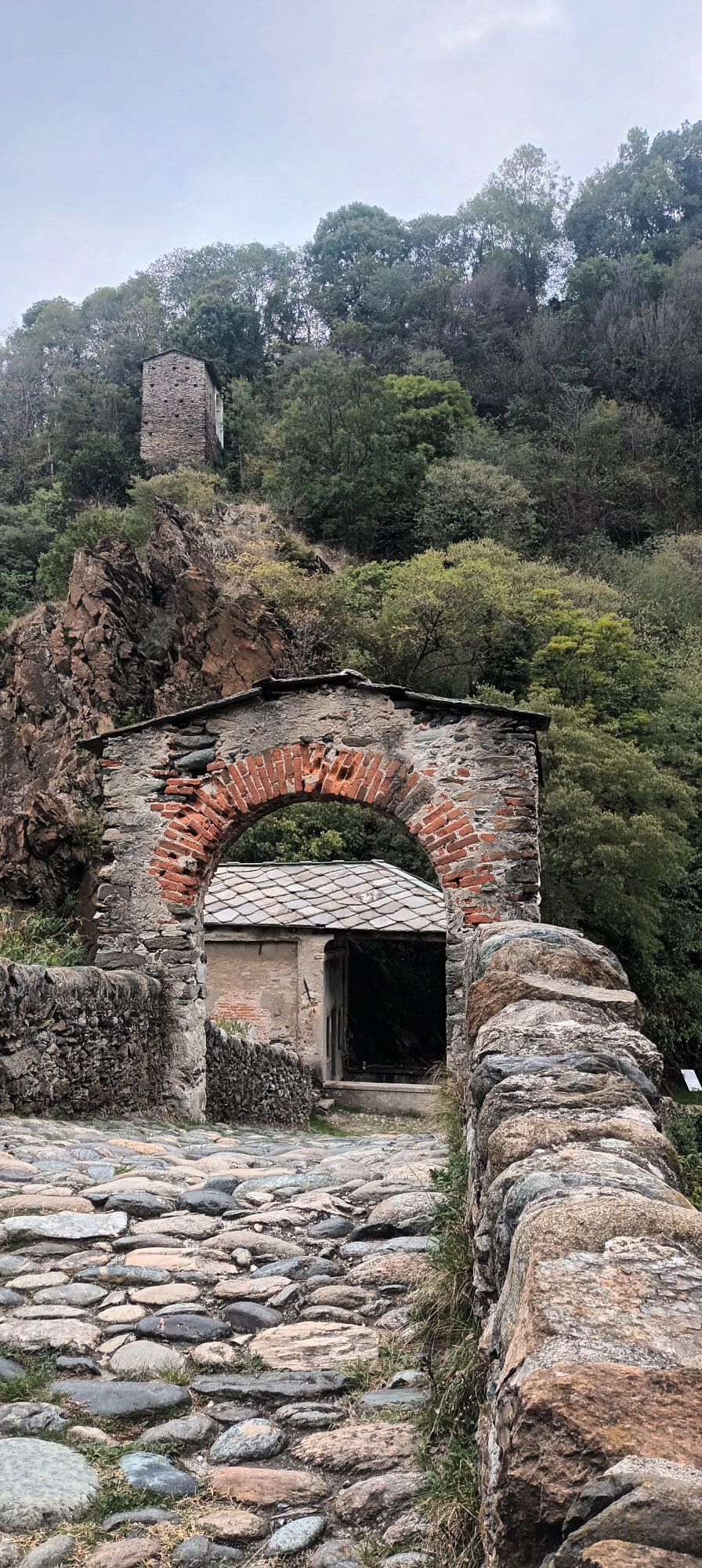
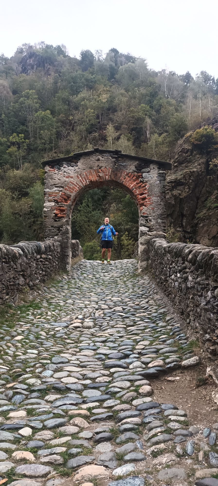
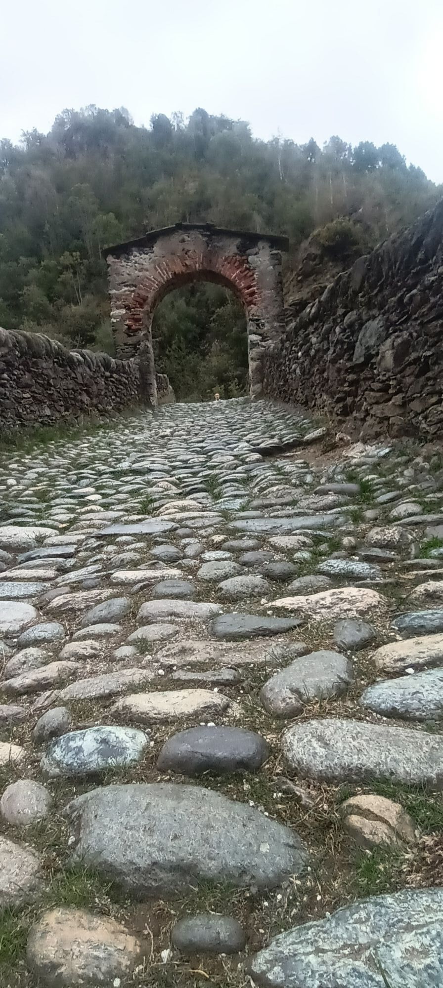
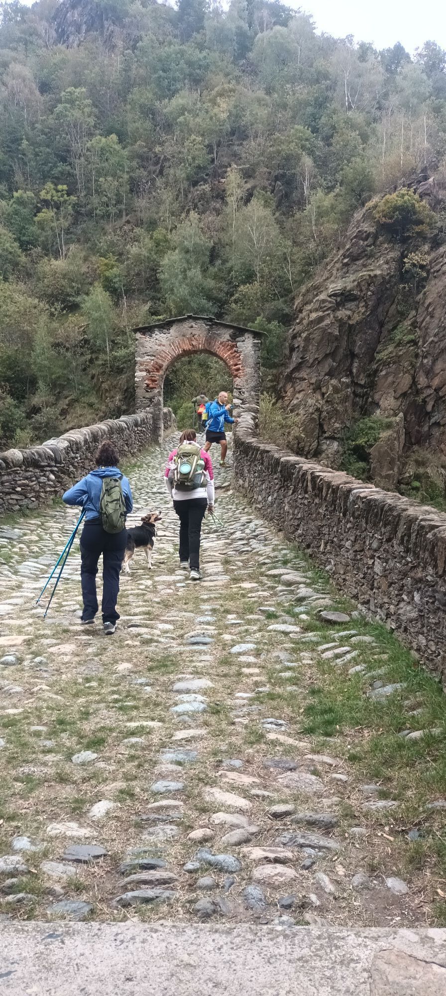

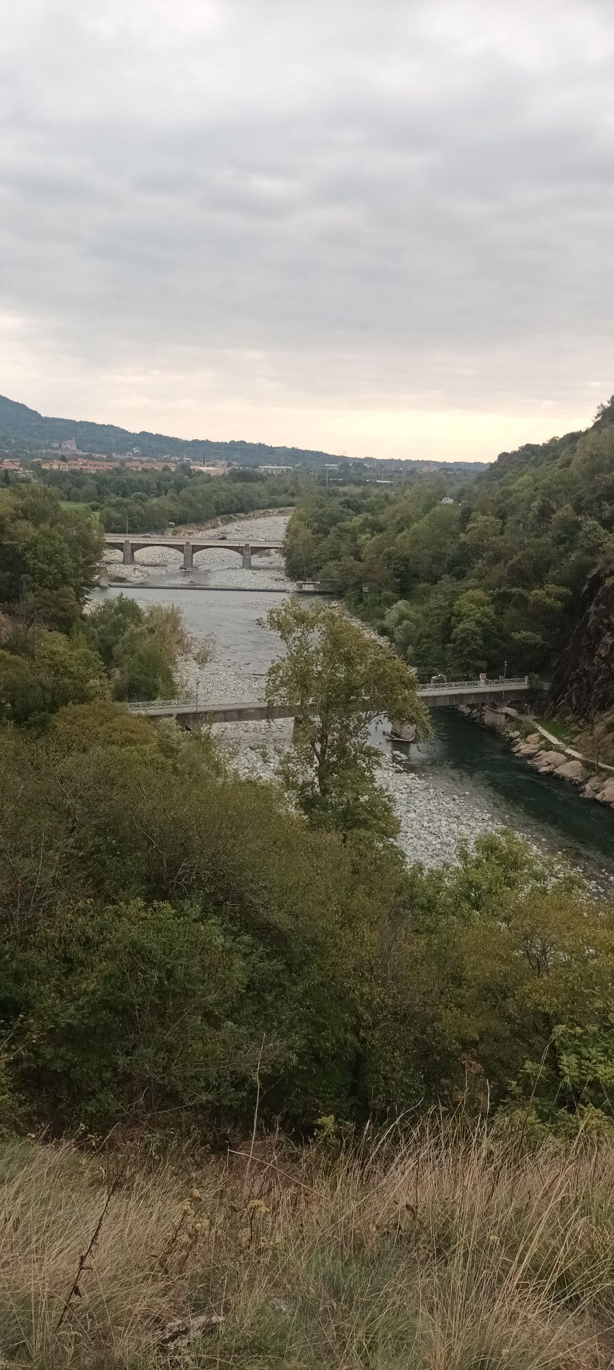
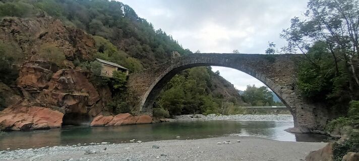
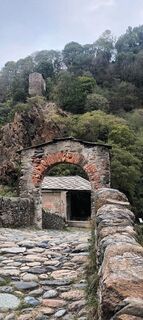
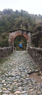
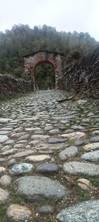
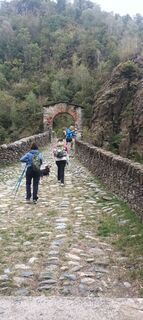
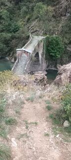
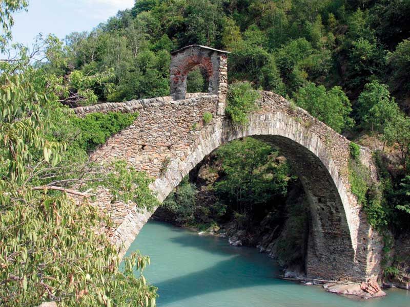
Starting from the Movicentro of Lanzo Torinese, follow the cycle/pedestrian path that leads to the entrance to the Ponte del Diavolo park.Cross the park along the wide path (pedestrians give way), possibly...
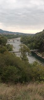
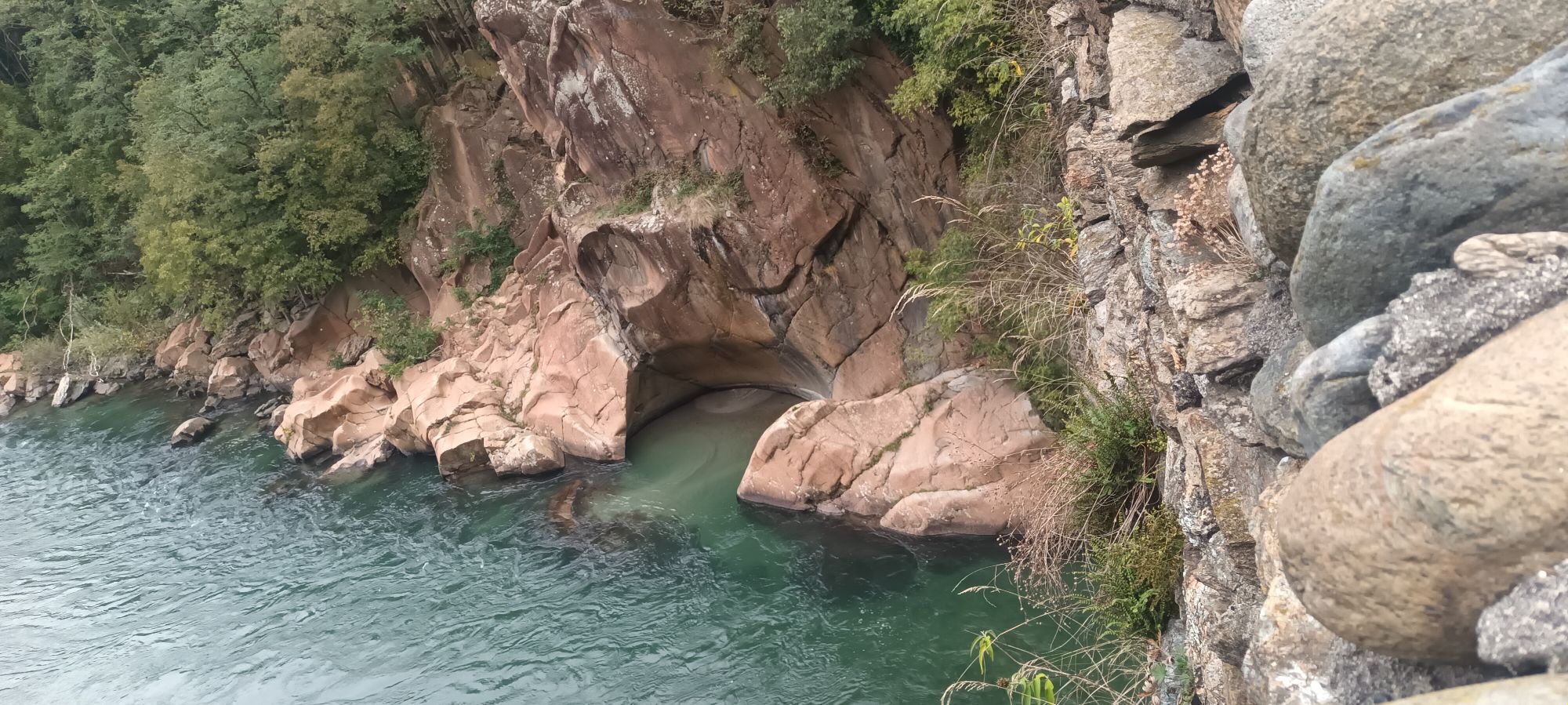
Starting from the Movicentro of Lanzo Torinese, follow the cycle/pedestrian path that leads to the entrance to the Ponte del Diavolo park.Cross the park along the wide path (pedestrians give way), possibly guiding the bike by hand on the short stretches of bumpy path. Once you reach the Casa del Parco and cross the equipped area, take the climb towards Regione Montebasso. After a few kilometres, at the signposted crossroads, go down towards Cafasse. Once you reach the SP1 provincial road, (pay maximum attention to vehicular traffic, travel a few dozen meters towards Lanzo, keeping to the left and taking advantage of the large area that allows you to stay away from the main road. Once you reach the road widening, a sign indicates the safest point to cross the busy road to take the secondary road again.Once you descend towards the rural area to the east of the town of Cafasse, you will follow the Stura di Lanzo River for a few kilometers along rural roads and almost flat paths. After passing the Cafasse sports centre, on secondary asphalted roads you reach the town center and continue northwards to the central square where you turn left to go back up to Monasterolo. Be careful when crossing the SP1 regulated by the traffic lights. Once you reach the flat area of the "Funghetto", take a road on the left which immediately becomes a dirt road and enters the woods. The dirt road, at times challenging due to the irregular surface but without too much effort, will lead to the border with the Municipality of Fiano. Once you have crossed the asphalt road, the route will resume on the path with a short but challenging descent to be tackled preferably with a hand bike. In the woods, coming across some small natural fords, you continue without difficulty. You will then encounter a steep climb (possible portage).A rural road will then lead with a fun descent towards the chapel of San Rocco di Fiano. Turn right onto the asphalt road and take the first marked path on the right. The forest ends at a production plant and you will continue along the SP181 provincial road for one km in a south-west direction towards La Cassa (pay attention to vehicles).Turn right to reach the chapel of San Biagio, in the Varisella area, go up along the wide path (along the stretch a sign indicates the pedestrian detour towards the area of the archaeological remains of the ancient Baratonia Castle). At the top of the path, turn right onto the dirt road that leads to the village of Baratonia. From the square a sign indicates the direction to descend towards the Ceronda stream. Cross over the metal bridge and take the rural roads through the woods, still following the signs, to find yourself in the town of Varisella. Along the ordinary road system go up to the Filliè area. Next to the area equipped for campers there is a dirt road (priority for pedestrians and inhabitants of the villages) which leads first to Moncolombone and then, after a stretch in the woods, to the Ramai village.Be careful on the descent towards the little bridge over the small ravine of the Rio Creus. After crossing the Ramai hamlet, go down the ordinary road and continue for about 3 km up to Vallo Torinese. A sign indicates the left turn into the town center and shortly afterwards, the climb towards the chapel of San Rocco begins on the left again. Once passed, you travel along the rocky roads that overlook like a balcony towards the plain with a fascinating panorama that at times will accompany the return of this first ring. The subsequent descent leads to Monasterolo.Once you have crossed the town, turn left onto the ancient Lanzo road along which the climb towards Ca' Bianca is well signposted where a Big Bench has been installed. A place with breathtaking views on the clearest days. Having returned from the detour, take the ancient road of Lanzo which will lead again to the Devil's Bridge, concluding the stage.

Populära turer i närområdet
-
Colle della Dieta - ring from Germagnano
Landsvägscykel 41,7 km -
Lake Monastero from Pessinetto Outside
MediumCykling 30,9 km -
Ring of Monte Castello from La Cassa
MediumVandring 11,0 km -
Alpine Ring from the Lys Pass
MediumVandring 15,3 km -
Ca' Bianca and Big Bench from Monasterolo di Cafasse
ljusVandring 4,13 km -
The ruins of the Baratonia castle, churches and puddles of Varisella
MediumVandring 10,1 km -
Ring of Santa Cristina from Ceres
MediumVandring 7,84 km -
ROCCA CANAVESE Nelle vigne di Pedimonte
MediumMountainbike 18,0 km -
Viù - Alpe Bianca - Pian Fum
MediumCykling 28,0 km -
Turcin Mill Ring from Lanzo Torinese
MediumVandring 10,3 km
Vandring och spårning


Missa inte erbjudanden och inspiration inför nästa semester
Din e-postadress har lagts till på e-postlistan.