


Via dello Sbrinz - Via del Gries Stage 2: Baceno - Ponte


From the square of the town hall you go back to the church and follow the beautiful paved mule track towards Orridi di Uriezzo - Verampio until you meet the crossroads for Premia. You go up along the beautiful...
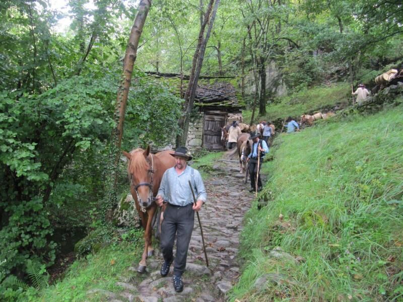
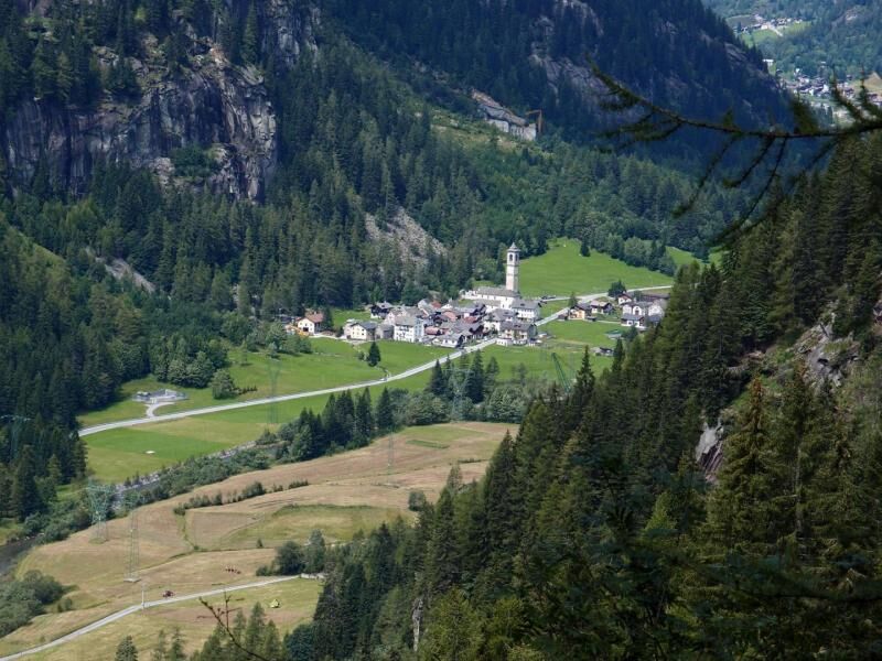
From the square of the town hall you go back to the church and follow the beautiful paved mule track towards Orridi di Uriezzo - Verampio until you meet the crossroads for Premia. You go up along the beautiful mule track to a barn, cross the main road and continue on the mule track until you reach a beautiful votive chapel (Cappella d'la Posa). Alternatively, from the square of the town hall, take the steps in front of the newsstand and climb up to intersect the main road. A little further on, take a path (signposted) that goes up the hillside above the road and reaches the Cappella d'la Posa. From here the mule track continues along the hillside to Pioda. Continuing along several small roads you reach the sports ground then, alternating beautiful stretches of mule track with asphalt stretches along internal roads, you pass Rozzaro, Piazza and Rodis to arrive in the small square of the town hall of Premia. From the car park below the town hall, a flat mule-track breaks off, which soon reaches the road to the hamlet of Cingio. Go down to the main road where there is a beautiful chapel (Cappella dal Self), a lovely stone staircase begins here, which goes down to the bridge over the River Toce, and then back to Cagiogno. Take the asphalt road until you reach the large barn before the bridge (which you do not cross) and, remaining on the left hydrographic bank, turn right, following the hiking arrows with G00 signs and take a sheep track that continues along the artificial lake of Piedilago. From the end of the lake you return to an asphalt road that continues on level ground passing below the hamlet of Cristo and continuing along the river. Further on, the track becomes a dirt road once again and runs beautifully through well-maintained meadows until it reaches the bridge right in front of the Terme di Premia. Instead of going towards the bridge, follow the signs for the Via del Gries and continue along the meadows along the Toce for a long stretch with a gentle slope until you reach Casa Cini. Cross the hamlet and continue on the sheep track that runs along the river until it intersects a quarry track. Cross the River Toce at the ford (if there is water, use the bridge at Case Cini) and you arrive on the main road that you follow until Chioso and Foppiano. From the centre of Foppiano the mule track keeps parallel downstream of the valley until you reach the road bridge. From there you continue following the state road but instead of entering the tunnel you turn right and follow the old hairpin bends of the Casse (there are also some small paths that cut through) where cars no longer pass, until you reach th elocality of Fondovalle. Here you cross the bridge over the Toce and take the agricultural road, a long flat road that goes up the valley on the left bank (always follow the signs for Via del Gries) that leads to Valdo. Cross the River Toce again, then go uphill in the direction of the chairlift departure area, but just before arriving, go straight on along the pedestrian road that runs along the river, cross the wooden bridge over the Toce and reach the small square of the Town Hall of Formazza in the locality of Ponte.

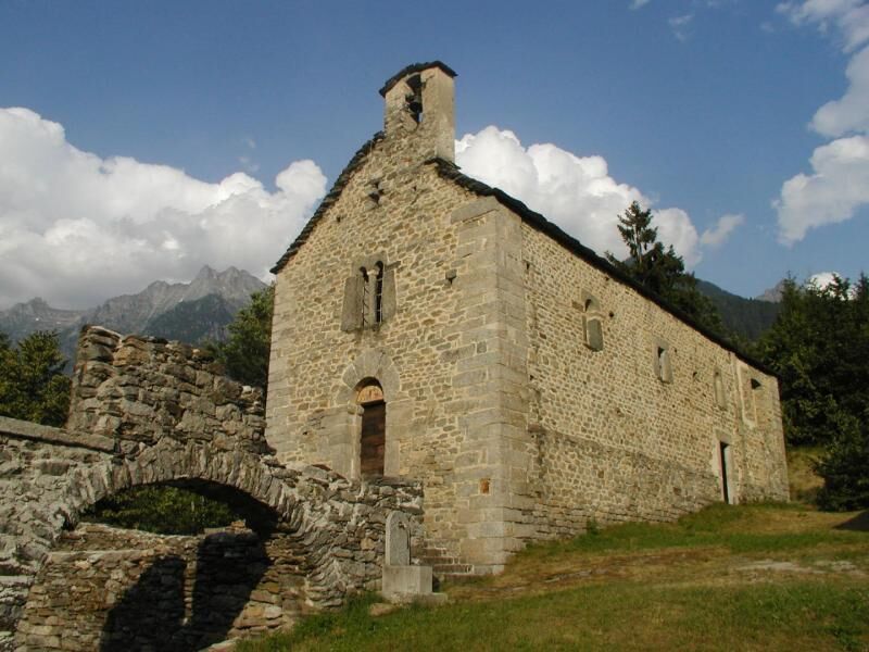
Orridi di Uriezzo Gorges, San Bernardo Hospice, Parish Church of Premia, Mineralogical Museum of Premia, Premia Terme and Village of Cadarese, Walser Culture and Architecture in Formazza, Fortified house in Ponte
Populära turer i närområdet
-
4,0
Foroglio-Calnègia-Foroglio
MediumVandring 8,37 km -
5,0
Bosco Gurin-Lago Melo-Lago Pero-Bosco Gurin
MediumVandring 10,6 km -
Blinnenhorn route
tungVandring 106,6 km -
Tour Blinnenhorn
MediumLångdistans vandringsled 109,5 km -
5,0
TESSIN | Foroglio
MediumVandring 3,86 km -
5,0
Cimalmotto-Alpe Magnello-Cimalmotto
MediumVandring 8,82 km -
Linescio-Campo Vallemaggia
MediumVandring 10,1 km -
4,0
Bavona Valley: Foroglio-Calnègia-Foroglio
MediumTema spår 8,46 km -
Campo Vallemaggia Route (SvizzeraMobile 965)
MediumSnösko 4,85 km -
Bocchetta d'Arbola
MediumVandring 19,4 km
Vandring och spårning


Missa inte erbjudanden och inspiration inför nästa semester
Din e-postadress har lagts till på e-postlistan.