


Argentera Valley: Ring tour Alpe Plane - Piano della Milizia (No. 40)


The circular route from Ponte Montenero in Valle Argentera, located at the bottom of the long flat stretch of the valley, reaches with the first diagonal the 'Alpe Plane' mountain pasture located a little...
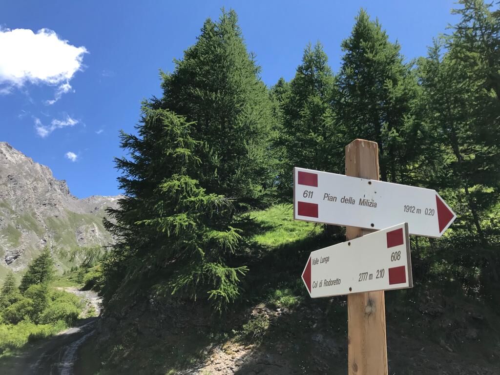
The circular route from Ponte Montenero in Valle Argentera, located at the bottom of the long flat stretch of the valley, reaches with the first diagonal the 'Alpe Plane' mountain pasture located a little upstream, with the second the Pian della Milizia, while the last diagonal leads back to the starting point. This is a very scenic hike, except for the last part, which takes place in the midst of a very cool forest with dense undergrowth. Climbing up to Alpe Plane on an easy track, along a steep slope, among meadows populated by a great variety of flowers, among sparse conifers and some rocky outcrops, you can observe the intersection between Valle Lunga and Valle del Miol. 2,100 metres, we reach the Pian della Milizia, an alluvial plain eroded by glaciers, all the while enjoying a spectacular view of the Argentera Valley and the sequence of bold peaks that surround it.

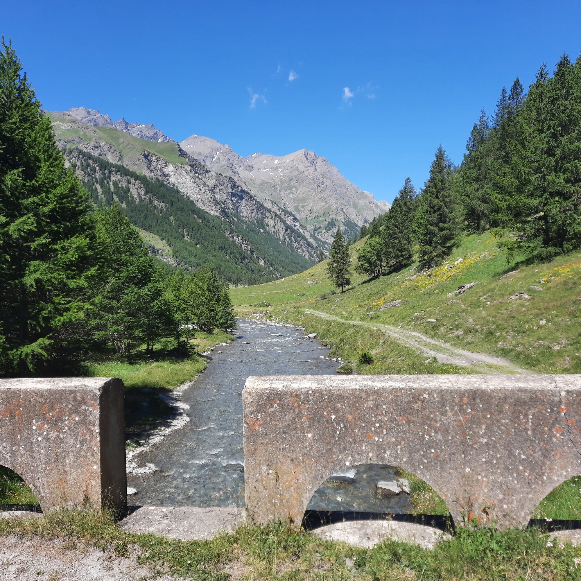
From Cesana, drive towards Sauze di Cesana (5.5 km), go past the village and, at the roundabout, continue towards Sestriere/Valle Argentera; after 1.5 km turn right at the crossroads and descend to the entrance of the valley; cross the Ponte Terribile bridge and continue for 7.3 km, paying attention to pedestrians along the way. Leave the car in the car park in Località Montenero at the stone bridge at an altitude of approximately 1920 metres, where the itinerary begins.
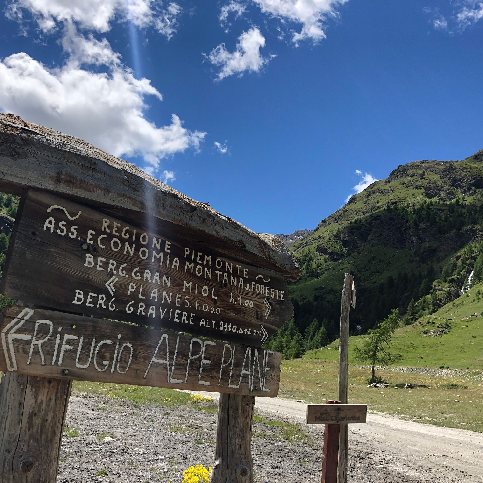
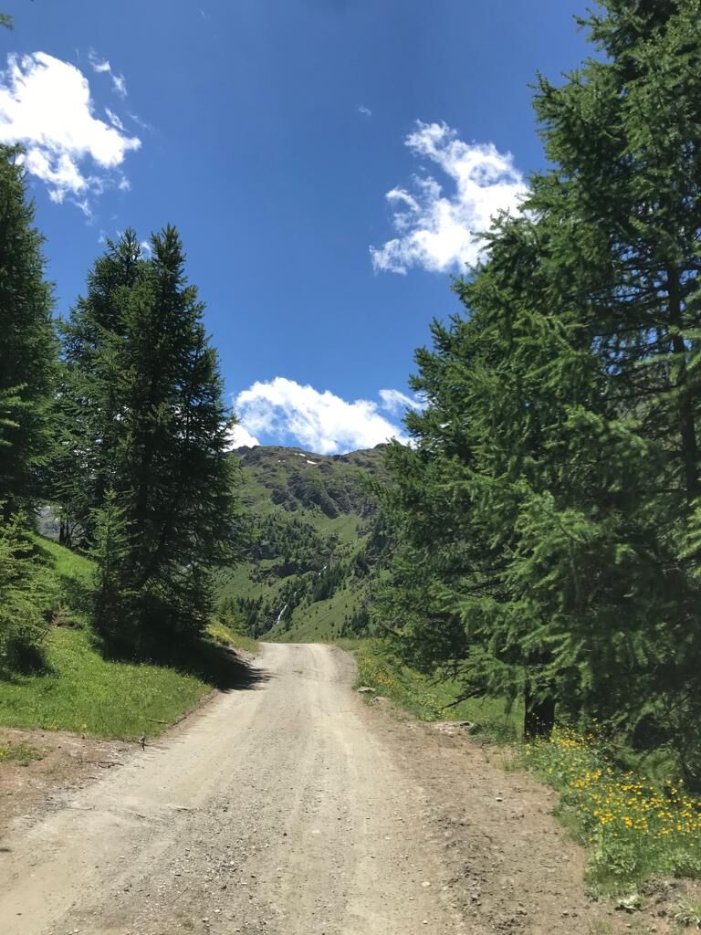
After crossing the bridge over the Ripa river, take the track that begins to climb diagonally to the right, indicating Alpe Plane. The track climbs gradually for about 1.200 km, reaching the mountain pasture in about 30 minutes, whose restaurant offers typical specialities and local products. From here, still following the carriage road, ignore the path that climbs to the left to Valle Lunga, and turn right across a small bridge; from here the panoramic carriage road leads to Pian della Milizia at an altitude of about 2,100 metres. The carriage road that climbs to the Gran Mioul mountain pasture also starts from the plateau, as well as a path that goes up the river (towards Col Mayt and Laghi Fioniere). After crossing the bridge over the Gran Mioul, the carriage road continues to the right, initially almost flat and then descending gently at first and then more steeply until it reaches the starting point at Ponte Montenero.
Ja
Wear clothing and footwear appropriate to the environment and season.
The road is open to motorised traffic, please be careful.
By car from Turin, follow signs for Tangenziale Nord in the direction of Trafori - Frejus.
Take the A32 motorway towards Bardonecchia and exit at Oulx -Monginevro-Sestriere.
Continue on the main road towards Cesana Torinese and pass through the village and continue in the direction of Sauze di Cesana (5.5 km).
At the roundabout in the village, continue in the direction of Sestriere/Valle Argentera and after 1.8 km at the crossroads take the road on the right that descends to Valle
From June to September, a toll is required for vehicles intending to drive through the valley. A toll is required for motorised vehicles intending to travel along the Valle Argentera municipal road. Access is limited to 350 vehicles. Unfortunately, there is no way of knowing at the moment except by going to the site what number of entrances are still available per day.
The fee is daily and for each motorised vehicle (regardless of the number of occupants) and will be collected in the Ponte Terribile locality at a wooden kiosk right on the road down the valley from the state road.
In delimited and marked spaces Parking
Dedicated parking at Ponte Montenero
- Before embarking on any excursion, it is advisable to consult weather bulletins or ask the local tourist offices for information.
- It is good practice not to undertake a hike alone, always inform yourself of your destination.
- Do not throw rubbish into the environment but take it with you, collecting any rubbish left by others.
- The hiking times given are approximate and may vary depending on weather conditions and your own abilities.
Tasting of typical dishes at the Agriturismo Alpe Plane refreshment point
No drinking water point
Park in marked parking spaces / speed limit 20km/h
Follow the rules of the valley as indicated on the signs at the entrance to the valley
Populära turer i närområdet
-
5,0
BOBBIO PELLICE Upslowtour - Loop 2 of the refuges
tungCykling 37,6 km -
CESANA T.SE Val Thuras Valley
MediumVandring 7,58 km -
SAUZE DI CESANA Argentera Valley
MediumMountainbike 30,7 km -
Val Thuras and Tornior bivacco (Cesana T.se)
MediumMountainbike 37,5 km -
CESANA T.SE Thures - Cima Bosco
MediumVandring 10,6 km -
PERRERO The lakes of Conca Cialancia
tungMountainbike 21,6 km -
CESANA T.SE Ring Cesana - Sauze di Cesana
MediumMountainbike 14,7 km -
PRALI Ring of Rocca Bianca
tungMountainbike 17,9 km -
The Roads of the Forts
tungPilgrimsled 226,8 km -
Argentera Valley : Brusà del Plan- Ponte Montenero (no. 39)
ljusVandring 6,02 km

Vandring och spårning


Missa inte erbjudanden och inspiration inför nästa semester
Din e-postadress har lagts till på e-postlistan.