


Palatinate Hut Trail Stage 02 - Neidenfels - Weidenthal


From Neidenfels we continue to follow the Palatinate Hut Trail marking, which takes us through the village of Esthal. Passing historic fountains and the Wolfsschluchthütte, we leave the village and follow...
From Neidenfels we continue to follow the Palatinate Hut Trail marking, which takes us through the village of Esthal. Passing historic fountains and the Wolfsschluchthütte, we leave the village and follow the marking to the junction "Eschdler Bänke" on the Heidenkopf, passing a shelter to Weidenthal. There is accommodation available at the Bärbel holiday apartment in Weidenthal (06329-1209, mobile: 0151-57787575).
UFFBASSE! - Campaign for respectful coexistence in nature
Fire & smoking - Making fires, smoking, and barbecuing are strictly prohibited in the forest
and must be absolutely avoided! Fires and thus great damage to nature and wildlife can only be prevented this way.
Be considerate - always behave cautiously, kindly, and considerately
towards everyone you meet on the way.
Nature conservation - Stay on designated paths and avoid unnecessary noise when
you are in nature. Leave the forest at latest at dusk to not disturb the rhythm of nocturnal animals.
Picnic & waste - Remember to carry a garbage bag and take your trash home with you.
Use only the furnished rest areas for breaks and picnics.
Leash dogs - Please always keep your dog on a leash. Other visitors and animals
will thank you.
More info at www.pfalz.de/uffbasse

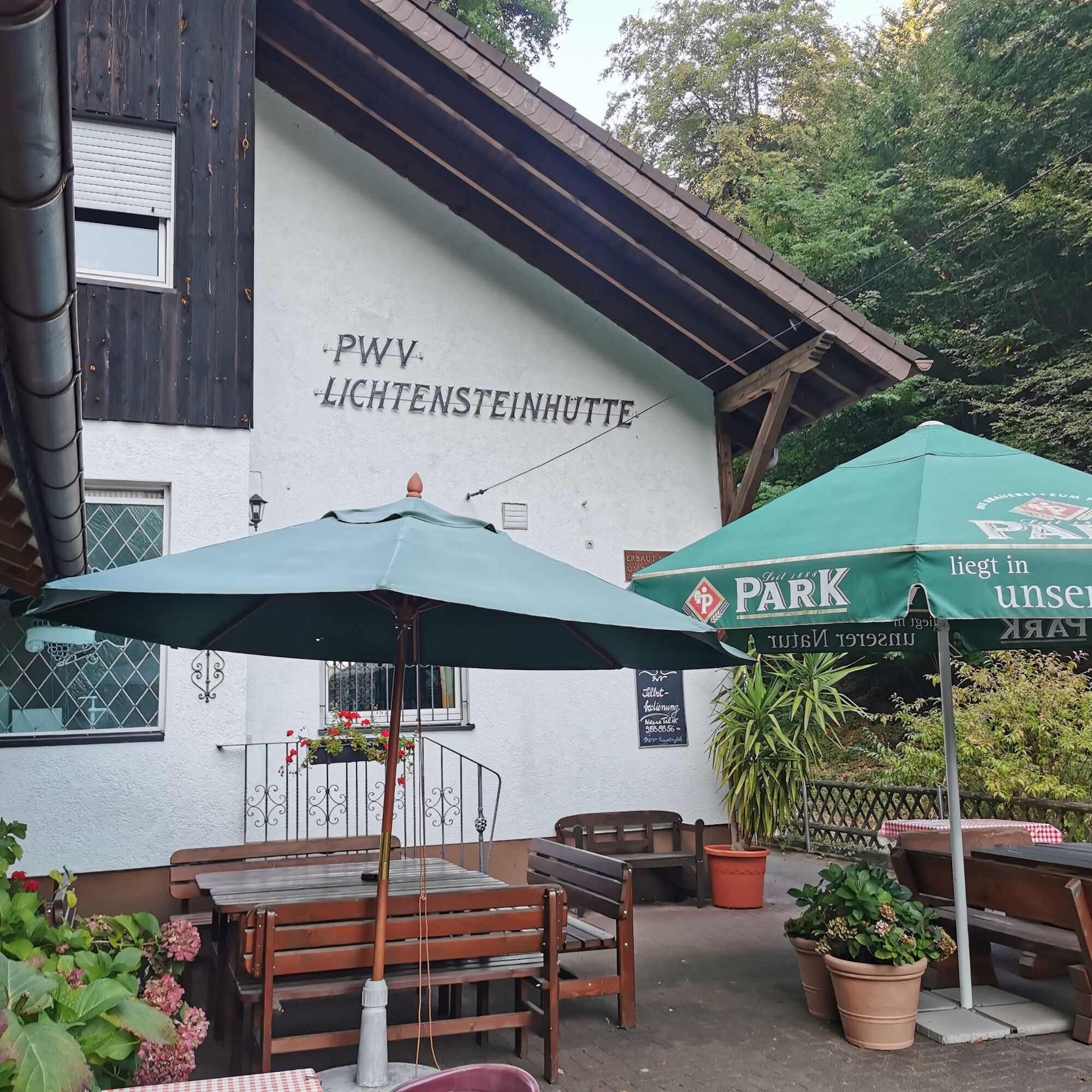
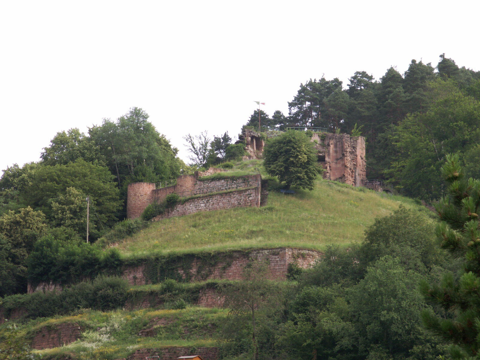
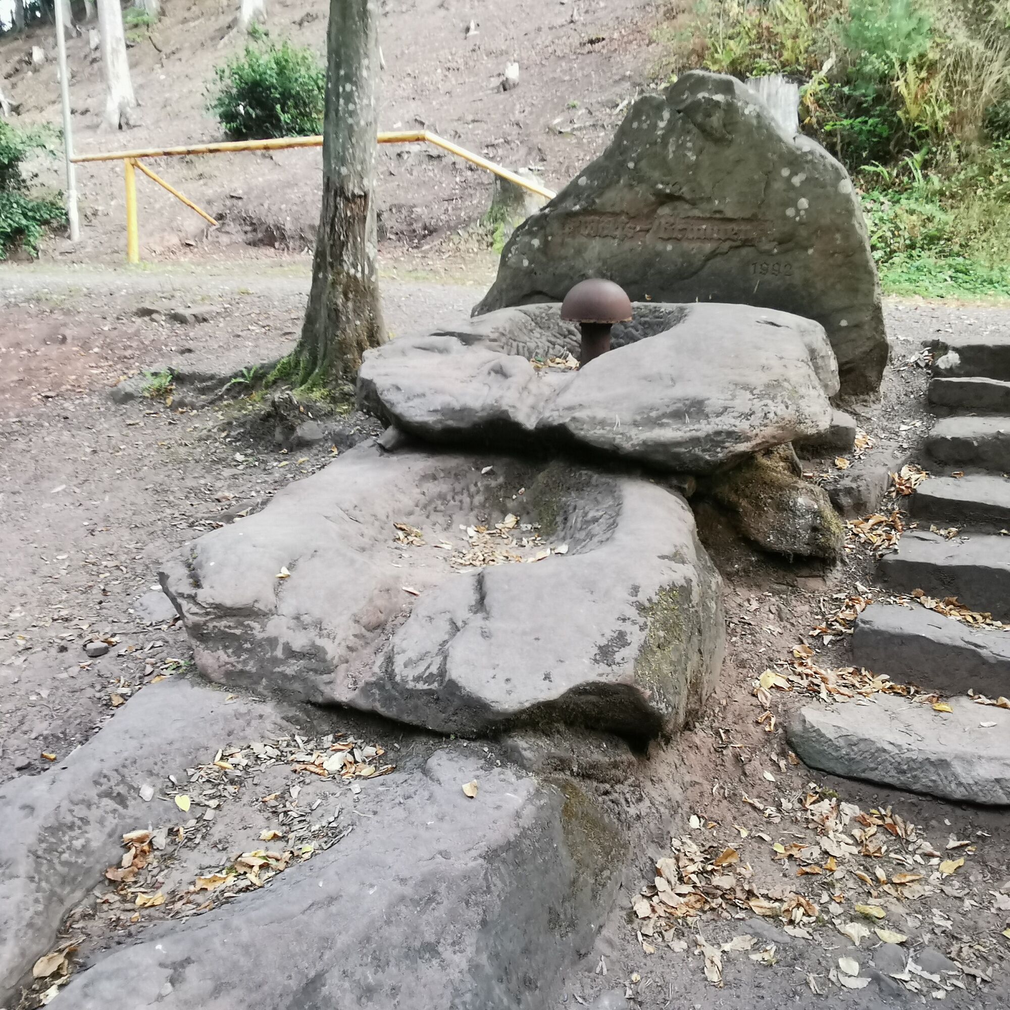
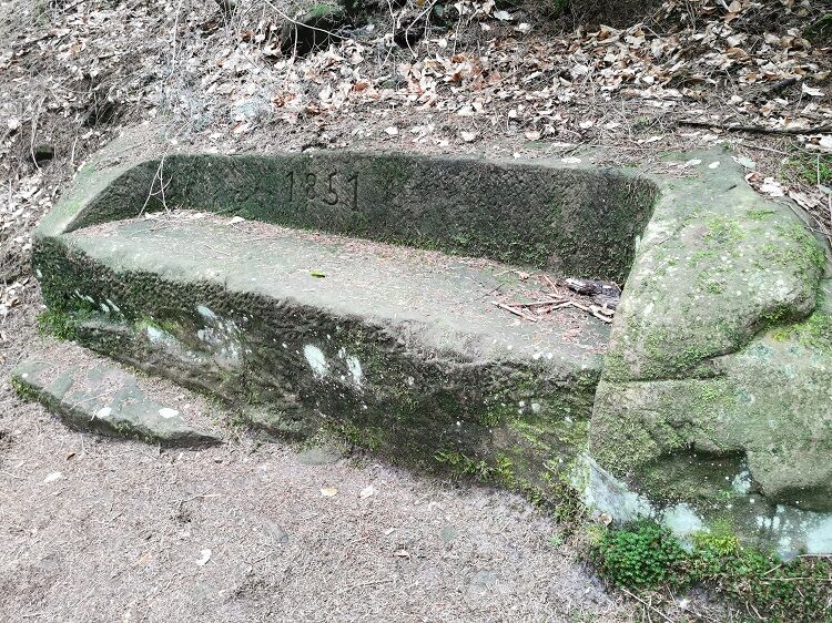

From the Lichtensteinhütte, we hike along the streets below Neidenfels Castle (not directly on the path) towards the village square, which is 100m from the Neidenfels train stop. Federal Road 39 is crossed and the railway line is crossed through a small tunnel. Now we are back on a forest path that we ascend. On our further route lies a stone bench from 1851. We continue to follow our marking and then reach our next destination, Ritterstein No. 129 "At the Herrentisch". On the way from Herrentisch to Esthal, we pass the "Stone of Seeing" from the school project "On the Trail of the Celts".
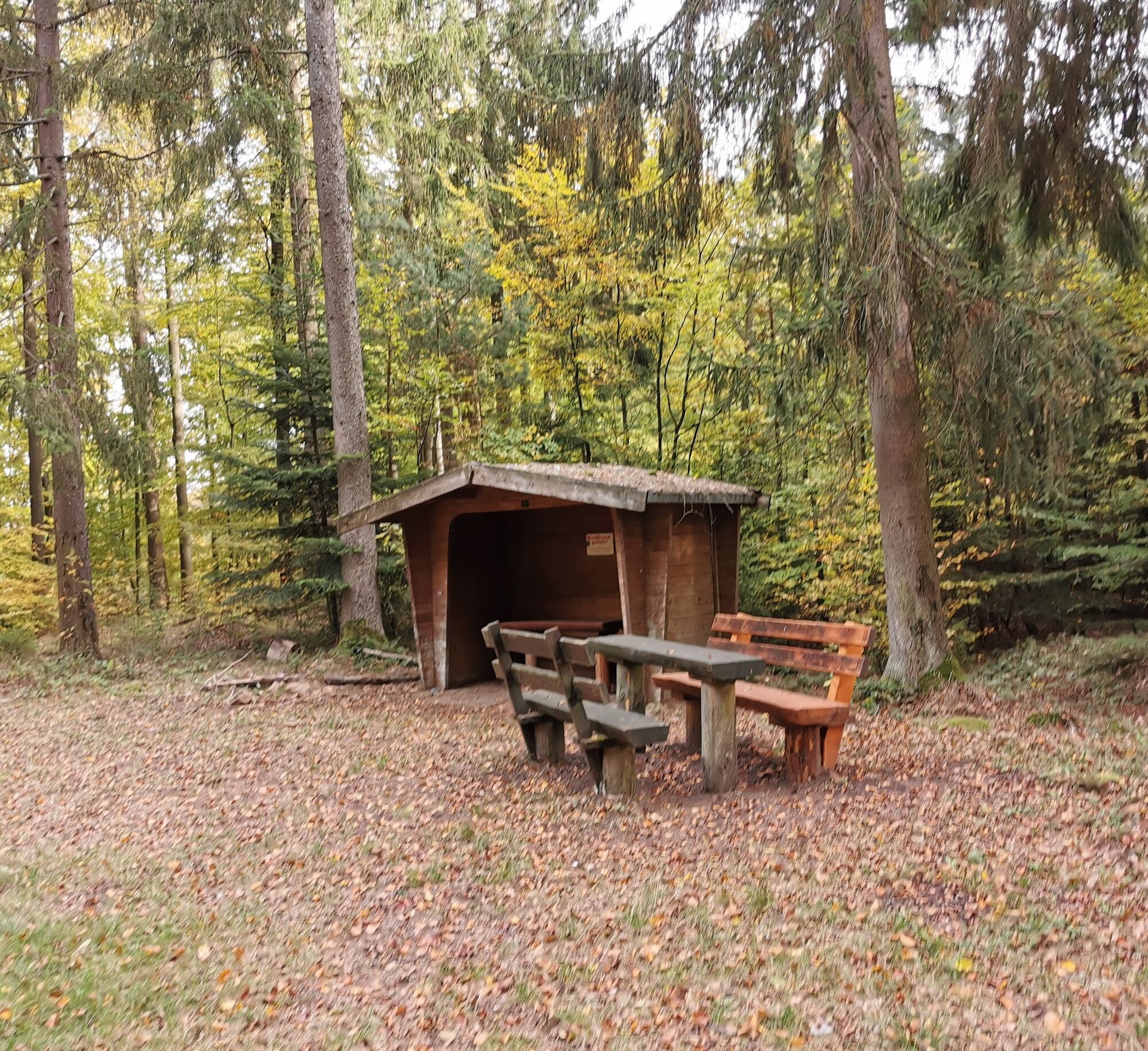
Shortly before reaching District Road 23, you can take a small detour to the viewpoint "Esthaler Vorstadt". It is 300m off our path. Opposite the sports hall is the beautifully designed "Wögelbrunnen". A short detour worth taking. The Wögelbrunnen is part of the Fountain Trail, which leads around Esthal. We continue to follow the marking of the Palatinate Hut Trail to reach Esthal. At the entrance to the village is the "Tränkenbrunnen" - an old wash fountain that was formerly used for washing laundry. In Esthal, there is also the opportunity to stop by the "Esthaler Bürgerstübl". Along the street through Esthal there is much to discover. At the height of the school / community center, we can take a small detour of 100m to another stone from the school project. After passing the street along Esthal, we come to another very nicely designed fountain, the "Schelmenteich Fountain". Then we go down a path towards the Wolfsschluchthütte (serving food). After our stop at the Wolfsschluchthütte, we go back a short distance (about 300m) on our "old path". Then we continue straight ahead and follow the marking of the Palatinate Hut Trail. At Nauwiese, we enter the "Dreibrunnental", along the Breitenbach over the Goldbrunnen and the following Dreibrunnenbach, we pass a shelter with a rest area. At the Esthaler Bänke there is a triangular boundary stone that marks the boundary of the three municipalities Esthal - Elmstein - Weidenthal. From the Esthaler Bänke, the route goes down to the Weißenbach and over the Stempelweg to the train stop in Weidenthal.
For our hiking routes, we recommend the following standard equipment:
Sturdy footwear Clothing adapted to the weather Sun and rain protection A sufficient supply of food and drinks, as there are not always dining or shopping opportunities available or open. Even though the paths are very well marked throughout, it is recommended for safety reasons to always carry an appropriate hiking map, so that, for example, in the event of a thunderstorm or emergency you can quickly find a safe area.
Hiking on natural paths and trails - Especially in autumn, be aware that fallen leaves on the ground can hide unevenness, roots, stones, or holes in the path. After thunderstorms or heavy rains, trees may still fall or branches come down. Especially in adverse weather conditions, natural paths can have muddy and slippery sections. Not all rocks or cliffs are secured with ropes or rails. Sure-footedness is required in places. You must expect impairments of this kind when hiking. If you believe certain sections are impassable for you, you should avoid them. Despite the "unmissable" marking of the premium hiking trails, we recommend always carrying an appropriate hiking map for safety reasons, so that you can quickly find a safe area in case of a thunderstorm or emergency. Closures and detours must be absolutely observed.
Danger situations - In an emergency, quick help is needed. Even though phones can send GPS signals, classic rescue points are often the quickest. These are located at places easily accessible for rescue vehicles. Remember the points with green signs and a white cross. In an emergency, return there and provide the number on the sign to the emergency services. This way, rescuers know where to find you.
Coming from Neustadt an der Weinstraße (A65): Exit Neustadt/Weinstr. Nord, then follow B38/B39 to Lambrecht (Pfalz) – and further to Neidenfels station.
Coming from Kaiserslautern (A6): Exit Enkenbach-Alsenborn, then direction Fischbach/Bad Dürkheim. Follow B48 to the junction towards Bad Dürkheim. Then continue on B37 towards Bad Dürkheim / Neustadt a. d. Weinstr.; in Frankenstein follow B39 to Neidenfels – station. Parking is available at the station.
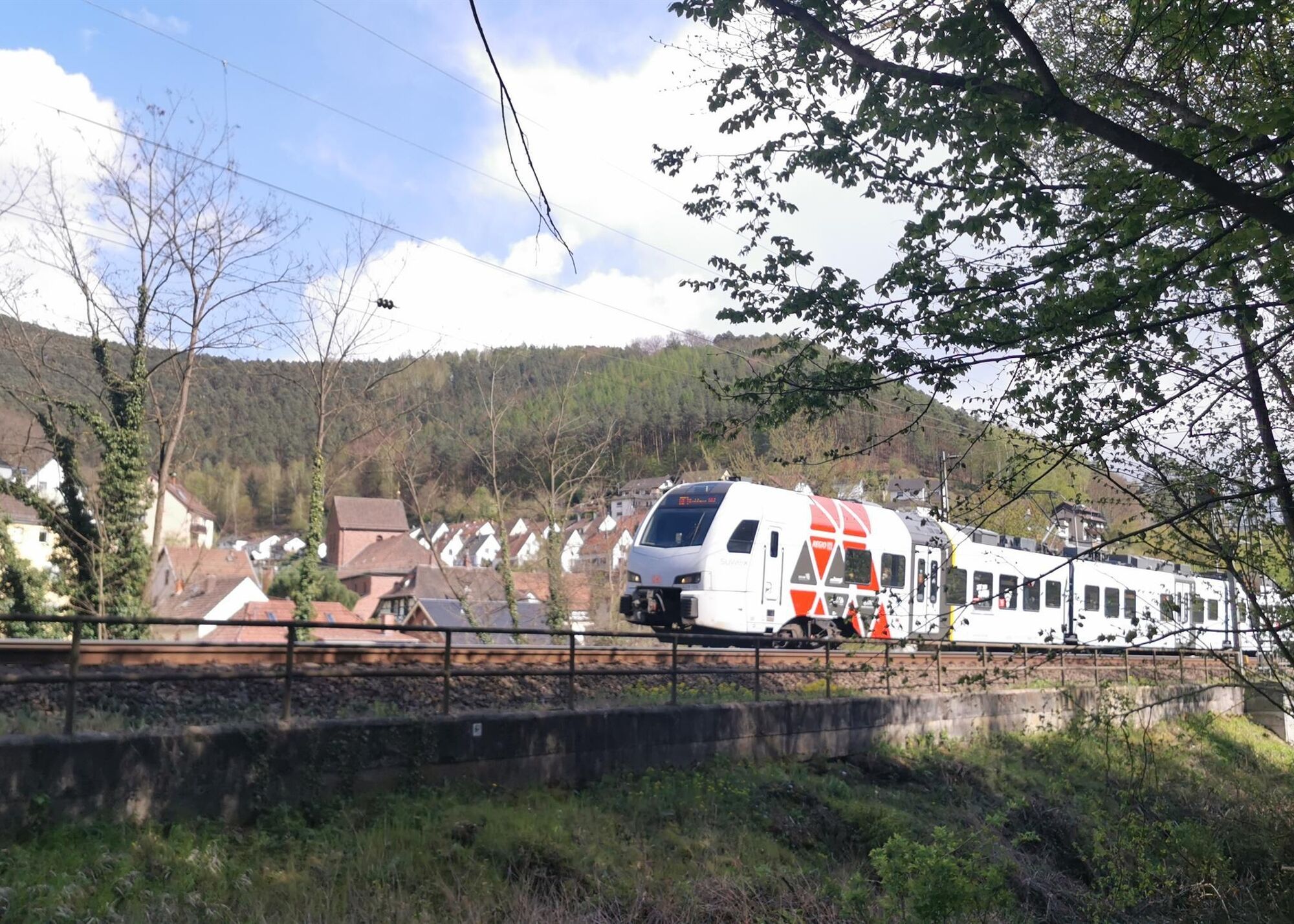
By S-Bahn to Neidenfels station
Parking is available directly at the Neidenfels station
Ja
Accommodation possibilities at the Lichtensteinhütte in Neidenfels (Tel. 06325/9888856) or via WhatsApp 0156-79195447 and in Weidenthal at the Bärbel holiday apartment (06329-1209, mobile: 0151-57787575)
Shopping opportunities for groceries are available in Lambrecht (Aldi, Lidl, SBK, Netto) and in Iggelbach (Tante Emma Lädchen 06328 902979)
Bakeries are also located in Esthal: Bakery Baßler (06325 988940), Lindenberg: Lindenberger Backshop (06325/353954), Elmstein: Bakery Ehrat (06328 989058) and Bakery Baßler (06328 9028079), Lambrecht: Ehrats Backhaus (06325 989103) and Bakery and Confectionery Hofmann (06325) 184735
Butcher shops are located in Lambrecht: Butcher Streb (06325 980860) Butcher Claus Maier (06325 2643)
Please observe opening times, best to call ahead and ask
Here is a tip for transport:
MoD (Mobility on Demand): Flexible on the move in all towns of the association municipality, simply download the app and book a ride. In each town, there are various stops served by MoD. Prices are roughly comparable to a bus ride. https://www.mobility-on-demand.com/so-gehts/
Taxi phone numbers:
Taxi Mansmann, Lambrecht (Pfalz), 06325 2657 and 0151 11160312
Taxi company Kratz, Lambrecht (Pfalz), 06325 3040047 and 0171 6596388
A stop at the Wolfsschluchthütte. Please note, the hut is only open on Wed., Sat., and Sun.
Populära turer i närområdet
-
3,6
Ganerbenweg - Premium circular hiking route in the Freinsheim holiday region
MediumVandring 10,5 km -
Wachenheim - Eckkopf - Heidenlöcher - Wachenheim
MediumVandring 12,8 km -
4,3
From wide view to wide view
MediumVandring 9,72 km -
Ramberg - Drei Burgen Weg
MediumVandring 17,2 km -
3,5
Leininger Monastery Trail - Premium hiking trail with audio and video stations
MediumVandring 15,3 km -
4,8
Ganerbenweg interactive - Premium hiking with audio and video stations
MediumVandring 10,5 km -
5,0
Wachenheimer Valleys Route to Oppauer Haus
MediumVandring 11,7 km -
Palatinate Wine Steig Stage 03 Bad Dürkheim - Deidesheim
MediumLångdistans vandringsled 15,2 km -
Palatinate Wine Route stage 05 Neustadt a. d. Weinstraße - St. Martin
tungLångdistans vandringsled 19,8 km -
Pfälzer Weinsteig Stage 4: Deidesheim - Neustadt an der Weinstraße
tungLångdistans vandringsled 19,9 km
Vandring och spårning


Missa inte erbjudanden och inspiration inför nästa semester
Din e-postadress har lagts till på e-postlistan.