


Salzburger Almenweg - Stage 24: St. Martin – Werfenweng


On the penultimate stage of the official course of the Salzburger Almenweg, a bit of melancholy is spreading, but not for long. Not quite yet! It is still important to enjoy every step and every moment....
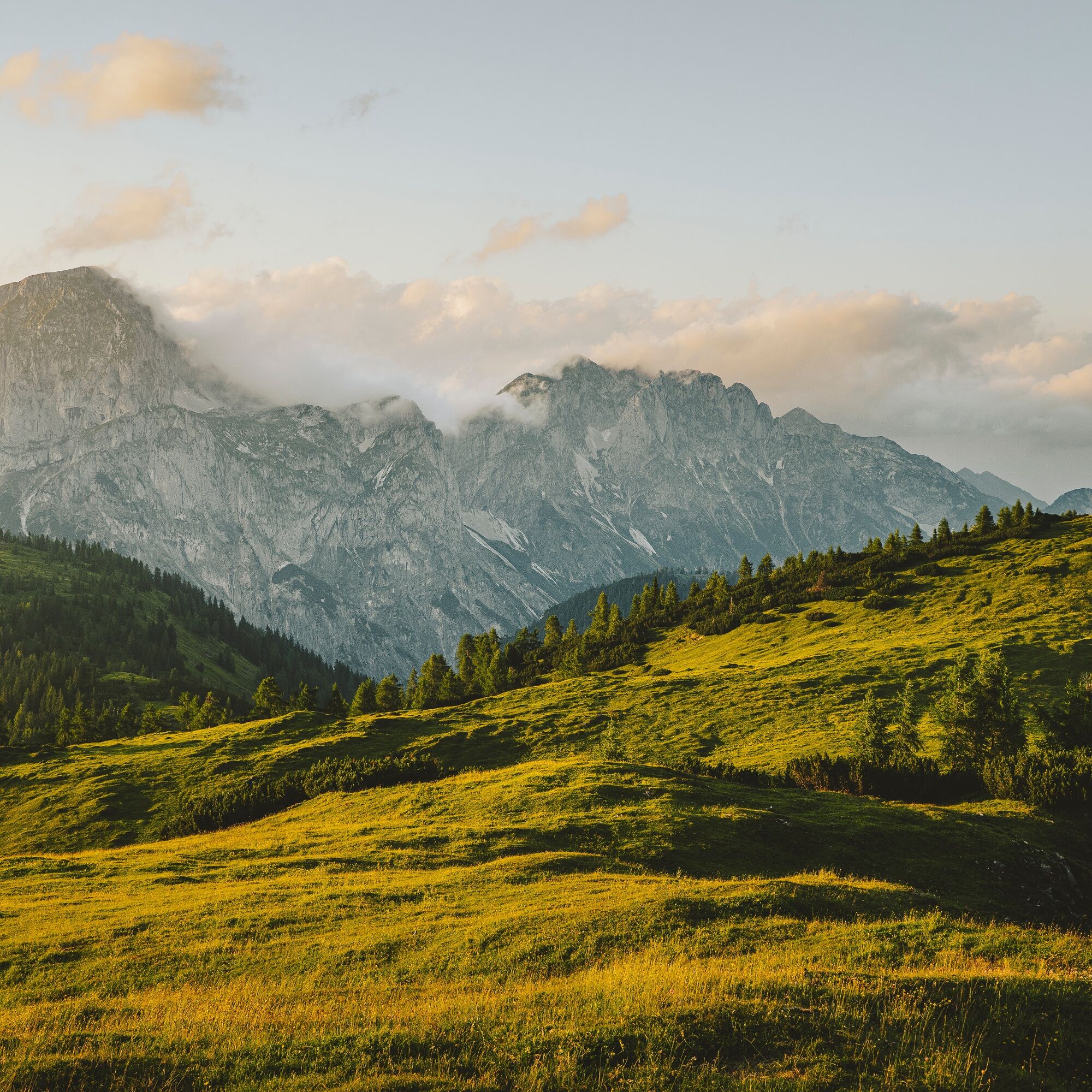
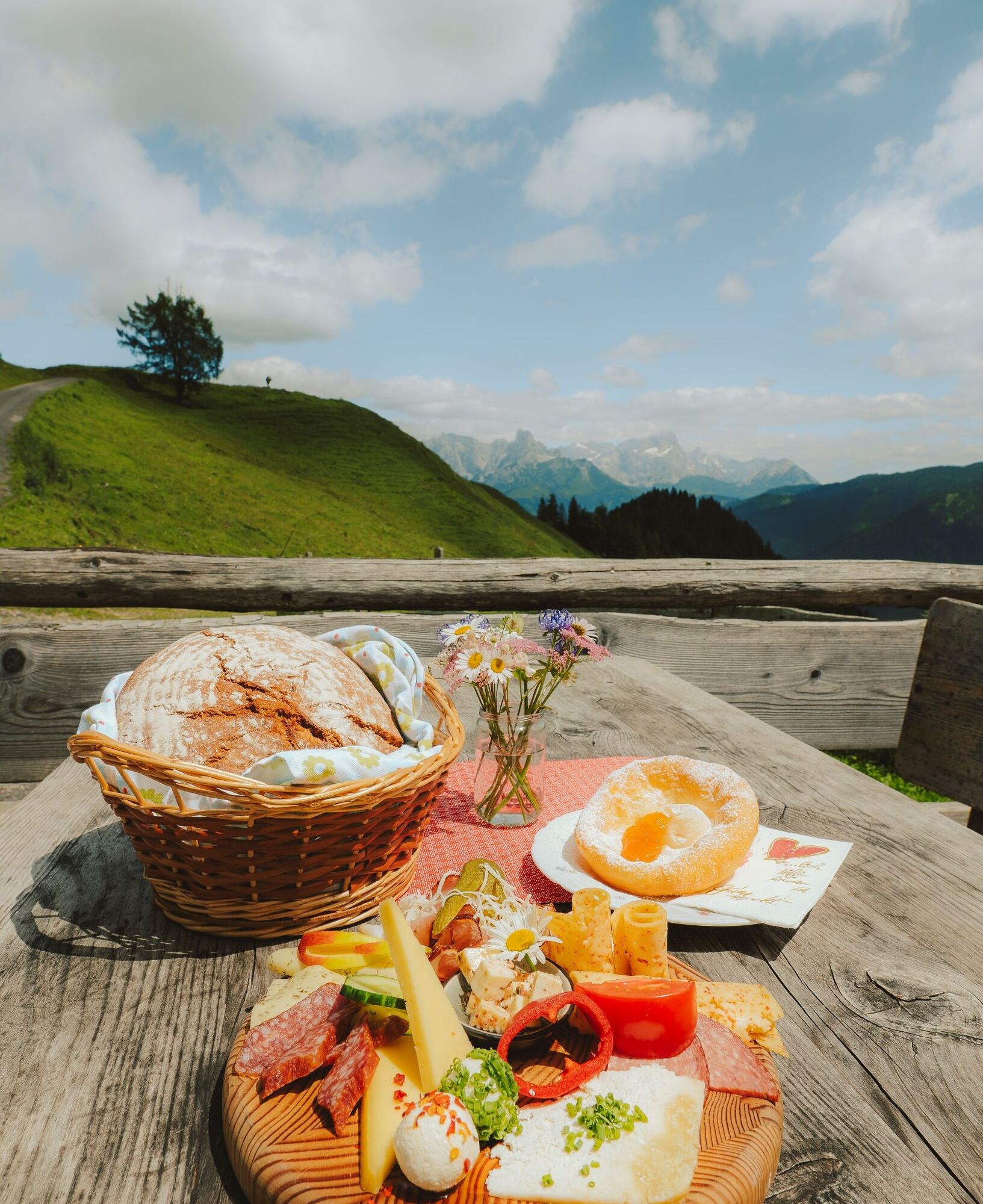
On the penultimate stage of the official course of the Salzburger Almenweg, a bit of melancholy is spreading, but not for long. Not quite yet! It is still important to enjoy every step and every moment. More than ever! This stage from St. Martin leads through a beautiful alpine landscape and past a certified alpine summer hut along the way. Here, a stop is always worthwhile, especially to enjoy the fantastic panorama of the Hochkönig and the Hohe Tauern.
Tomorrow, we come full circle in Pfarrwerfen. But today it is important to enjoy the beauty with all your senses once again up here and the alpine life with its costums and tradtitions, the seasonal specialities and special people who welcome hikers with warm hospitality. The high trail leads to the Dr.-Heinrich-Hackel-Hütte at 1,531 meters above sea level, from where the descent to the stage destination, the Alpine Pearls village of Werfenweng, takes place.
Off the beaten track
Not far from St. Martin lies the "Lammer Valley Ancient Forest". The trees that grow here, "the Lammertaler Wächter", the "Große Buche" and the "Alte Tax", are among the tallest trees in Austria. This special piece of forest is located at 1,300 metres above sea level and is so well hidden that it has never been used for forestry. Over the centuries, this place became an excursion destination that houses amazing natural wonders and offers a special form of refreshment, especially on a warm summer day.
Alpine Trail History
The Dr. Heinrich-Hackel hut is closely associated with one of Salzburg's best-known alpinists. Mountaineer, innkeeper and TV and radio presenter Sepp Forcher (1930 – 2021) was born in Rome and spent his early childhood in South Tyrol. After the South Tyrol Agreement, his parents decided to turn their backs on Italy and fled with their son to SalzburgerLand. From 1940, Sepp Forcher's parents were hut owners of the Dr. Heinrich-Hackel hut and so this became his second home for ten years. In the course of his life, he himself was a hut owner in the Grossarl Valley and at the Zeppezauerhaus on the Untersberg, at whose rebuilding in 1914 Dr. Heinrich Hackel (1874 – 1960) was a part of.
The stage start in St. Martin is directly at the church, from where the Almenweg leaves the centre of the village via the Unterbachstraße, which turns into the Knablstraße, in a westerly direction. A short road and finally a footpath in the forest lead up to the Buttermilchalm, from where a magnificent view of the valley and the Gosaukamm opens up. Past the alpine pasture, leave the access road immediately behind it to the left and so you reach the non-managed Ostermaisalm on a narrow, partly steep forest path.
Here, the two hiking trails branching off to the left are ignored and the trail continues straight ahead on a forest road that crosses the northeast flank of the Korein to a crossroads above the Karalm. The Karalm is a certified alpine summer hut, which can be reached in 5 minutes by descending from the crossroads to the right.
Back at the crossroads, coming from the Karalm, turn right at the bend at the barrier into the forest and onto hiking trail no. 94 in the direction of Koreinalm. This partly steep section of the route can be a bit slippery in spring, when there is snow or after rainfall: good shoes are absolutely necessary here, poles are also helpful.
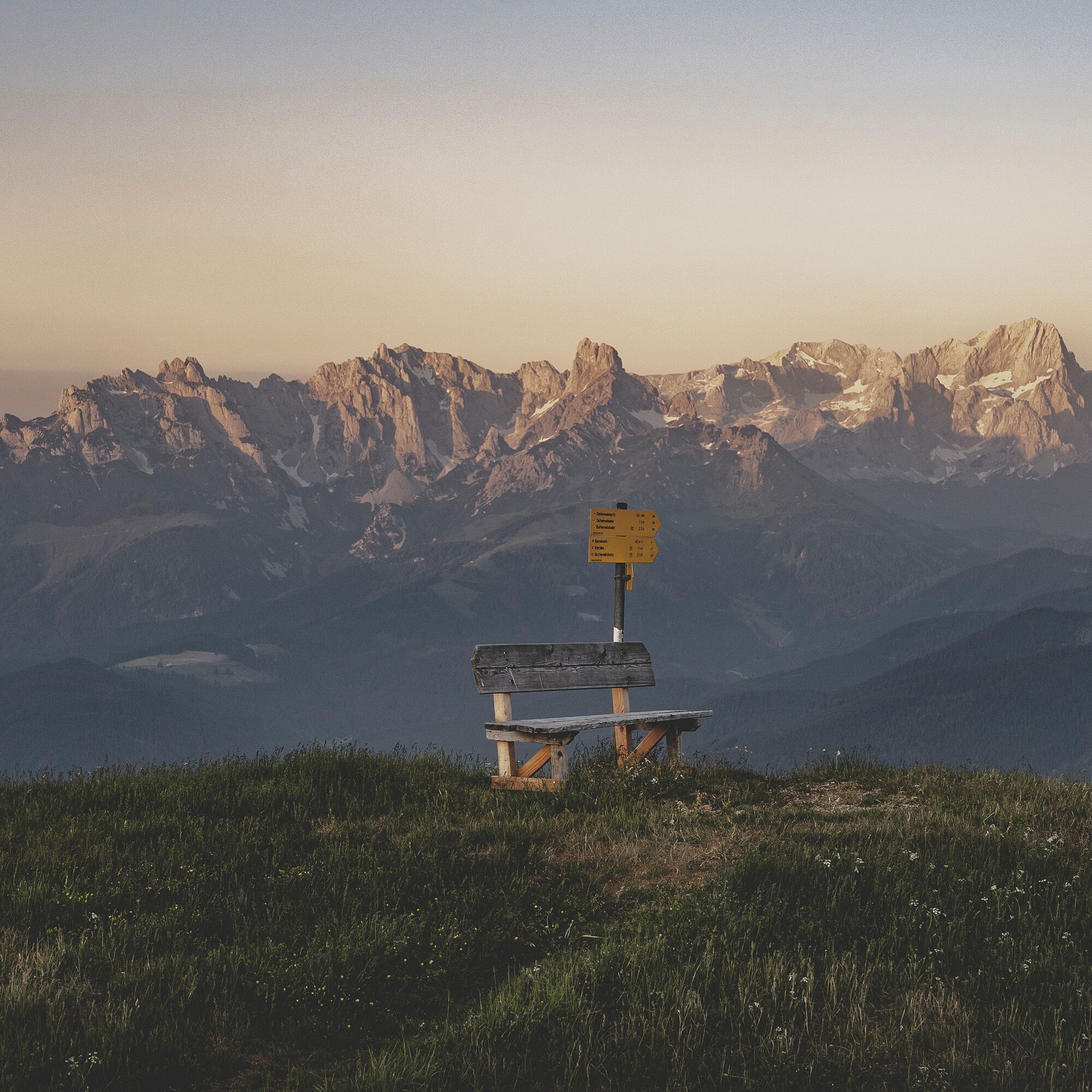
At the Koreinalm, at the fork in the road, take path no. 94a on the right, which leads to the Frommer Hochalm. From here, the Almenweg follows a beautiful high-altitude trail with impressive views of the Tennengebirge, the Hochkönig and the Hohe Tauern.
Don't be confused by the numerous signposts at the Frömmer Hochalm: The Salzburger Almenweg branches off to the right to the Höhenweg 201. After a little more than 2 kilometres along the Brandlbergköpfe, the trail goes downhill again. The footpath leads above the Laubichlalm and joins the forest path 51b, from where the Almenweg branches off to the right after approx. 150 metres into hiking trail 51. This leads after about 600 metres to the Dr.-Heinrich-Hackel-Hütte. Once there, the innkeepers spoil hikers with local delicacies – in good weather on the panoramic terrace with a magnificent view of the Hochkönig. [Note: If you stay here instead of in Werfenweng, this stage ends here. The next day you hike over the remaining part of stage 24 down into the Wengerau, where stage 25 branches off to the right at the highest point of the Wengeraustraße. In this case, you don't have to hike down to Werfenweng – for more information, see description Stage 25.]
From the Dr.-Heinrich-Hackel-Hütte, the descent takes place via path no. 51 over 550 metres in altitude down to the Wengerau, from where the Almenweg first leads over the Wengeraustraße in the direction of Werfenweng. After about 400 metres, a footpath branches off to the right, which runs parallel to Wengeraustraße and reaches it again after about 500 metres. The Almenweg now follows the road for 150 metres and then turns left onto another footpath. In a loop back to the Wengeraustraße and now finally over it leads to today's stage destination directly into the center of Werfenweng (892 m).
Refreshment and accommodation options
Various accommodation options directly in St. Martin, www.stmartin.info
Karalm (1,444 m), (after approx. 1.5 hours) May to October, T. +43 664 135 90 81 refresh. / Alpine summer hut
Brandstättalm (1.575m), (after approx. 5 hours) May to October, T. +43 664 200 51 50, Self-catering hut, by reservation only.
Söldenhütte (former Dr. Heinrich-Hackel Hütte) (1,530 m), (after approx. 5.5 hours) May to October, T. +43 664 34 29 114 refresh. / accomm.
Numerous places to stop for refreshments an overnight stays in Werfenweng, https://www.werfenweng.eu/ refresh. / accomm.
Accomodation Partner Salzburger Almenweg Information and Booking Centre powered by Trail Angels: Wenger Alpenhof, more information: https://www.werfenweng-hotel.com/ , T. +43 6466 20 034
Bella Grotta - Weisses Rössel, T. +43 6468 7607
Haus Biechl, more information: https://www.haus-biechl.at/, T. +43 664 4288889
Hier finden Sie alles rund um den passenden Wanderschuh, die perfekte Ausrüstung und die richtige Geh-Technik.
To make sure your day in the mountains is an unforgettable experience, here you can find some tips to keep you safe in the mountains.
St. Martin is easily accessible with public transport - by train with the S-Bahn Line 3 you can reach the ÖBB stop Golling-Abtenau from Salzburg’s Main Train Station. From here, you continue with the regional bus lines 470/471 to St. Martin am Tennengebirge.
St. Martin is easily accessible with public transport - by train with the S-Bahn Line 3 you can reach the ÖBB stop Golling-Abtenau from Salzburg’s Main Train Station. From here, you continue with the regional bus lines 470/471 to St. Martin am Tennengebirge.
If you arrive by car, you can park for free in St. Martin at the Badesee/Moa car park or at the new town hall/tourist office for a longer period of time. Please do not forget to leave the "Salzburger Almenweg parking disc" from the brochure in your car.
For further information about the Salzburger Almenweg click here.
The Karalm, a certified alpine summer hut, is surrounded by the Höheneggkopf (1,430 m), Frommer Kogel (1,883 m) and Hofschoberberg (1,666 m) in the middle of a spacious alpine landscape. Here it’s all about enjoying the magnificent view.
Populära turer i närområdet
-
4,7
Tour around the Gosaukamm
MediumVandring 20,9 km -
4,6
Donnerkogel vom Gosausee mit Intersport Klettersteig C/D und Himmelsleiter
tungVia ferrata 7,70 km -
4,7
Mühlenweg und Winnerfall Scheffau am Tennengebirge
MediumVandring 4,79 km -
3,6
Wanderung zur Ostpreußenhütte in Werfen (1.630 m)
MediumVandring 11,2 km -
3,7
Auf die Ostpreussenhütte
MediumVandring 16,6 km -
4,2
Wasserfallweg (UNESCO-Geopark Erz der Alpen)
ljusTema spår 4 km -
4,5
Wengerau - Tauernkogel - Eiskogel - Napf - Wengerau
MediumHög tur 15,5 km -
3,6
Salzburger Gipfelspiel: To the Gerzkopf and the Schwarzen Lacke
MediumVandring 8,39 km -
4,1
Heinrich Kiener Haus / Hochgründeck 1827m (453)
MediumVandring 12,6 km -
5,0
Tennengebirge: Werfener Hochtrohn über Nordanstieg
tungHög tur 13,8 km
Vandring och spårning


Missa inte erbjudanden och inspiration inför nästa semester
Din e-postadress har lagts till på e-postlistan.