The pearls of the Malvaglia Valley
Vandring 5,0
Navigera
Navigera
Få den här turen på din mobiltelefon
Karta
The pearls of the Malvaglia Valley
Vandring
8,12 km
Skanna QR-koden och starta navigeringen i appen bergfex
QR Code
Vandring och spårning

The pearls of the Malvaglia Valley

Avstånd
8,12 km
Varaktighet
03:10 h
Uppstigning
601 hm
Havets nivå
1 415 - 2 017 m
Nedladdning av spår
Karta
The pearls of the Malvaglia Valley
Vandring
8,12 km

After zigzagging our way from the road to Cascina di Dagro, we too can play hide and seek by plunging into a dense forest that, in little more than an hour, will take us to the high pastures of Prou, at...


Beskrivning av

After zigzagging our way from the road to Cascina di Dagro, we too can play hide and seek by plunging into a dense forest that, in little more than an hour, will take us to the high pastures of Prou, at 2000 metres above sea level, where the old alpine pasture now used as a refuge.

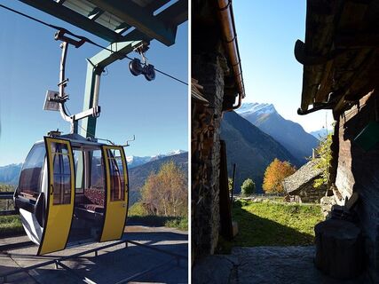
With ease, we continue along the more or less level path, which in three quarters of an hour allows us, maintaining the same altitude, to reach the pleasant Alpe di Cióu alpine pasture, which includes a couple of truly suggestive masonry buildings.

Behind the huts rises the steep southern flank of the Cima di Piancabella, an impervious slope called Madéi. The place name reveals that wild hay was also mown here. From Ciòu, you can return to Dagro on the path that descends towards the forest, which, in the shade of conifers, passes along the Ör della Strega, the 'Witch's Ridge', until you return to Cascina di Dagro and Dagro.

 

Vägbeskrivning
Dagro
(1 411 m)
Gondolstation
0,0 km
Sass Malt
(1 415 m)
Restaurang
0,1 km
Alpe di Prou
(2 006 m)
Korridor/terräng
3,1 km
Alpe di Cióu
(1 996 m)
Korridor/terräng
4,3 km
Sass Malt
(1 415 m)
Restaurang
8,1 km
Vägbeskrivning
Karta
The pearls of the Malvaglia Valley
Vandring
8,12 km
Dagro
(1 411 m)
Gondolstation
0,0 km
Sass Malt
(1 415 m)
Restaurang
0,1 km
Alpe di Prou
(2 006 m)
Korridor/terräng
3,1 km
Capanna Prou
(2 016 m)
Tillflyktsort (ej hanterad)
3,1 km
Alpe di Cióu
(1 996 m)
Korridor/terräng
4,3 km
Dagro
(1 411 m)
Gondolstation
8,1 km
Sass Malt
(1 415 m)
Restaurang
8,1 km
Beskrivning av

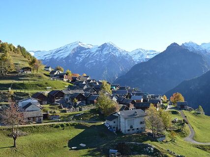
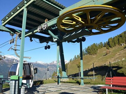
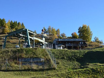
This pleasant itinerary starts from Dagro, a gentle sun terrace at an altitude of almost 1400 metres, from which the gaze is pleasantly captured by a magnificent panorama of valleys and peaks that play hide and seek with each others.

Författaren
Tillhandahålls av Bellinzona e Valli Turismo
Logo
Dela turné
Karta
The pearls of the Malvaglia Valley
Vandring
8,12 km
Fel
Ett fel har inträffat. Vänligen försök igen.
Information om rutten
Gondol/kabelbana

Ja

Utrustning

 Hiking boots
Sun cap
Water-bottle
Sunglasses
Sun cream
Hiking map
Camera
Food

Ytterligare information & tips
Ytterligare information

Montagnepulite: This project was born to promote an effective management and sustainable use of mountain huts in Ticino, and in particular the litter management. The responsible management of litter in the mountains is a matter of common sense. We can all contribute: www.montagnepulite.ch

Värderingar
5,0
5
(1)
4
(0)
3
(0)
2
(0)
1
(0)
1 Kommentar
Avatar från Patrick de Gier
Patrick de Gier
17. golg. 2025
Kontrollerat borta
Great tour for a small walk, not to intense, great view.
Hjälpsam (0) |
Rapport
Fel
Ett fel har inträffat. Vänligen försök igen.
Skriv ett omdöme

Recensioner hjälper andra användare att välja sitt nästa äventyr. Vänligen betygsätt endast turen, inte vädret eller ditt mellanmål.

Välj en av stjärnorna för att betygsätta resan
Dålig tur
Svag turné
Medelmåttig resa
Bra tur
Utmärkt tur
Vandring och spårning

Vandring och spårning

Vandring och spårning
Över 550.000 turförslag, detaljerade kartor och en intuitiv ruttplanerare gör appen till ett måste för alla naturentusiaster.
Vandring och spårning