


Mühlenkreisel - Wasserläufer 6


For hundreds of years, water wheels turned in the Weida valley of the Saxon-Thuringian Vogtland and powered numerous mills. These were mainly cutting and grinding mills. But fulling, tanning, bone, oil,...
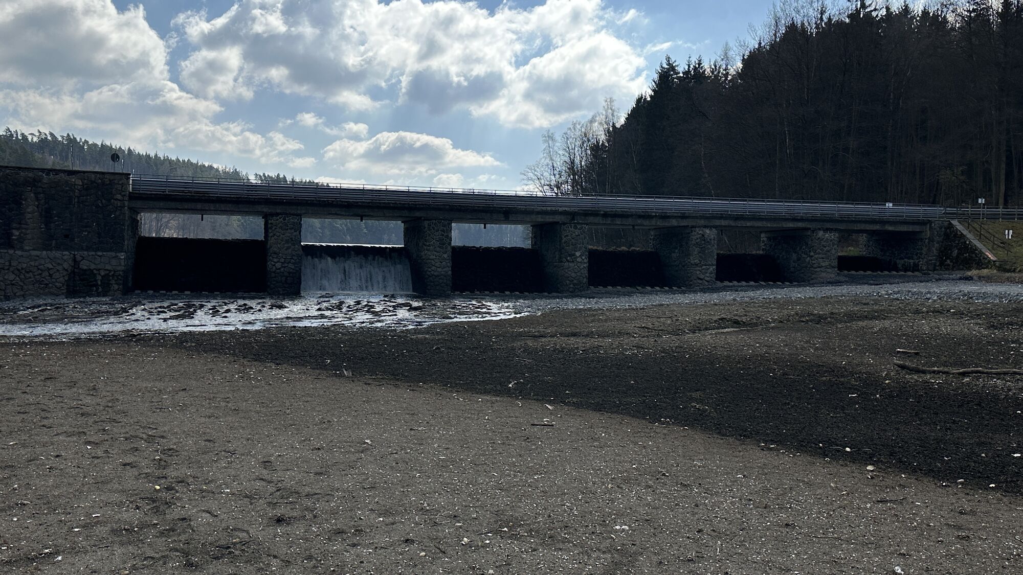
For hundreds of years, water wheels turned in the Weida valley of the Saxon-Thuringian Vogtland and powered numerous mills. These were mainly cutting and grinding mills. But fulling, tanning, bone, oil, paper, and hammer mills were also present. At one time, there were over 100 mills in the Weida catchment area, providing people with work and bread. Unfortunately, most fell victim to the "mill die-off." To keep these mills remembered for posterity, the circular hiking trail "Mühlenkreisel" informs via information boards about the former mills and their significance in past times.
The "Wasserläufer" project is a new hiking project that creates new circular trails on the existing hiking network. The circular hiking trails are continuously developed to offer a high-quality hiking experience.

Pay attention to your fitness and take adequate amounts of drinks with you on the hike.
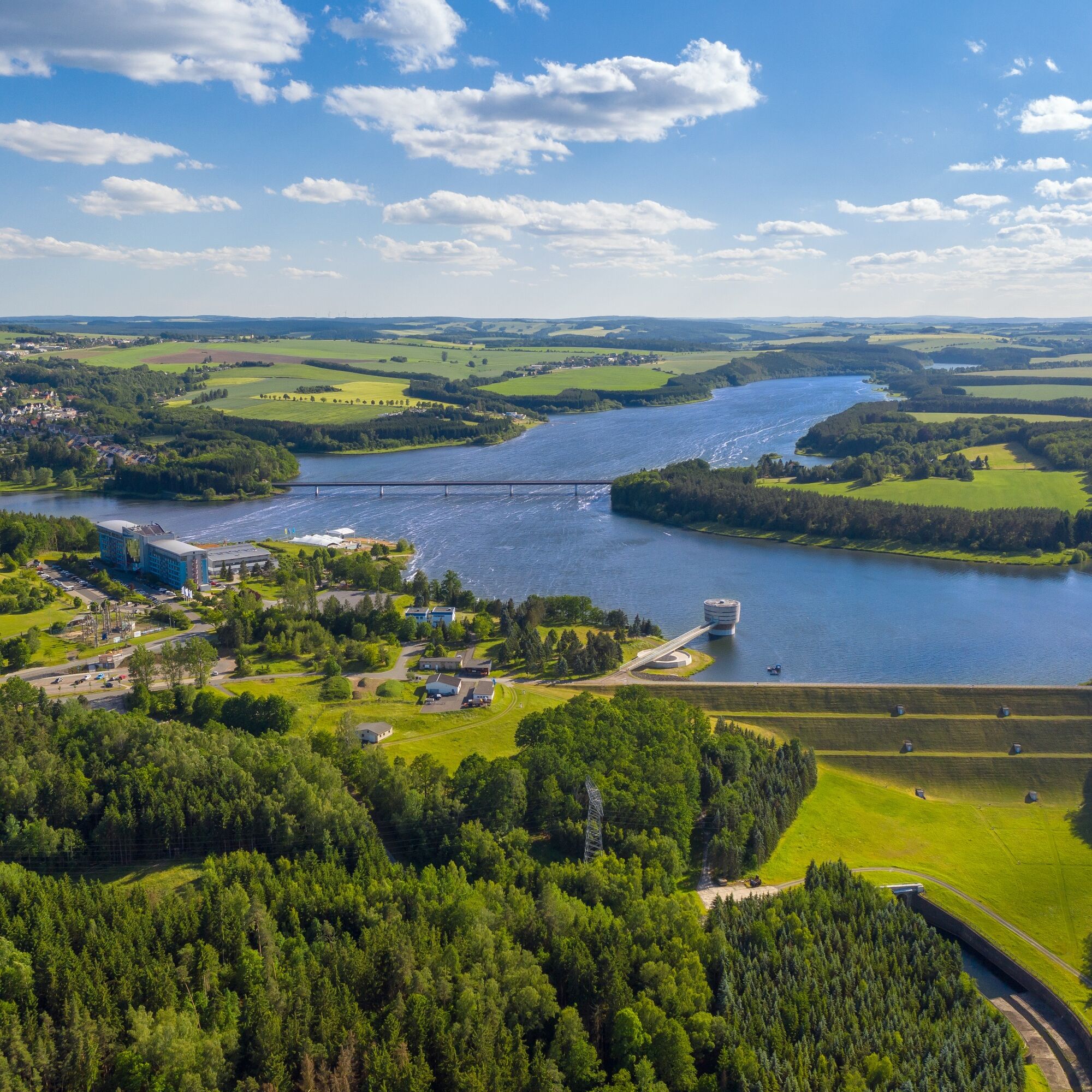
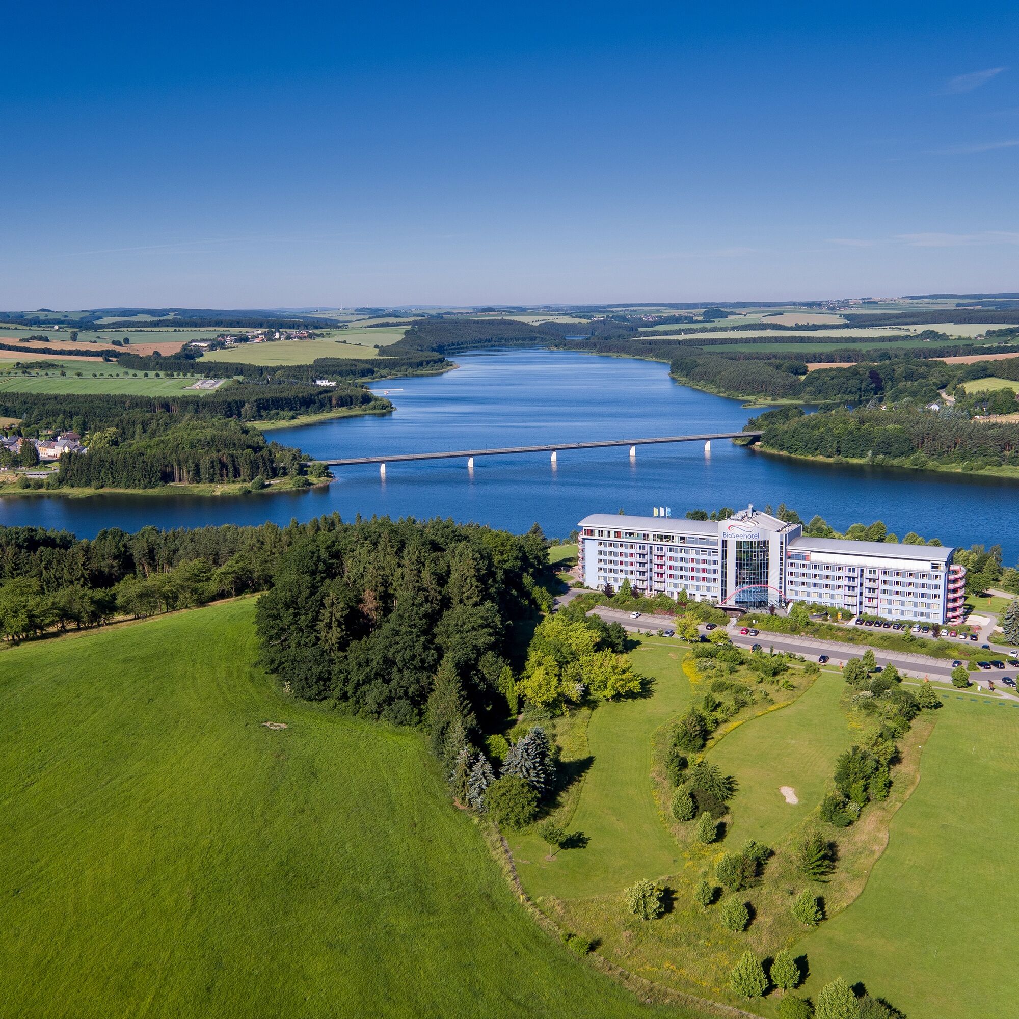
You can reach Zeulenroda via the A9 exit Triptis. Continue via the B2 to Auma, and via the L1087 to Zeulenroda. In Zeulenroda follow the signs to Bio-Seehotel.
accessible by train and bus
Hikers can travel by train to Zeulenroda, further travel by bus to the starting point is possible
Further information is provided by the PRG at 03661/706565 or the Vogtland Tourism and Transport Center at 03744/19449 or www.vogtlandauskunft.de
The hiking car park is available as a public parking lot
Populära turer i närområdet
-
Wandern an der Vorsperre Riedelsmühle
ljusVandring 7,79 km -
5,0
Circular hiking trail for children - "1000-Ponds-Circular Route"
ljusVandring 8,28 km -
Circular route Weidatalsperre
tungVandring 13,7 km -
From Osterburg to Auma reservoir
MediumVandring 11,2 km -
Circular hiking route Greiz
MediumVandring 21,8 km -
Promenade path at Zeulenrodaer Meer (barrier-free)
ljusVandring 3,39 km -
Peatland adventure trail in Pöllwitzer Forest
ljusTema spår 5,33 km -
Around the earth axis town
Vandring 16,4 km -
Circular route Riedelmühle forebay
ljusVandring 3,03 km -
Circular hiking route “Wünschendorf hiking offers”
MediumVandring 25,5 km

Vandring och spårning


Missa inte erbjudanden och inspiration inför nästa semester
Din e-postadress har lagts till på e-postlistan.