


Theme Trail Pfanntal


The Pfanntal is one of the smaller side valleys surrounding Goldlauter-Heidersbach like a crown of stars. It is bordered in the south by the Steinhorst, the large and small Erleshügel (839 and 813 m respectively),...
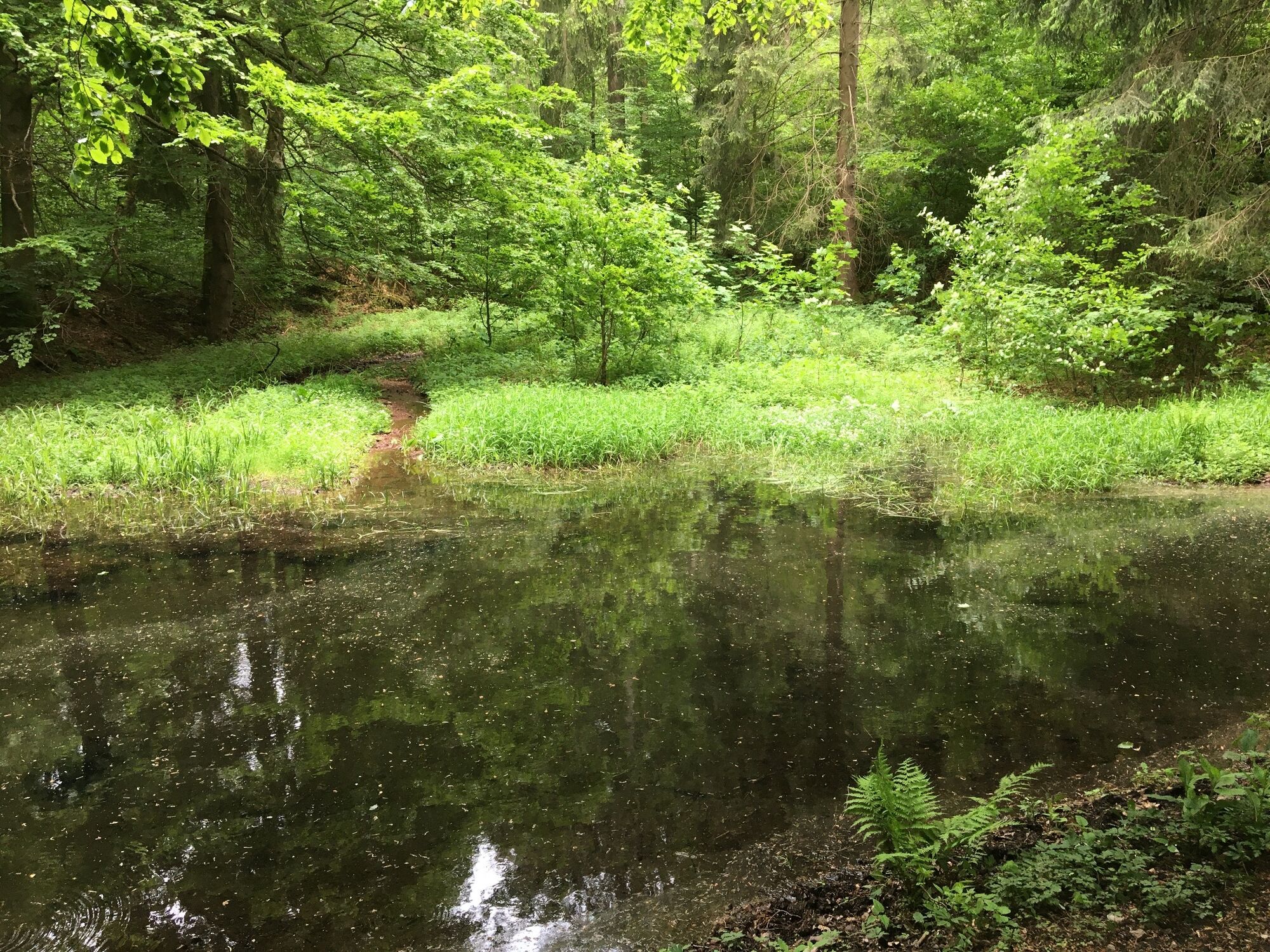
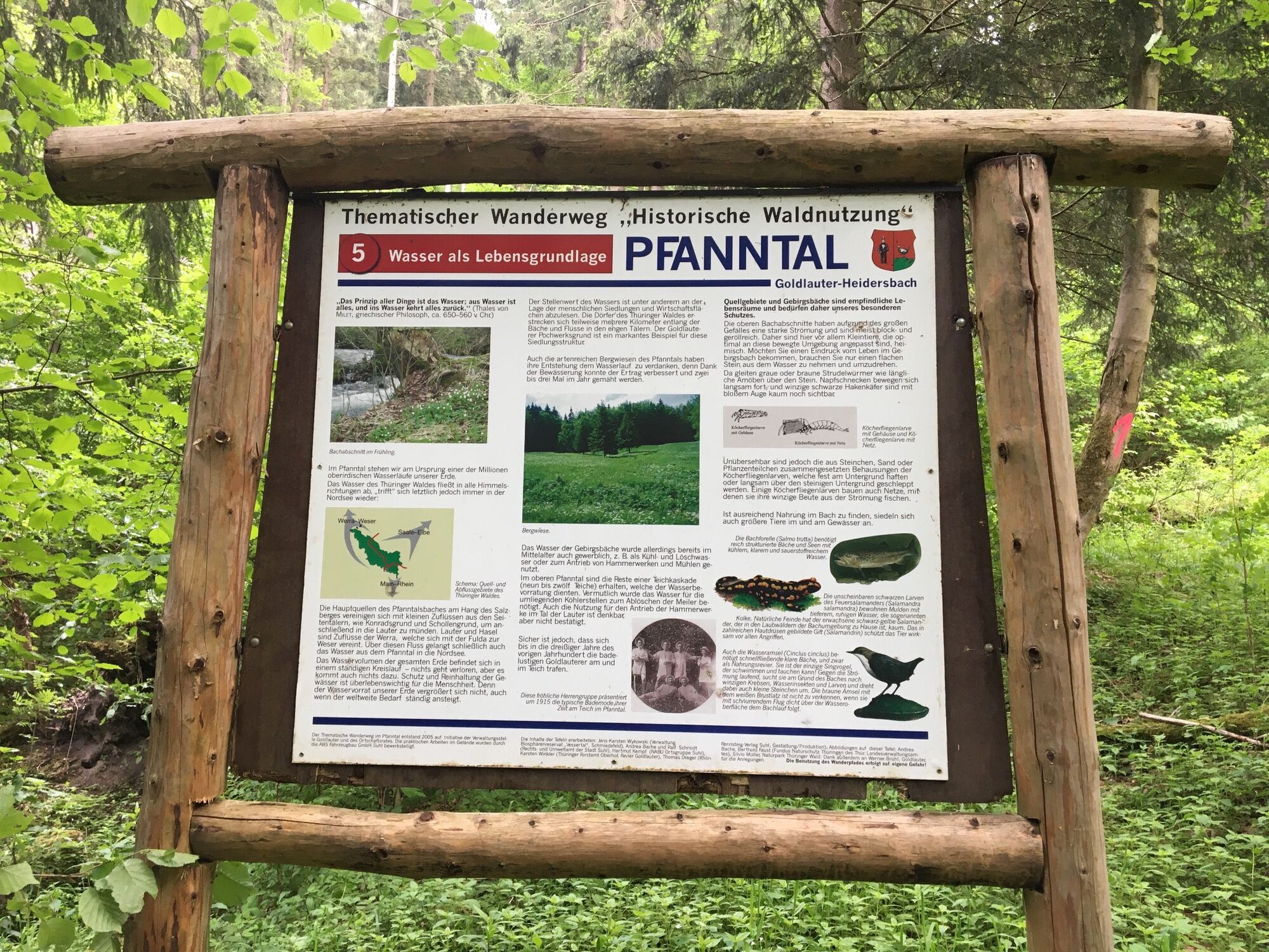
The Pfanntal is one of the smaller side valleys surrounding Goldlauter-Heidersbach like a crown of stars. It is bordered in the south by the Steinhorst, the large and small Erleshügel (839 and 813 m respectively), and to the northeast by the foothills of the Salzberg (866 m). The Pfanntalswasser flows through the Pfanntal, originating on the slope of the Salzberg and fed by several streams including from the Pfanntalswand and Konradsgrund. Even in mid-May, the tributaries to the Pfanntalswasser are generous. Most water flows from the Kleiner Erleshügel through the Schattengrund (sometimes mistakenly called "Schollengrund"). But upstream in the Konradsgrund, probably named due to former mining, water bubbles happily to the Pfanntalswasser. The stream has never dried up in the last 25 years, not even in 2003 when the Dürren Lauter was completely dry. At the upper end of the Pfanntalswiese, the pond and crossing over the stream have been redesigned. In earlier times, there were ten ponds here. Their water could be used during droughts to keep the mills on the Lauter running. The David Foundation project, aimed at making mountain streams passable for living creatures, also focuses on the Pfanntalswasser. Obstructions, mainly under paths, have been evened out. Mighty spruce trunks were shortened and laid crosswise by horse logging so the brook meanders and pool ripples form where water remains even during dry spells. This can enable, for example, fire salamander larvae to survive. At the same time, these trunks offer a mini-habitat for species living in deadwood. However, the force of the stream during snowmelt was underestimated when setting this up, so most wood logs have shifted and no longer lie across the stream. Now, they only serve as deadwood.
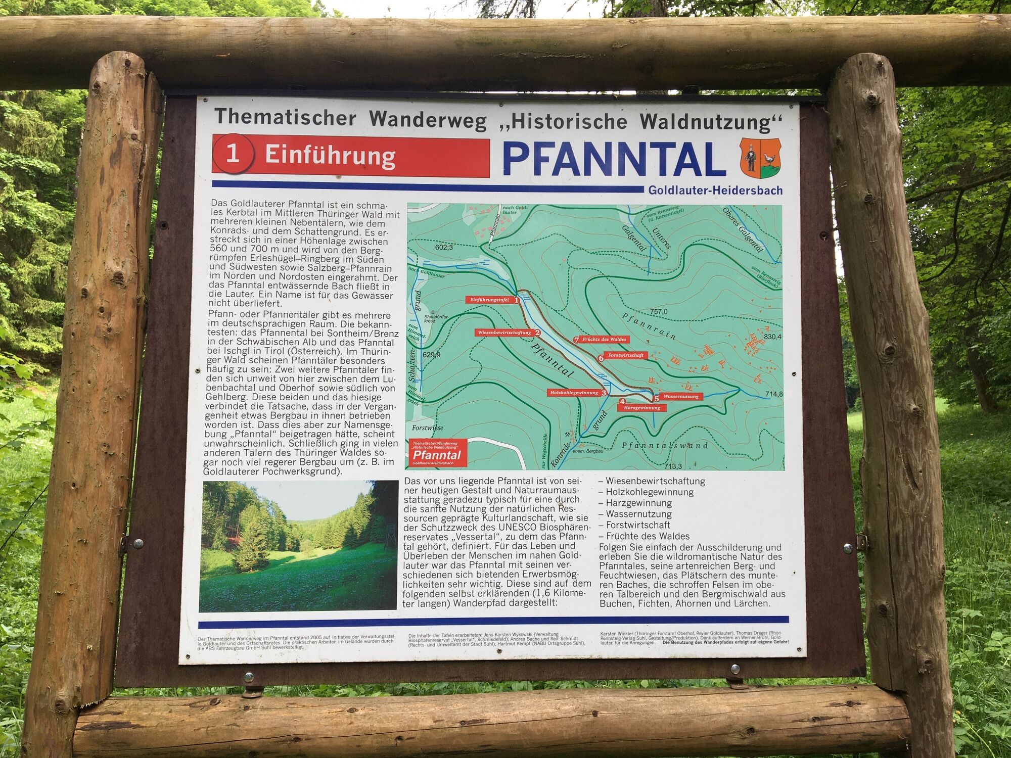
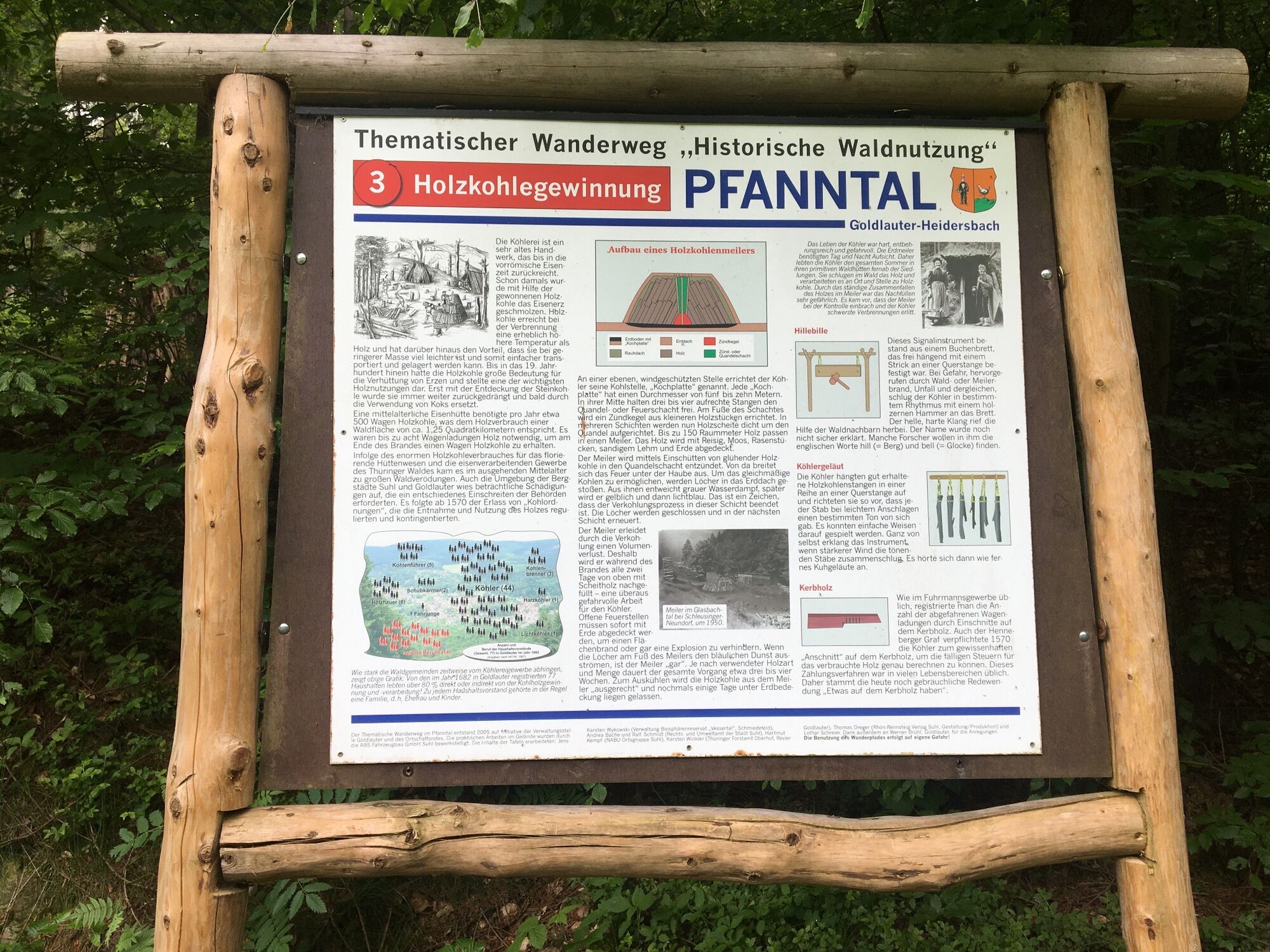
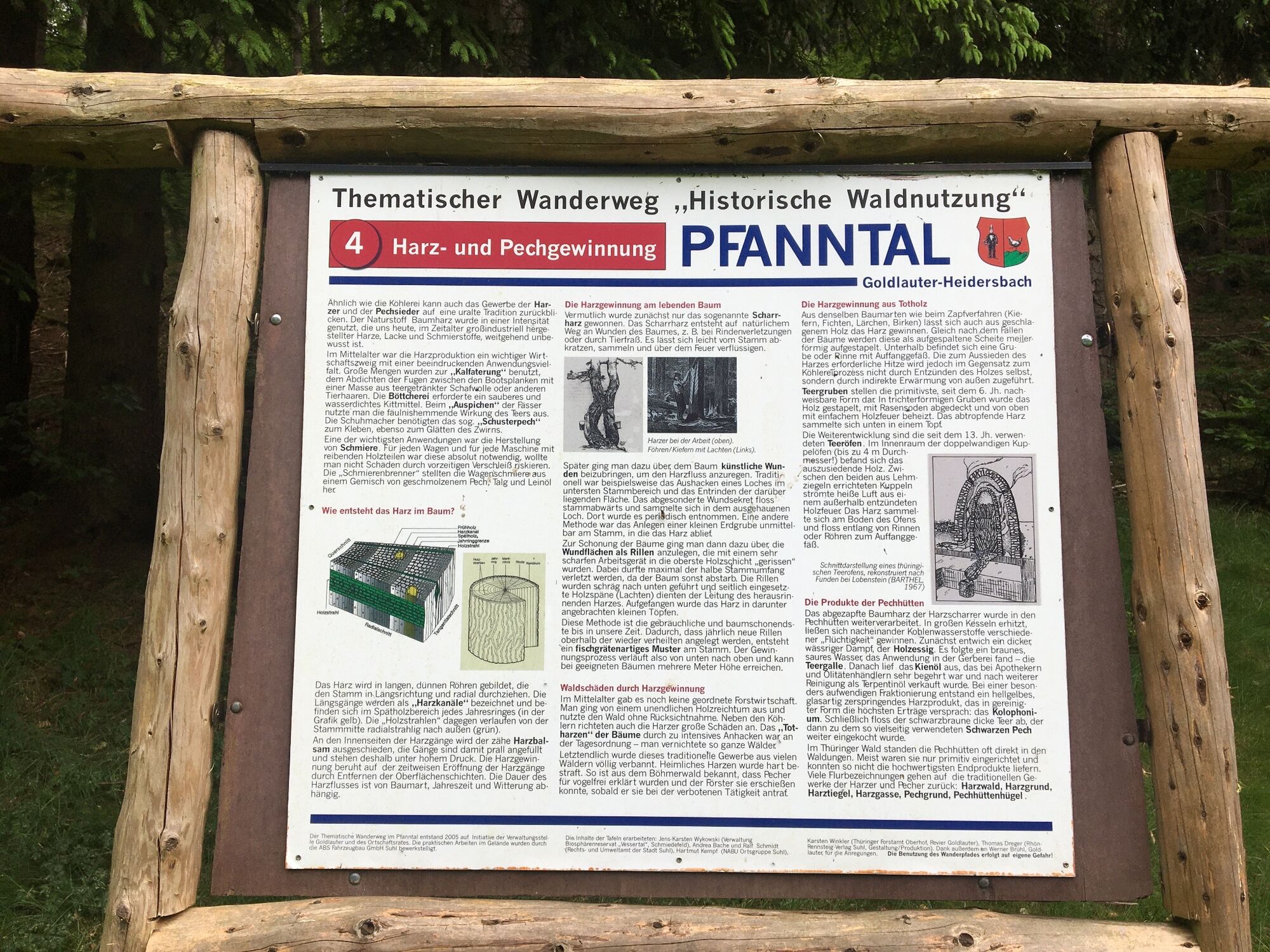
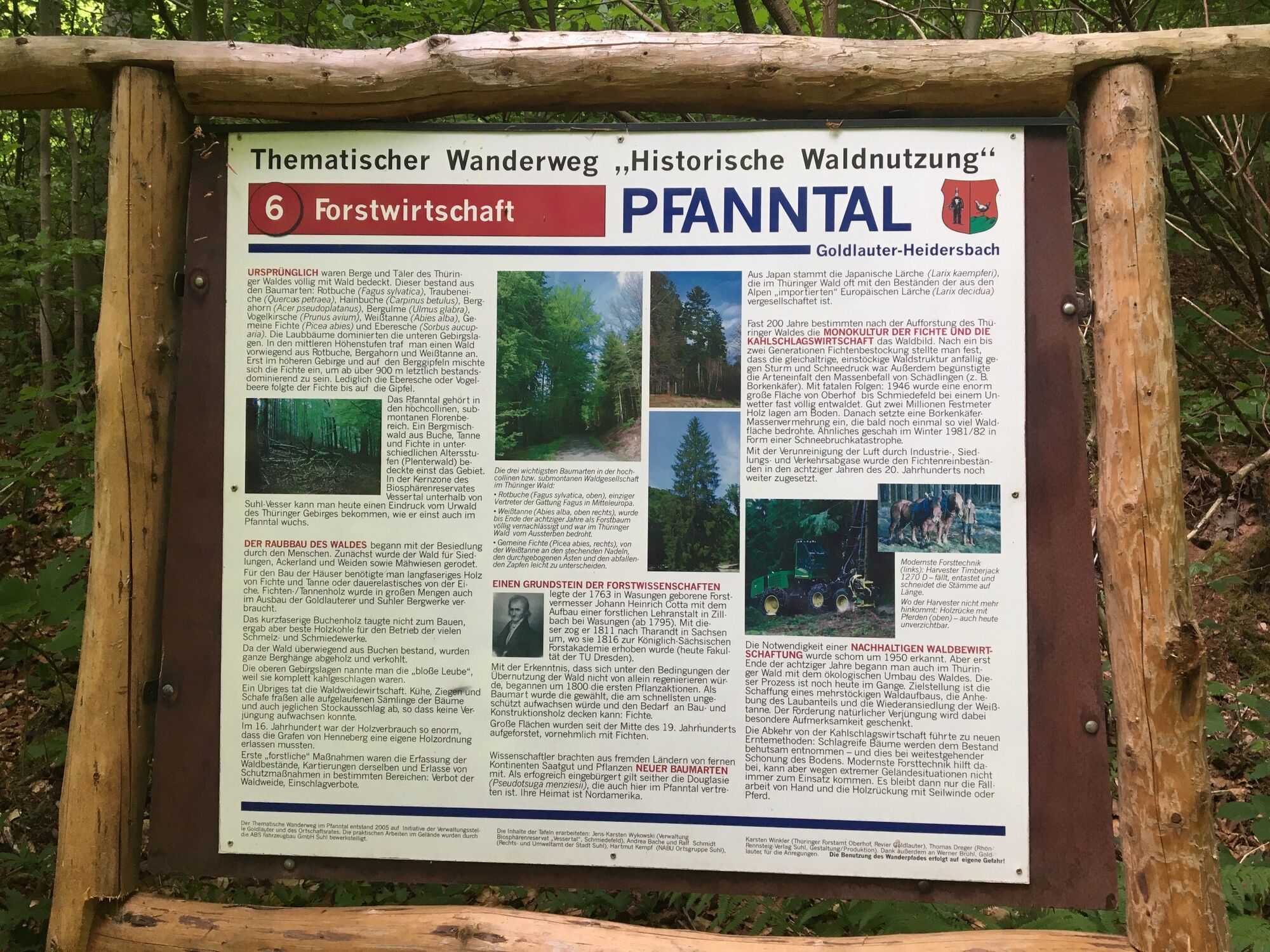
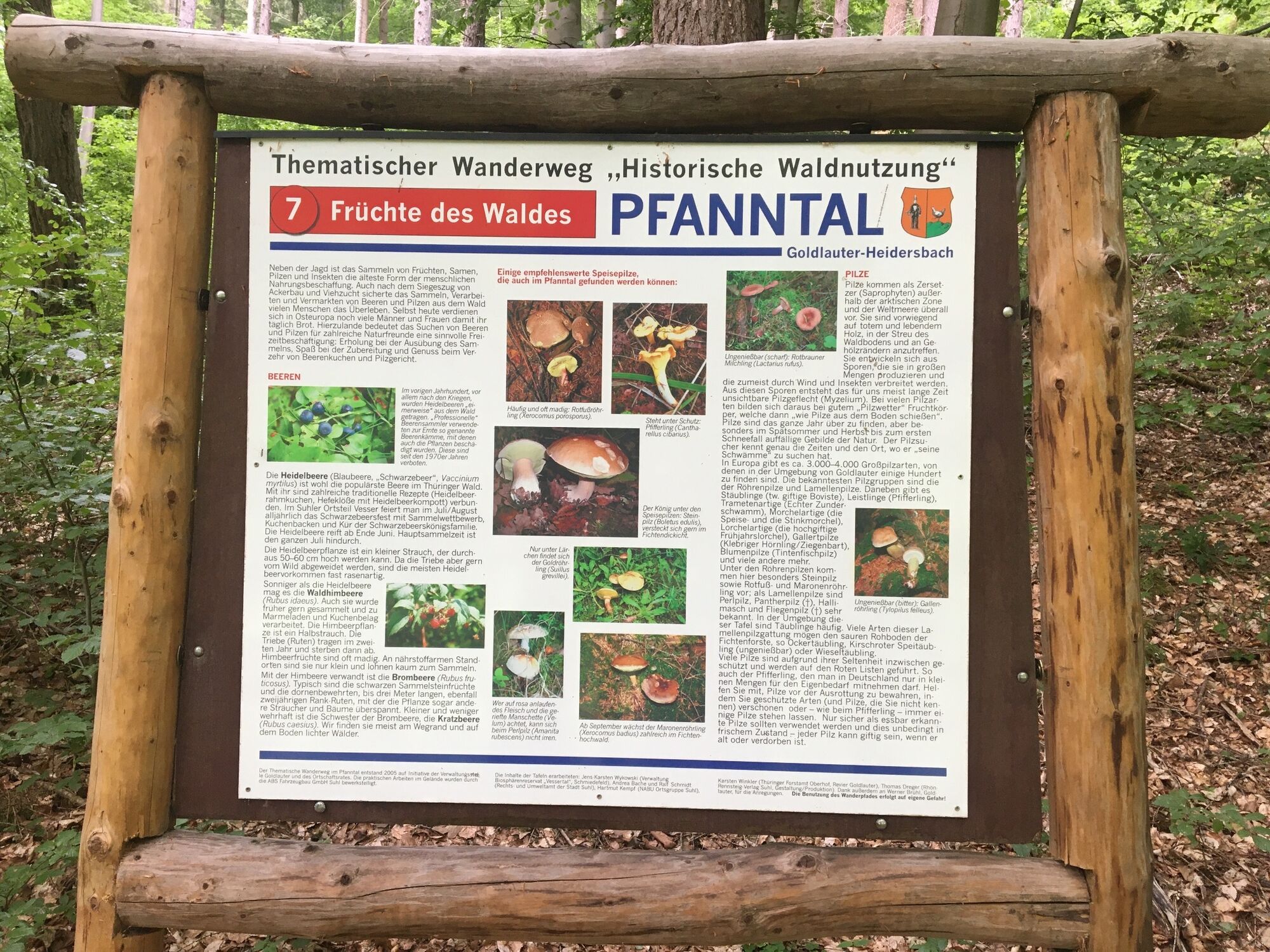
When we arrive at the entrance of the Pfanntal, one of seven information boards awaits us, which have been renewed in the past weeks. They tell us how diverse (and sustainable!) forest and nature were used by our ancestors. Here, not only wood was felled, the meadows in the Pfanntal were grazed by sheep, resin was obtained, charcoal and pitch were produced, hydropower was used, and the forest’s fruits were harvested.
The highlight of the hike, about 1.5 km long with just under 50 meters of elevation gain, is certainly the idyllic pond at the summit point, where a rest is recommended. Especially early in the morning and evening, many songbirds can be heard and perhaps seen here. The birdlife in May in the Pfanntal is lively. At the mouth into the Lauter, the dipper and grey wagtail can be heard and seen. The grey heron often visits. Upstream, 22 species were found, including our smallest songbirds: goldcrests in summer and winter, then beside chiffchaff and willow warbler also the wood warbler in two territories. The blackcap sang at eight sites up to the Pfanntal pond, and from the beech forest on the Salzberg slope came the dull pumping call of the rare turtle dove. It could be called the bittern of the forest. With some luck, you might see the treecreeper. Like a mouse, it scurries straight up the tree trunk. Its song resembles that of the chaffinch but at least one octave higher.
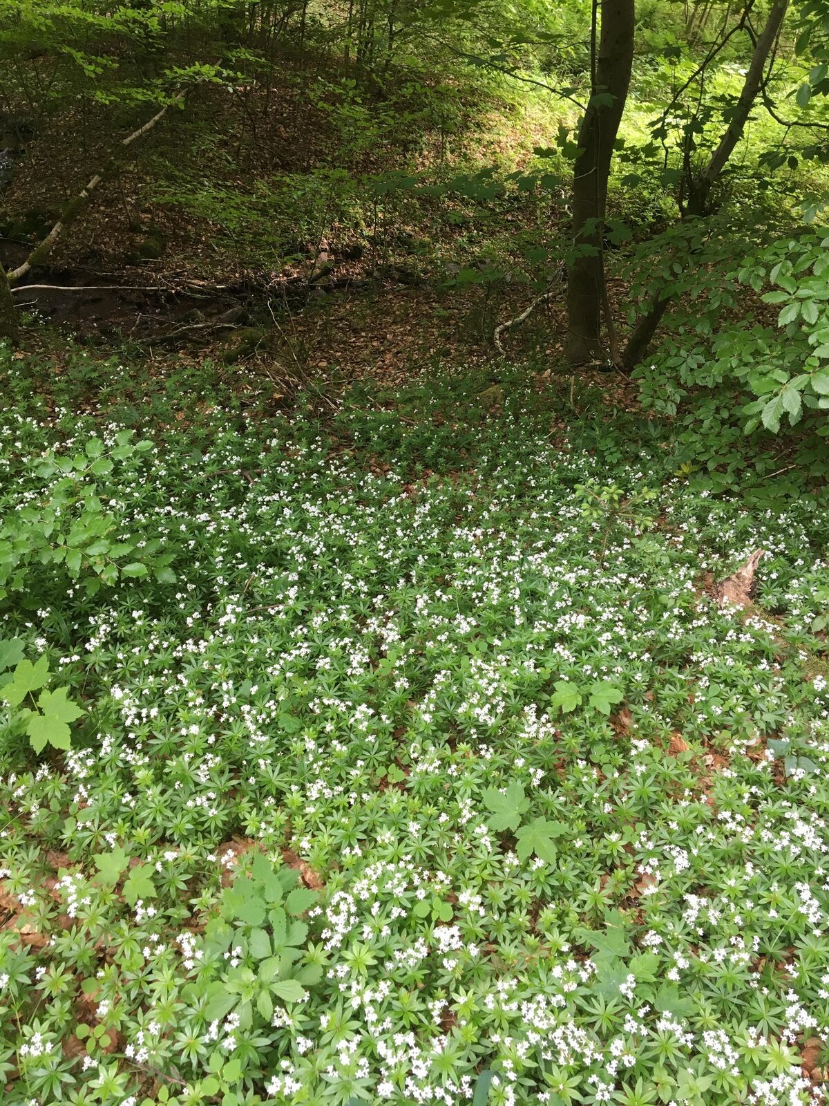
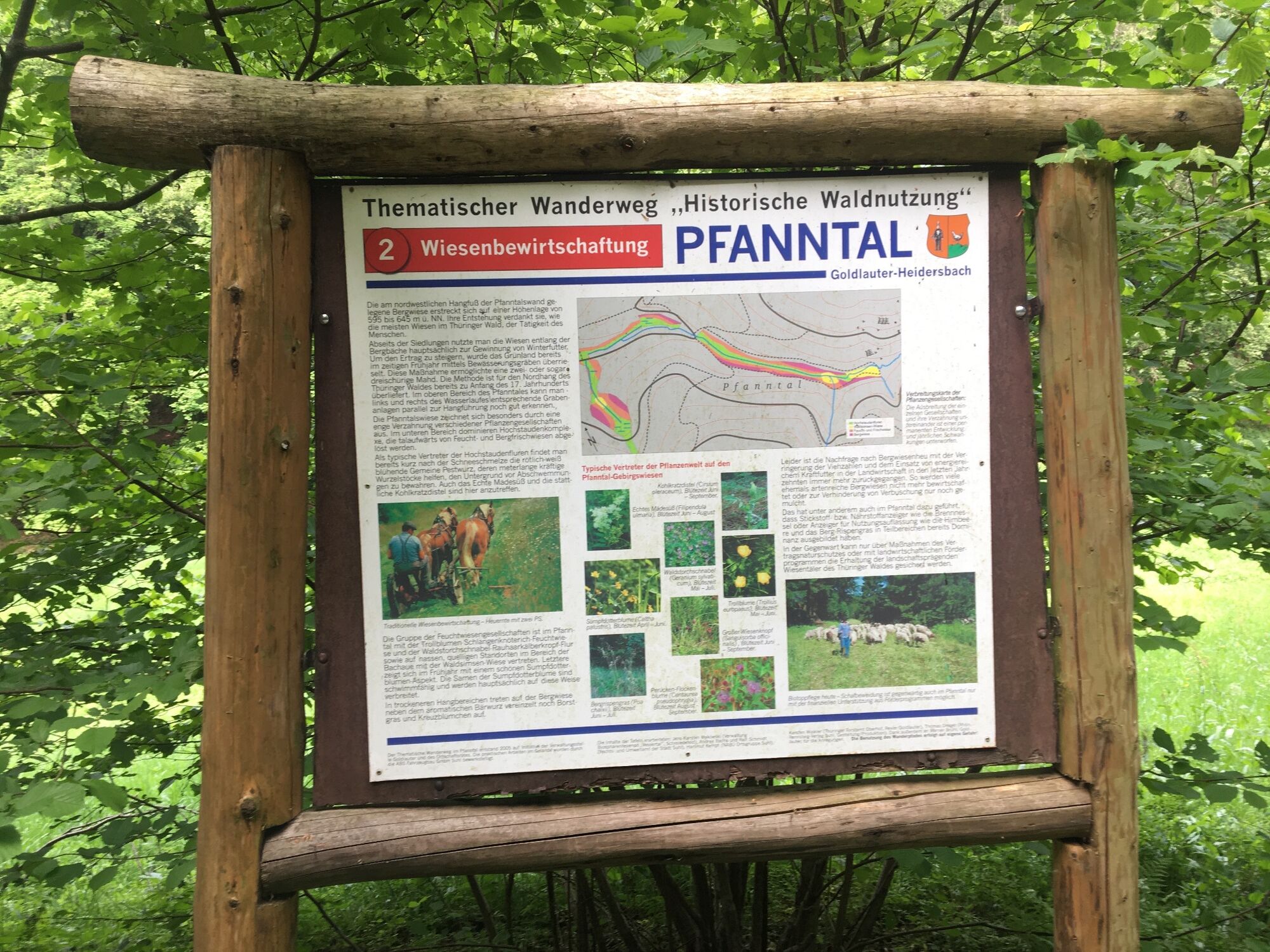
The theme trail also leads us through an interesting plant world. Here we do not walk through the usual spruce plantations but through a mixed forest that mainly houses beeches, but also maples, hazelnuts, and even some green Douglas firs (the Goldlauter area has magnificent specimens). On the ground, the blooming sweet woodruff, greater stitchwort, and plants with wonderful German names greet us, such as creeping bugle, stinking geranium, and of course lady fern.

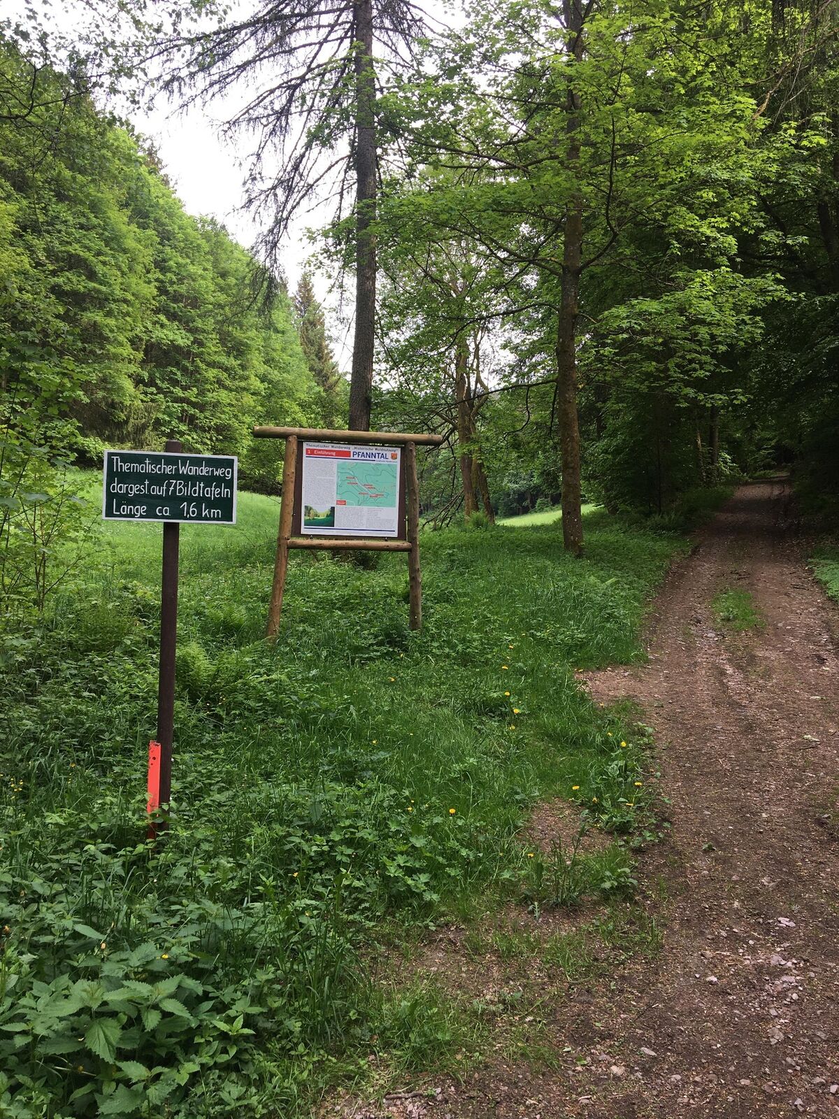
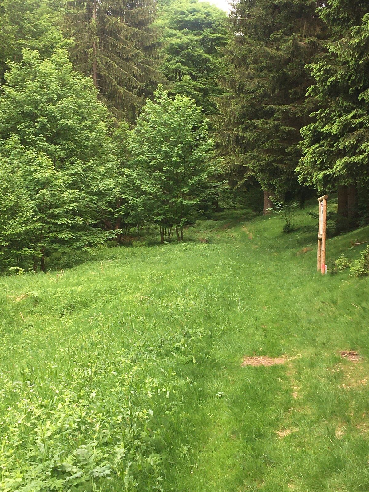
You should start at Suhl-Goldlauter at Pfannrain. The summit path also begins at this point, and you follow it for the first few meters. Right at Pfannrain, a signpost points to the Pfanntal. This beginning is quite steep but also short. Then, at the entrance to the Pfanntal, it goes uphill again, but afterwards, the path only goes straight ahead and then slightly downhill.
Ja
Ja
Sturdy footwear, rainwear, drink supply, first aid kit, GPS device (mobile phone), hiking sticks, emergency bread.
Always stay on the well-marked hiking trails. Always bring your mobile phone, compass, and map on the hike. Hiking sticks are almost always advisable, especially in wet weather.
Coming from the A71, take exit 19 (Suhl / Zella-Mehlis) and continue on Gothaer Straße south towards the center. After the Suhl town entrance, turn left twice towards Goldlauter.
You can reach Suhl by trains of Deutsche Bahn. From the bus station directly at the train station, you can take the bus line D1 to the stop "Goldlauter Brücke" to reach the starting point of the route.
You can use the Deutsche Bahn travel portal for planning your journey.
Use the parking lot on Suhler Straße - turnoff Zellaer Str. (Google NAV point)
You should walk the path early in the morning or in the evening to enjoy the extensive bird concert.
Populära turer i närområdet
-
3,0
Circular hike - "4 ponds hike" Neustadt am Rennsteig - Thuringian Forest
MediumVandring 12,6 km -
4,0
Circular hiking route "Oberschönauer Felsenwanderung" - Steinbach-Hallenberg - Thuringian Forest
tungVandring 12,0 km -
The Rennsteig - long-distance hiking trail from Hörschel to Blankenstein - Thuringian Forest
tungLångdistans vandringsled 169,0 km -
5,0
Hiking - Summit hiking trail - Suhl-Goldlauter - Thuringian Forest
tungVandring 32,1 km -
Circular hike - Around the Schönbrunn reservoir - Thuringian Forest
MediumVandring 15,6 km -
4,5
Hike over the Rennsteig & the Schneekopf to the Schmücke
tungVandring 20,9 km -
5,0
Circular Hiking Route - Lütsche-Flößgraben - Thuringian Forest
MediumVandring 13,8 km -
Circular hike to Bärenstein & Pfanntalsteich
MediumVandring 9,10 km -
4,5
Hiking - Rennsteig - Stage 4 - From Grenzadler to Allzunah
tungVandring 20,2 km -
4,0
Über den Rennsteig zum Schneekopf
tungVandring 21,8 km
Vandring och spårning


Missa inte erbjudanden och inspiration inför nästa semester
Din e-postadress har lagts till på e-postlistan.