


Kalksteiner Jöchl & Hohe Geil


The starting point is the ski gate car park at the Badl-Alm in Kalkstein (1,640 m), approx. five kilometres after Innervillgraten. From the car park in Kalkstein, first take the forest path towards Alfenalm,...
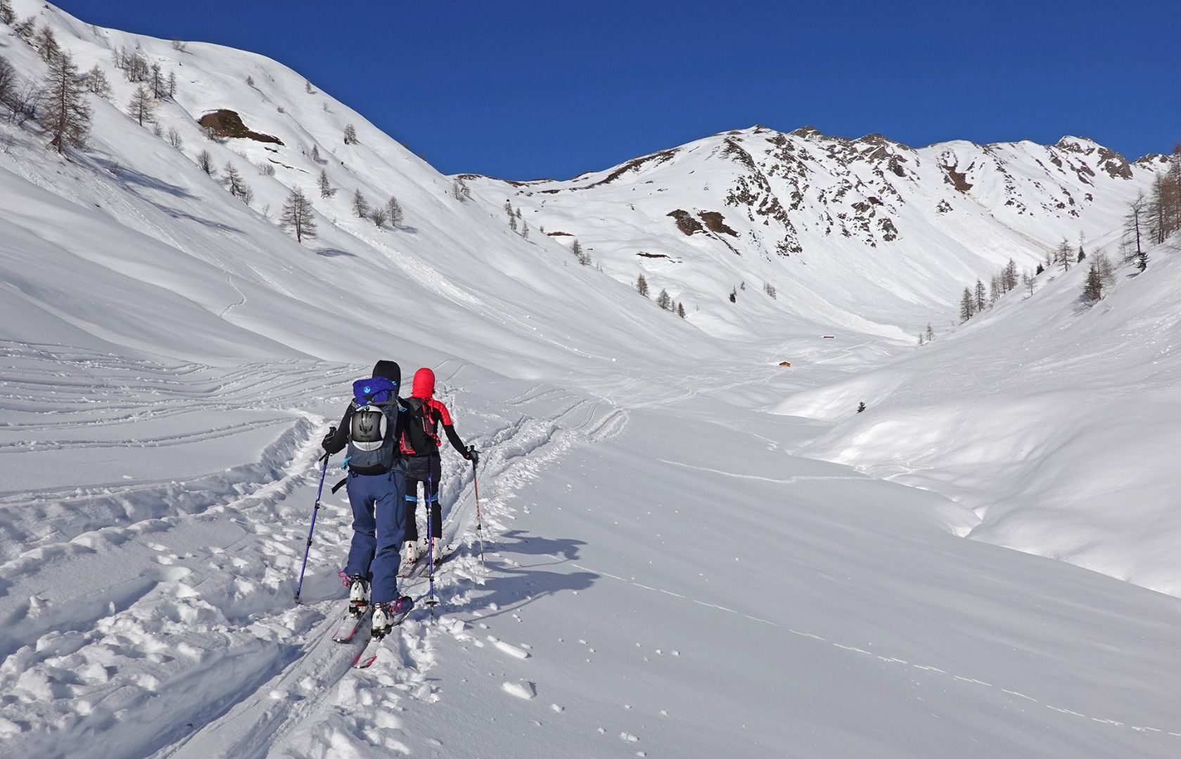
The starting point is the ski gate car park at the Badl-Alm in Kalkstein (1,640 m), approx. five kilometres after Innervillgraten. From the car park in Kalkstein, first take the forest path towards Alfenalm, turn right shortly before and follow the road north-west into the Roßtal valley to the end of the valley with a small hut (approx. 2050 m). From there, the ascent leads to the left in a westerly direction, initially over a somewhat steeper section, later over hollows and humps to the Kalksteiner Jöchl (2,350 m). From here, the ascent continues northwards over a broad ridge to the summit cross of the Hohe Geil (2,494 m)
Descent: As ascent.
Characteristics: The Kalksteinjöchl is a crossing into the neighbouring Gsiesertal on the South Tyrolean side. Until the 1950s it was considered a smugglers' path. This tour is an easy introductory tour, also suitable for beginners. Great views both from the Kalksteinjöchl and from the Hohe Geil to the Sexten Dolomites and the neighbouring Gsiesertal.
Mit dem Auto bis zum Parkplatz Kalkstein
Mit dem Bus bis zur Haltestelle Innervillgraten Kalkstein
Parkplatz Kalkstein
Webbkameror för rundturen
Populära turer i närområdet
-
4,6
Mountain hike to Mountain „Lutterkopf and Durakopf (2145/2275m)“
MediumVandring i berg 11,8 km -
5,0
Antholzer See - Steinzger Alm
MediumVandring 7,48 km -
4,8
Seerunde
ljusVandring 2,66 km -
5,0
Heimkehrer Kreuz - Hornischegg - Sillianer Hütte
MediumVandring 9,43 km -
4,2
Seespitze
MediumVandring 13,7 km -
4,0
Innervillgraten - Kalkstein - Alfenalm - Schönegg
MediumVandring 12,6 km -
4,5
Thurntaler Rundweg - Parggenspitze - Hochrast
MediumVandring 18,0 km -
5,0
Trojertal, Hintere Trojeralm
ljusVandring 8,97 km -
5,0
Rote Wand
MediumHög tur 12,0 km -
5,0
Schwarzsee
MediumVandring 7,38 km
Vandring och spårning


Missa inte erbjudanden och inspiration inför nästa semester
Din e-postadress har lagts till på e-postlistan.