


Stuibenfall Umhausen circular hike


Foton av våra användare
-
 © Thorsten Tom FreundSkapad på 13.08.2023
 -
 © Harry VerkaikSkapad på 16.07.2023
 -
 © Harry VerkaikSkapad på 16.07.2023
 -
 © Ronald CapelSkapad på 26.09.2025
 -
 © Ronald CapelSkapad på 26.09.2025
 -
 © Ronald CapelSkapad på 26.09.2025
 -
 © Ronald CapelSkapad på 26.09.2025
 -
 © Ronald CapelSkapad på 26.09.2025
 -
 © Ronald CapelSkapad på 26.09.2025
 -
 © Andreas PammingerSkapad på 22.08.2025
 -
 © Andreas PammingerSkapad på 22.08.2025
 -
 © Andreas PammingerSkapad på 22.08.2025
 -
 © Andreas PammingerSkapad på 22.08.2025
 -
 © Andreas PammingerSkapad på 22.08.2025
 -
 © okidoki1980Skapad på 15.08.2025
 -
 © Jörg KleySkapad på 17.06.2025
 -
 © Jörg KleySkapad på 17.06.2025
 -
 © Jörg KleySkapad på 17.06.2025
 -
 © Jörg KleySkapad på 17.06.2025
 -
 © Jörg KleySkapad på 17.06.2025
 -
 © Jörg KleySkapad på 17.06.2025
 -
 © Jörg KleySkapad på 17.06.2025
 -
 © Jörg KleySkapad på 17.06.2025
 -
 © Jörg KleySkapad på 17.06.2025
 -
 © Martin HudelistSkapad på 25.11.2024
 -
 © Martin HudelistSkapad på 25.11.2024
 -
 © Martin HudelistSkapad på 25.11.2024
 -
 © Martin HudelistSkapad på 25.11.2024
 -
 © Martin HudelistSkapad på 25.11.2024
 -
 © Martin HudelistSkapad på 25.11.2024
 -
 © Martin HudelistSkapad på 25.11.2024
 -
 © Martin HudelistSkapad på 25.11.2024
 -
 © Martin HudelistSkapad på 25.11.2024
 -
 © Martin HudelistSkapad på 25.11.2024
 -
 © Martin HudelistSkapad på 25.11.2024
 -
 © Thorsten Tom FreundSkapad på 13.08.2023
 -
 © Thorsten Tom FreundSkapad på 13.08.2023
 -
 © Thorsten Tom FreundSkapad på 13.08.2023
 -
 © Thorsten Tom FreundSkapad på 13.08.2023
 -
 © Thorsten Tom FreundSkapad på 13.08.2023
 -
 © Thorsten Tom FreundSkapad på 13.08.2023
 -
 © Thorsten Tom FreundSkapad på 13.08.2023
 -
 © Thorsten Tom FreundSkapad på 13.08.2023
 -
 © Thorsten Tom FreundSkapad på 13.08.2023
 -
 © Thorsten Tom FreundSkapad på 13.08.2023
 -
 © Thorsten Tom FreundSkapad på 13.08.2023
 -
 © Thorsten Tom FreundSkapad på 13.08.2023
 -
 © Thorsten Tom FreundSkapad på 13.08.2023


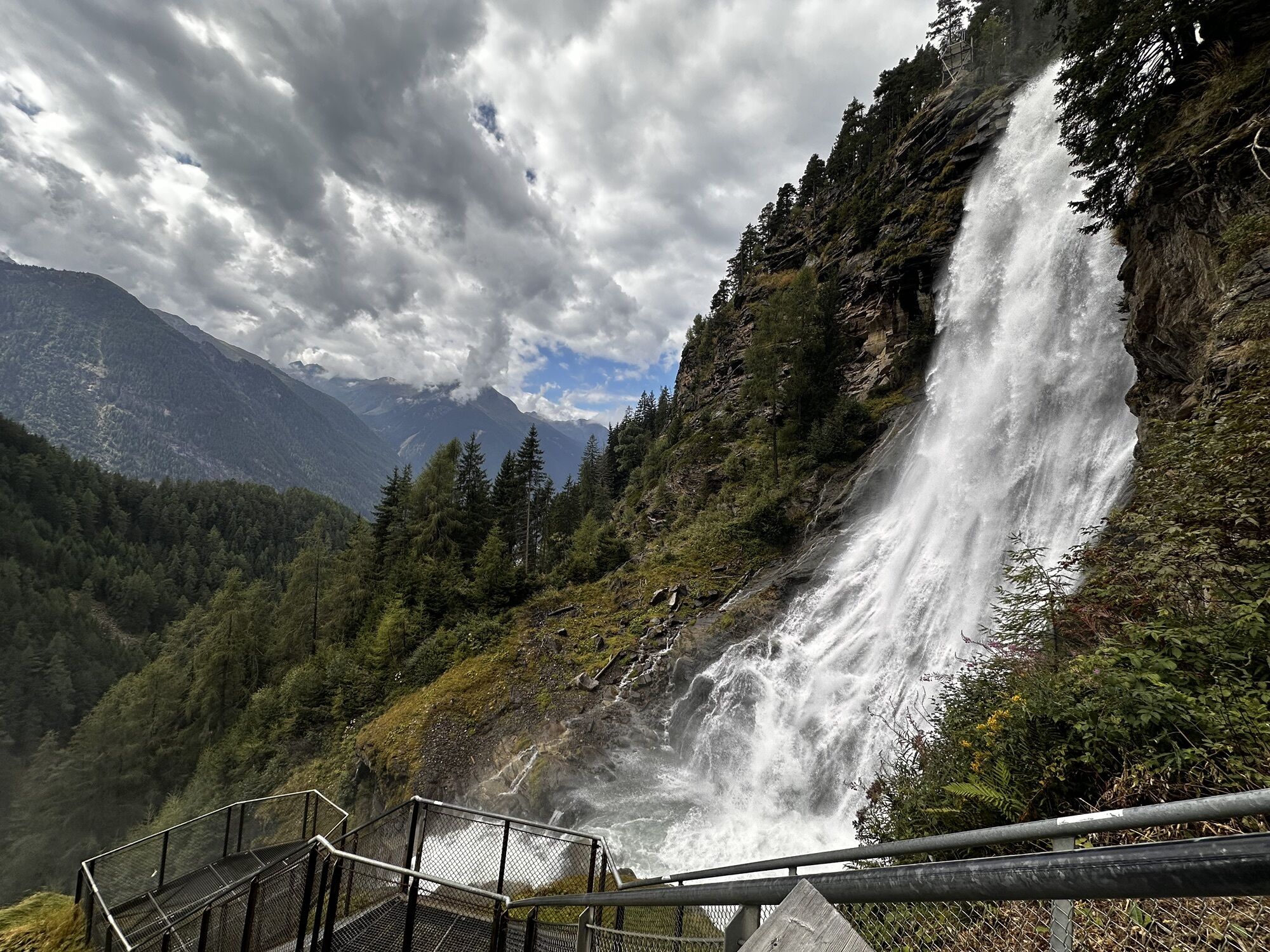


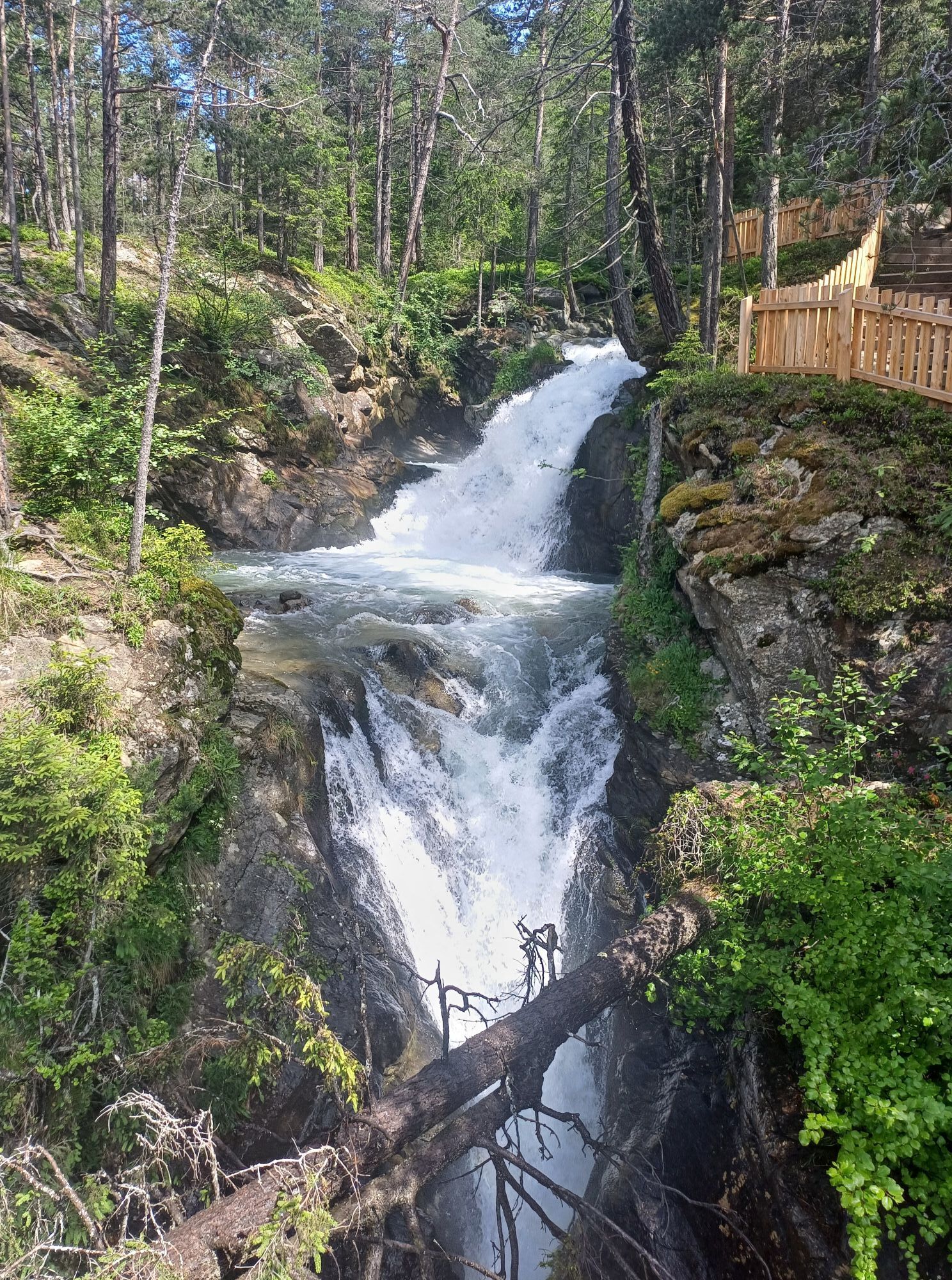

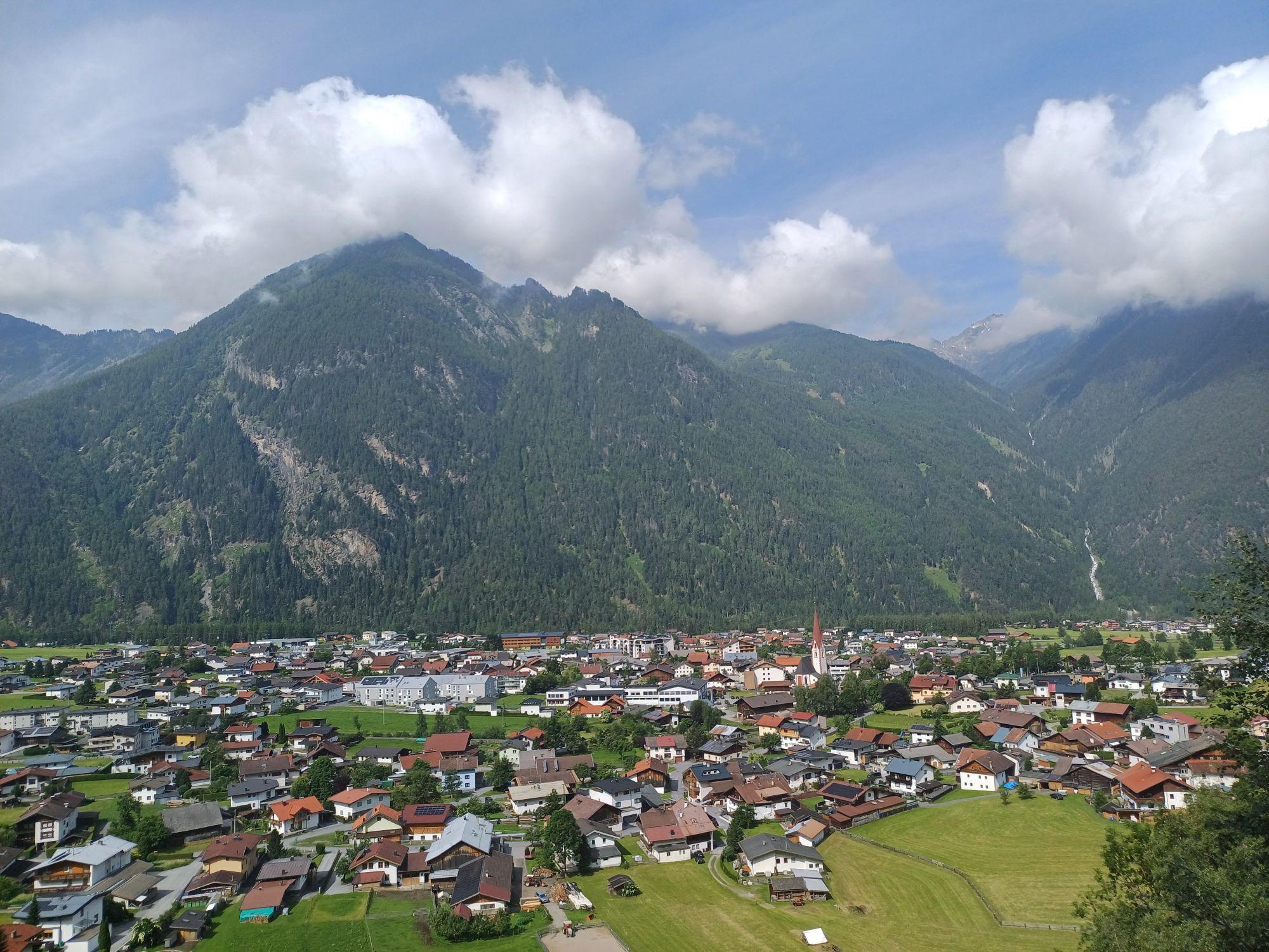


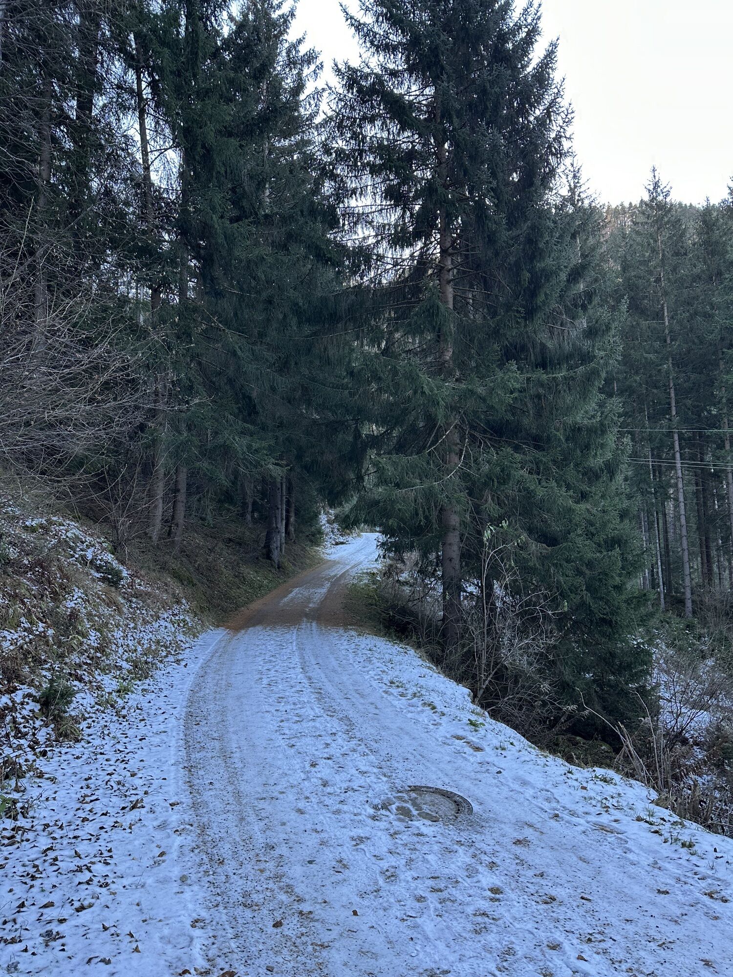


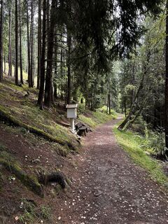
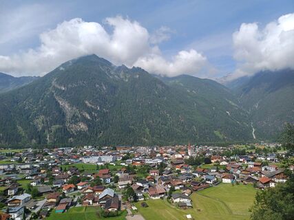
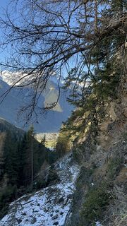
The hike starts at the Bischoffsplatz parking lot in Umhausen. From there, follow the wide Fortsweg behind the Kneipphäusl restaurant uphill to the junction leading to the "Waalweg Arzwinkel." The path...
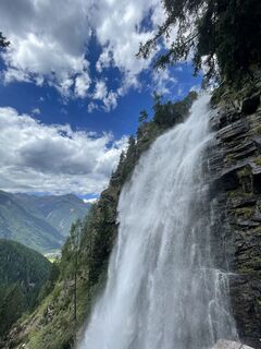
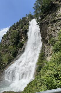
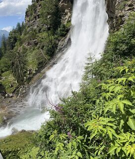
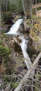
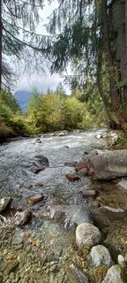
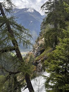
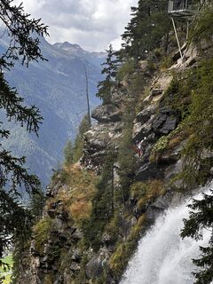
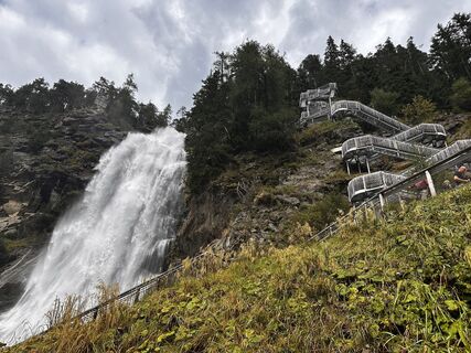
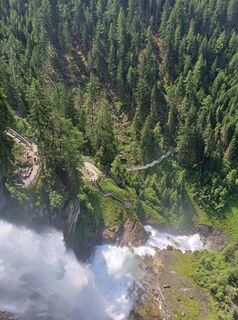
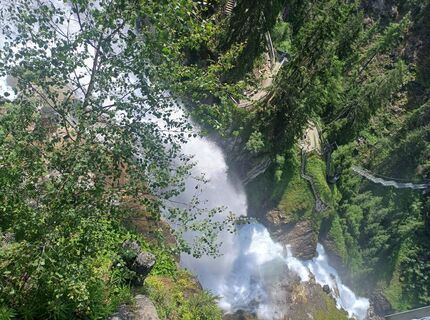
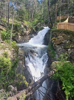
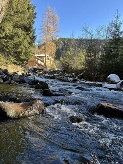
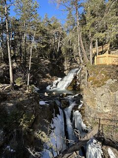
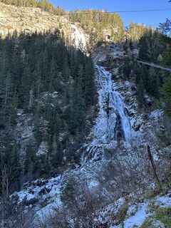
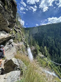
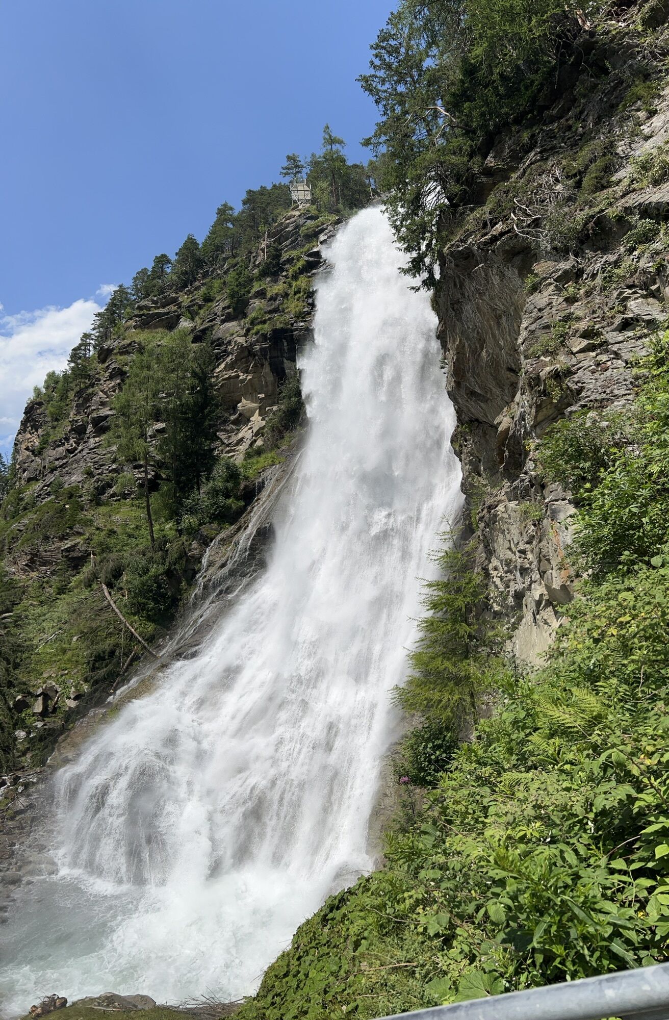
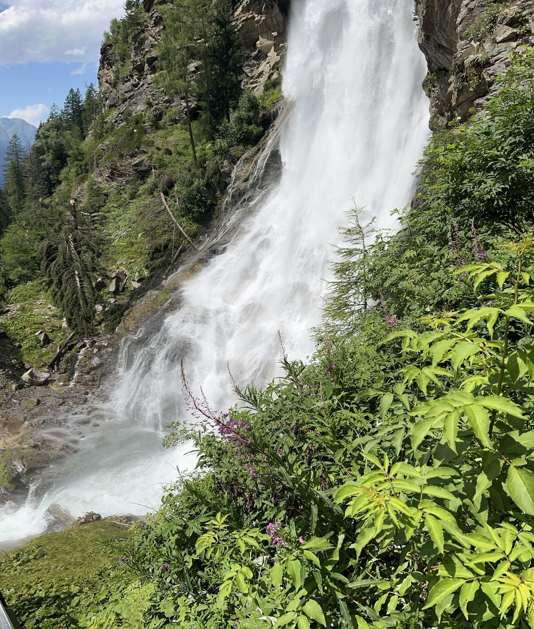
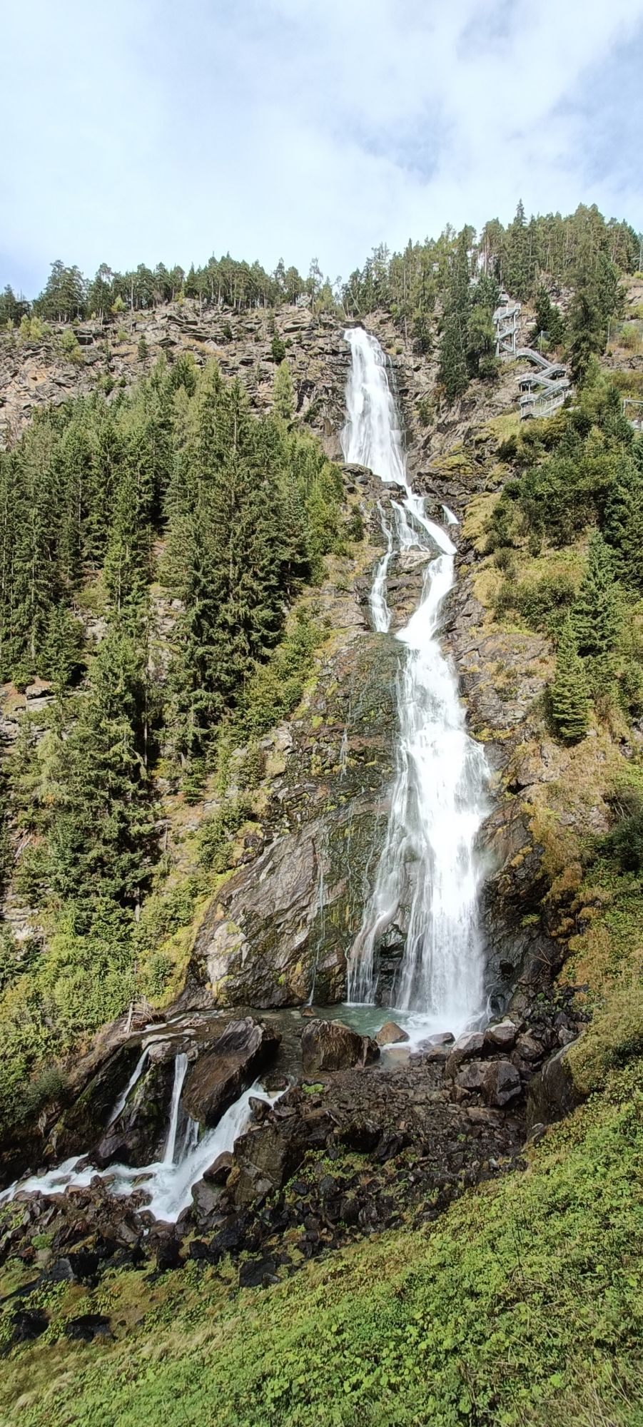
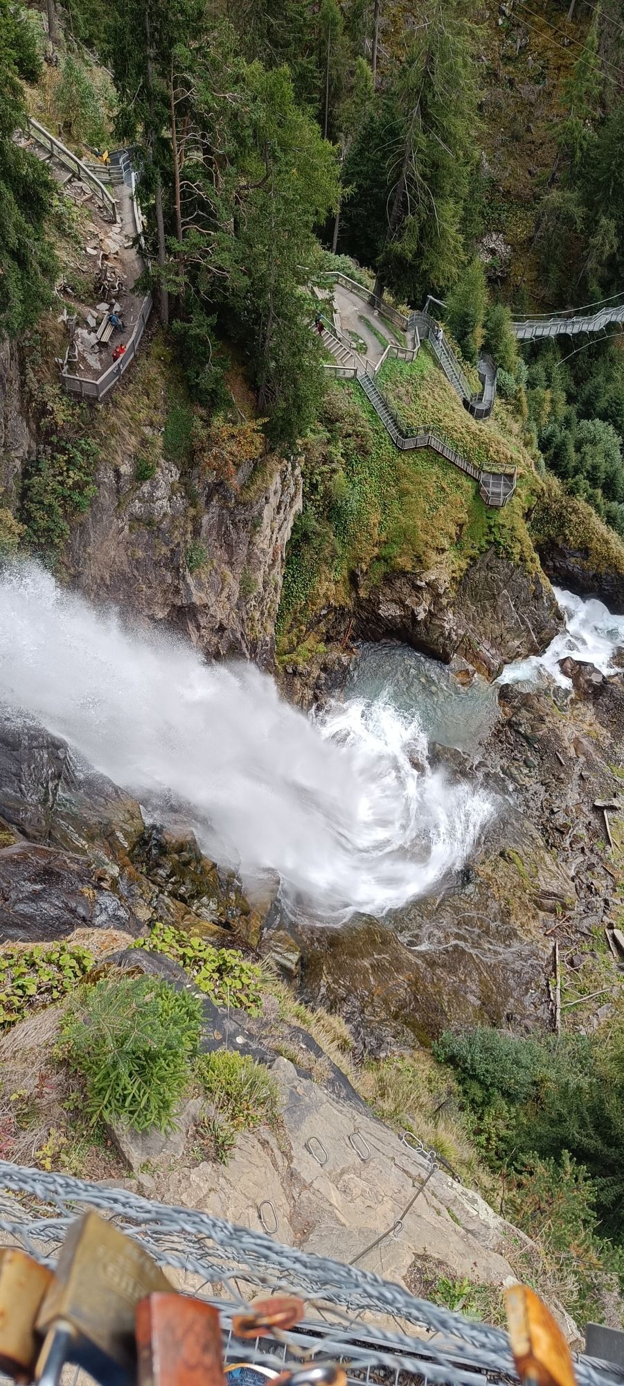
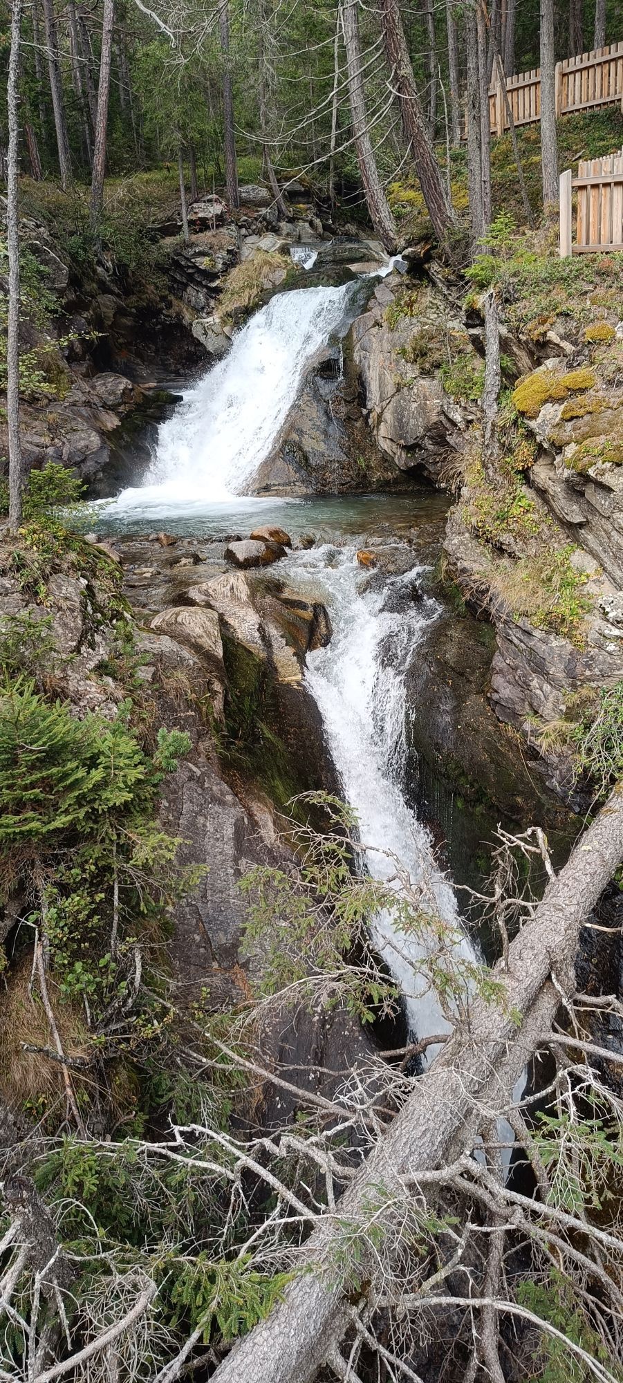
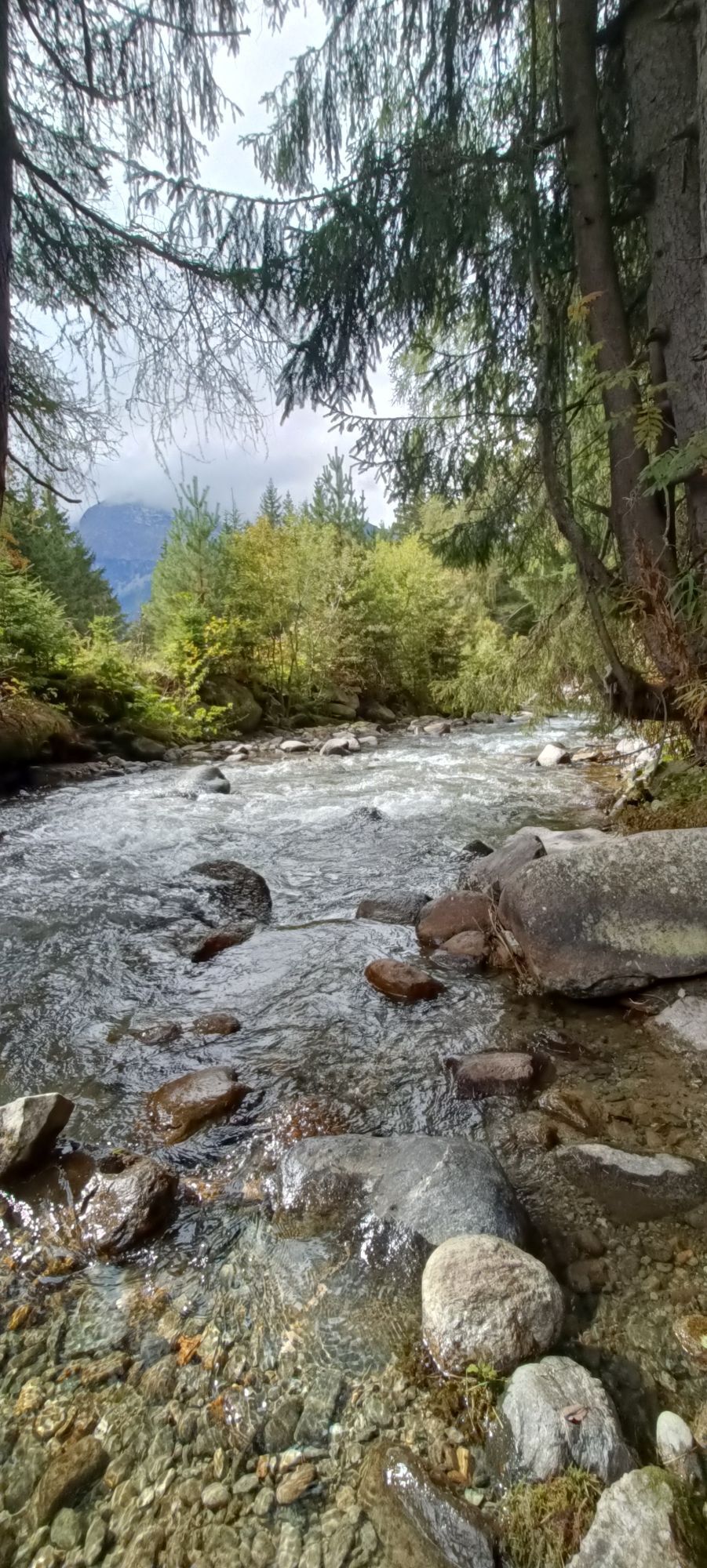
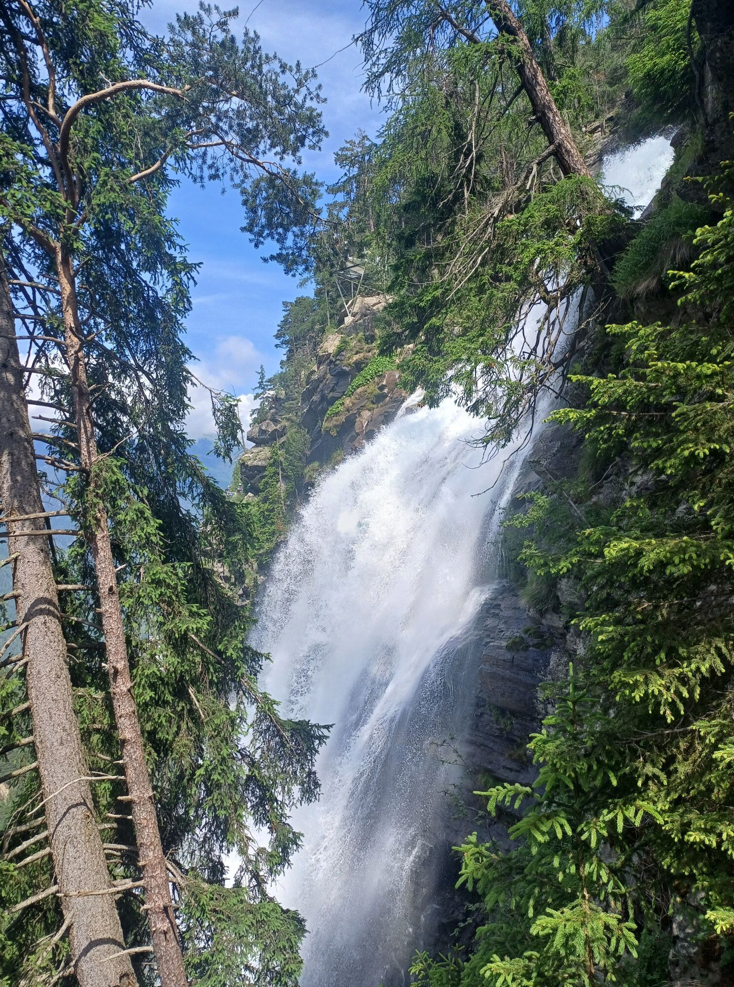
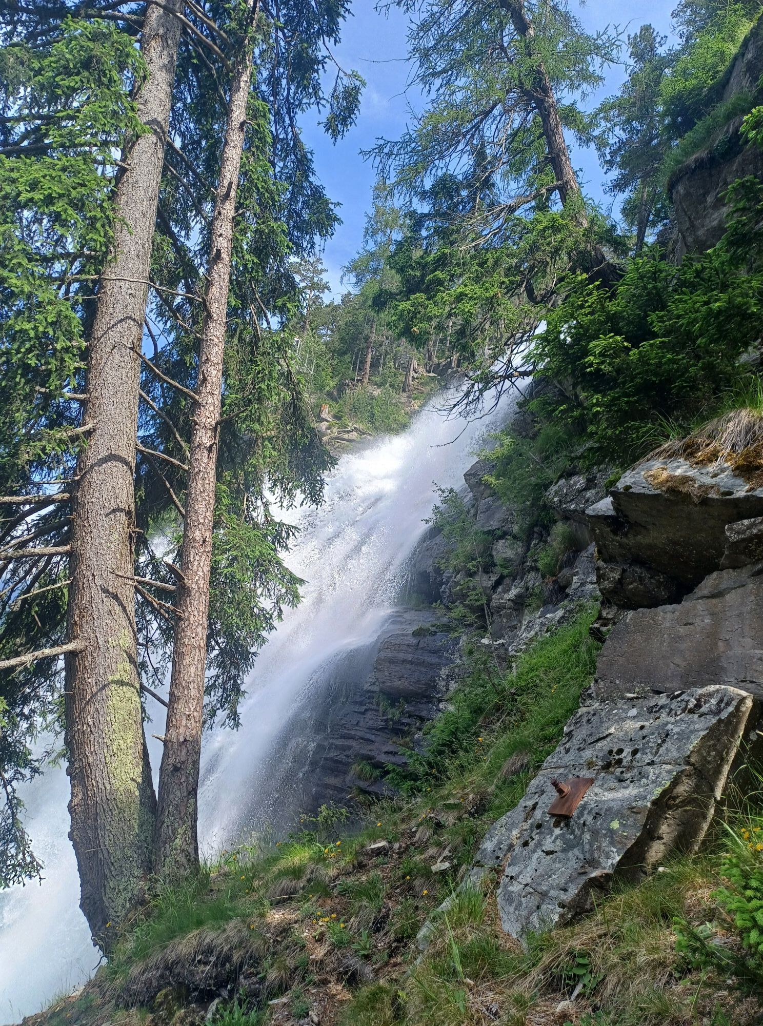
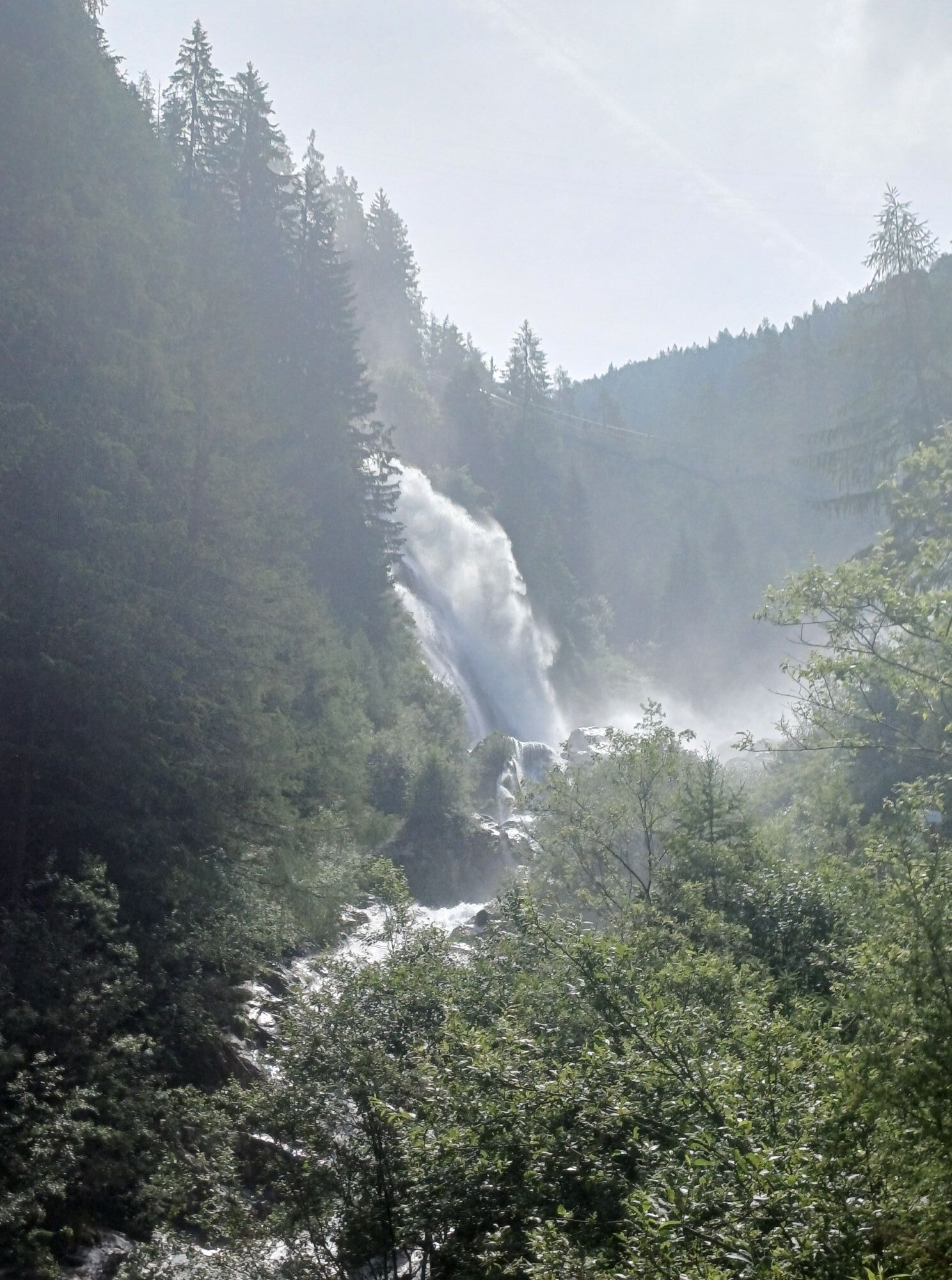
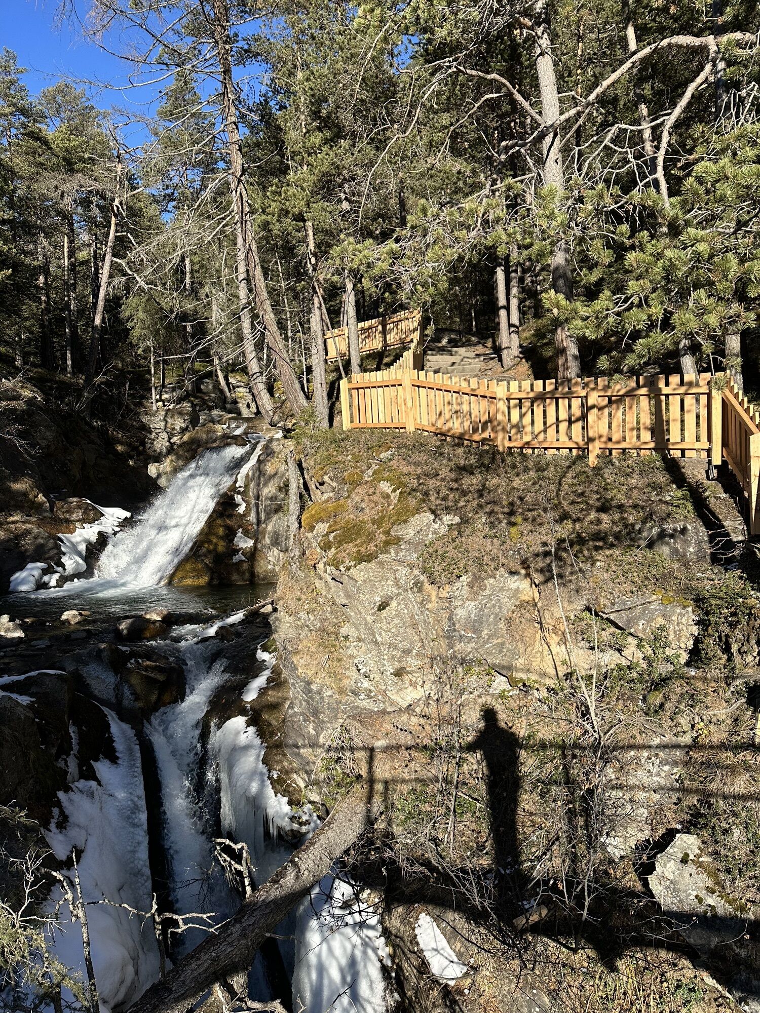
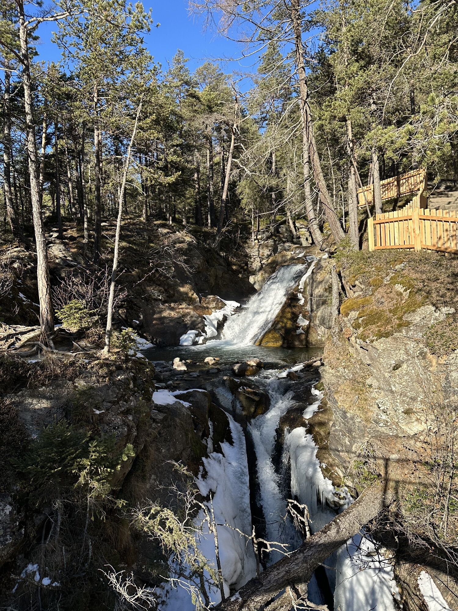
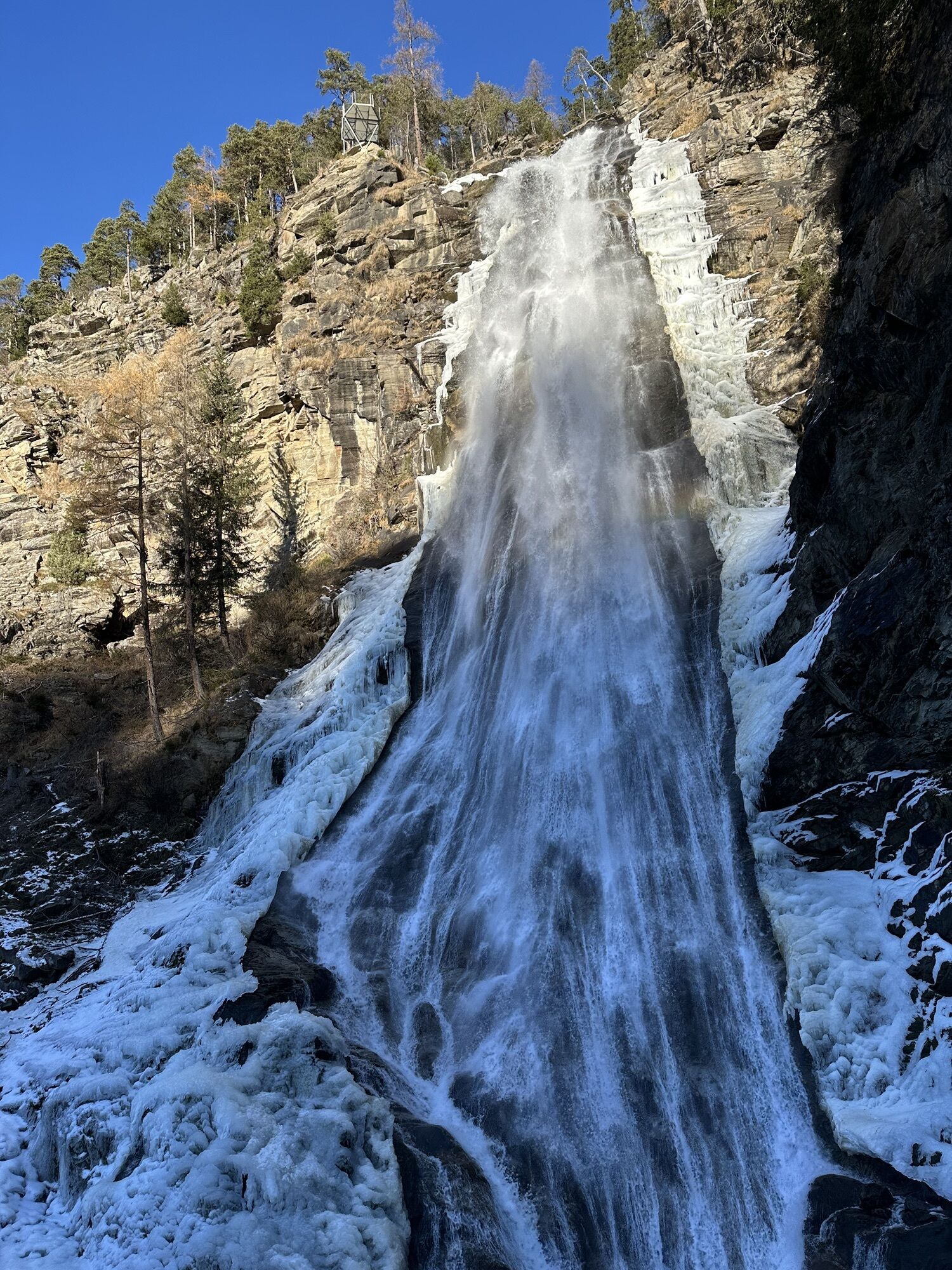
The hike starts at the Bischoffsplatz parking lot in Umhausen. From there, follow the wide Fortsweg behind the Kneipphäusl restaurant uphill to the junction leading to the "Waalweg Arzwinkel." The path calmly winds along the Waale until you reach a gravel road. There, turn right along the bubbling Horlachbach stream uphill to the foot of the mighty waterfall, the Stuibenfall - Tyrol's largest waterfall.
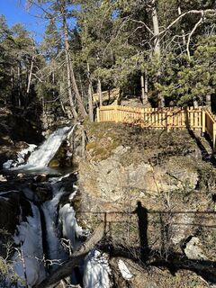
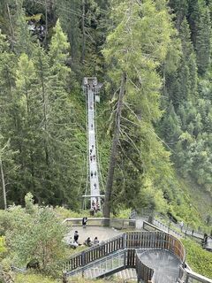
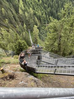
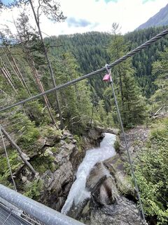
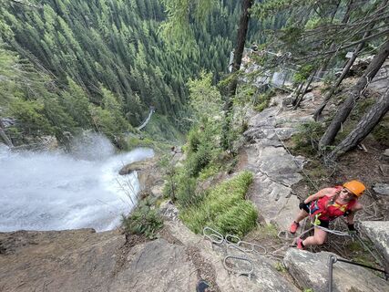
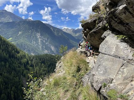
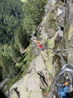
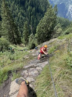
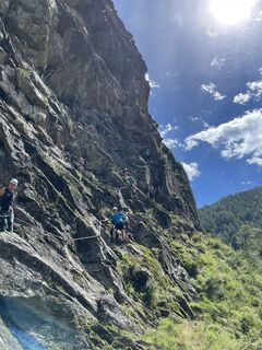
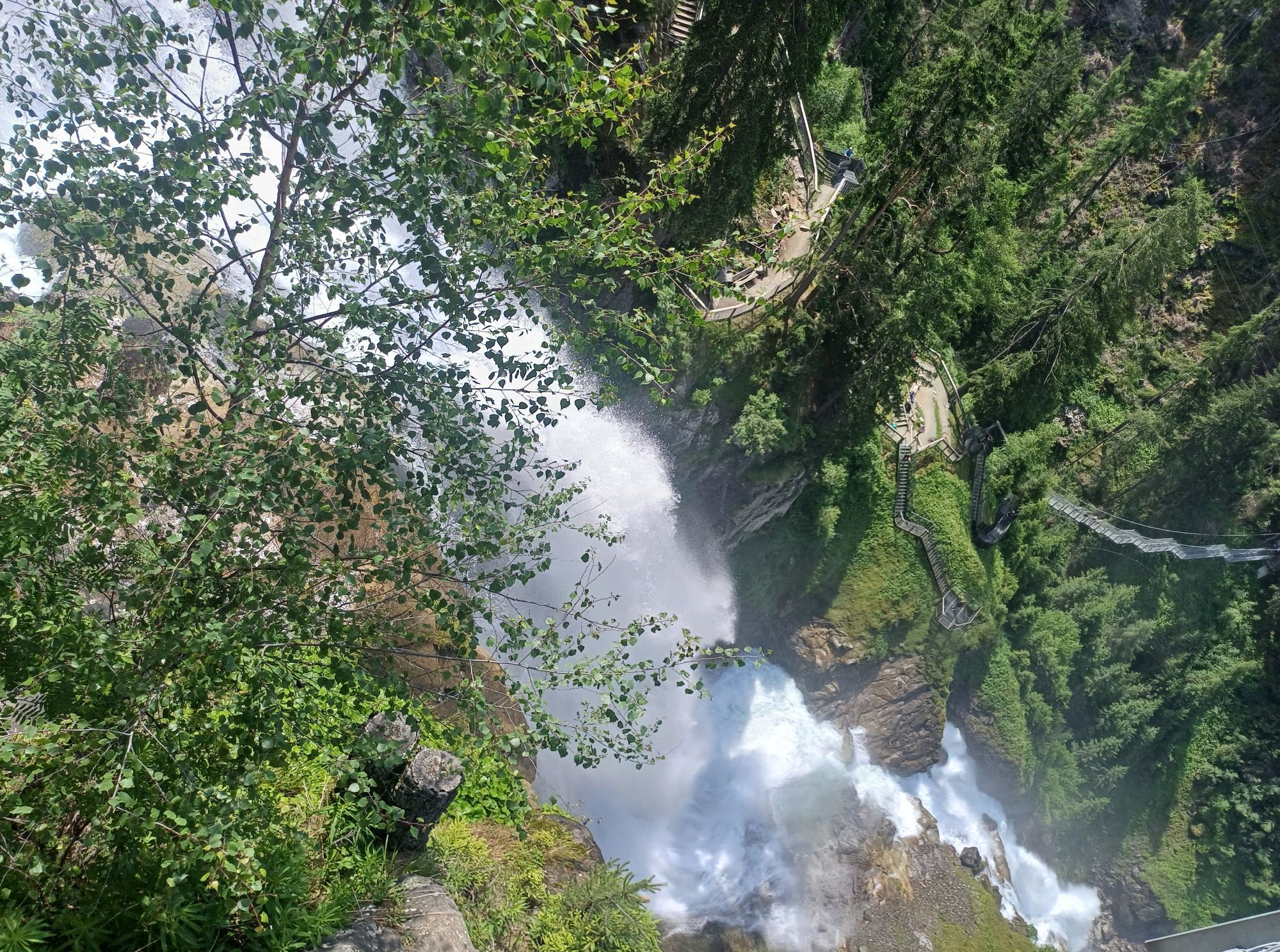
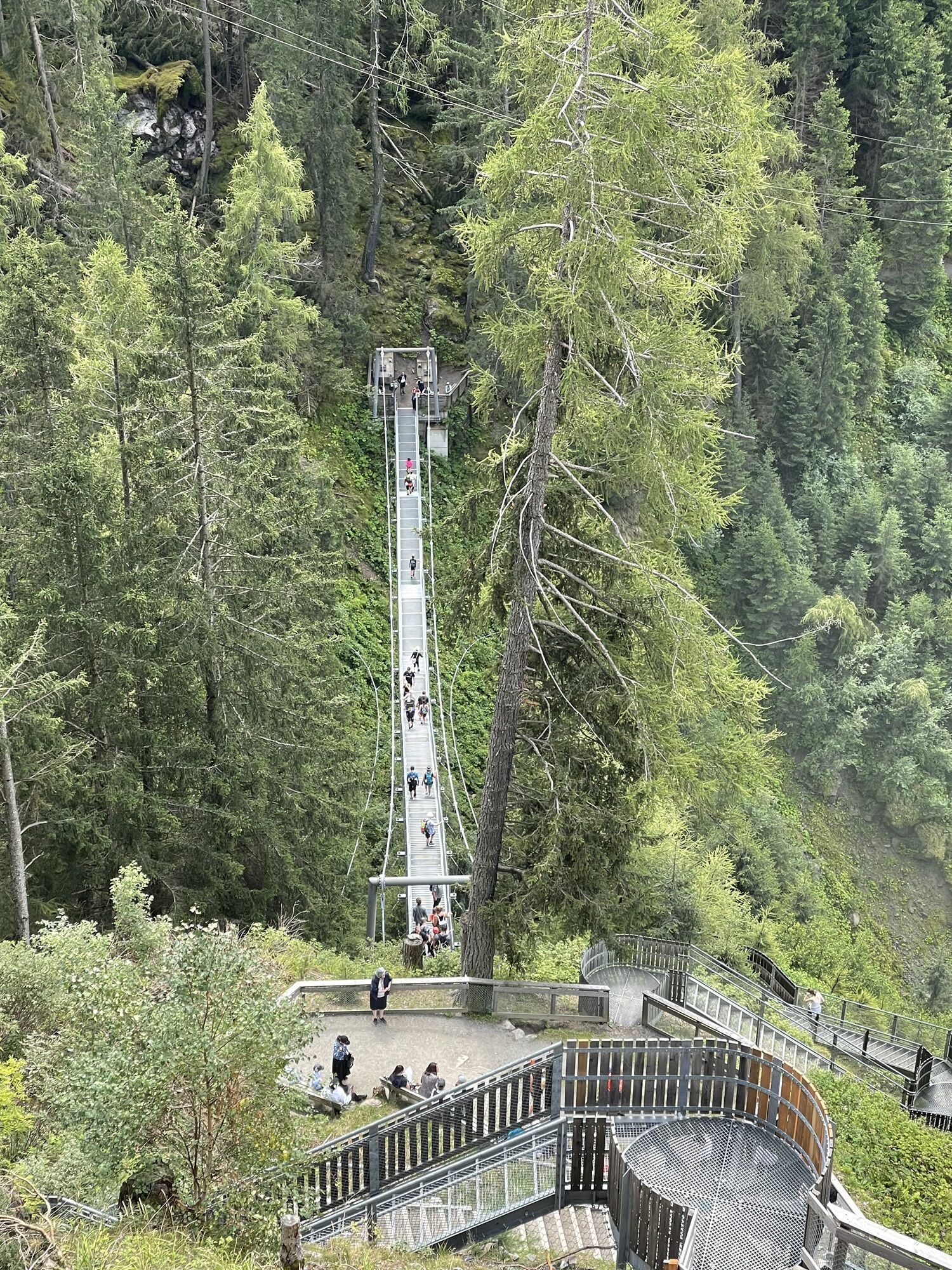
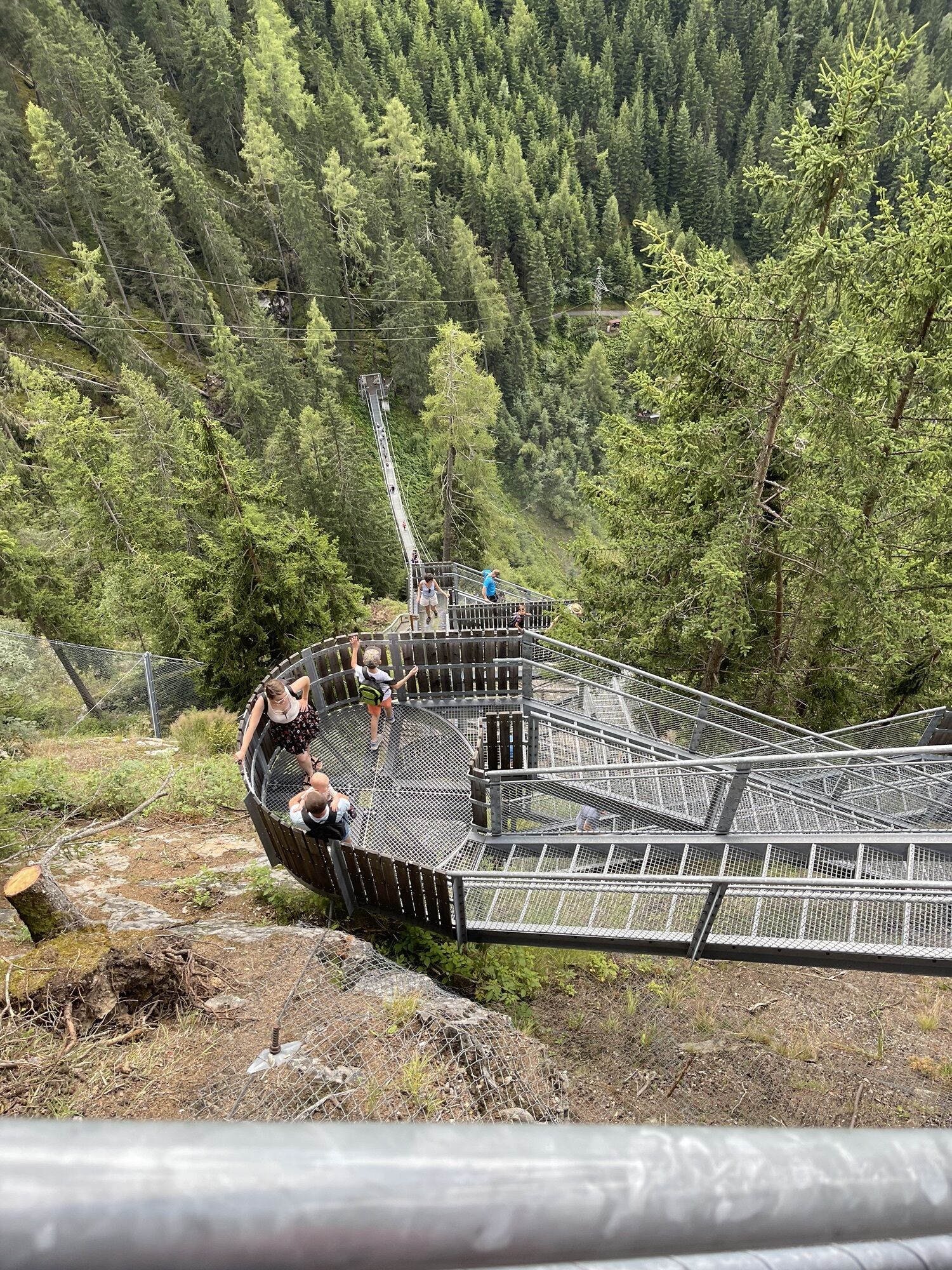
Always with a view of the fascinating natural spectacle, you climb to the right of the cascading waters on over approximately 700 steps up to the origin of the Stuibenfall. Along the way, you pass the scenic platforms and the 80-meter-long suspension bridge.
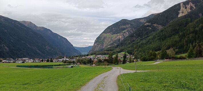
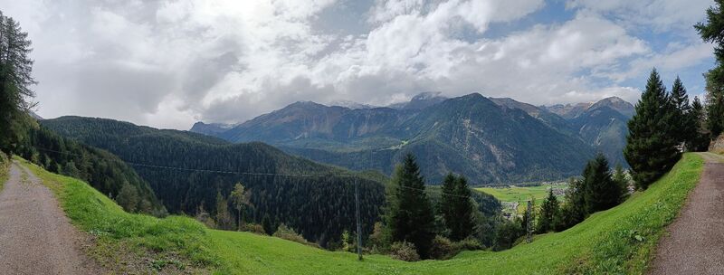
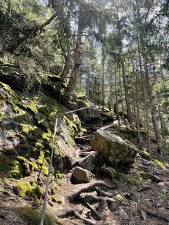
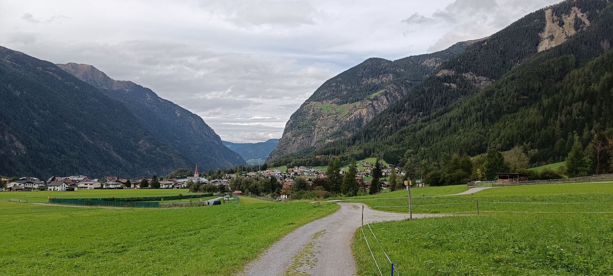
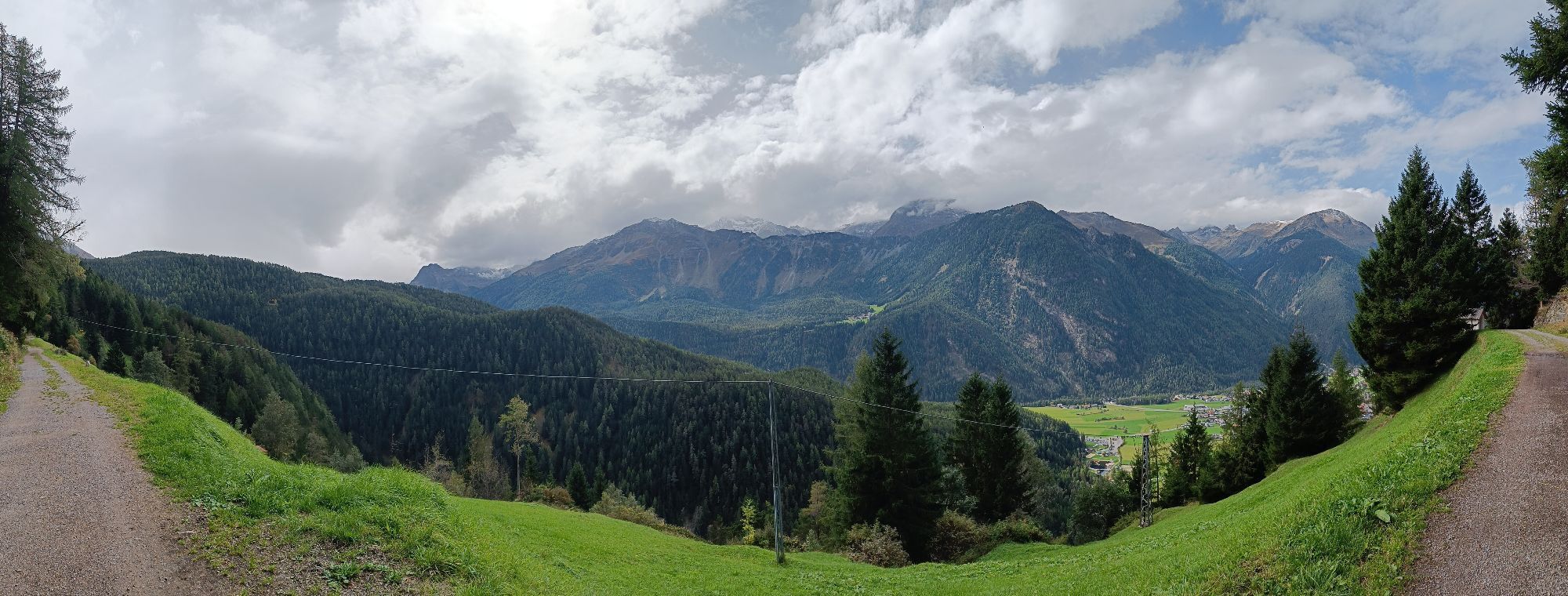
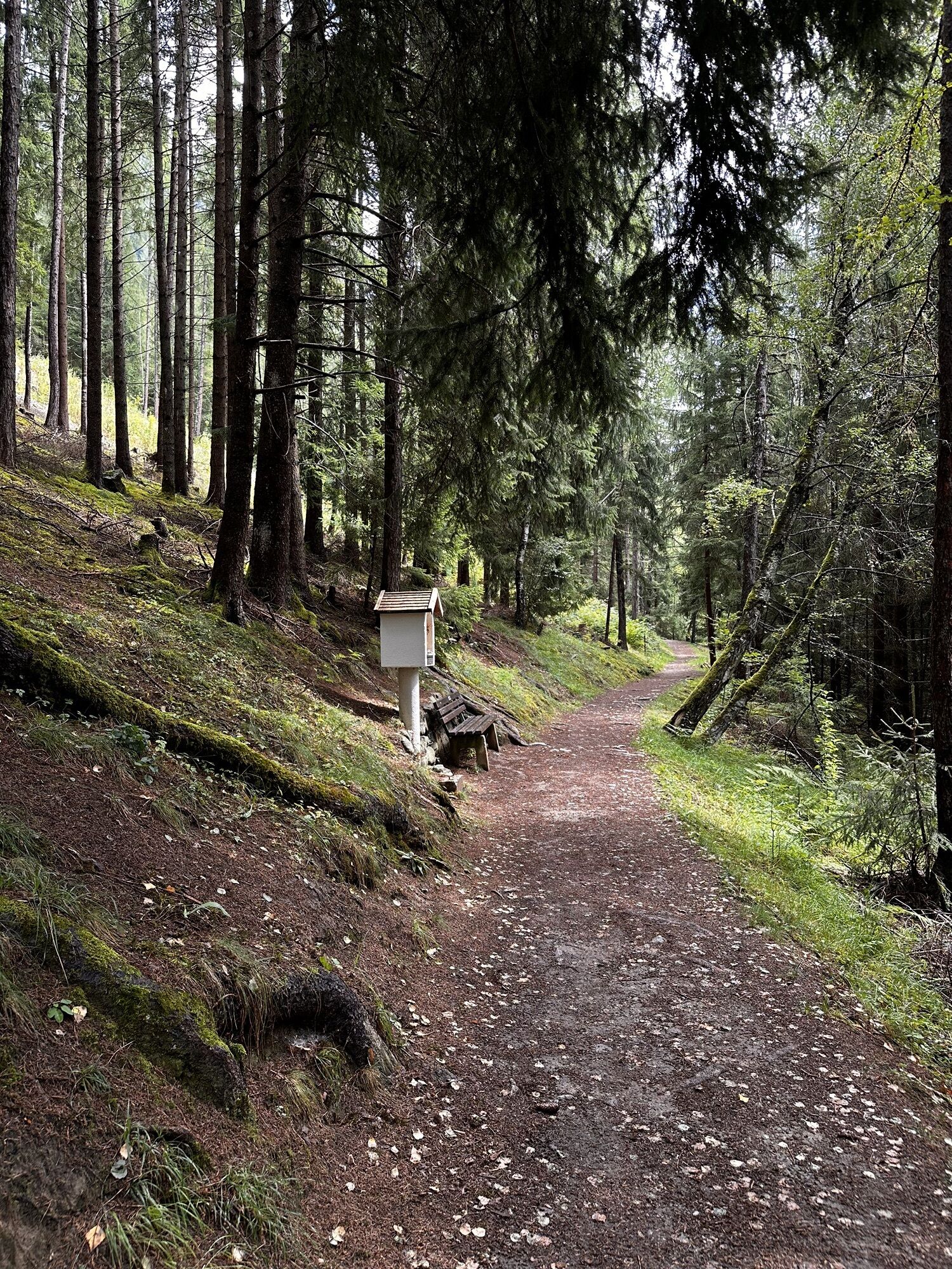
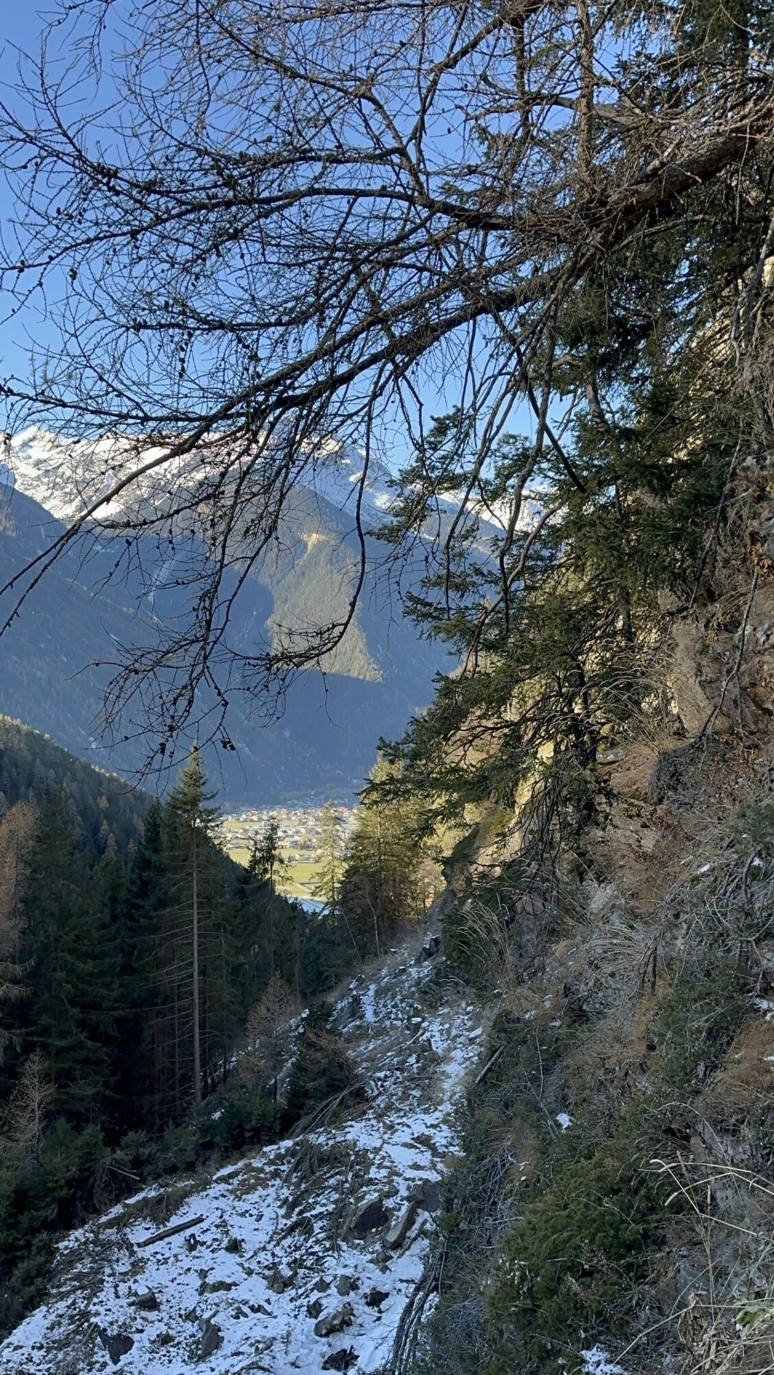
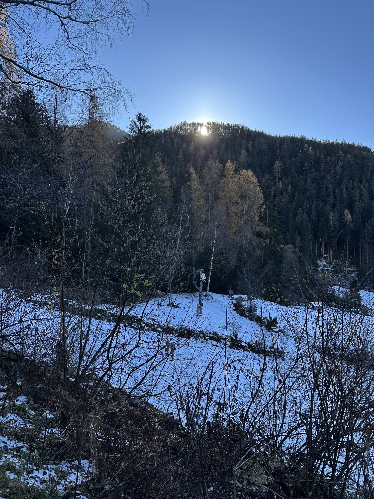
At the top, continue over a picturesque mountain meadow to the Stuibenfall guesthouse. From there, the hike continues uphill to the Höfle district and then down the Umhauser Höhenweg back to Umhausen. Once back in the valley, a large intersection opens. From there, enjoy a leisurely walk on the signposted Steppsteig trail to the "Stuiben-Nannele," then cross the gravel road and follow a trail through the forest past the Ötzi Village and the Umhausen natural swimming lake back to the starting point of the hike.
Cooling off at the Kneipp pool located at the Bischoffsplatz parking lot is recommended.
Have you already tried our new discovery trail?
Debris flows, flood disasters, and water for agriculture. The Horlachbach moves not only water masses but also the history of the valley.
Find more information here.
Due to trail maintenance with helicopter transport, the hiking trail to STUIBENFALL from Umhausen starting at the Waldcafe Stuböbele and from Niederthai at the Holzbrücke entrance will be completely closed on Wednesday, 09/17/2025, from 9:00 AM to 4:00 PM!!

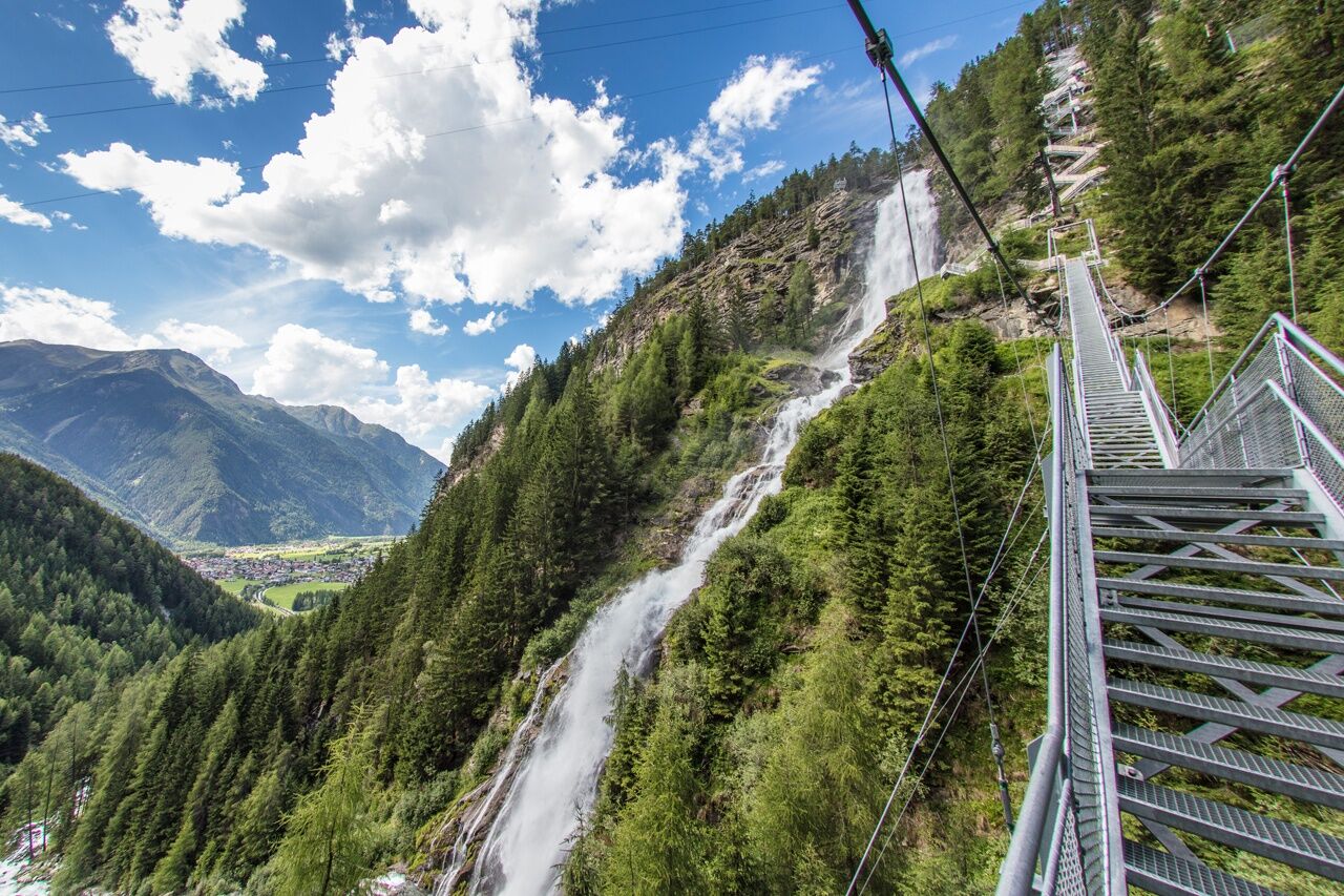


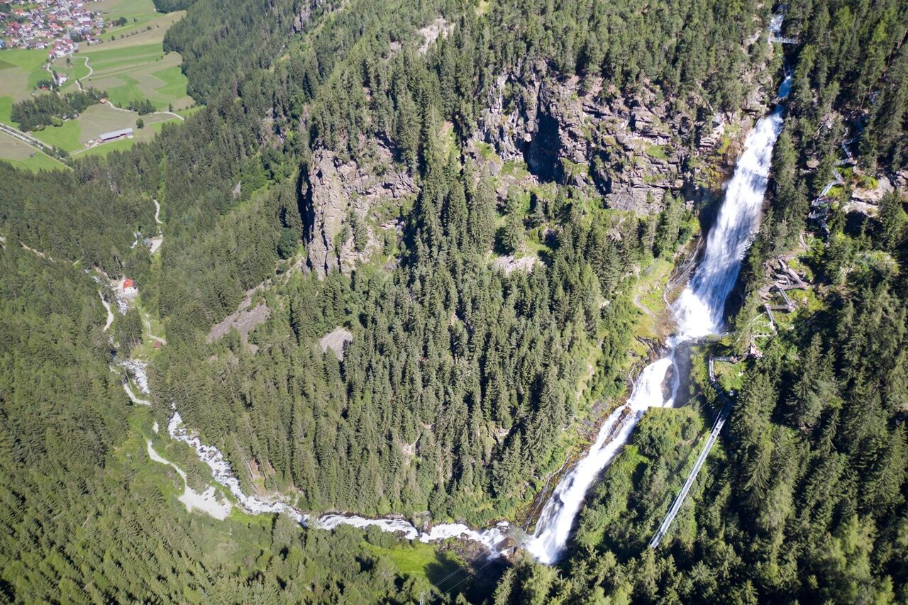
The start of the hike is at the Bischoffsplatz parking lot in Umhausen. From there, follow the wide Fortsweg behind the Kneipphäusl restaurant uphill to the junction leading to the "Waalweg Arzwinkel." The path calmly winds along the Waale until you reach a gravel road. There, turn right along the bubbling Horlachbach stream uphill to the foot of the mighty waterfall, the Stuibenfall - Tyrol's largest waterfall. Always with a view of this fascinating natural spectacle, continue to the right of the cascading waters, climbing over about 700 steps to the origin of the Stuibenfall. Along the way, you pass scenic platforms and the 80-meter-long suspension bridge.
At the top, continue across a picturesque mountain meadow to the Stuibenfall guesthouse. From there the hike continues uphill to the Höfle district and then descends via the Umhauser Höhenweg back to Umhausen. Once back in the valley, you reach a large intersection. From there, enjoy a leisurely walk along the signposted Steppsteig trail to the "Stuiben-Nannele," then cross the gravel path and follow a forest trail past the Ötzi Village and the Umhausen natural swimming lake, returning to the starting point of the hike. Cooling off in the Kneipp facility located at the Bischoffsplatz parking lot is recommended.
Ja
Ja
Appropriate equipment such as breathable and weather-appropriate outdoor clothing is required for all hikes and routes.
Easy hiking trail; suitable for beginners as well
Please check the current weather report
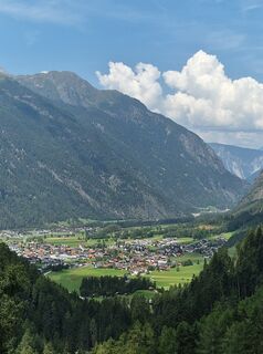
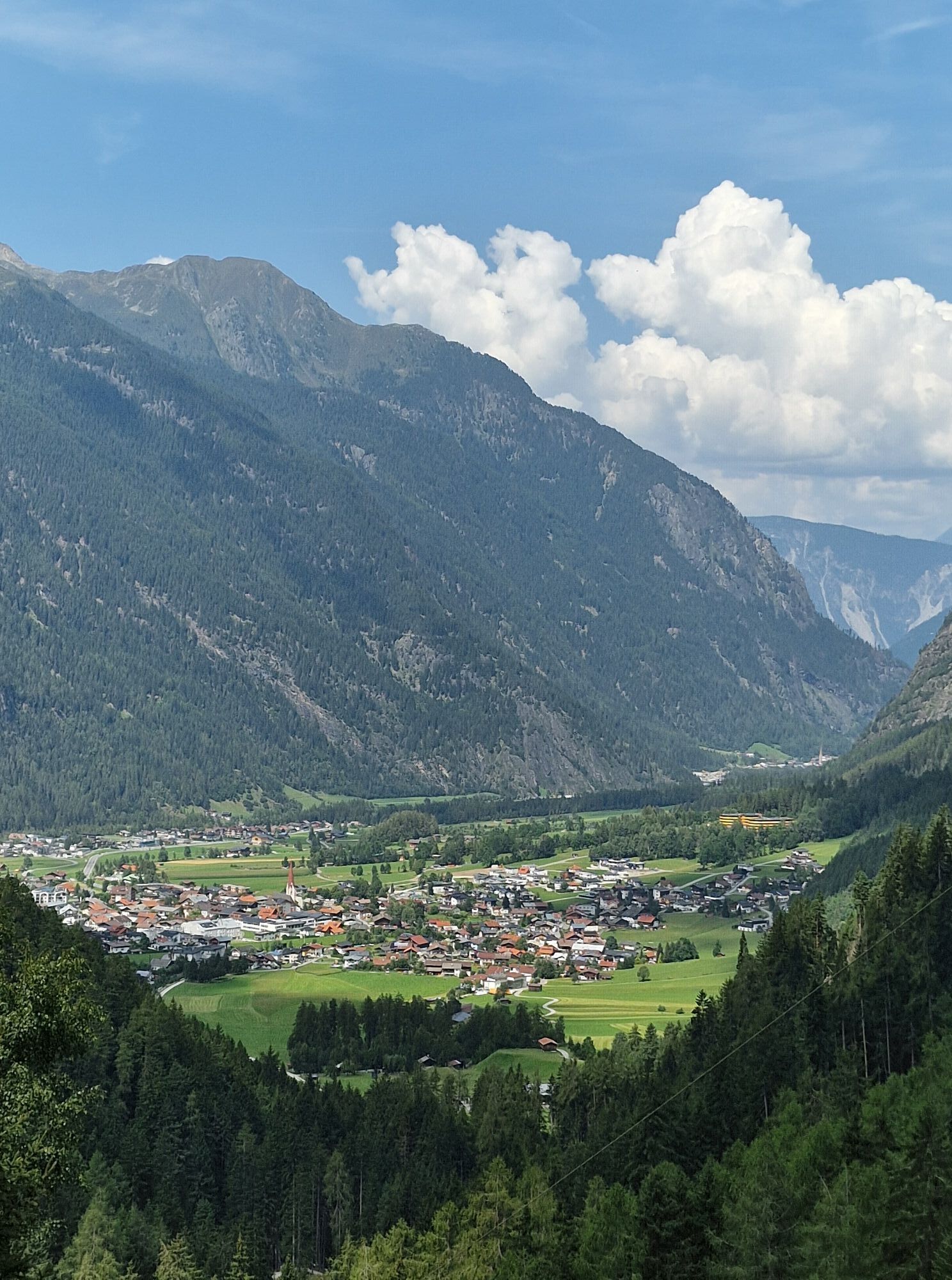
Driving to the ÖTZTAL valley. Located in Tyrol, the ÖTZTAL branches off to the south as the longest side valley of the Eastern Alps. Traveling by car leads visitors through the Inn valley to the valley entrance and then along the Ötztal valley. In addition to the toll motorway, country roads can also be used. Use the route planner to quickly and conveniently determine your journey. Route planner: https://www.google.at/maps
Travel comfortably and safely by train to the Ötztal train station. The final stop or exit point is ÖTZTAL station. From there, you can conveniently and quickly continue using public transport or local taxi services throughout the valley to your desired destination!
The current bus schedule is available at: http://fahrplan.vvt.at
In Umhausen, the following parking options are available:
Mure parking lot | free of charge Bischoffsplatz parking lot | Cost: € 6.00 car day ticket, paid between 7:00 AM and 6:30 PM Multi-day tickets available Guests with disabilities park for free - please present your ID Buses park for free
Stuibenfall
A scientific study on the health-promoting effects of the Stuibenfall for patients with sports asthma showed an increase in lung function of 58%. If you spend one hour in the spray area of the waterfall two to three weeks in a row, this method works better than conventional cortisone sprays.
WATER IN THE ÖTZTAL
Water, the defining element of the Ötztal.
Freshwater melted from glaciers by the sun feeds the meadows and the Ötztaler Ache, which runs through the 65 km-long valley. The catchment area of the Ötztaler Ache covers 893 km² with an elevation spanning about 700 to 3,774 m. This glacial meltwater fills the population's water reservoir and ensures drinking water supply.
Glaciers store three quarters of all freshwater reserves and are thus the largest natural water reservoirs in the world.
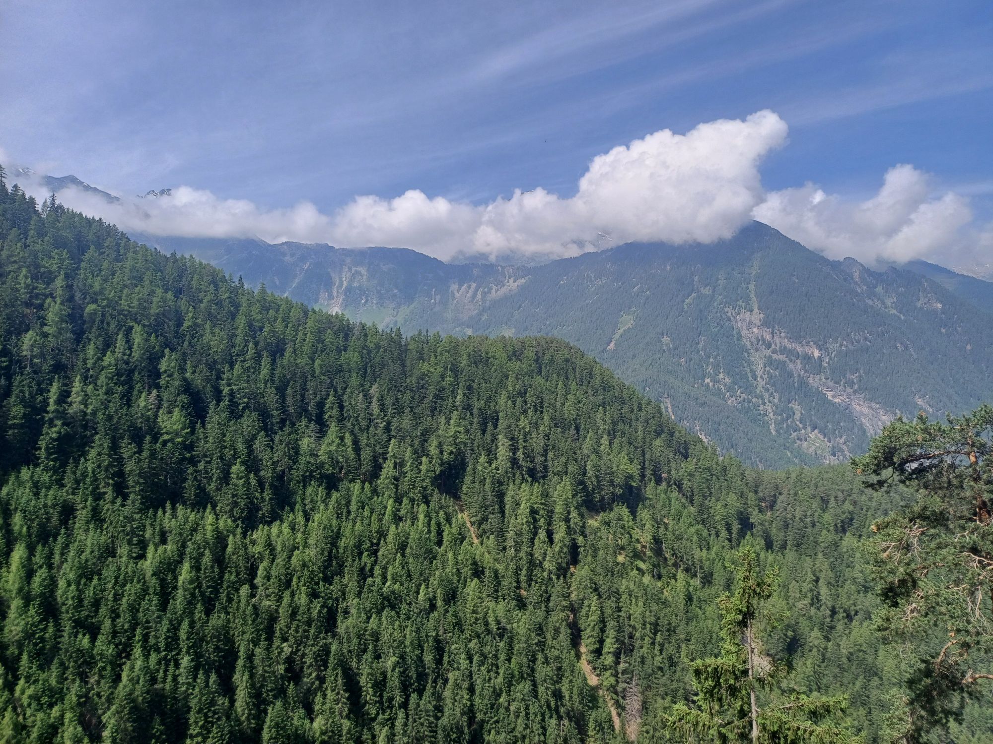
In 1770, advancing ice repeatedly dammed large lakes, which, when they burst, caused catastrophic floods throughout the Ötztal valley and even the Inn valley. The natural hazard motivated people increasingly to engage with their environment and fostered glacier research. The diversity of water in the Ötztal serves not only science. The Ötztal glaciers are also recreational areas for residents and guests as these "ice wonders" also serve as hiking and especially skiing areas. Moreover, glacial meltwater has made possible action-packed recreational activities like rafting, white-water rafting, and many more.
More information about hiking in the Ötztal can be found here
Populära turer i närområdet
-
4,7
Winnebachsee Hut – Längenfeld/Gries
MediumVandring 4,74 km -
4,6
Summit route Faltegartenköpfl
MediumVandring 4,04 km -
4,4
Oetz - Piburger See - Oetz
MediumVandring 7,16 km -
4,2
Hike Stuibenfall - Umhausen
ljusVandring 2,95 km -
5,0
Larstigalm - Niederthai
ljusVandring 3,24 km -
4,5
Amberger Hut - Längenfeld/Gries
MediumVandring 5,60 km -
4,8
Faltegartenköpfl (01)
ljusSkitour 4,19 km -
4,7
Umhausen - Stuibenfall - Umhausen
MediumVandring 7,94 km -
4,6
Summit route Weather Cross from Hochoetz
MediumVandring 3,06 km -
5,0
Nissl Alm - Längenfeld/Gries
ljusVandring 5,17 km
Vandring och spårning


Missa inte erbjudanden och inspiration inför nästa semester
Din e-postadress har lagts till på e-postlistan.