


Lagazuoi Tunnels


During the First World War, soldiers of the Italian front built an intricate system of tunnels which, starting near the "Cengia Martini", led to the "Lagazuoi Forepeak", in order to undermine the Austrian...
During the First World War, soldiers of the Italian front built an intricate system of tunnels which, starting near the "Cengia Martini", led to the "Lagazuoi Forepeak", in order to undermine the Austrian enemy positions.
In addition to this, they also built: a "shoulder" tunnel that emerged outside near the Forepeak, a tunnel to contain all artillery, a spiral tunnel, a lower branch leading to Cengia Martini and finally, a horizontal branch that allowed connection to the combat position at Cengia Martini. The branch constituting the Italian mine tunnel was blown up on June 20, 1917.
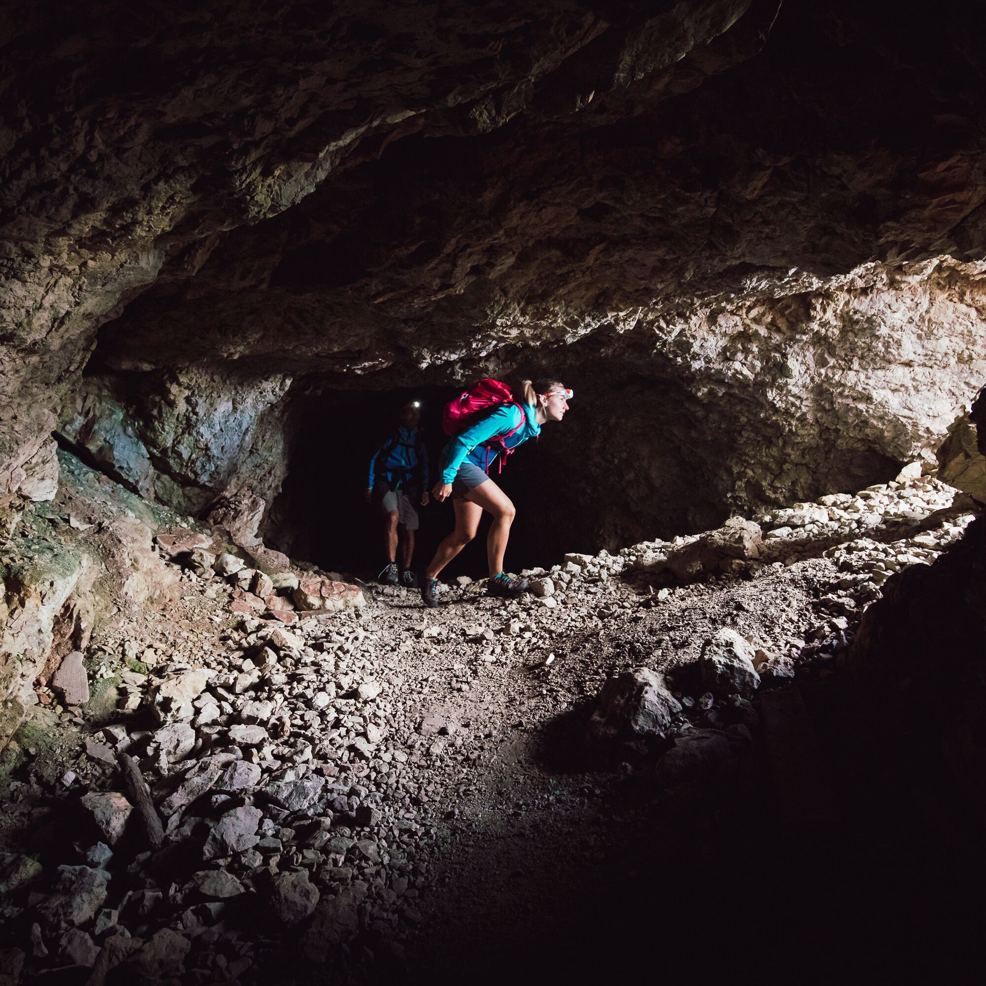
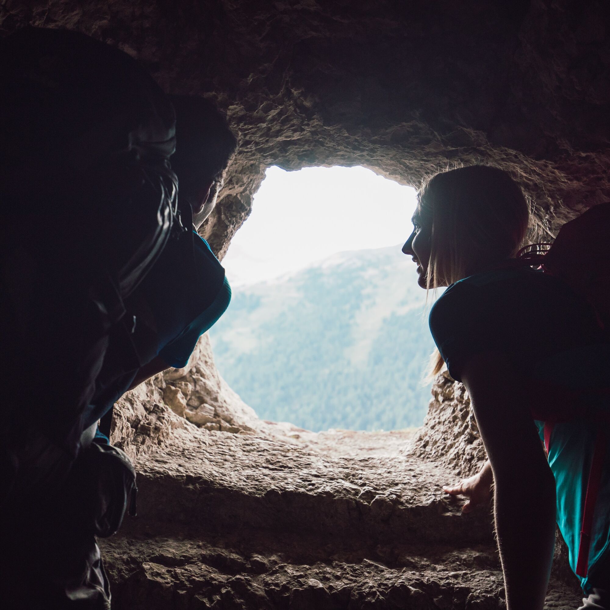
The Lagazuoi Tunnel was fully restored between 1997 and 2004 and opened to visitors: today it is an atypical via ferrata that allows safe passage through over 1 km of the "Small Lagazuoi" interior. The route is fully equipped with a steel cable and does not present particular difficulties. Damp and dark, it is only lit for short stretches by the few spectacular slits carved into the rock.

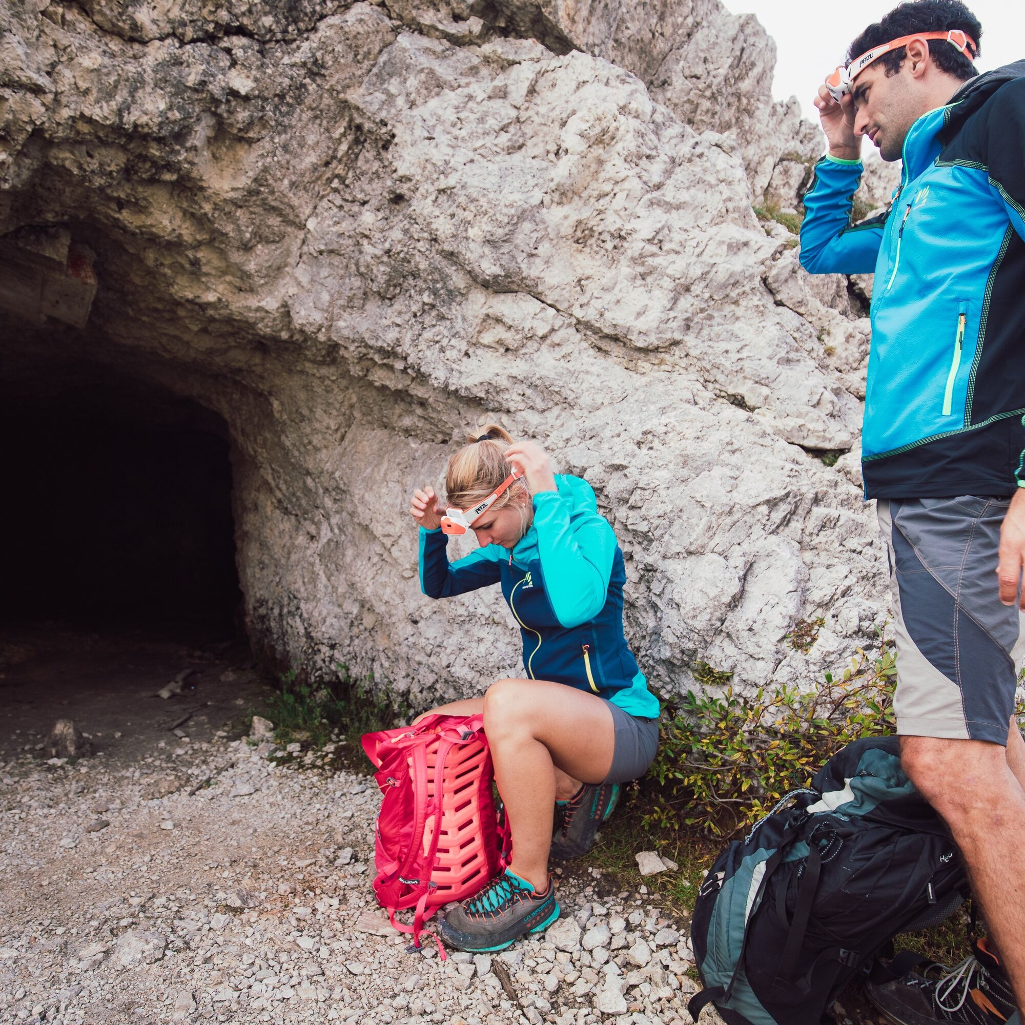
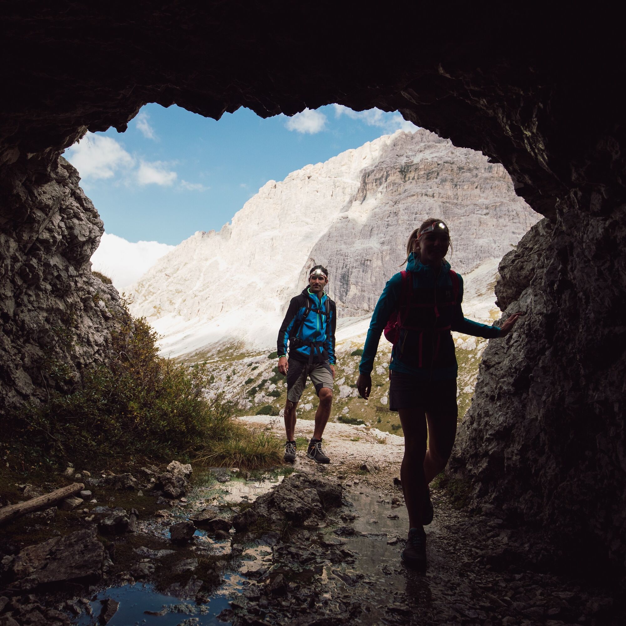
Departure from the Lagazuoi cable car with trails 402 and 401 until reaching the Lagazuoi panoramic terrace. The return for the first 2 km is along the tunnels that start at the top of the cable car. The use of a helmet and a headlamp is mandatory. Equipment rental is available at Falzarego Pass at the cable car station.
Ja
Ja
Ja
Ja
The via ferrata kit:
comfortable boot adaptable to foot shape with a rubber sole cut to prevent slipping long trousers breathable t-shirt spare t-shirt (preferably breathable) sweatshirt or fleece windproof and waterproof jacket breathable socks harness via ferrata kit: 2 slings, two carabiners (one with a locking gate) and an energy absorber climbing helmet (to be worn already on the approach to avoid falling rocks from above) via ferrata gloves waterproof backpack or with waterproof cover sunscreen anti-glare sunglasses emergency rope (necessary usage skills)
Not recommended for those who suffer from claustrophobia.
Always let someone know your destination and approximate duration of the hike.
The emergency phone number is 112 or 118 (ambulance).
By car
From Innsbruck Brenner A22 motorway to the Bressanone tollbooth, continue through Val Pusteria, Val Badia, Campolongo Pass, Arabba and Falzarego Pass. From Verona/Milan Brenner A22 motorway to Egna Ora tollbooth, continue through Val di Fiemme, Val di Fassa, Pordoi Pass, Arabba and Falzarego Pass. From Venice A27 motorway Belluno exit follow the Agordina 203 to Agordo, Caprile, Falzarego Pass.
By train
Nearest railway stations:
Belluno - 70 km Brunico - 48 km Ponte Gardena - 51 km
By bus
Brunico - 47 Km connection via SAD line www.sad.it Belluno – 70 Km connection via Dolomitibus line www.dolomitibus.it
By plane
Venice Treviso/Venice Marco Polo – 160/170 km Innsbruck - 140 km Verona – 270 km Milan Bergamo/Milan Malpensa - 310/400 km
Falzarego Pass, starting and ending point of the hike, is connected to the tourist centers of the Province of Belluno and Trentino - Alto Adige by suburban lines.
More information, schedules and service activation dates at www.sad.it and www.dolomitibus.it
At the lower station of the "Lagazuoi" cable car there is a large free parking lot.
Before leaving, we recommend you check the weather, which changes rapidly in the mountains, and the condition of the route.
For some tunnels, it is recommended to bring a torch.
"The sustainable hiker's handbook":
choose the itinerary according to your physical and technical abilities inform yourself before departure about the route you intend to undertake (distances, elevation gain, time required, springs, fountains, mountain huts, lifts, bivouacs, etc.) check the condition of the chosen trail never undertake a hike alone always carry down all waste please stay on marked trails please be quiet do not collect stones or minerals do not feed animals no fires allowed do not pick flowers and plants
Populära turer i närområdet
-
4,8
Passo Giau roundtrip
MediumVandring 8,10 km -
4,7
Pederü - Fanes Hütte
ljusVandring 12,0 km -
4,6
Giro delle Cinque Torri (Rifugi Averau, Nuvolau e Scoiattoli) dal Passo Giau
MediumVandring 10,8 km -
4,4
Rif. Pisciadú - Grödner Joch über Mittagstal (676)
ljusVandring 7,61 km -
4,0
Sellastock - Der Berg der Ladiner
Vandring 8,56 km -
3,7
Tomaselli (D) mit NO Abstieg (C) + Lagazuio Tunnel (A/B)
Via ferrata 8,30 km -
4,9
Pisciadùsteig Sella Gruppe
MediumVia ferrata 7,15 km -
5,0
Col Pradat - Puez Hütte - Cirjoch - Edelweiß-Hütte
MediumVandring 16,8 km -
4,0
Ferrata brigata degli alpini - Col dei Bos
MediumVia ferrata 4,90 km -
Via Ferrata Ivano Dibona
MediumVia ferrata 9,23 km
Vandring och spårning


Missa inte erbjudanden och inspiration inför nästa semester
Din e-postadress har lagts till på e-postlistan.