


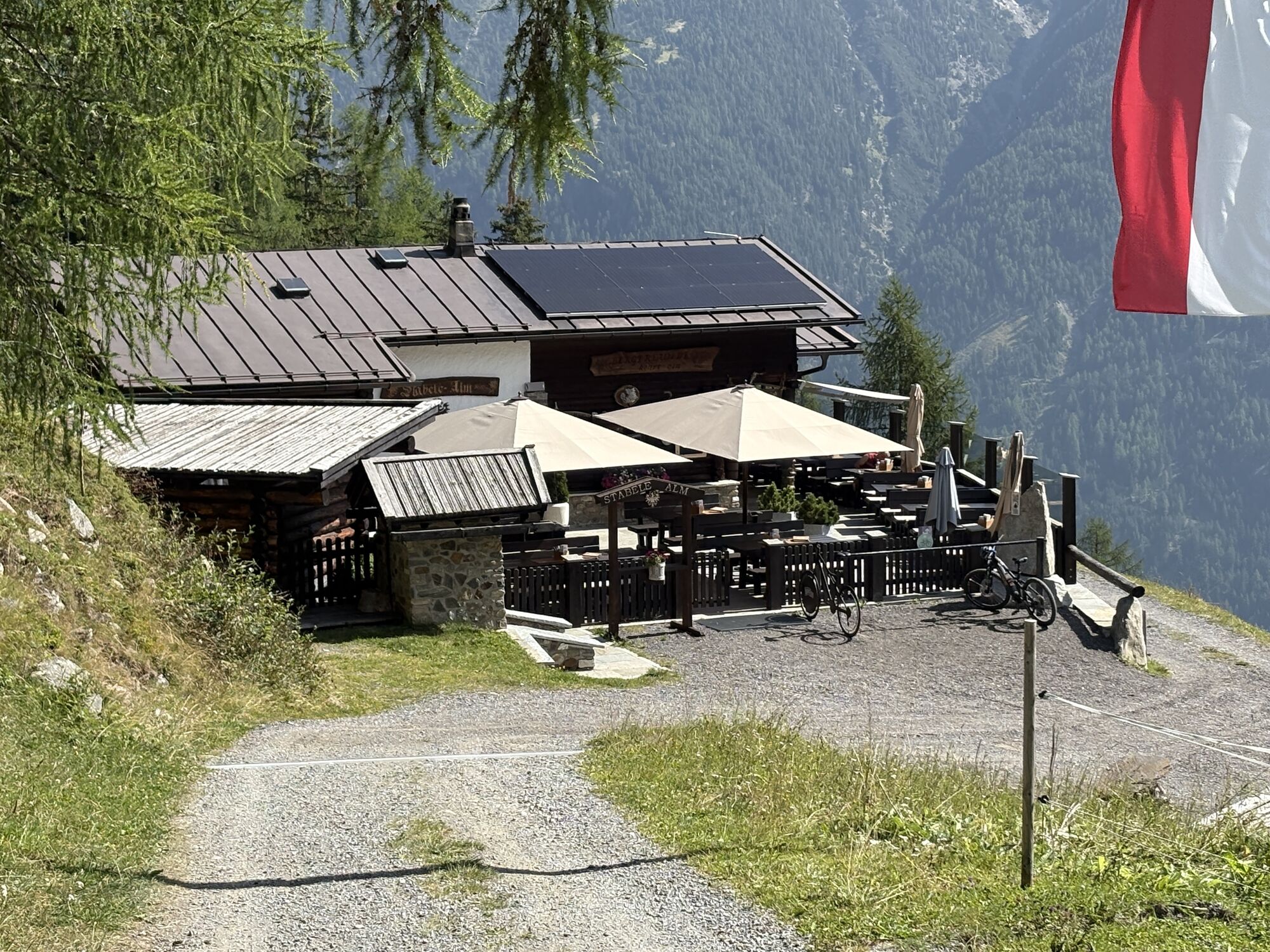
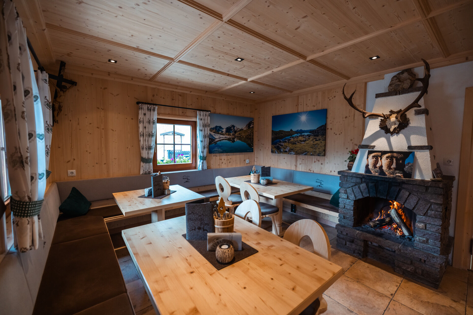
Stabelealm - Längenfeld


From the parking lot in Lehn (near the via ferrata entrance), the mountain path steadily climbs in the direction of Stabelealm. Along the path, you cross or see the Lehner Waterfall. The way continuously...
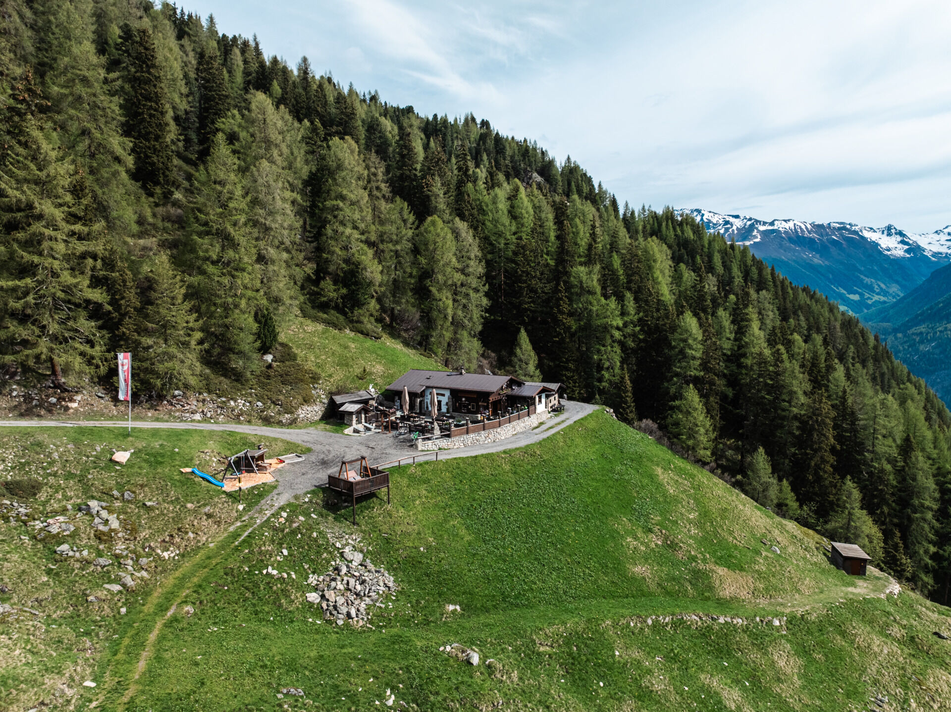
From the parking lot in Lehn (near the via ferrata entrance), the mountain path steadily climbs in the direction of Stabelealm. Along the path, you cross or see the Lehner Waterfall. The way continuously ascends past the tree line up to Stabelealm at 1908 m.
There is a second option to reach Stabelealm via a broad but longer forest road starting in Unterried. First, follow the signs towards Wurzbergalm, then the winding path to Leckalm. From there, the forest road gently descends until you reach Stabelealm. (Duration: approx. 4 hours)
Stabelealm belongs to the Genussplatzlen. "Regional, seasonal, honest cuisine – what's available is enough!" is the motto. Genussplatzlen are committed businesses that act regionally & sustainably whenever possible. Learn more at www.oetztal.com/genussplatzlen


There are 2 different ways to get to Stabelealm.
Option 1: From Lehn near the via ferrata entrance along the steep mountain path towards Stabelealm. (Duration: approx. 2h)
Option 2: Via a wide but longer forest road starting from Unterried passing Wurzbergalm and the unmanaged Leckalm. (Duration: approx. 4h)
Ja
Appropriate equipment such as breathable and weather-adapted outdoor clothing is required for all hikes and routes. Carrying a first aid kit, a mobile phone, possibly a hiking map, and sufficient provisions especially for hikes without dining options is necessary.
Moderate mountain trail; suitable for sure-footed and experienced mountain hikers; good physical condition, mountain experience and mountain equipment (see under equipment) necessary. Please observe the current weather report.
The drive into ÖTZTAL
The arrival by car takes travelers via the Inn valley to the valley entrance and then along the Ötztal. Besides the toll highway, country roads can also be used. With the route planner, your drive can be quickly and conveniently determined. To the route planner: https://www.google.at/maps
Travel comfortably and safely by train. The final stop or exit point is ÖTZTAL train station. Then you can conveniently and quickly travel through the entire valley to your destination by public transportation or local taxi services. The current bus schedule is available at: http://fahrplan.vvt.at
The following parking options are available in Längenfeld:
Parking lot in Lehn – near Heimatmuseum – paid, €3.00 (Option 1) Parking lot in Unterried - start of Wurzbergalm hike - free (Option 2)
The hut taxi to Stabelealm runs once weekly during the summer season.
Reservation is required.
Ötztal Tourism - Information Längenfeld +43 (0)57200 300
More info on hiking in Ötztal can be found here.
Stabelealm is also accessible via the Lehner Waterfall via ferrata. (Follow the via ferrata path to Stabelealm) Duration: approx. 2 hours
Populära turer i närområdet
-
4,7
Winnebachsee Hut – Längenfeld/Gries
MediumVandring 4,74 km -
4,5
Oetz - Piburger See - Oetz
MediumVandring 7,16 km -
4,2
Hike Stuibenfall - Umhausen
ljusVandring 2,95 km -
4,4
Stuibenfall Umhausen circular hike
ljusVandring 9,32 km -
5,0
Larstigalm - Niederthai
ljusVandring 3,24 km -
4,5
Amberger Hut - Längenfeld/Gries
MediumVandring 5,60 km -
3,4
Peerler Lake
MediumVandring 12,6 km -
4,7
Umhausen - Stuibenfall - Umhausen
MediumVandring 7,94 km -
4,6
Summit route Weather Cross from Hochoetz
MediumVandring 3,06 km -
5,0
Nissl Alm - Längenfeld/Gries
ljusVandring 5,17 km

Vandring och spårning


Missa inte erbjudanden och inspiration inför nästa semester
Din e-postadress har lagts till på e-postlistan.